Air quality remains unhealthy with storms looming Wednesday night
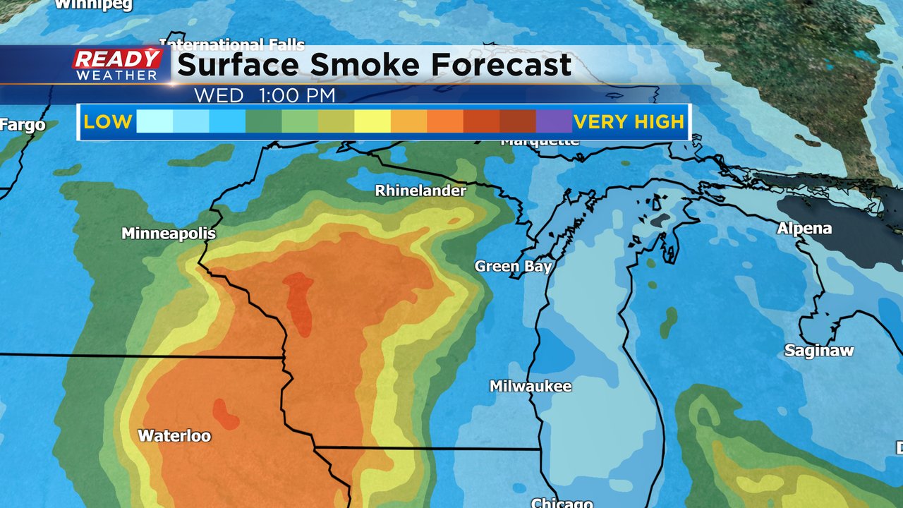
The Air Quality in southeast Wisconsin is finally starting to improve but is still high enough to be considered "very unhealthy" for most of southeast Wisconsin with an air quality index between 200-300.
The smoke at the surface should get a little bit better on Wednesday. We've already seen some improvement on our tower cams that are showing some blue sky here and there. Some smoke will remain through Wednesday afternoon and Thursday morning but Thursday afternoon moderate to good air quality should return.
In addition to the air quality concerns, we are also watching the potential for some storms the next few days. Our storm chance starts Wednesday night with a cluster or line of storms likely forming in west central Wisconsin and moving southeast. Some weather models have those storms moving over our local area while others keep them to our north or west. Any storms that do reach southeast Wisconsin have a chance to be on the stronger side but western and central Wisconsin have the better chance for severe weather where they are under the Level 2 Slight Risk.
Regardless of whether we see the overnight storms Wednesday night into early Thursday a few more rounds of scattered showers and storms will be possible throughout Thursday from the morning to the afternoon and evening.
Thanks, in part, to a warm day with high humidity, any storms that do form on Thursday would have the possibility to be on the strong to severe side. All of southeast Wisconsin is in the Level 1 Marginal risk for that possibility.
Download the CBS 58 Ready Weather app to track when the air quality gets better and track any storms that form.


