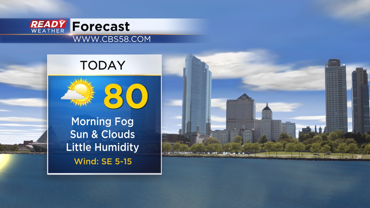
Patchy to dense fog has been impacting most of the morning commute Wednesday but should dissipate by the mid-morning hours. The rest of Wednesday looks nice with relatively low humidity, a mix of sun and clouds and highs around 80.
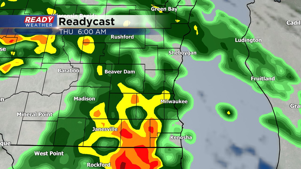
Thursday is a different story with rain and storms rolling in Wednesday night and a round of moderate to heavy rain and even a stronger thunderstorm possible Thursday morning. That first round of rain could linger through late morning then a few scattered showers and storms are possible with a second round in the late afternoon and evening hours.
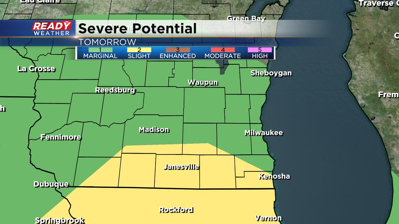
The potential second round of storms could be the one that has a better chance to be strong to severe, but is heavily conditional on if we see sunshine in the early afternoon and how long the first round lingers. Wind and hail would be the main threats but an isolated tornado cannot be ruled out.
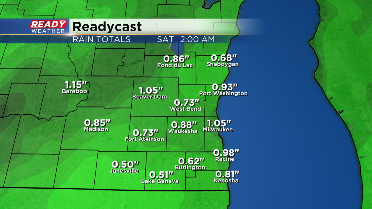
Most of the storms Thursday and even some that linger into Friday could be big rain makers with all of southeast Wisconsin getting over a half inch of rain and some areas easily picking up an inch of 1.50" of rainfall.
Download the CBS 58 Ready Weather app to track the next round of storms.


