Mid Afternoon Update: Wind Chill Advisory issued well inland for tonight


Updated 2:45 pm Thursday, January 6th 2022:
A Wind Chill Advisory has been issued for Dodge, Jefferson, and Walworth counties from 9pm this evening through 9am Friday. These areas could experience wind chills as cold as -25°, which leads to frostbite on exposed skin in 30 minutes.
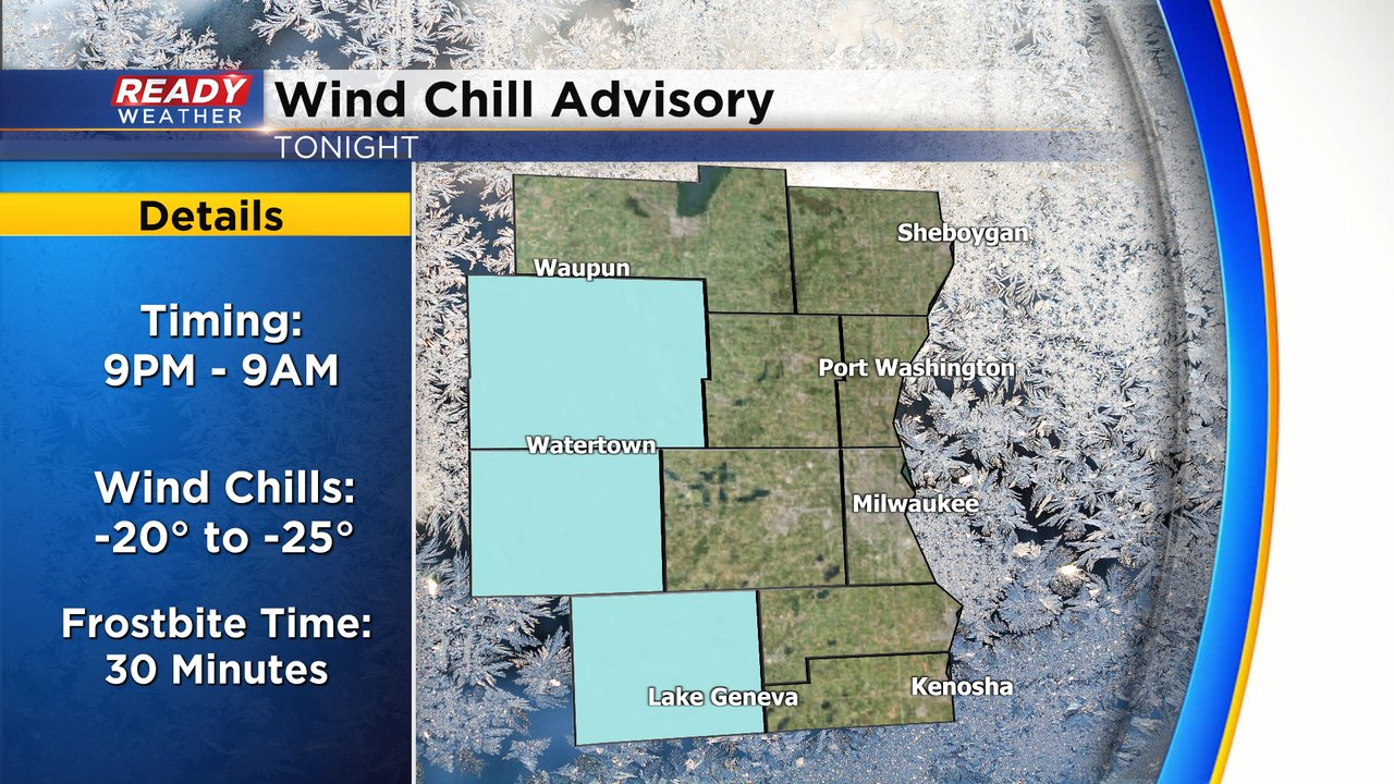
The rest of SE WI will experience wind chills of -10° to -20°.
--------------------------------------------------------------------------------------
Wednesday was all about the dropping temps, gusty wind and light snow showers. Temperatures Wednesday hung out in the low 20s most of the day. The wind gusted between 35-45 mph in many communities with peak wind gusts felt from the mid-morning through late afternoon.

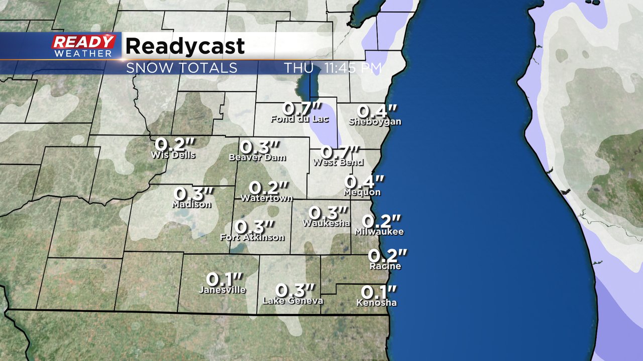
Most of southeast Wisconsin saw up to 2" of snowfall. Dodge County got the most with 3-4" reported there.

Another round of light snow and flurries will be possible on Thursday. Some of you may be waking up to a fresh dusting of snow leading to slick roads. The light snow showers and flurries will be possible throughout the day as some moisture remains. This will be a very light and fluffy snow with very fine snowflakes which may make it hard for the radar to pick up on it. By the end of Thursday a dusting to a few tenths of snow may be possible. An isolated fluffy inch of snow isn't out of the question.
In addition to the continuing snow, the cold air is really moving in. Low temperatures Thursday morning were in the upper single digits and low tens. High temperature Thursday will likely stay in the upper teens for most of the area with an isolated 20* possible. With a bit of a breeze still hanging on Thursday and Thursday night with gusts to 20 mph, the wind chills will continue to be a factor. Wind chills will be the worst on Friday morning to -15*.

Wind chill advisories and warnings have been issued to our west where wind chills are coldest Thursday and Friday morning. At this point it looks like our local viewing area will stay warm enough to not be included in any advisory. Also look at the winter weather advisories and winter storm warnings well to our south. Kentucky and Tennessee are expecting a nice winter storm with 4-8" of snow in some areas.

Download the CBS 58 Ready Weather app to track Thursday's snow and the dropping temps for Friday morning.