


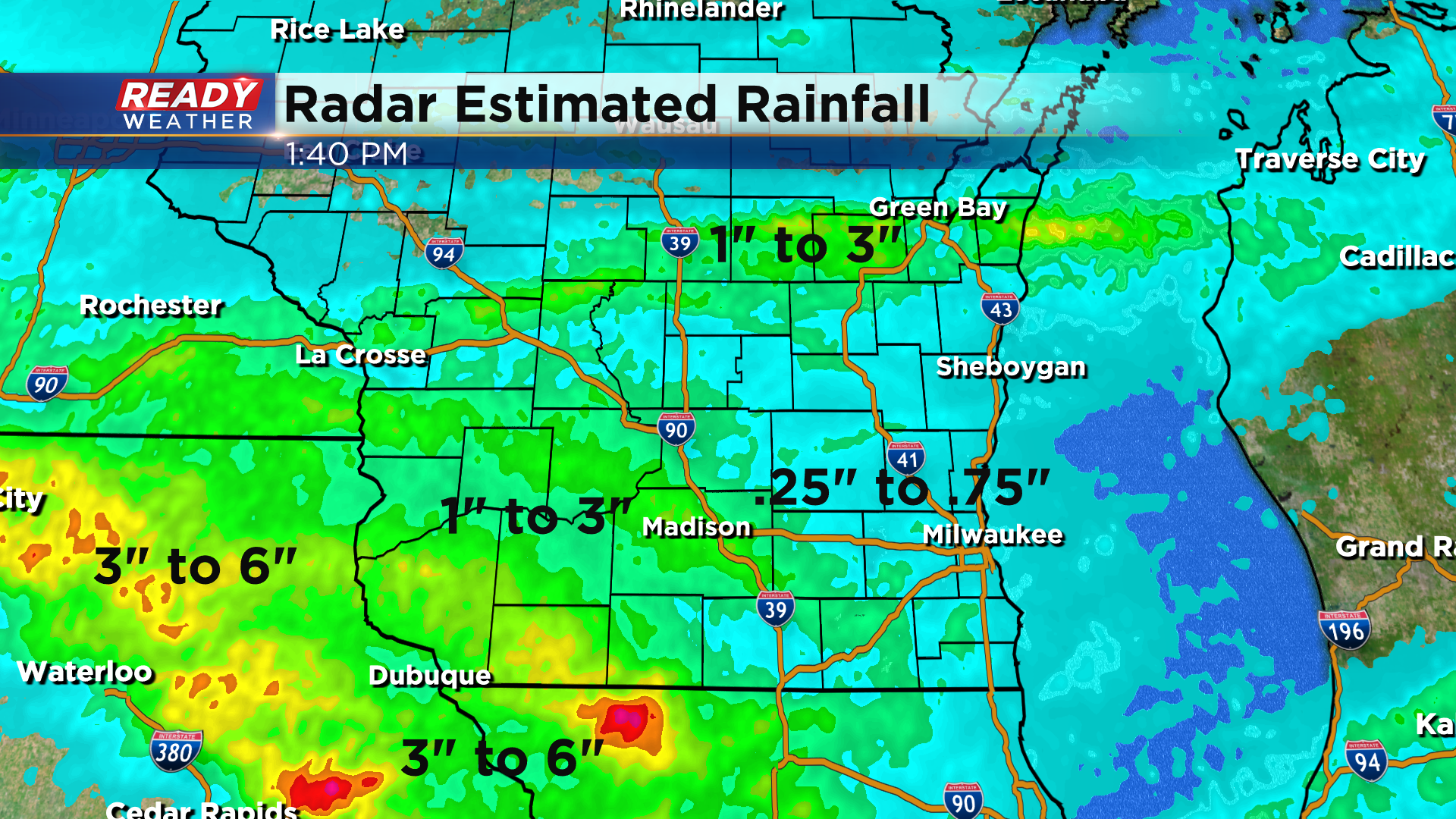
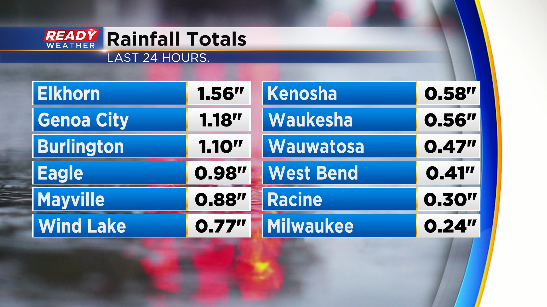
Some decent rain fall across southeast Wisconsin with round one of rain and storms, but thankfully we didn't see the flooding and several inches of rain like some areas did to our north and west.
We've had some off and on light showers during the day today, but that rain will pick up in intensity a bit more overnight tonight as a low pressure system tracks northeast through the state. Heavy rain producing storms will redevelop late this evening in northern Iowa and southwest Wisconsin.
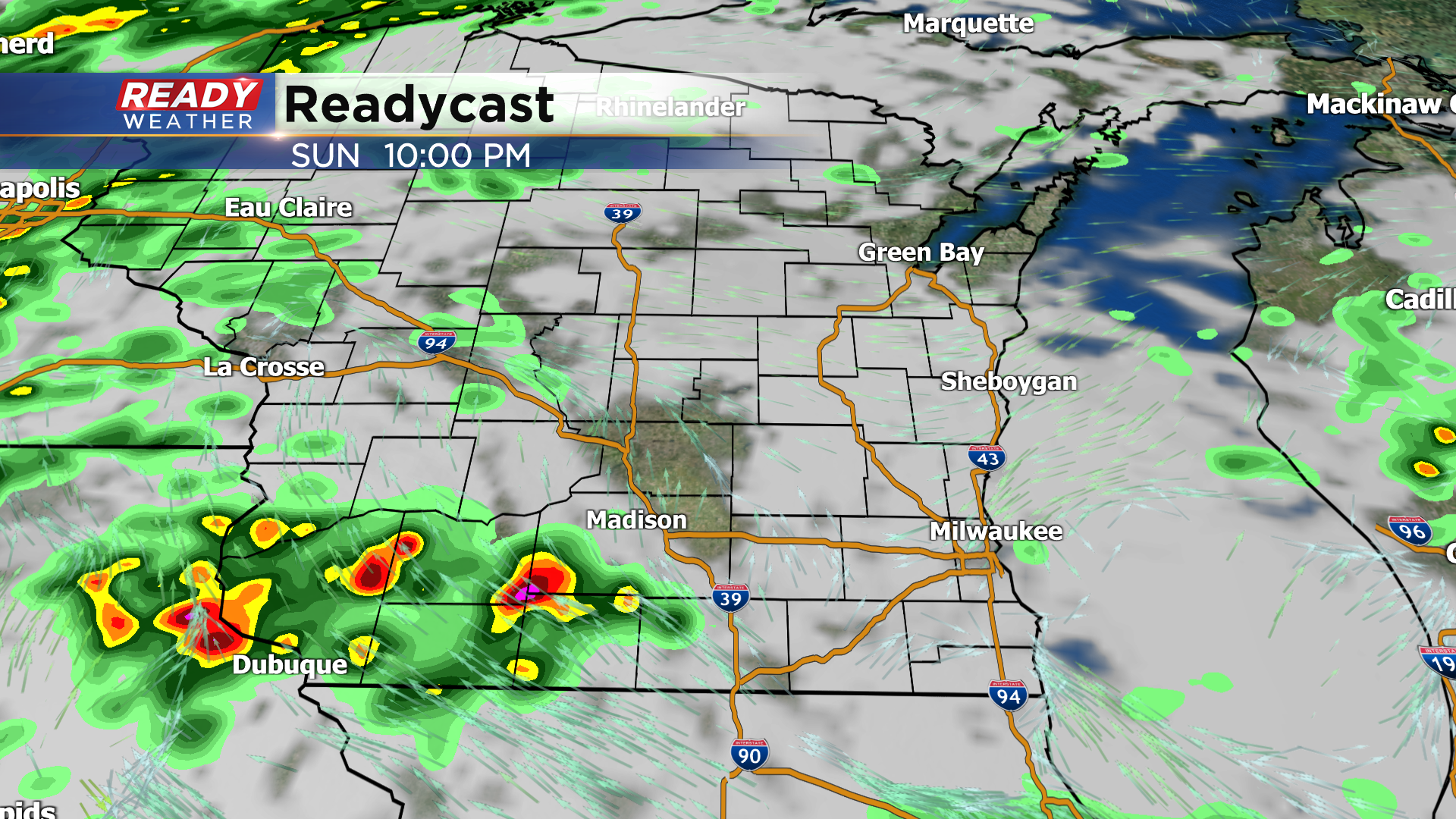
These storms will lift through the region during the overnight hours with the heavier rain generally exiting around or just after sunrise.
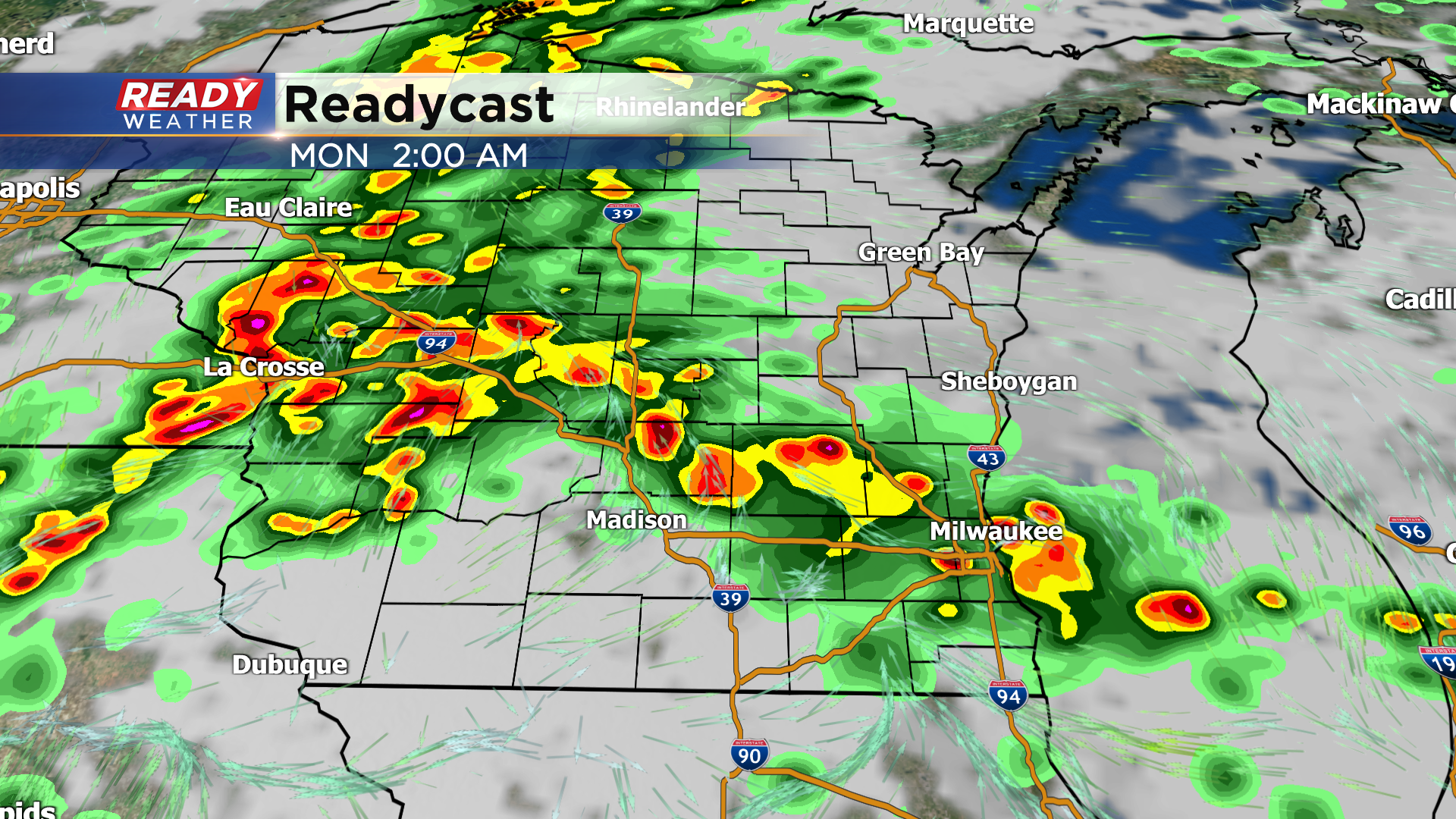
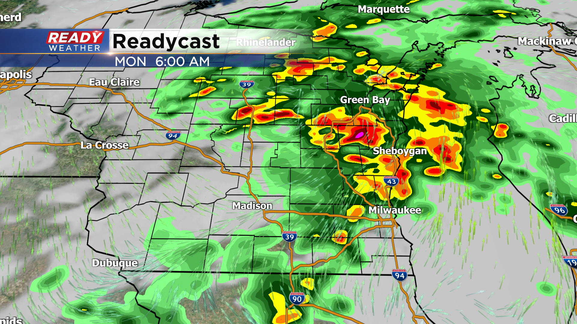
A few more isolated, lighter showers will linger through the morning until the cold front tracks through midday or early afternoon.
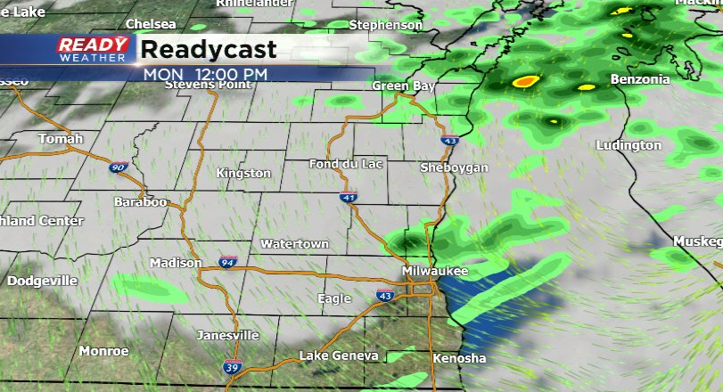
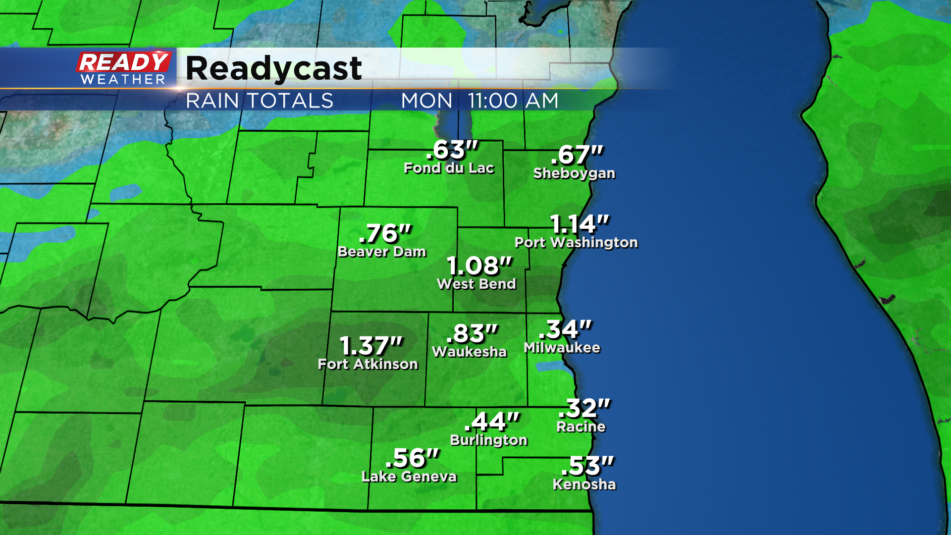
Thankfully these showers look to be a bit more progressive than they looked like they would be yesterday, so the threat for flooding is decreasing. An additional .25-.50" of rain is expected for most overnight with a few spots picking up .75-1.50".
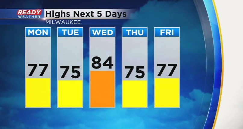
Dew points will gradually drop Monday afternoon and evening behind the cold front and remain at fairly comfortable levels for most of the week! The only exception is Wednesday we we see a minor uptick in humidity and temps as wind flip back to the southwest.
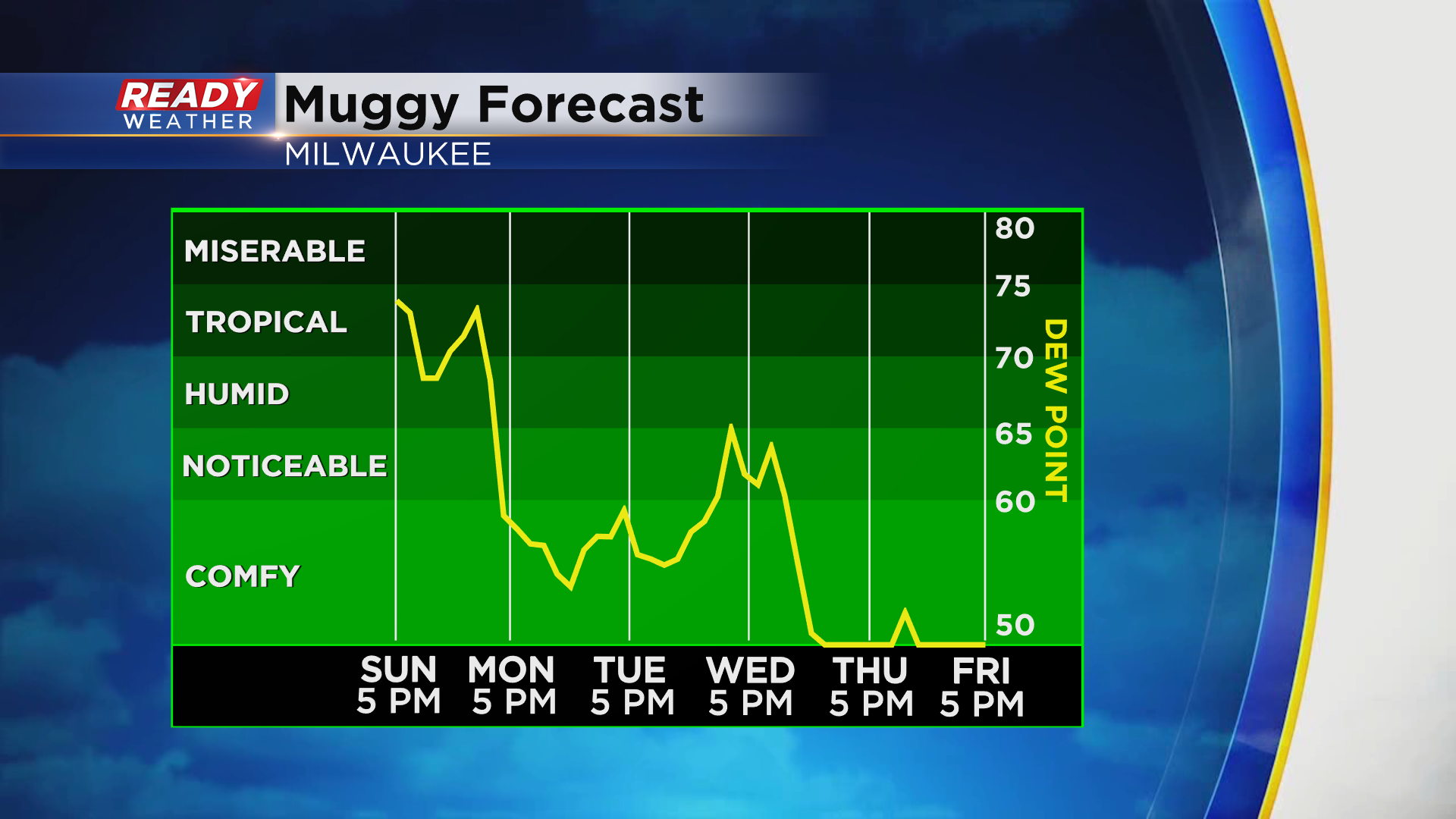
Otherwise expect mainly mid to upper 70s and dry weather through the work week. Only chance for rain after Monday come early Thursday morning in the form of a few sprinkles with another cold front.
Download the CBS 58 Ready Weather App to track the storms.