Another windy and warm day with rain chances arriving for the second half of the week


Monday was a record-breaking day in southeast Wisconsin with highs reaching 67 degrees in Milwaukee breaking the old record of 66 set back in 2012.

Tuesday is likely a little warmer with highs reaching the upper 60s to around 70. Even though Tuesday is expected to be warmer than Monday, we probably don't get close to records with that record of 76* set in 1990. The rest of the week is cooler as a lake breeze returns on Wednesday dropping us into the 50s then we drop again into the 40s with rain Thursday and Friday.

After another dry day Tuesday with a mix of sun and clouds we do have a low chance for rain on Wednesday with a few isolated showers. Thursday still looks like the best chance for rain this week and now the thunderstorm chance has increased a bit with scattered showers and storms likely.
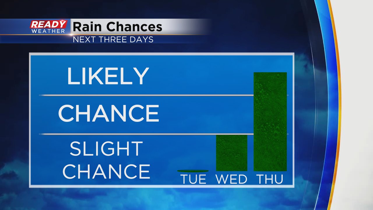
The isolated rain chance on Wednesday looks best in the afternoon and evening in our southern counties if it happens at all.

Thursday's rain looks like a soaker with another chance for a half to full inch of rain possible. Some lingering showers could continue into Friday before mostly dry weather returns for the weekend.

Download the CBS 58 Ready Weather app to track the warmth for Tuesday then the rain chances.