Back to average and beyond with one day of humidity the rest of the week


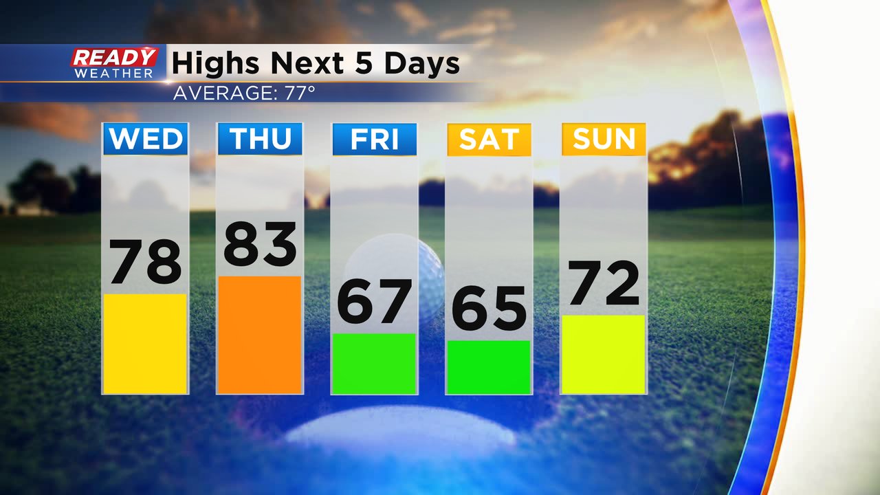
The weekend and the start to this week have seen really nice weather with virtually no humidity, good sunshine and no rain chances. That trend will continue on Wednesday but it will be a bit warmer with highs getting back to average in the upper 70s. Thursday still looks like the warmest day this week in the low 80s then we get a strong cold front that will drop into the 60s for highs Friday and Saturday.
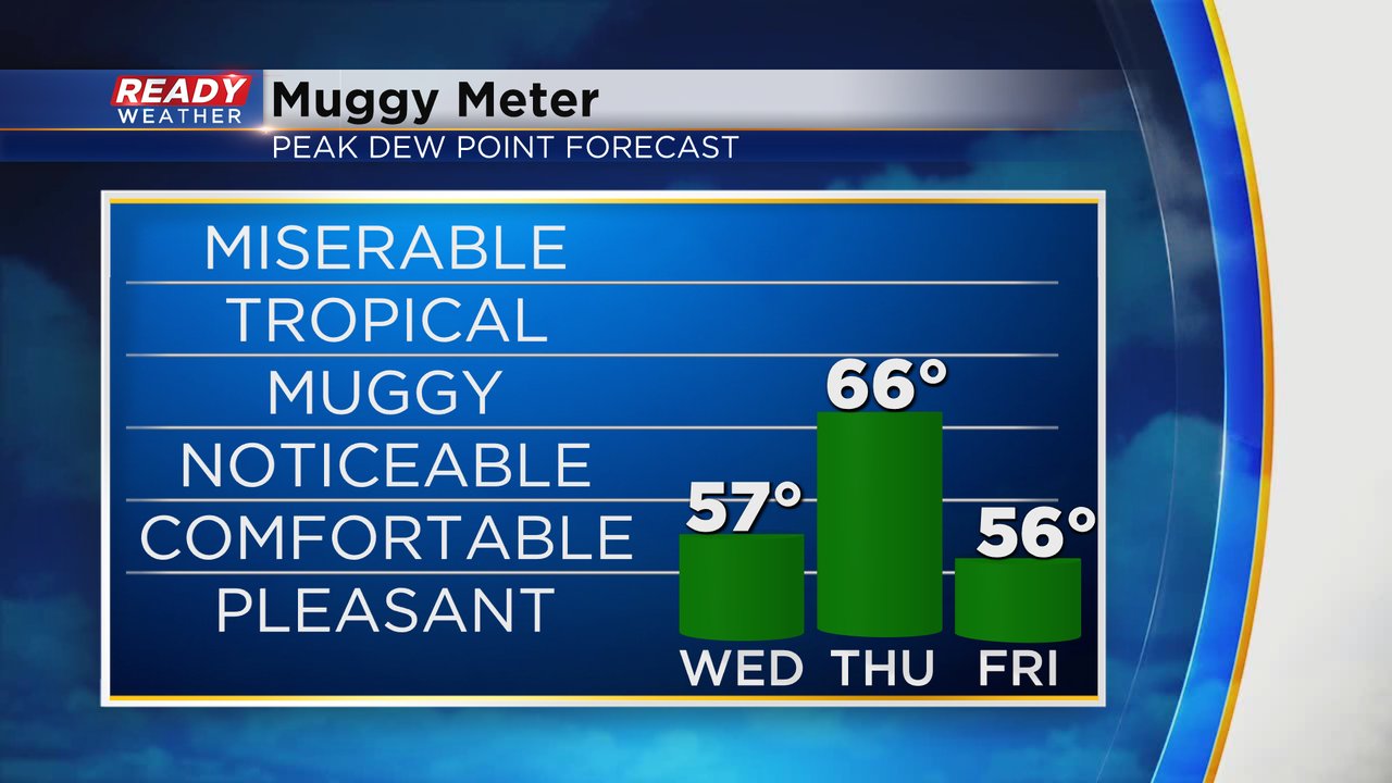
Humidity stays comfy on Wednesday then briefly rises on Thursday in the mid 60s for dew points. The cold front that drops the temps also drops the humidity with comfy weather returning Friday.
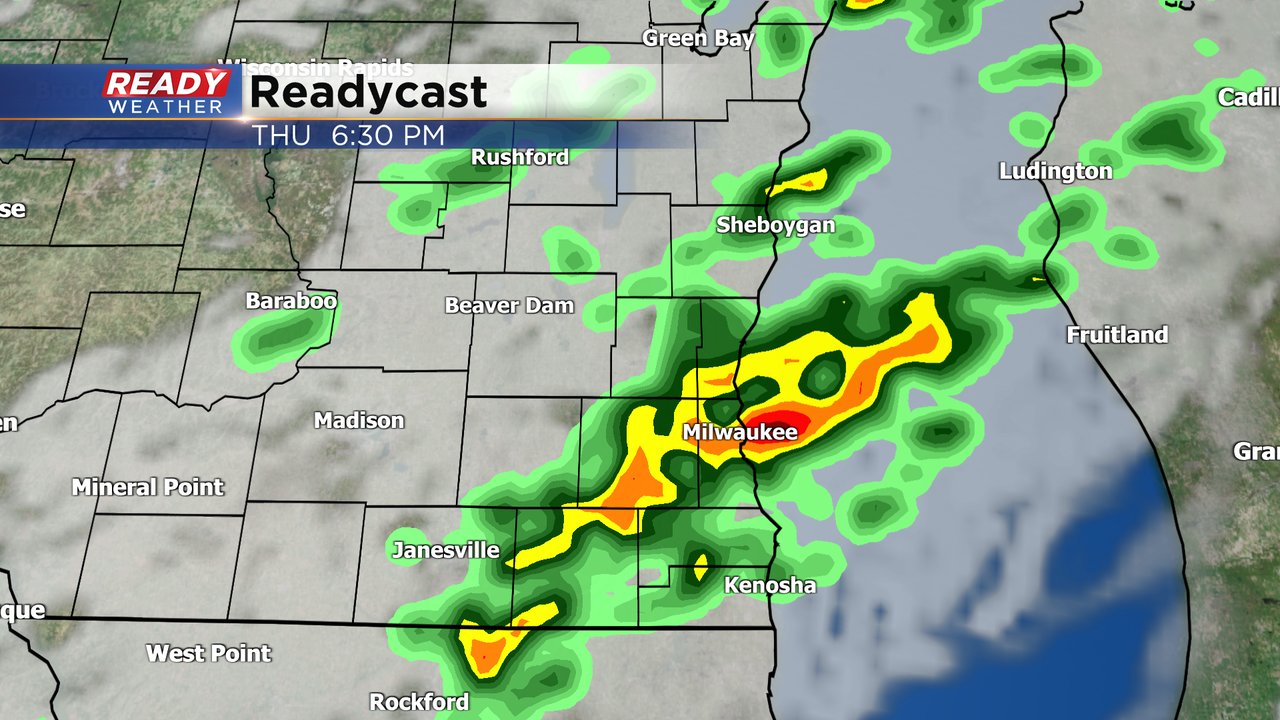
After a dry and sunny day on Wednesday, Thursday morning is also pretty sunny but the clouds start to increase by Thursday afternoon with a rain chance Thursday afternoon through Friday.
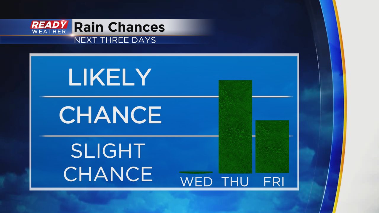
Our next rain chance doesn't arrive until Thursday mainly in the late afternoon and evening with some scattered showers and a few isolated storms.
Download the CBS 58 Ready Weather app to track the next chance for rain and the cooler temps on the way for the weekend.