Below zero wind chills continue through Christmas weekend


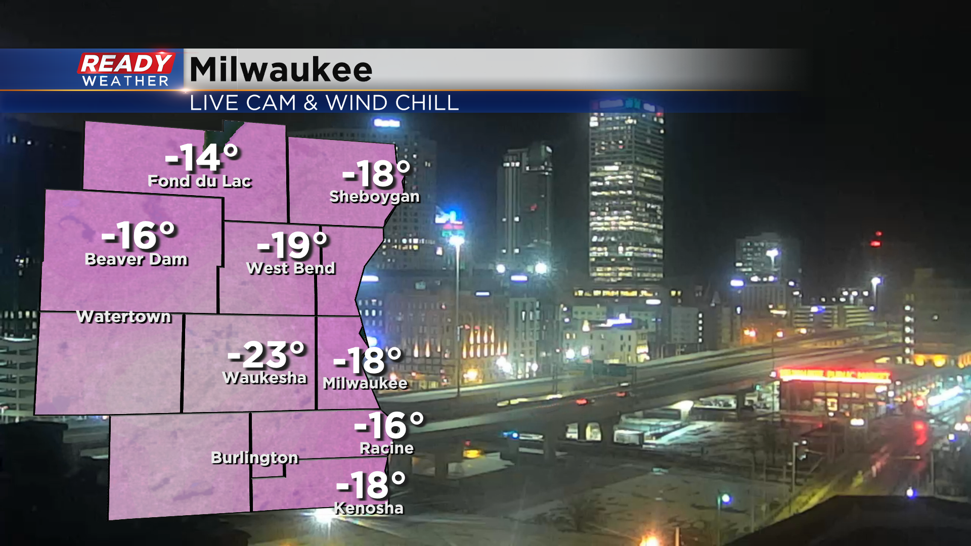
Wind chills aren't quite as cold as they were on Friday morning, but it currently feels like -15° to -25° for most of southeast Wisconsin.
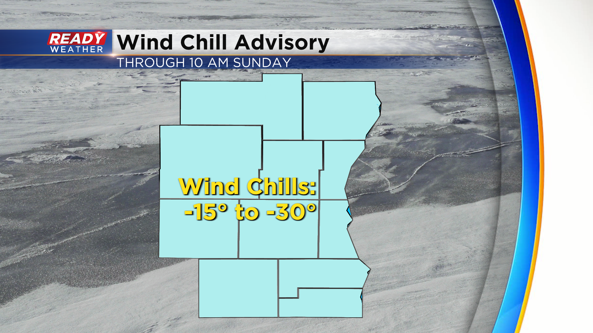
Wind chills will remain between -15° and -30° today through 10am Christmas morning as winds continue to gust between 25-40 mph. A Wind Chill Advisory has been issued for this stretch for all of southeast Wisconsin.
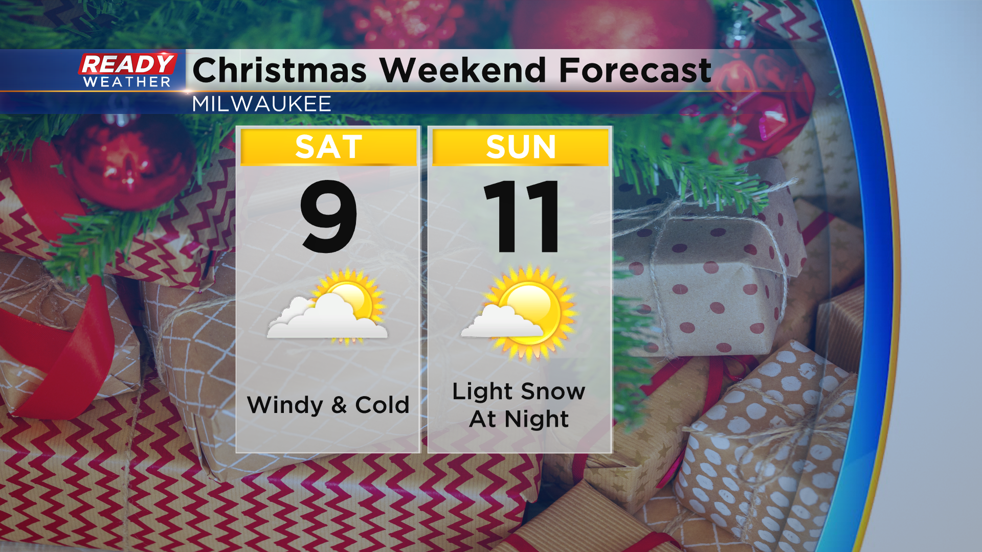
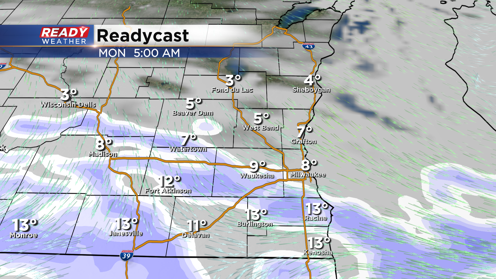
Not only will wind chills remain cold through the weekend, so will our temps. Highs will struggle to warm out of the single digits today and may make it into the low teens on Christmas Day.
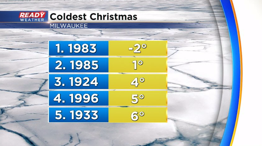
This won't be a record breaking Christmas cold, but it will be our coldest Christmas since 1996. That was our 4th coldest Christmas on record!
We'll have our first white Christmas in five years, and we're expected more patchy, light snow Christmas night into Monday morning. Less than an inch of powdery snow is expected.
Chilly temps continue for Monday, but we'll be making a run at 40° by Wednesday and well into the 40s for Thursday and Friday. Download the CBS 58 Ready Weather app for the full 7 day forecast.