Bitterly cold wind chills continue for Christmas Day


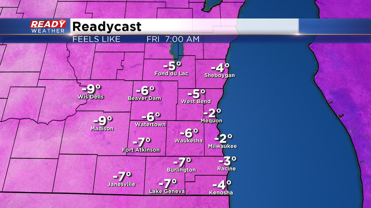
Update as of 8 am Friday...
The core of the coldest air is over us now. This morning we had single digit temperatures for lows across the area. Of course the wind made it feel subzero just about everywhere. Please limit your time outdoors, particularly this morning. At times, it'll feel like -10. Highs today will struggle to get to the low 20s. However, both the temperatures and wind chill numbers will improve drastically by Saturday.
______________________________________________________________________________________________________________
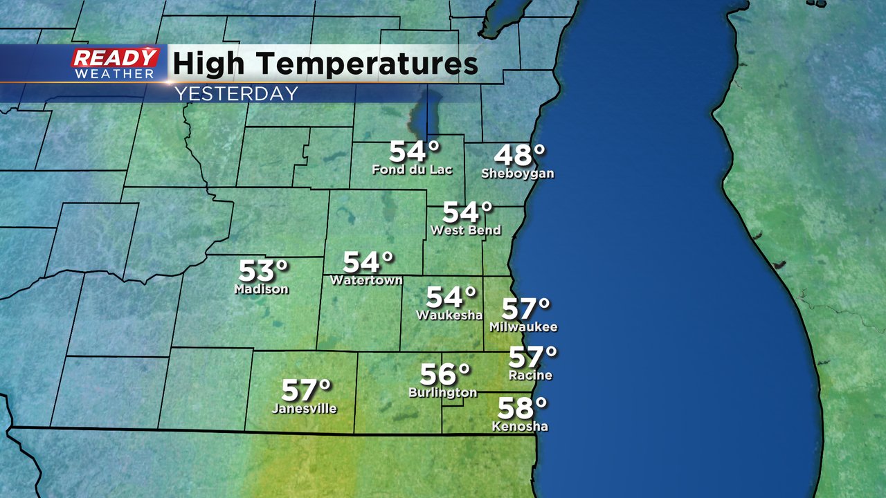
The high temperature on Wednesday was in the upper 50s in many spots across southeast Wisconsin. It was the warmest temps in a few weeks and Milwaukee's high of 57* was just one degree away from the record!
It was also a very windy day with wind gusts exceeding 40 mph in many spots with some getting close to 50 mph. The wind Thursday morning has stayed strong with wind gusts above 30 mph at times but the wind will stay strong all of Christmas Eve and Christmas Day consistently above 20 mph.

The dropping temps in the teens combined with the wind means that wind chills will be the big story for the holiday. Wind chills Christmas Eve day will stay in the single digits just above or below-zero.

Christmas Day is also expected to stay cold with highs around 20* under a partly cloudy sky and the wind at least breezy still gusting over 20 mph at times.

Wind chills will be at their lowest levels Christmas morning with everyone going sub-zero. A few could see wind chills as cold as -10* or even -15* below-zero. It's not Wind Chill Advisory criteria but it's certainly the coldest air of the season!
Download the CBS 58 Ready Weather app to track when the wind dies down and when temperature return to normal.