Chilliest lows of the season so far with a chance for showers Thursday night


Thursday morning was chilly! I think we can finally say that since morning lows were only a few degrees above record cold levels as lows dropped into the lower half of the 40s for most of southeast Wisconsin and Beaver Dam even dropped into the upper 30s!
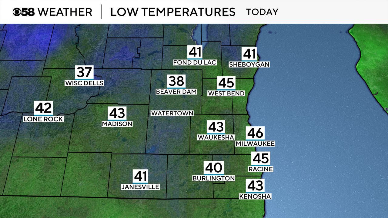
This is the first time Milwaukee has dropped into the 40s since the beginning of June. It's also the earliest date in the second half of the year for us to see 40s since 2017 when we dropped into the 40s on September 2nd. On average, we don't see our first 40s for low until the middle of September.

After the chilly start to Thursday our highs stay cool in the lower half of the 60s. We stay in that range or Friday and Saturday then warm into the upper 60s for the beginning of next week and eventually into the 70s.
Thursday morning chill came with some good sunshine. Clouds will slowly increase throughout the day. Our next chance for rain arrives Thursday night into early Friday morning. The best time period for rain is from 10 PM to 3 AM.

Any rain that we do see Thursday night looks to remain light with showers only amounting to up to 0.20" of rain. Once the rain ends early Friday morning we will stay dry for a few days with the next chance for rain not until the middle of next week when a little bit of warmth arrives.

Download the CBS 58 Weather app to track any showers and see when lows could drop into the 40s again.