We've got one week of February in the books. It continues to highlight the cooler and drier winter we've had across the area.
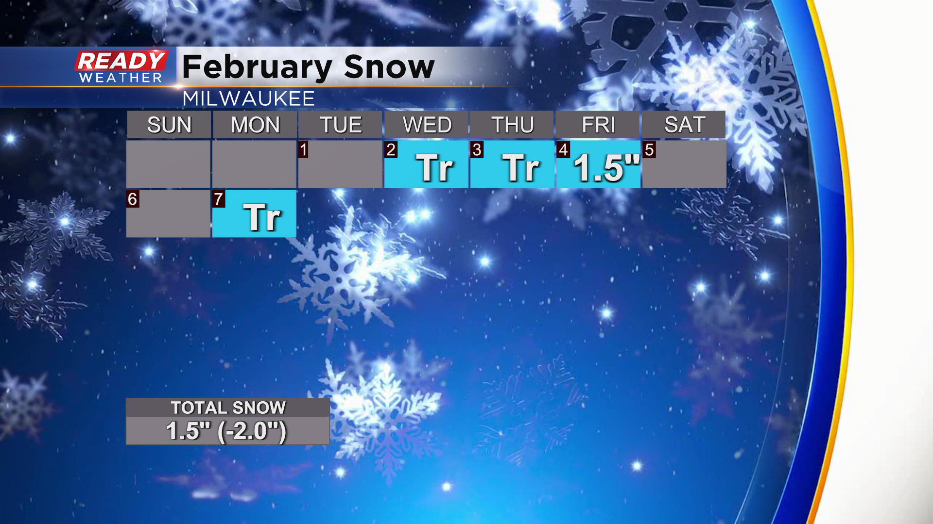
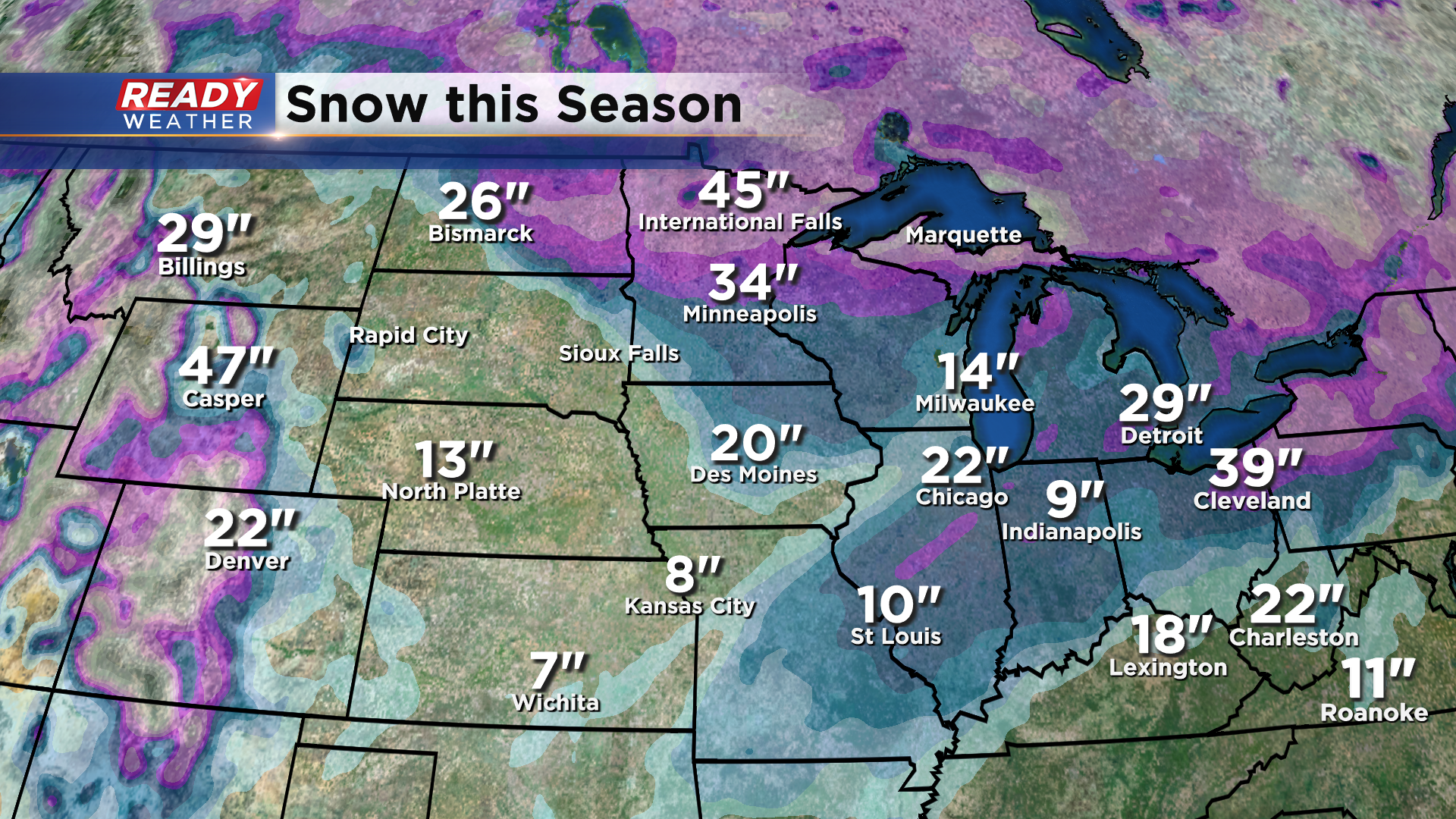
So far we've had just one day with accumulating snow. We're now down two inches from average to date this month. Places south of here have picked up more of the white stuff this season. It's all about that storm track which has often been south of the state this winter.
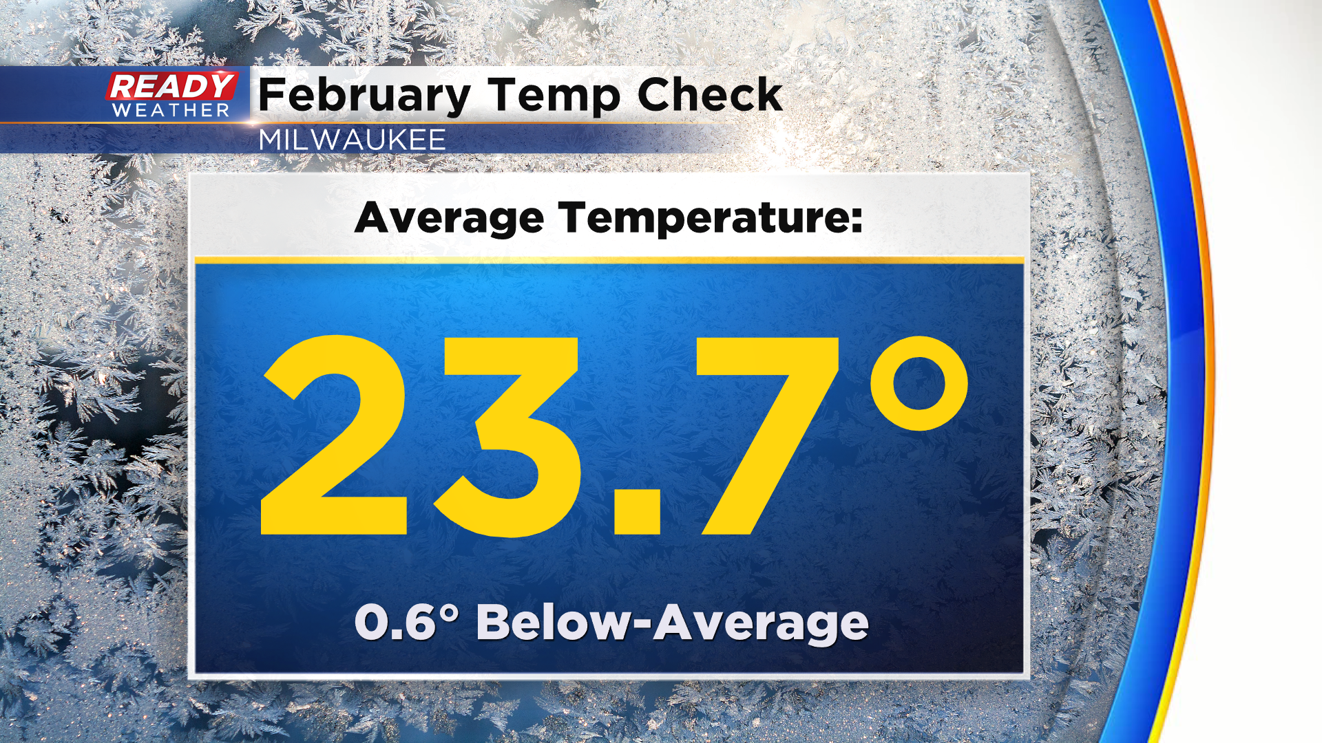
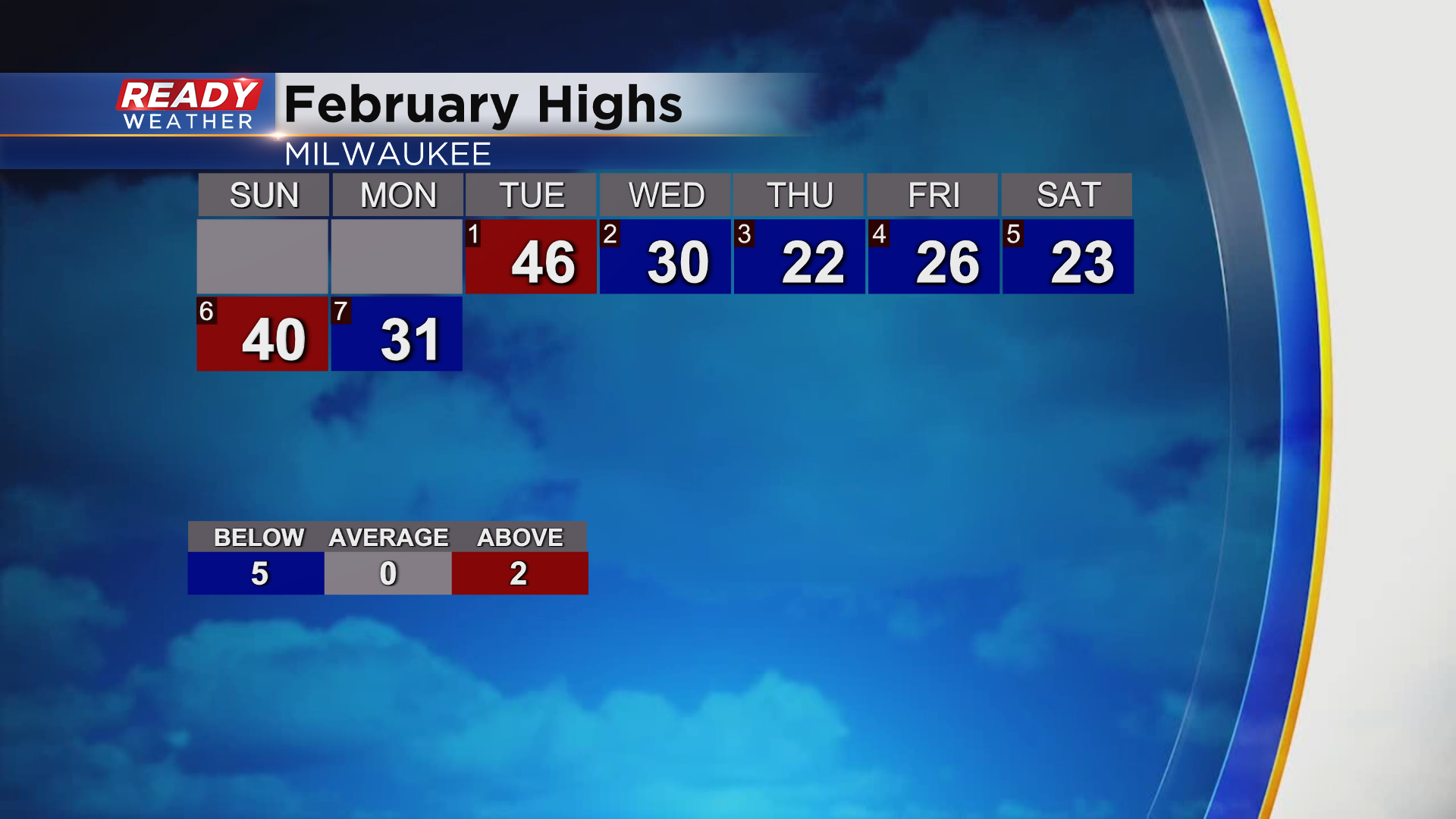
Likewise, our temps haven't been to exciting either. The numbers haven't been too far off, but show we are cooler than average.
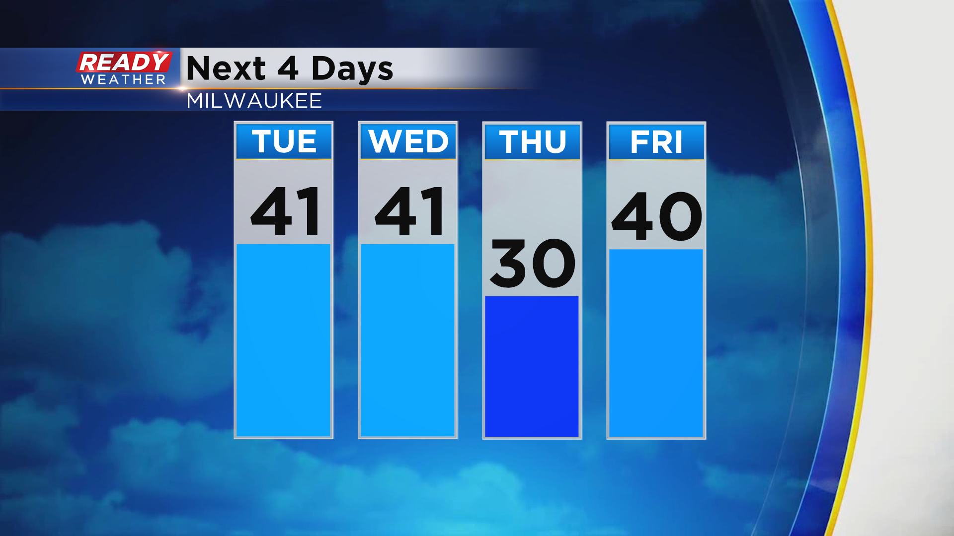
Just two days have been above average, both in the 40s.
There's a couple more forty degree days on the horizon.
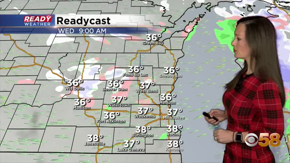
And when it comes to wet weather, we may be tracking more of a wintry mix than snow. As we get into the day tomorrow, a widely scattered light mix will be with us on and off. That looks to be in place for both the morning and evening commute as a couple boundaries pinwheel over the state.
At this time a light mix of snow, sprinkles or drizzle and isolated freezing drizzle is possible. Impacts should stay minimal with just a dusting likely.
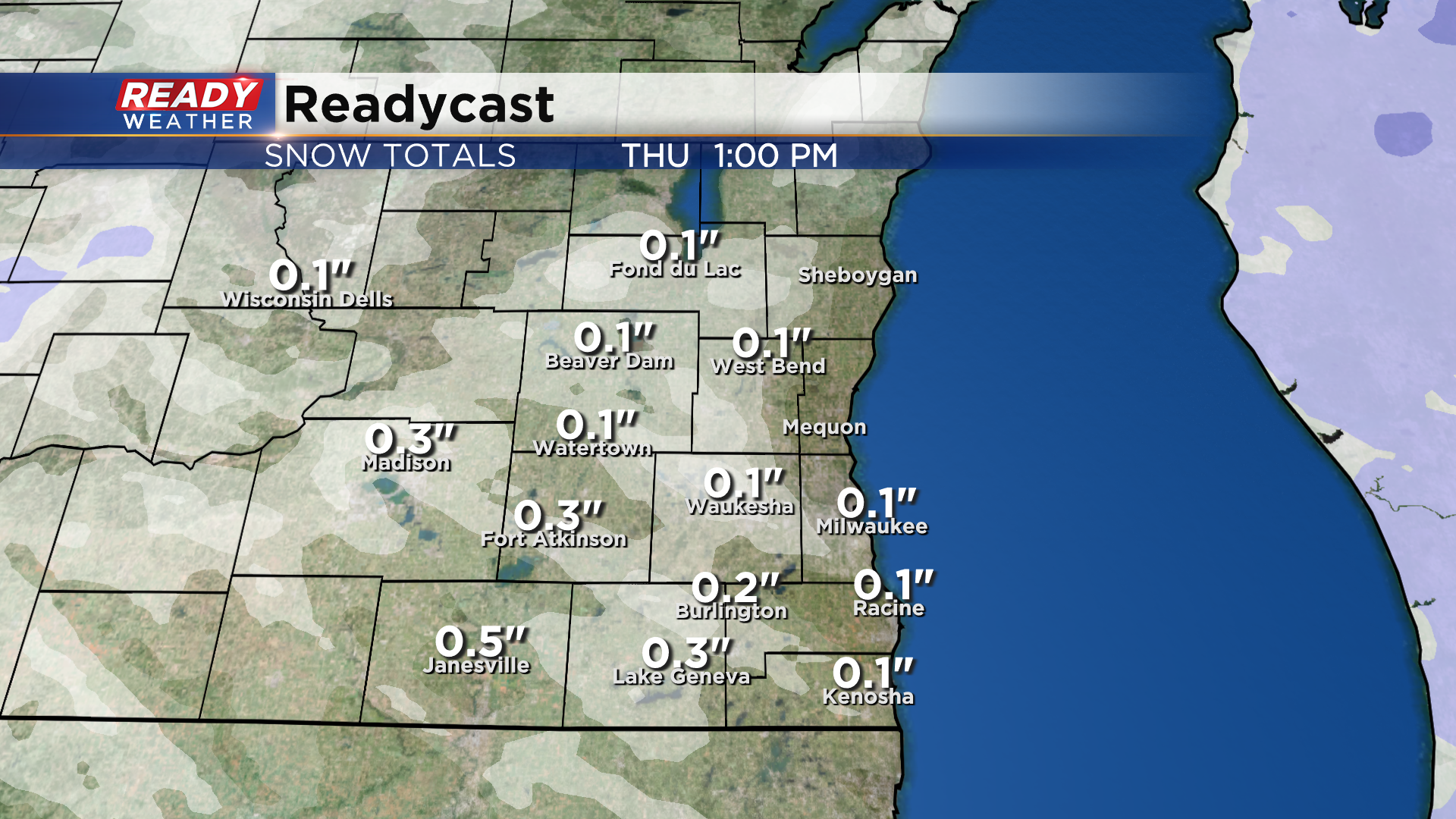
After a quiet day on Thursday, we'll have another chance for wet weather Friday. Even though temperatures could flirt with forty degrees, it appears cold air will rush down to the surface as precipitation takes places so a slightly better chance for minor snow accumulations is expected.
Another small snow chance arrives Sunday with colder highs in the twenties this weekend. However, at this time there are still no major snows in sight.
I'm meteorologist Rebecca Schuld