Chilly Monday then warming back above normal


Updated: Sunday February 6th 9:50 pm:
The cold front is pushing across southeast Wisconsin and is triggering a batch of freezing drizzle. You can't see it on radar, but the freezing mist is reducing visibilities from Fond du Lac to Beaver Dam to Watertown.
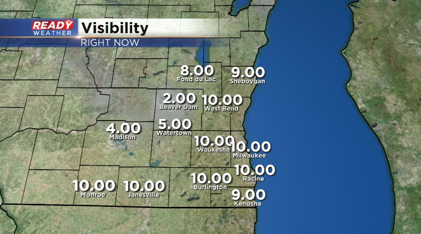
With temperatures in the upper 20s to low 30s, this could create some slick spots on roads as it continues to push east over the next few hours. Best chance of slick spots will be on elevated surfaces, but hopefully the lingering salt on the roads will limit the slick spots.
----------------------------------------------------------------------------------------
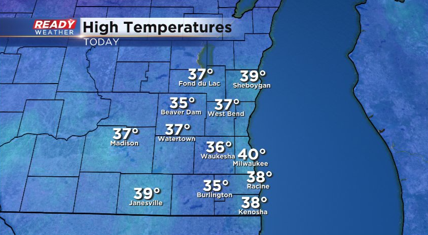
It was a fantastic early February day across southeast Wisconsin today as temperatures rose into the mid 30s to around 40°!
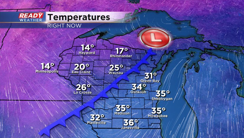
However, a cold front has been slowly making its way across the state throughout the day today and will slide through this evening, dropping temperatures into the low to mid 20s for highs on Monday.
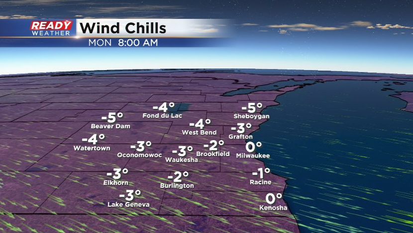
This front may trigger a few isolated flurries or freezing drizzle this evening, but it'll be very light. Winds will turn to the northwest overnight and become a bit breezy with gusts up to 20 mph, making it feel like the single digits above and below zero Monday morning.
After a chilly day on Monday, temperatures will rise back above normal with highs in the mid to upper 30s for most of the work week besides a slight cool down Thursday.
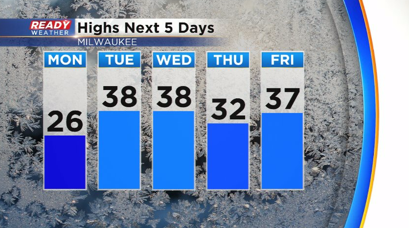
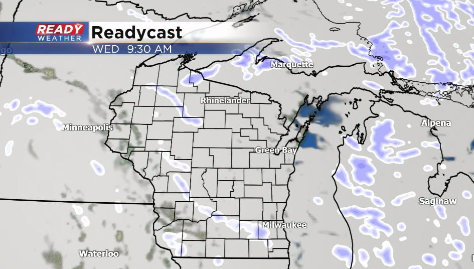
After a dry start to the week, a couple quick moving low pressure systems will track through Tuesday night into Wednesday and again Thursday night into Friday. The chance for a few rain and snow showers looks fairly isolated Wednesday with a better chance for rain and snow arriving with the end of the week system.
Download the CBS 58 Ready Weather App to see how much we'll cool down by next weekend.