


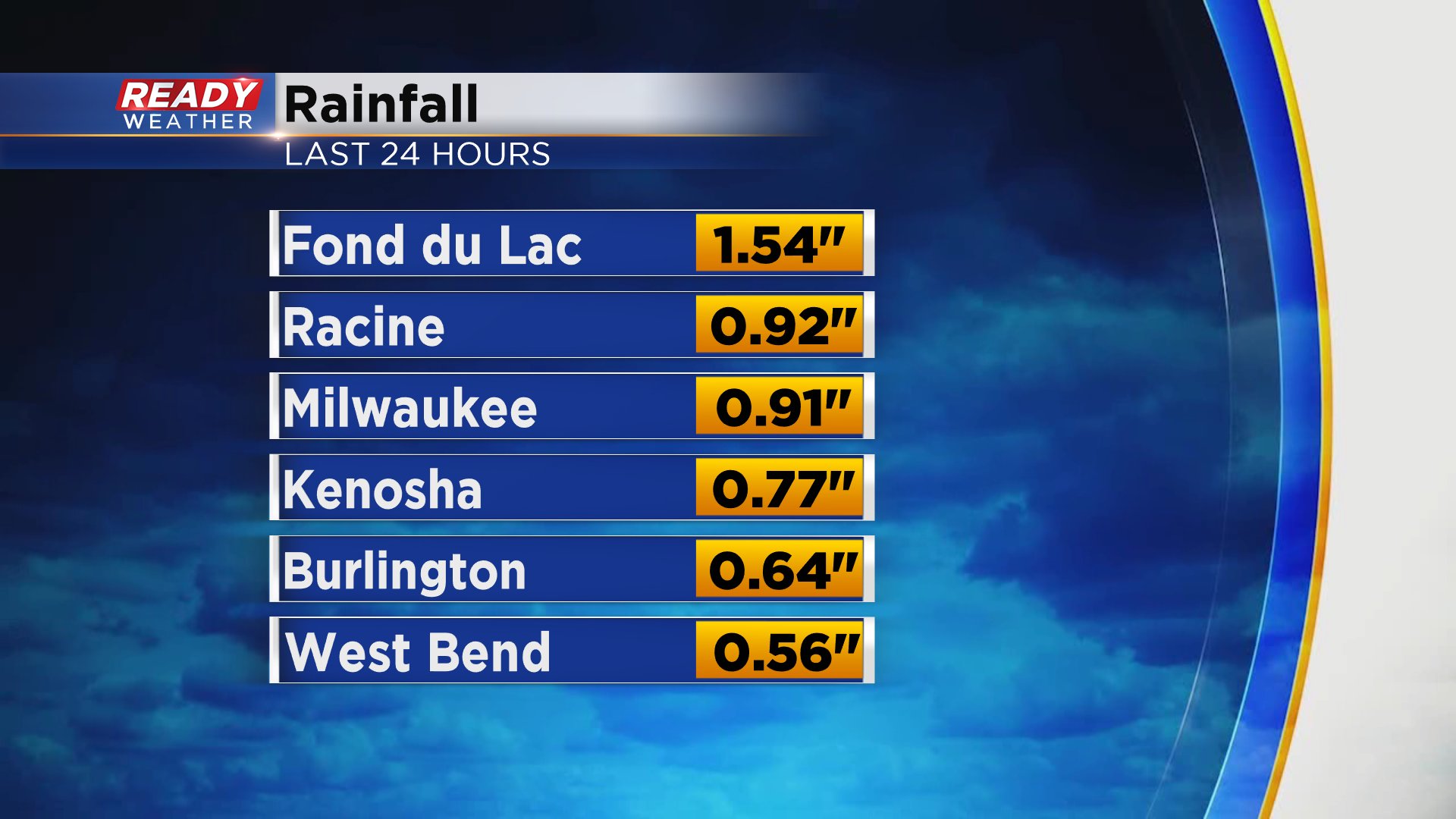
Southeast Wisconsin got a soaking rain Thursday night into Friday morning even with severe weather chances staying to our south. Some pockets of heavy rain moved through the area amounting to a half to full inch of rain for most spots. Fond du Lac saw the most rain with over 1.50" there.
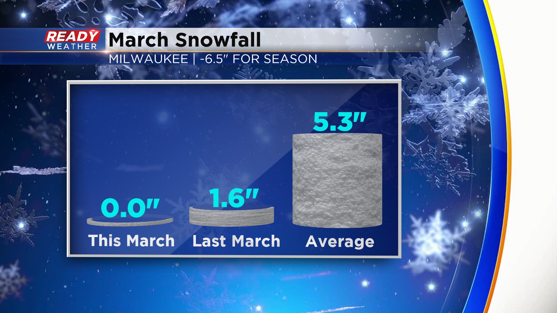
We saw a switch over to light snow in some northern communities but most of the precipitation ended before central and southern counties saw that snow. March hasn't seen much snow at all. A few western and northern counties have picked up a few inches here and there but Milwaukee has officially only seen a trace and no measureable snow. Currently Milwaukee sits about 6.5" below-average on snow for the season.
A cold front brought in the last slug of rain Thursday night and also cooled down temperatures. Friday's afternoon temps will hold steady in the upper 30s and wind chills by Saturday morning will be in the teens. It may be the first weekend of Spring but it will feel more winter-like with temps mainly in the 30s both days.

Saturday is overall dry under a mainly sunny sky but the clouds increase Sunday and there's a chance for some light snow late in the day. Right now the best chance for that snow looks to be in southern spots, but stay with Ready Weather for changes since it's a new development with the weather models.

Download the CBS 58 Ready Weather app to see the hour-by-hour forecast and what the temp and wind chill will be where you live.