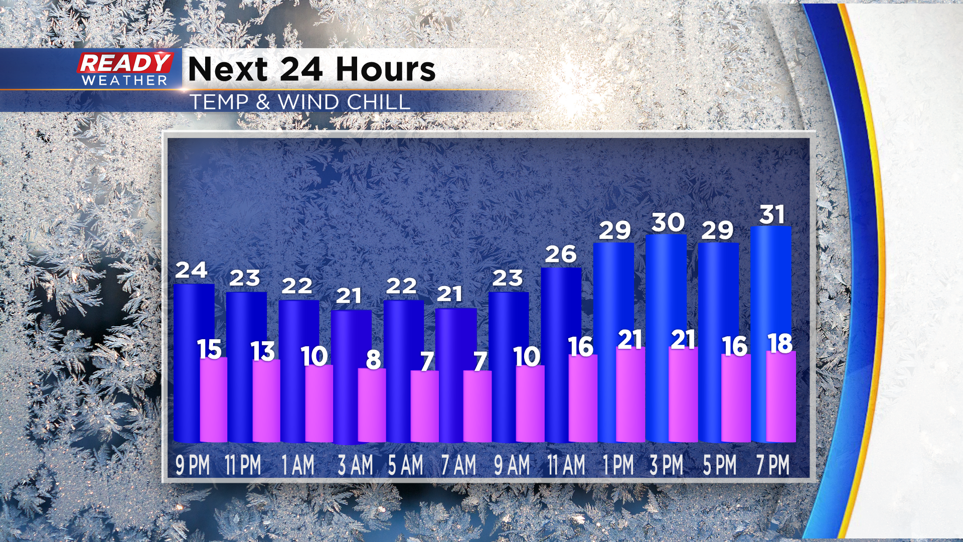
We had a few peeks of sun in parts of southeast Wisconsin this afternoon, but the holes in the clouds have filled back in as an upper level disturbance tracks through the area. This is generating some very light freezing drizzle this evening, which may created a few patchy slick spots on bridges or overpasses. This will come to an end overnight, but the clouds will linger into Monday. While we'll have a chance at a few peeks of sun on Monday, it'll be chilly thanks to winds gusting between 20-25 mph. This will keep wind chills in the teens to low 20s all day.
Another weak disturbance will move through overnight Monday night, bringing clouds back into the area. We can't rule out a few stray flurries, but overall it'll move through dry. By Tuesday afternoon some sunshine should start to mix with the clouds before more roll in for Wednesday.
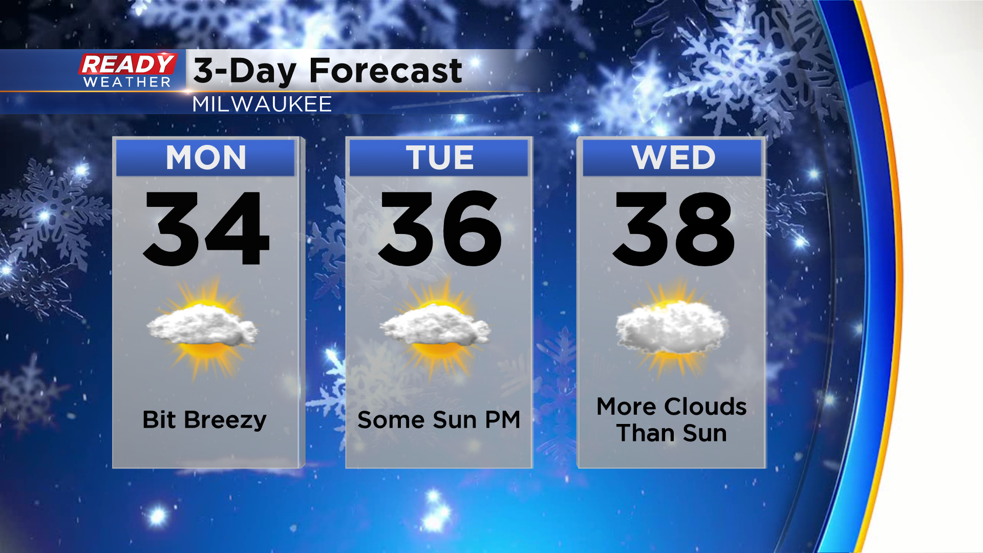
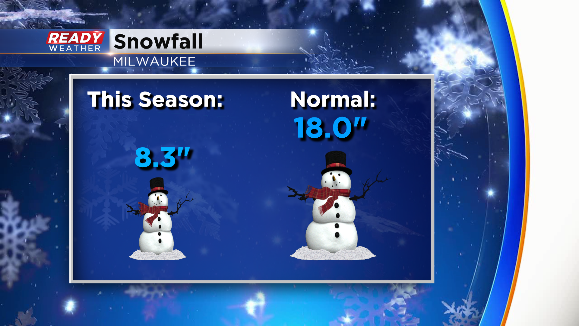
Temps will remain above normal in the 30s through the middle of the week, but colder weather will move in by next weekend after a system passes through the Upper Midwest on Thursday. That system will bringing us our next best chance at rain and snow showers with more wrap around snow showers expected on Friday. Right now it doesn't look like anything major. Although we've had more snow and flurries recently, Milwaukee is still around 10" below normal for snowfall this season.
Download the CBS 58 Ready Weather App to see how much temps will cool down by the end of the week.
