


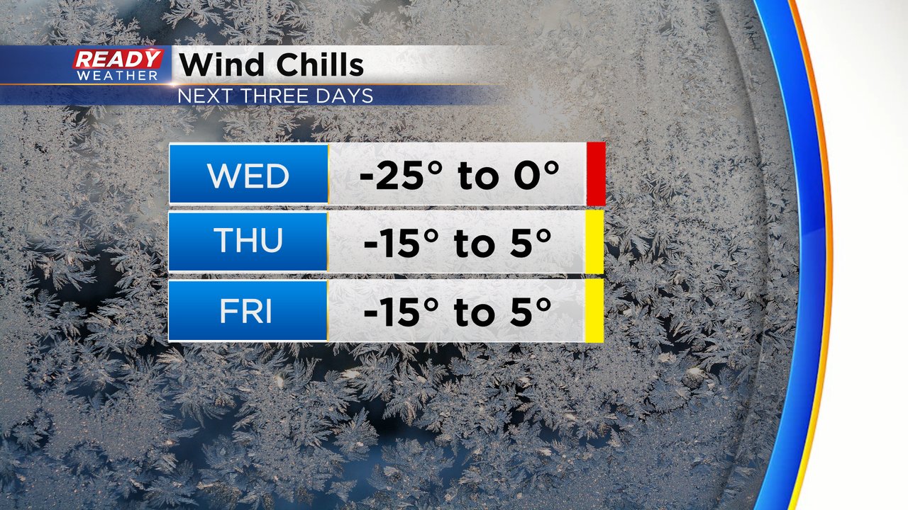
The cold air is starting to loosen its grip a bit. It's still cold but quite as dangerously cold. A wind chill advisory that has been in place since Sunday will expire Wednesday morning. Wind chills by Wednesday afternoon hover around or just below-zero. Thursday and Friday feature a "normal" Wisconsin winter chill with morning feels like temps to -15 and afternoon wind chills above-zero.
But as the cold air starts to get a bit better, we see snow chances return. A round of light snow that originally looked like it would stay in central and northern Illinois now seems to roll into some of our southern counties with Walworth, Racine and Kenosha Counties sitting in an area that could possibly see some snow.

If that snow does materialize those southern counties could get up to an inch of snowfall with highest totals near the IL border. A few flurries are possible as far north as Waukesha and Milwaukee.

Another round of light snow will be possible Thursday evening into Friday morning. This time all of southeast Wisconsin has the potential to see some snow. One to two inches of snowfall will be possible.

Both snows Wednesday evening and Thursday night will be very fluffy and easily removed with a broom or leaf blower. Download the CBS 58 Ready Weather app to track the light snows with the interactive radar.