


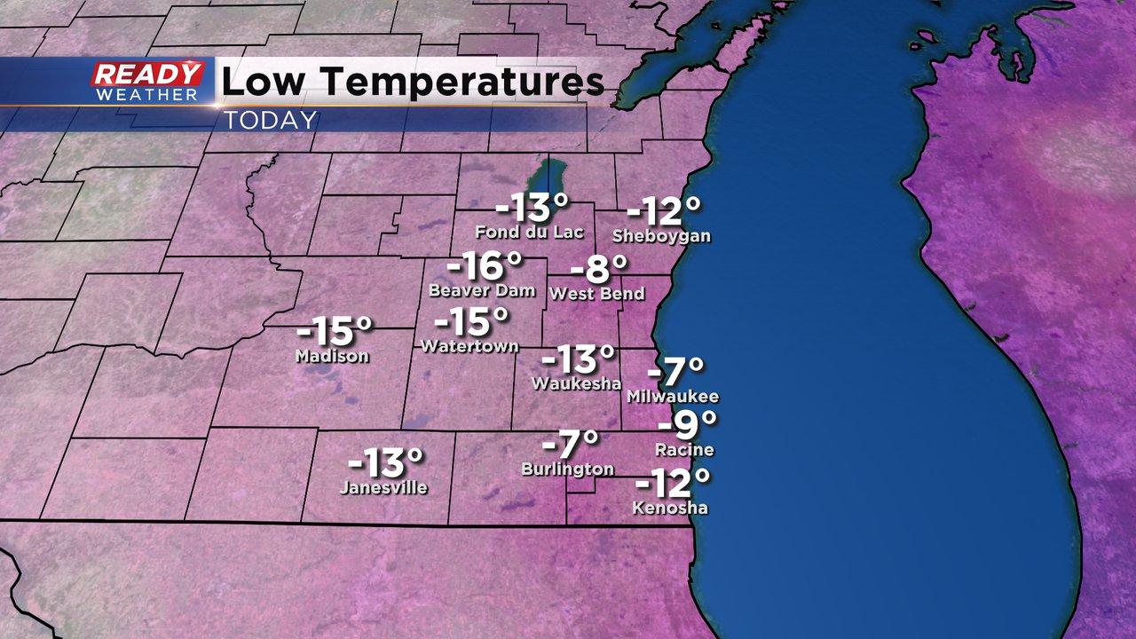
It's been over two years since southeastern Wisconsin has experienced a day this cold. Morning lows were well below zero, especially away from the lake thanks to the clear skies we had overnight.
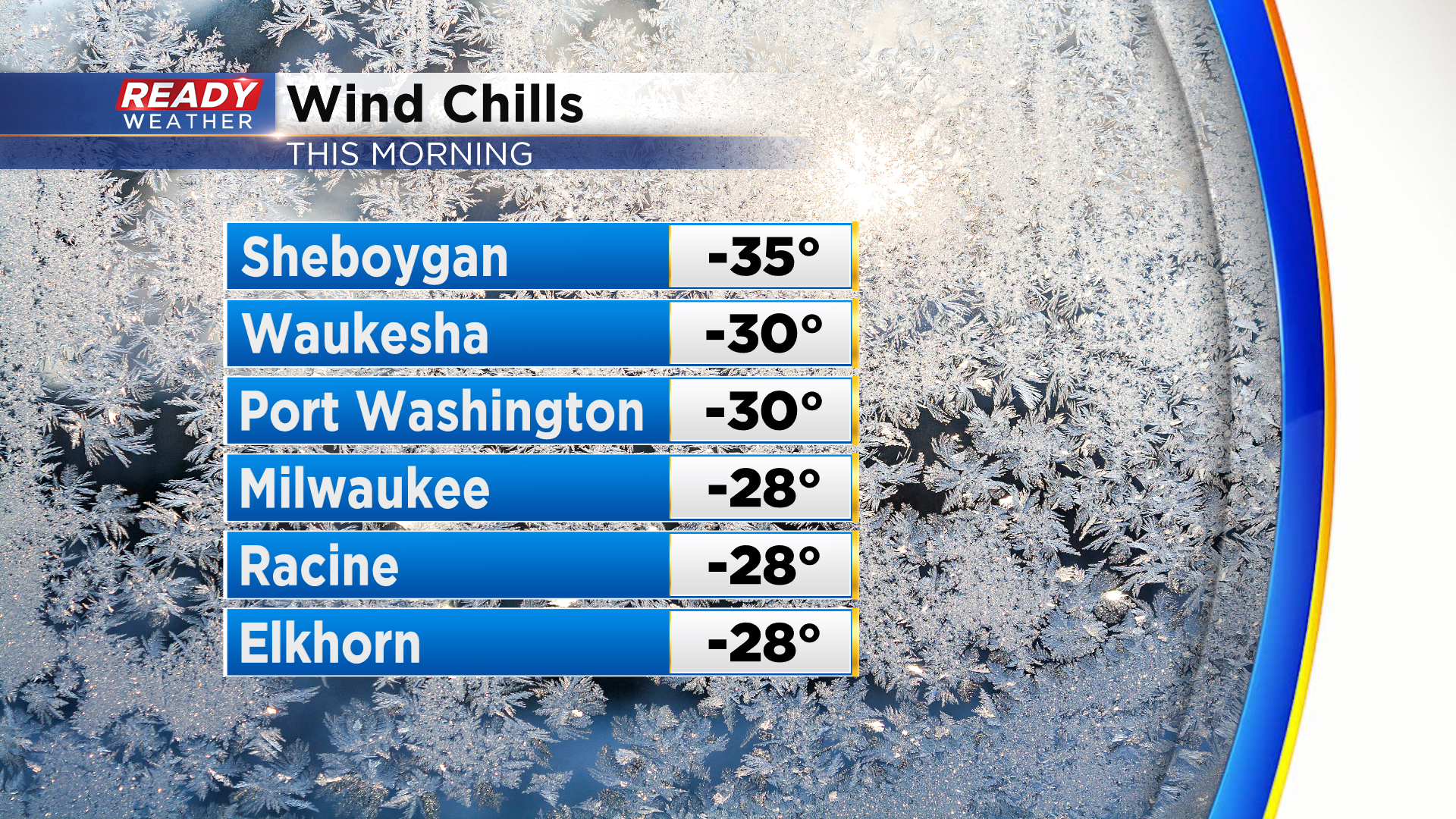
Once you factored in the breezy wind, it felt as cold as -25° to -35° across most of the area.
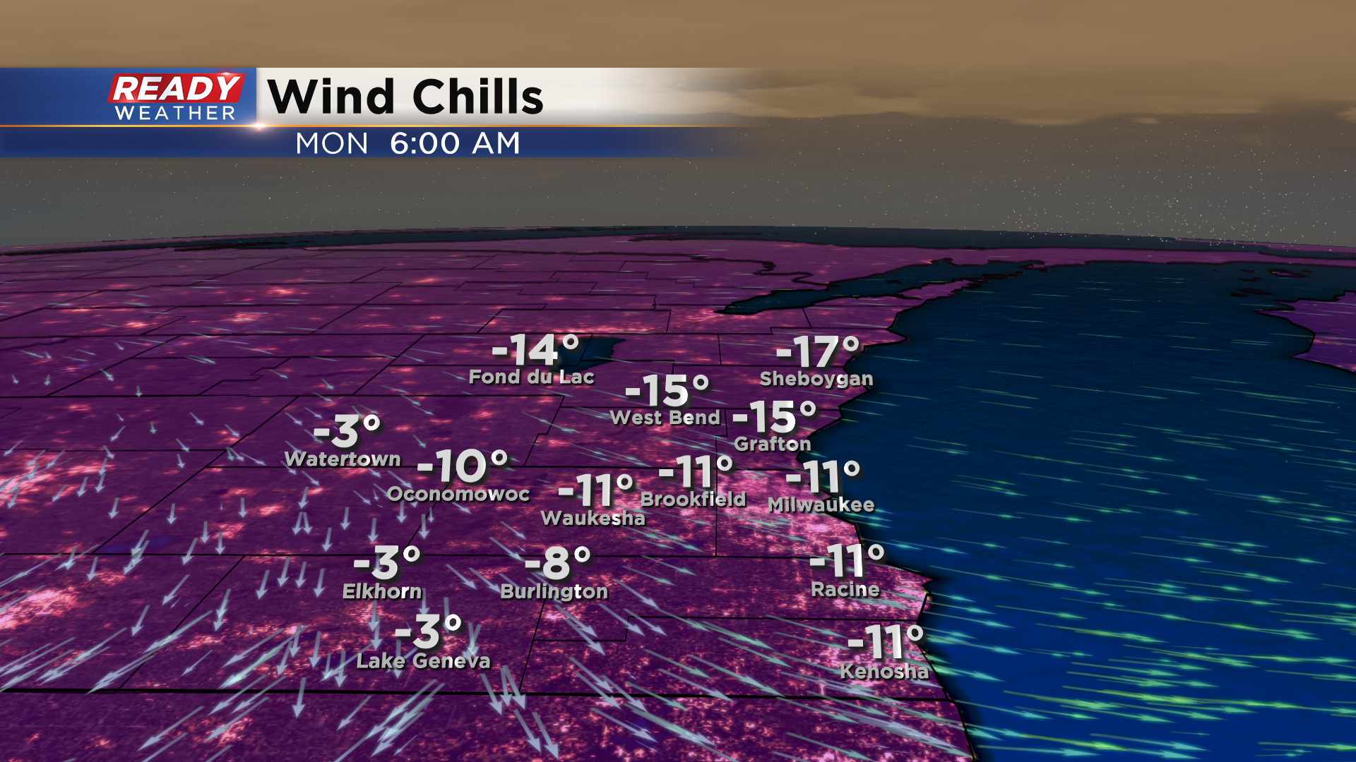
Clouds have rolled back into the area and will stick with us throughout the night, so temperatures will only drop into the single digits below zero tonight. Winds will be lighter tonight around 5-10 mph, so wind chills won't be as bad as this morning, falling to around -10° to -15° by sunrise Monday morning.
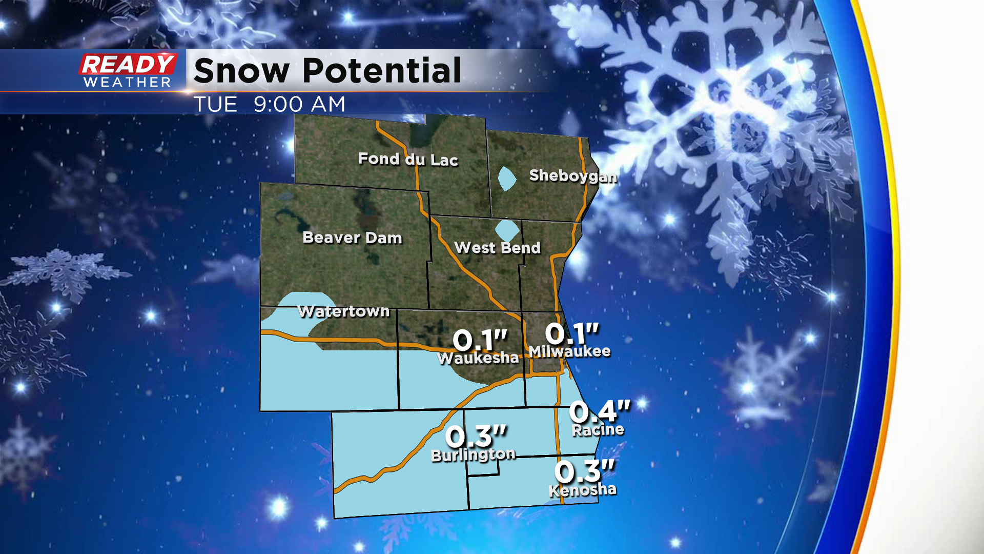
The clouds may produce an isolated flurry or two overnight, otherwise they'll hang around throughout Monday. There's a small chance for some patchy, light snow Monday evening along and south of I-94 (30% chance). This looks very similar to Saturday where a light coating of snow is possible with up to a half inch along with WI/IL border.
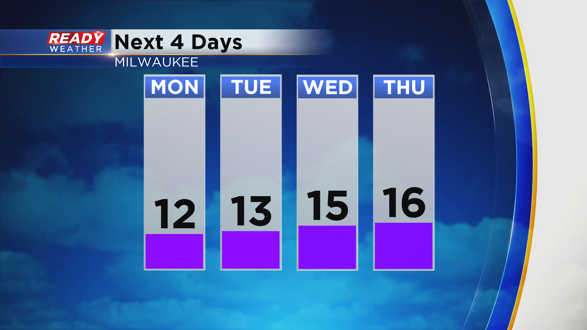
With more clouds around over the next few days, temperatures won't be as bone chilling at night and could rise into the low to mid teens during the day lakeside.
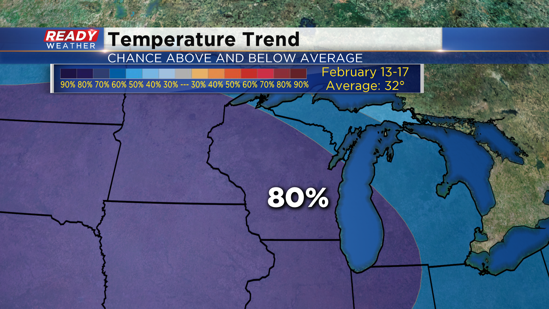
However this chilly weather pattern doesn't look like it's going anywhere anytime soon. The 6 to 10 day temperature outlook that takes us through February 17th shows an 80% chance for below normal temperatures.
Download the CBS 58 Ready Weather App to track the cold temperatures and minor snow chances.