Cool air continues this week with some signs of warmth after Labor Day


It was another chilly start to the day in southeast Wisconsin. Only Milwaukee was warmer than Monday morning. Everyone else was colder with a lot of communities dropping into the 40s and even some low 40s.

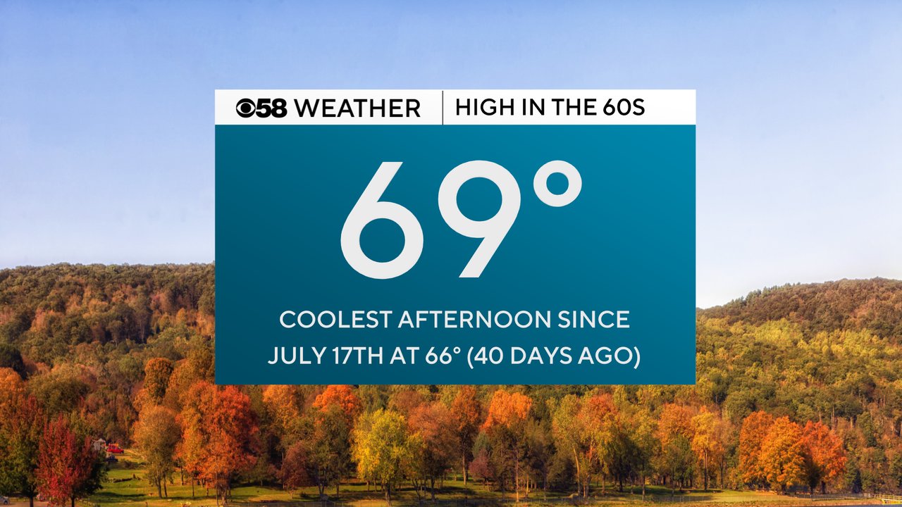
The cool start to the day Tuesday comes after highs for most of southeast Wisconsin on Monday stayed in the 60s. Only West Bend reached 70 degrees.

The 69 degree high in Milwaukee is the coldest high in 40 days since the middle of July when the high reached 66 degrees on July 17th.
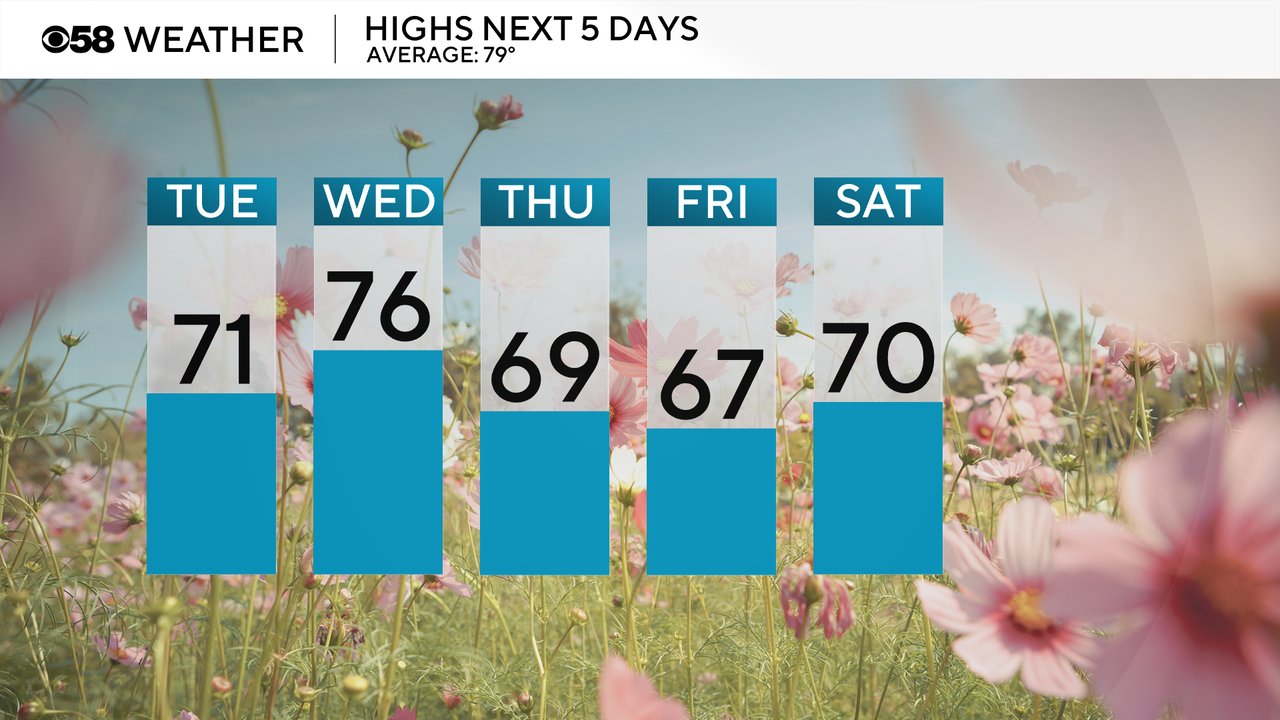
The cooler air will last through the rest of this week into the holiday weekend. Wednesday looks like the warmest day in the mid 70s as the wind briefly shifts to the southwest but even that is still a few degrees below average. Thursday and Friday have trended cooler with widespread 60s for highs.
Lows will stay cool as well. Expect mostly low to middle 50s for lows lakeside and middle to upper 40s away from the Lake in the morning. Thursday morning will be the warmest morning as clouds and rain chances Wednesday night prevent us from dropping too far.

The cool weather looks to last through Labor Day but then right when the kids go back to school next week we could start to see temps return to more normal levels. The Climate Prediction Center puts southeast Wisconsin in a "near normal" category from September 2-8. The average high during that time is around 78 so upper 70s and maybe even an 80 can be expected.

Download the CBS 58 Weather app to track the cool air and see how temps trend for the first week of school.