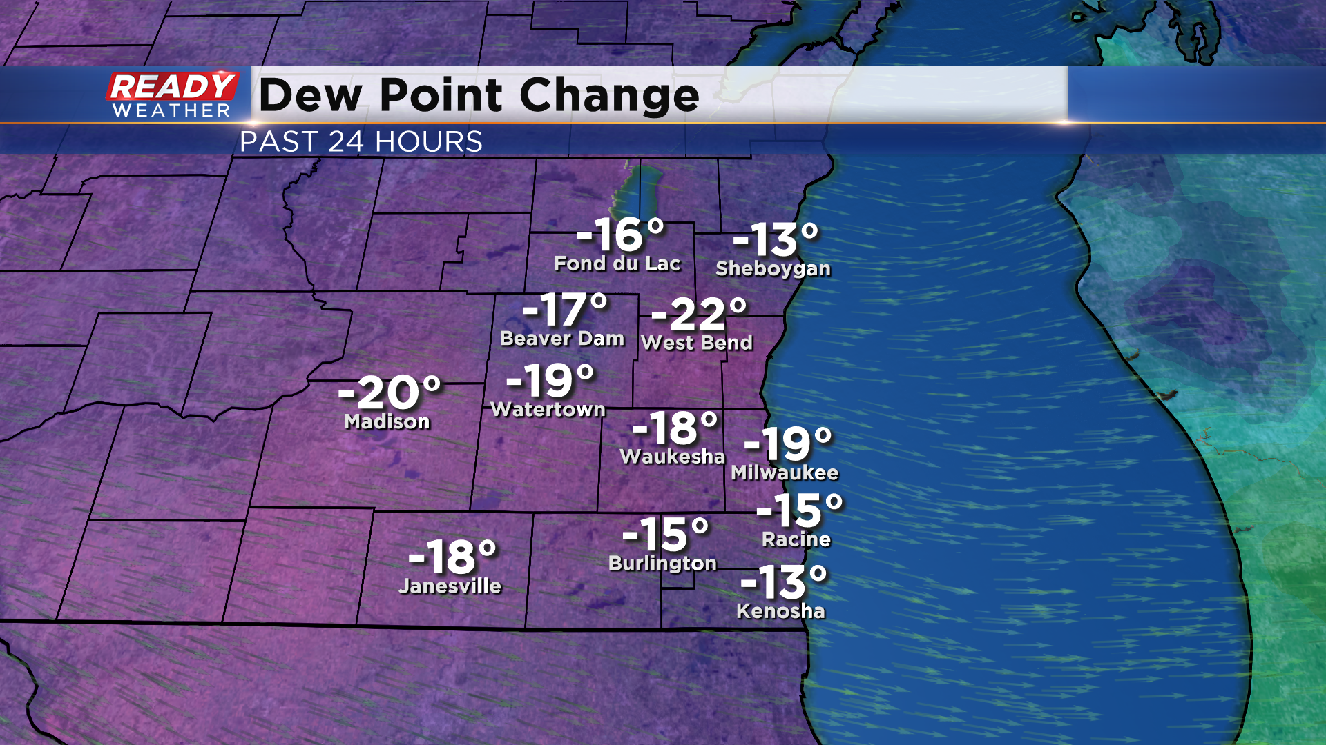
A cold front worked it's way through southeast Wisconsin this morning, and is giving us a break from the humidity! Dew points have dropped into the 50s to around 60 degrees this afternoon, which is a 20° drop from this time yesterday.
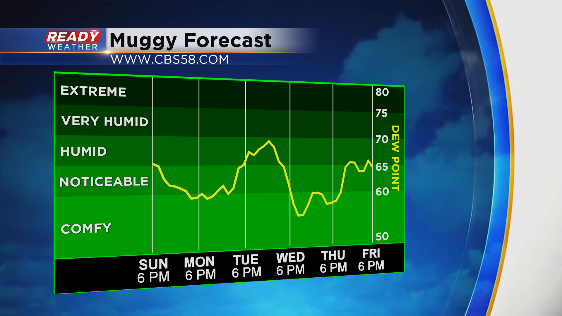
Comfortable humidity levels will continue tomorrow into Tuesday, but it'll turn a bit muggy again late Tuesday into Wednesday morning as a warm front moves into the region. Thankfully a cold front will move through Wednesday and knock those dew points back to comfortable levels on Thursday.
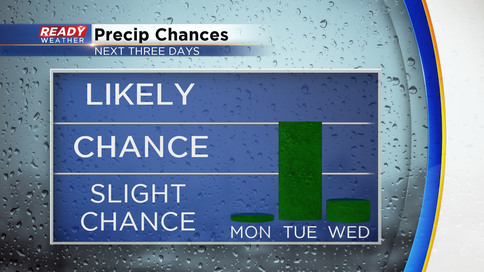
Dry conditions are expected Monday, but scattered shower and isolated storm chances move back in on Tuesday. A few showers or storms may linger into early Wednesday morning, but dry weather is expected for a majority of the day.
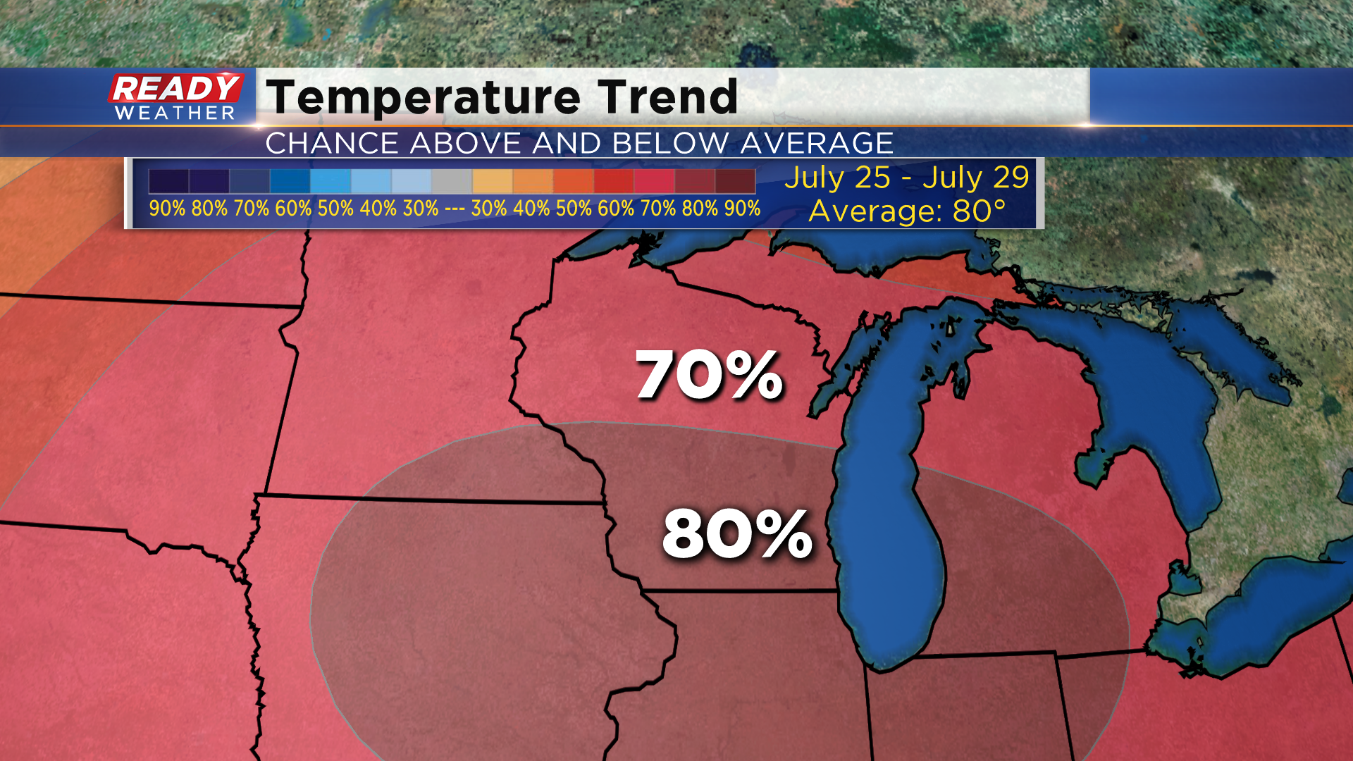
Temps will be cooler than they have been recently in the upper 70s to around 80 to start the week, but it does look like another round of heat and humidity is on the way for next weekend. The Climate Prediction Center has a 70-80% chance for above normal temps for the Badger State next weekend into early next week.
Download the CBS 58 Ready Weather App to see how warm temps may be next weekend.
