


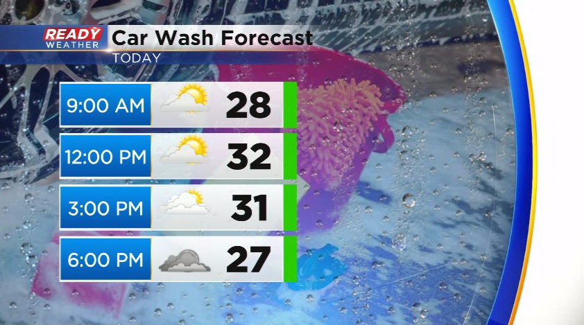
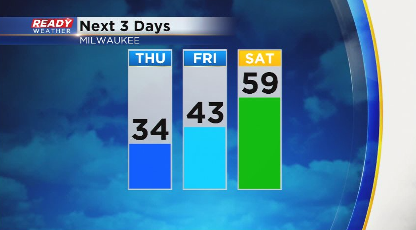
Blustery northerly winds behind a cold front have brought cooler temps into southeast Wisconsin this morning with most spots sitting in the 20s. We'll have times of sun and clouds today, but the northerly wind will hold temps in the low to mid 30s.
Temps will rise back into the low 40s Friday with a southeast wind then will jump into the mid 50s to low 60s on Saturday after a warm front moves through.
Dry weather is expected today and Friday, but shower chances return ahead of the cold front late Friday night into early Saturday morning.
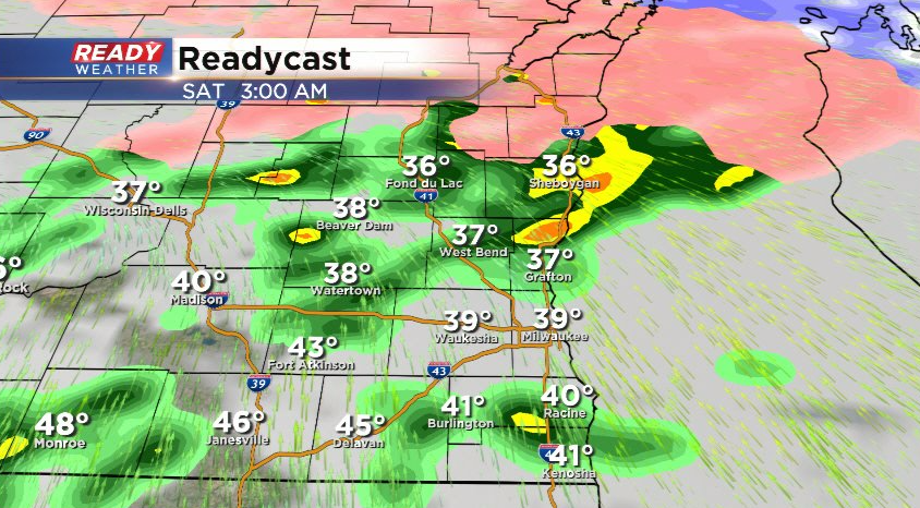
This round of showers looks to end by 9am with a break in the action until late afternoon and evening. As the cold front approaches from the west, rain will become likely Saturday evening with a few thunderstorms possible. A few storms could be on the stronger side with gusty winds and small hail, but the best chance for severe weather will be in Iowa and southwest Wisconsin where a level 2, Slight Risk, for severe weather is in place.
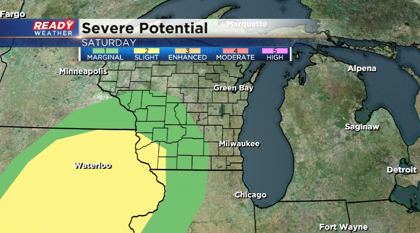
The level 1, Marginal Risk, does extend into western Jefferson county, but this area of storms will be weakening as they push into southeast Wisconsin. Any showers or storms will end by sunrise Sunday morning with strong winds and falling temps expected during the second half of the weekend. Download the CBS 58 Ready Weather app to track the strong storm chance this weekend.