


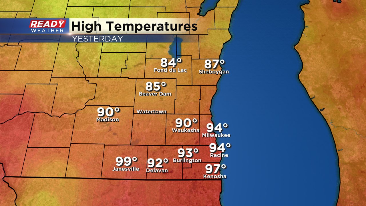
The dangerous heat from Monday and Tuesday is over and we can thank some severe storms for bringing us the cool down. High temperatures for the second day in a row reached into the 90s for most of southeast Wisconsin. It's the ninth time this year that highs have reached the 90s which is the average. It's also the fourth time Milwaukee has hit 94 degrees which is the hottest temp of the year. Northern counties stayed in the 80s since they saw storms first.
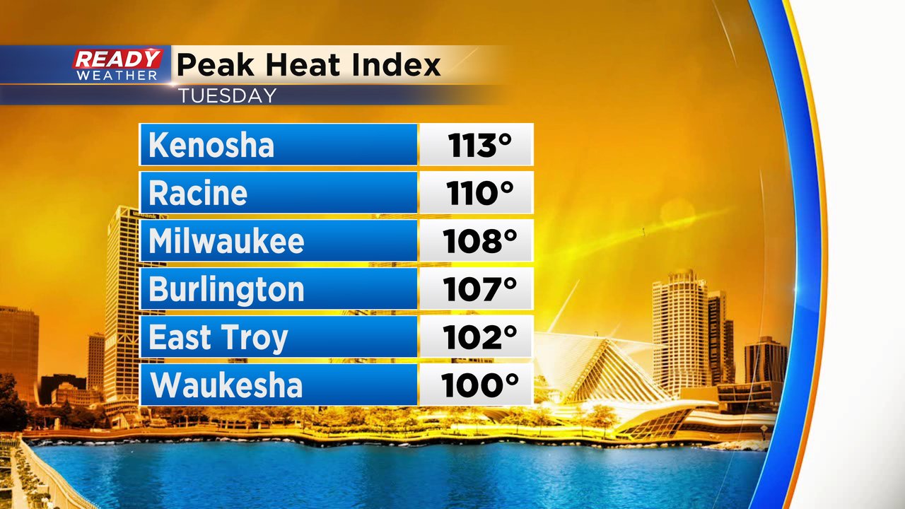
But the storms didn't get here fast enough to prevent dew points from nearly hitting 80 and feels like temps reaching the 100s for a good portion of southeast Wisconsin. Kenosha saw a heat index of 113! It was the hottest feels like temps day of the year!
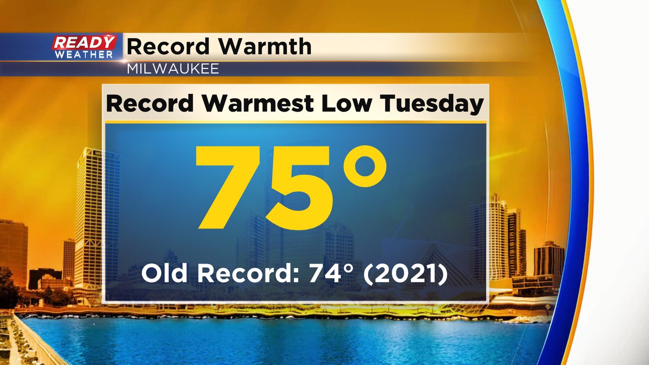
We did not break any record highs on Monday or Tuesday but we did break the record for the warmest low temperature. Tuesday from midnight to midnight we only dropped to 75 which breaks the old record of 74 set just a few years ago in 2021.
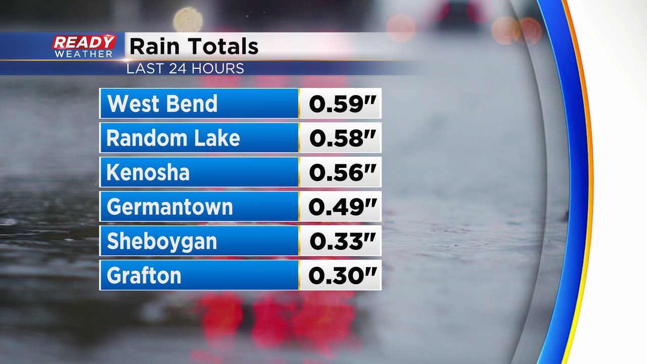
You have to wonder what the temperatures and humidity levels would have been if the storms didn't arrive. But they did, and they packed a punch in many communities. Severe storms were observed in many areas north of I-94 with trees reported down in Dodge, Washington, Ozaukee and Waukesha Counties.

Those communities that saw the storms also saw brief heavy rain with rain totals passing half an inch in many locations and most of southeast Wisconsin getting at least some rain.
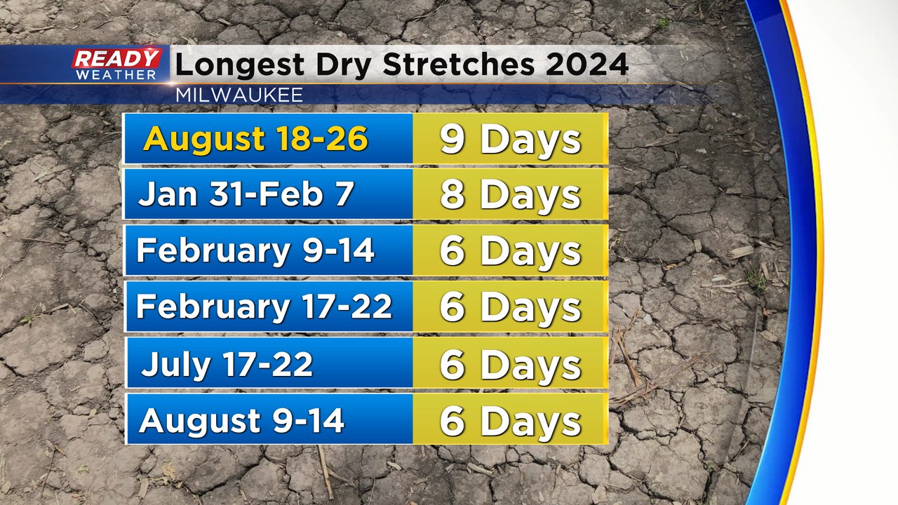
It was also the first time Milwaukee has officially measured any rain at Mitchell Airport since August 17th which means our longest dry streak of the year ends at nine days from August 18-26.
Download the CBS 58 Ready Weather app to track a few rain chances the next few days and see how temps trend going into Labor Day and the first week of school!