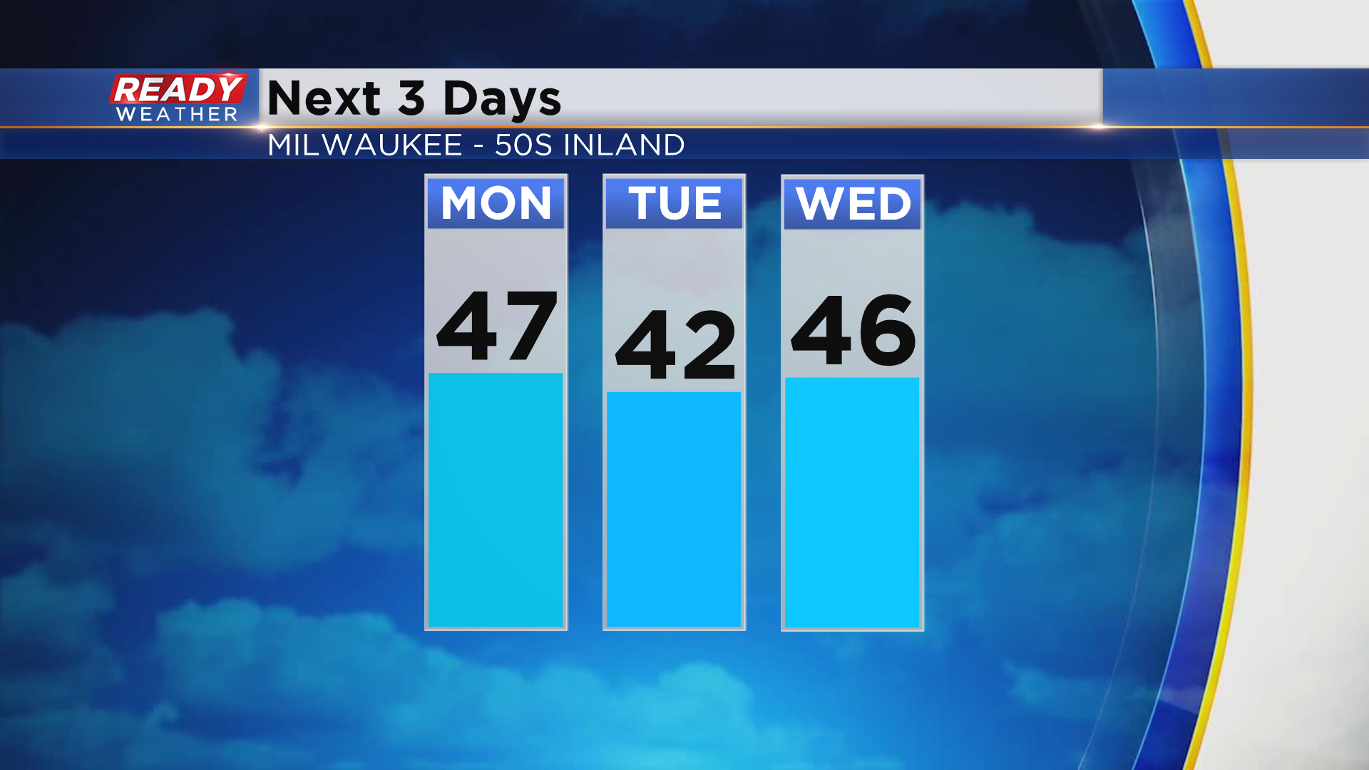
Dry weather returns to start the week after a gloomy weekend
It’s been a rather raw and gloomy day across the area today as the low pressure system responsible for yesterday’s severe weather across the Midwest slowly pulls away.
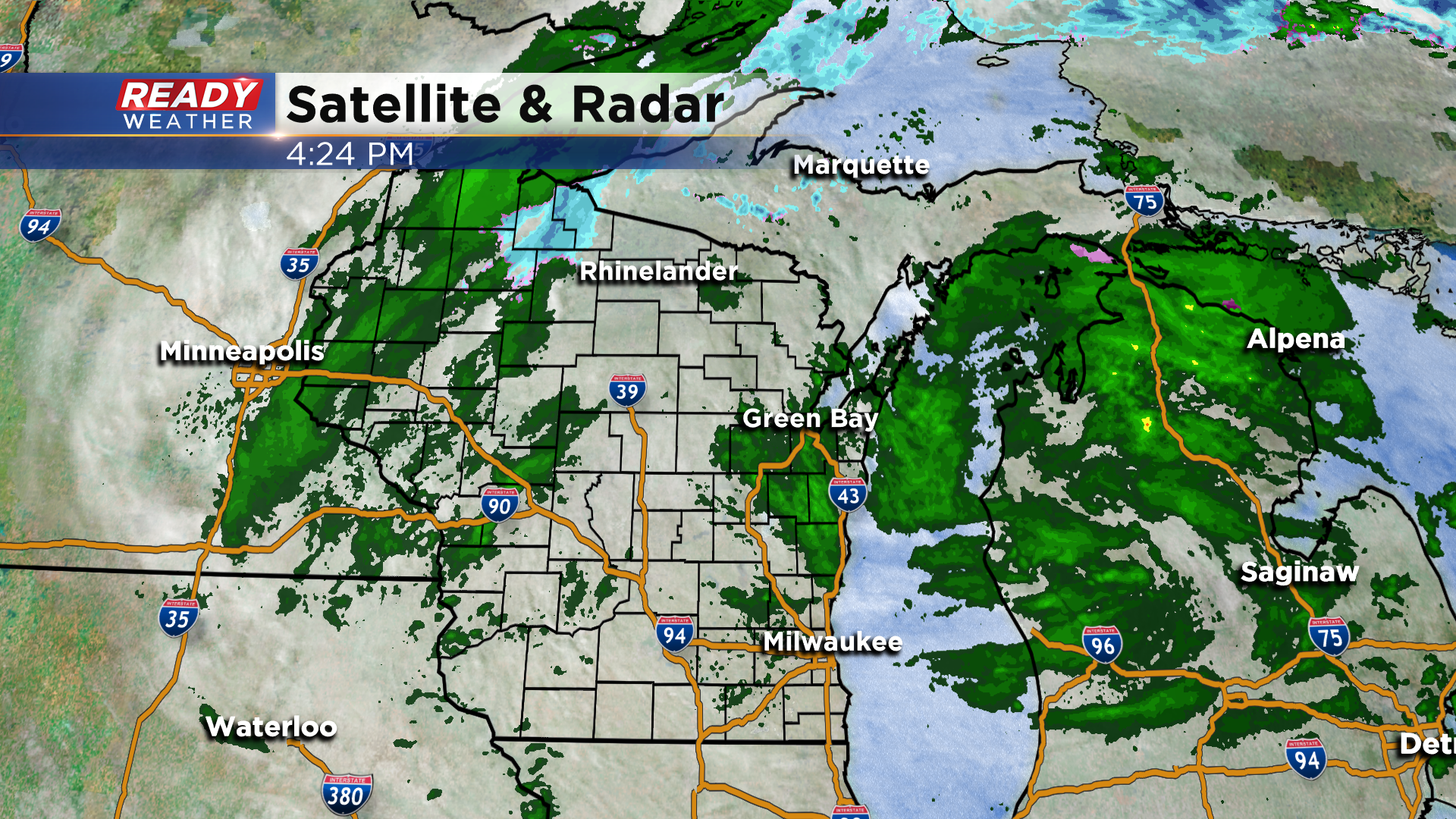
There have been waves of spotty light showers and drizzle on the backside of this low pressure system, and those will continue through mid evening before we dry out overnight.
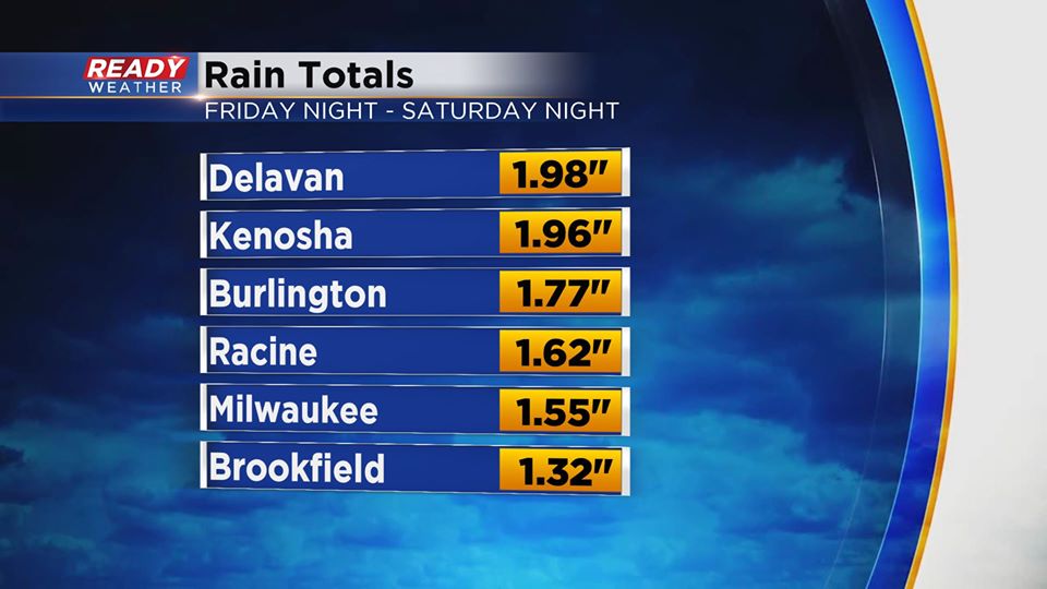
While the showers have been light today (Tr. - .10"), the rounds of showers and storms Friday night through Saturday night dropped 1-2" of rain across most of southeast Wisconsin.
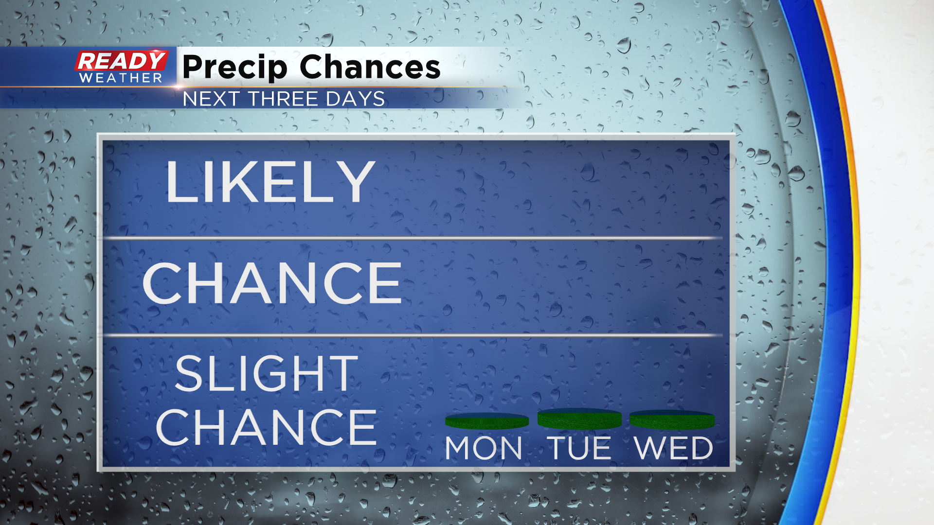
The good news is dry weather is expected for the next three days, so hopefully the water logged grass can dry out a bit.
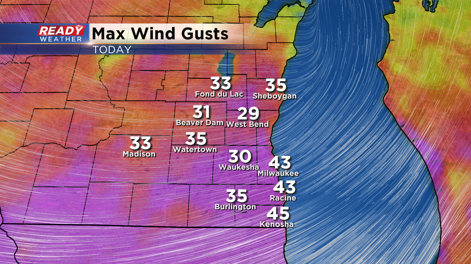
Winds have also been strong behind this system, gusting between 35-45 mph throughout the day.
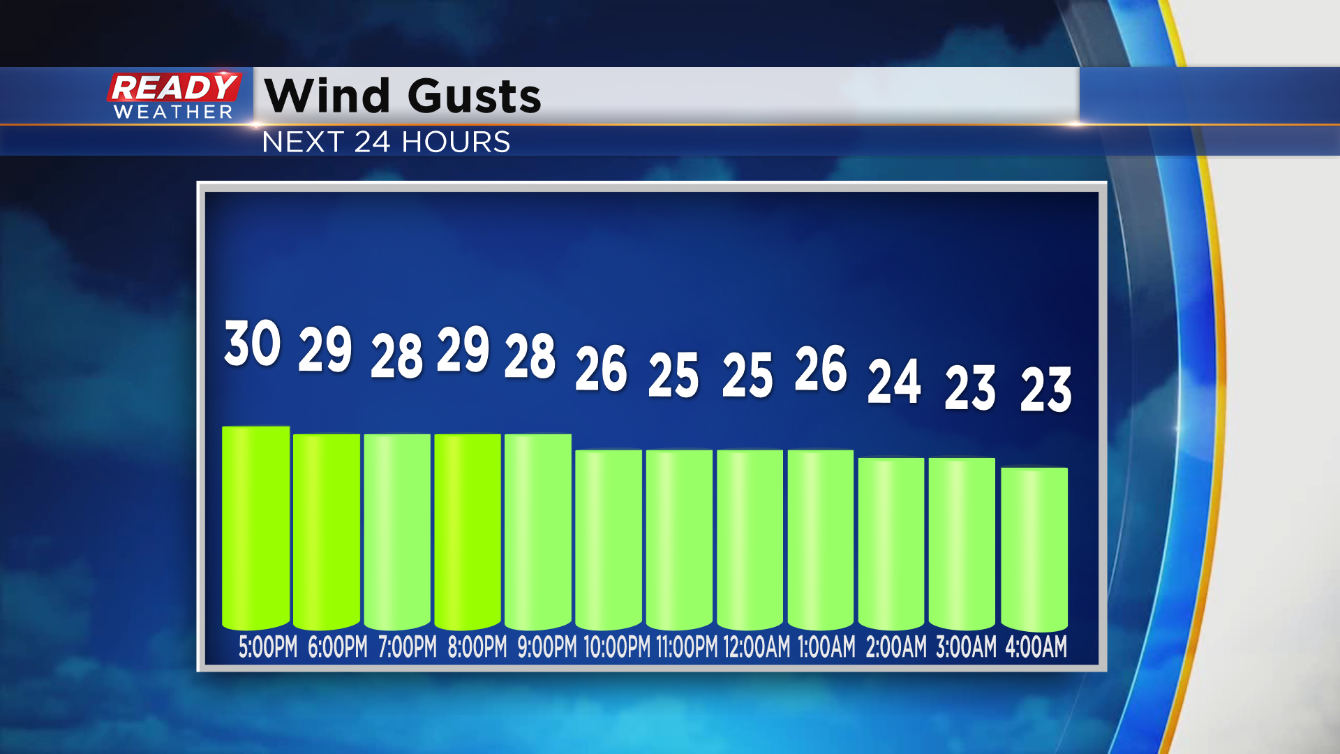
Winds will stay breezy overnight tonight, but will begin to taper off Monday morning.
While we'll be dry the next few days, it doesn't look like we'll have abundant sunshine. The farther west you go the next couple of days, the more sunshine and the warmer you'll be. Easterly winds off the lake will keep temps cooler and more clouds around lakeside than farther inland. Temps will generally be in the 40s lakeside and 50s inland.