Extreme heat arrives Monday and stays through Tuesday


2:30pm Update:
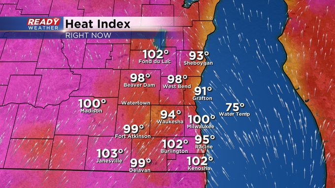
We have reached the 90s for the first time this month in Milwaukee. Our high dew points combined with high heat have feels-like temps pushing the triple-digits. Check it out:
Sunday was the start of our heat with high temperatures reaching the mid to upper 80s and even 90s in Kenosha County. Dew points Sunday stayed in the 60s with some good mugginess. Although the heat on Sunday was not as dangerous, Monday's heat could be.
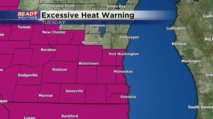
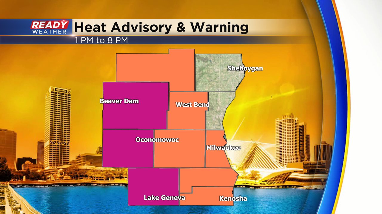
A Heat Advisory has been issued for Fond du Lac, Washington, Waukesha, Milwaukee, Racine and Kenosha Counties from 1-8 PM for heat index values over 100. It might be even hotter in our western counties with Dodge, Jefferson and Walworth Counties under an Excessive Heat Warning for heat indices over 105 at times. Right now Sheboygan and Ozaukee Counties are not included in any heat alerts with feels like temps expected to stay in the 90s there with a bit of a lake breeze.
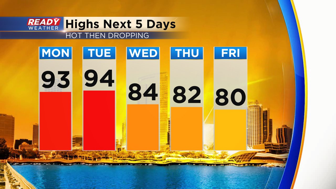
High temperatures are Monday and Tuesday are expected to be hot and potentially the hottest of the year around 93 Monday and 94 Tuesday. Then dropping through the 80s the rest of the week.
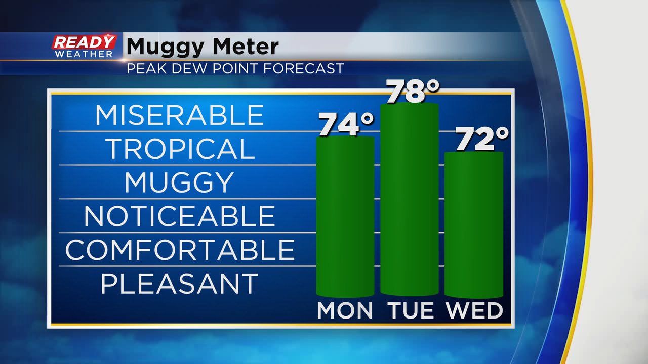
Even though the temps we will see Monday and Tuesday are similar to heat earlier in the summer, the dew points will be some of the highest we've seen this year. Tropical level humidity is on the way for Monday then well into the miserable category for Tuesday with dew points in the upper 70s. Even though by Wednesday the temps start to drop, the humidity will stick around until the weekend.
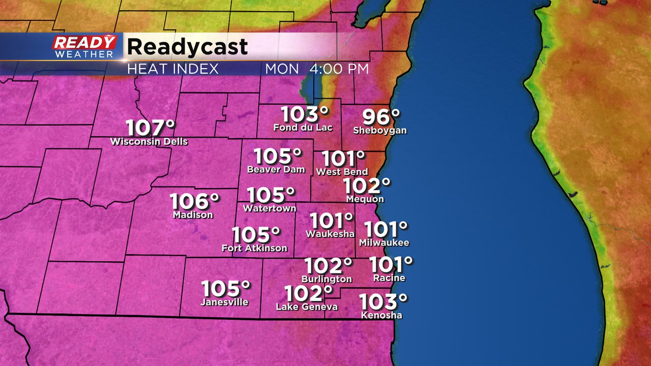
With all of the heat and humidity on Monday the feels like temperatures will likely reach into the 100s with most spots peaking between 100-105.
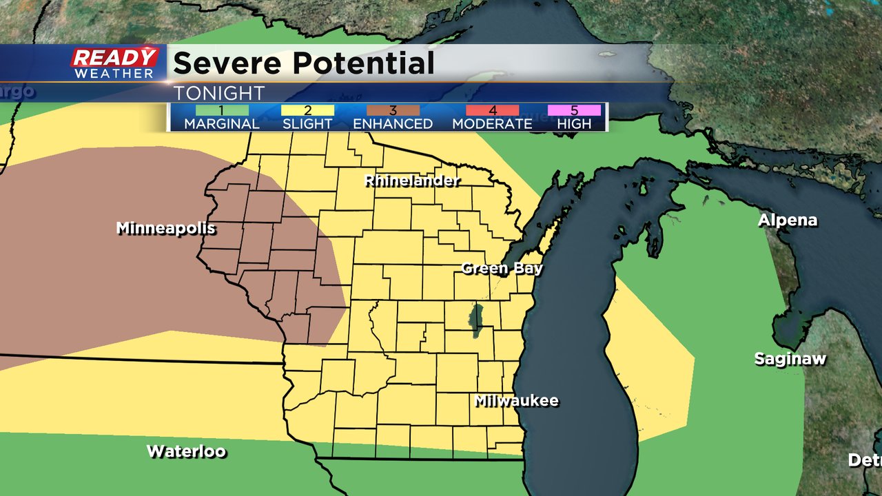
We are also tracking some storm chances the next few days. Most of southeast Wisconsin is under a Level 2 Slight Risk for Monday night as a cluster of storms forms in the Dakotas/Minnesota and moves east. The better chances are towards Green Bay but some of those storms could clip our northern counties mainly around/after midnight. It's one of those situations where the storm chance is fairly low, but if storms do hit us they would likely be strong/severe thanks to all the heat and humidity. More storms are possible evening that could also be strong/severe.
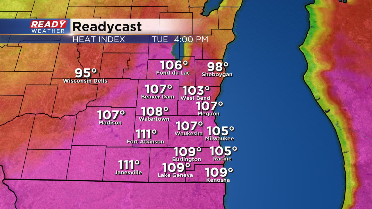
With the heat and humidity expected to be a little more intense on Tuesday the heat index values could reach 110 degrees or more in some spots. There are some uncertainties for Tuesday in regards to storm chances and clouds that could impact temps.
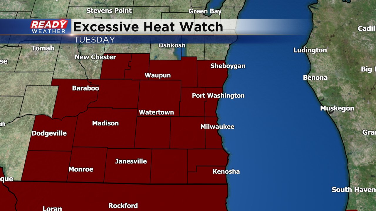
Because of the continued heat an Excessive Heat Watch has been issued for all of southeast Wisconsin for Tuesday afternoon and evening. The watch will likely be upgraded to either an advisory or warning for most of southeast Wisconsin or it's also possible that some counties are not included in either if temps are trending a touch cooler.
Download the CBS 58 Ready Weather app to track all the heat the next two days.