Fall's last weekend reveals more cold air by Sunday

-
2:04

‘Keep my cousin’s name alive’: Easter celebrations turn...
-
4:18

Bereaved Together hosting 7th annual mothers’ conference in...
-
5:11

Entertainer previews Community Smiles Dental’s ’Laugh for...
-
2:28

Chilly Election Day then wintry mix and showers return
-
2:11

Meet CBS 58’s Pet of the Week: Tito
-
3:09

SkyDance Pet Lodge’s ’Defensive Walking Training Lab’ keeps...
-
2:10

Big races in Wisconsin’s spring election Tuesday
-
2:06

Crews respond to fire at Milwaukee U-Haul facility, same location...
-
2:44

Natalie’s Everyday Heroes: Marquette students produce live...
-
2:34

’What we’re asking for is intervention’: Teachers’ union...
-
1:50

Kenosha man gets $2M bond, charged with killing estranged wife...
-
1:48

New grocery store opens on Milwaukee’s north side as city battles...

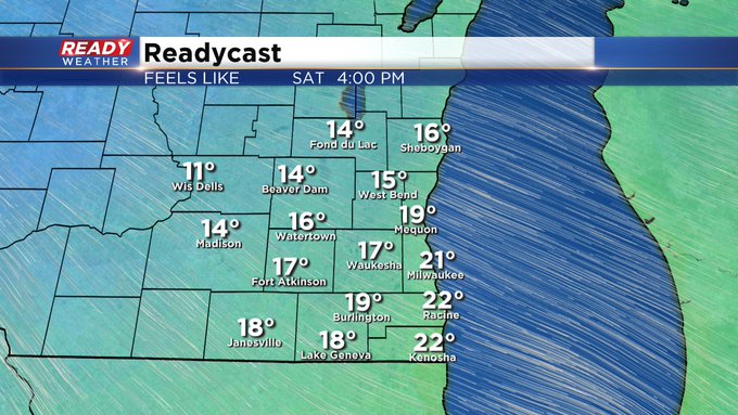
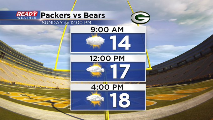
Milwaukee (CBS58)--Don't get used to the near 40 degree temps today. Readings take a slide as soon as later Saturday as arctic air begins to intrude, at least for a while. Highs will struggle to get into the 20s by Sunday. Any wind will make it feel that much colder. In fact, look for wind chill numbers to stay in the lower teens for the second part of the weekend. Heading to the Packers game on Sunday, dress for winter! Look for highs only near 20 with the real feel deal near 10!!

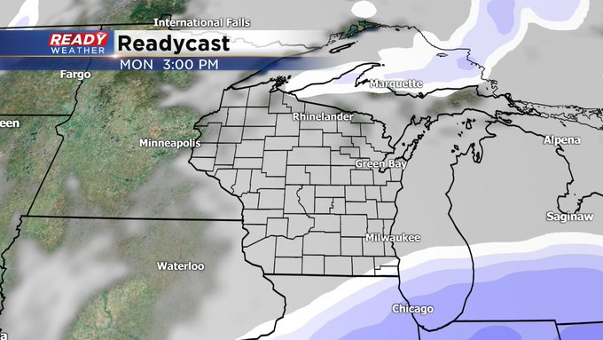
Our next best shot of snow comes Monday, especially the second part of the day. The computer models are still wrangling with the date, but it looks like the southern half of the viewing area could get a glancing blow.
Stay tuned for further updates thorughout the weekend with CBS58 Ready Weather forecaster Sam Kuffel.