Few flurries today into tonight before sunshine returns to end the week


The low clouds have returned across the Badger state today as a couple of low pressure systems track across the Midwest. The stronger system is missing us to the south, but a weak low tracking across the state is triggering a few flurries and sprinkles.
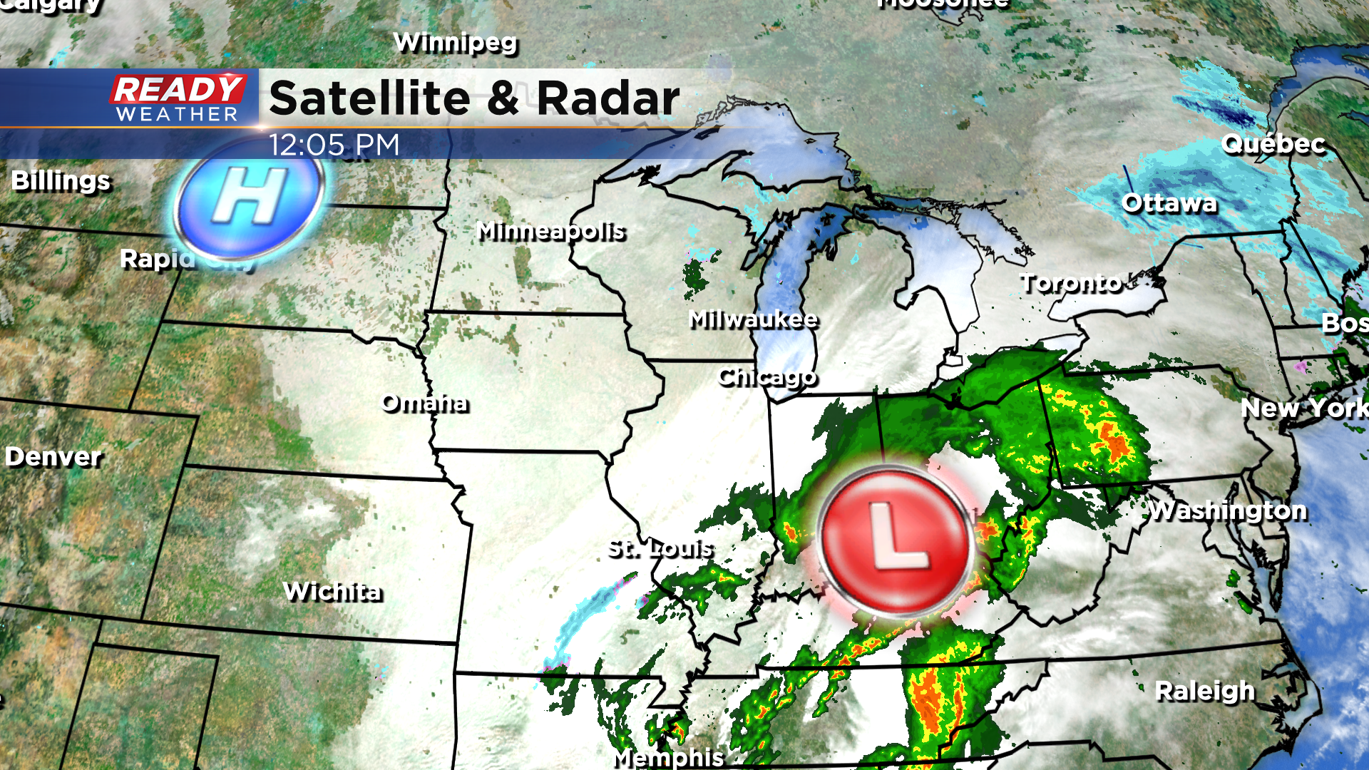
Stray flurries and sprinkles will be possible through the rest of today before isolated snow showers develop this evening. Nothing more than an isolated dusting is expected with flurries tapering off before daybreak Friday.
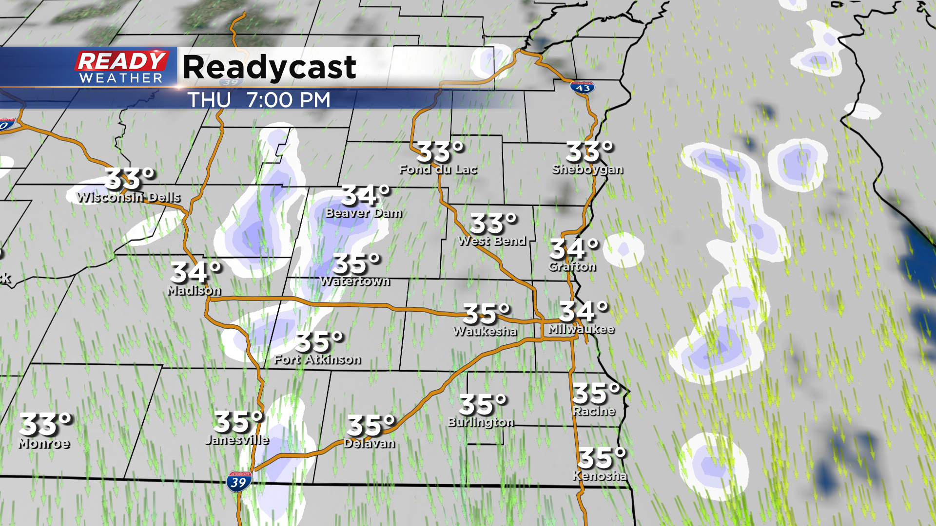
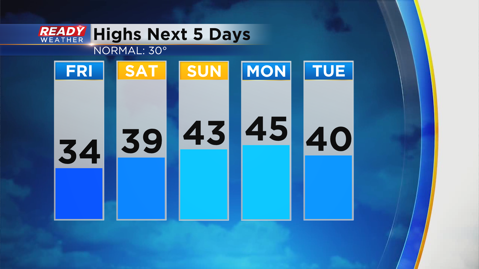
Clouds linger through Friday morning, but will start to decrease Friday afternoon and evening, leading to more sunshine Saturday. Clouds will gradually start to stream in on Sunday ahead of our next system which will mainly be steady rain in southeast Wisconsin all day Monday. There isn't much snow in the forecast for the next week as temperatures remain well above normal in the upper 30s to low 40s.
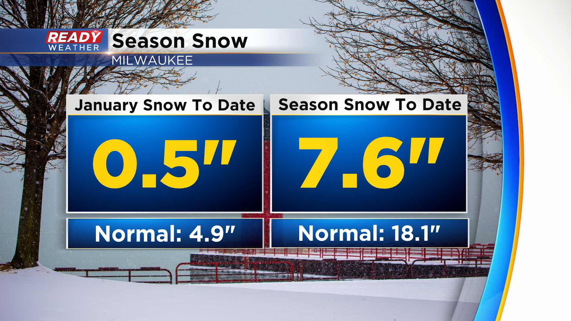
January is typically our snowiest month of the season on average, but Milwaukee has only had a half inch of snow so far this month. We're running close to 5" below normal in January and over 10" below normal on the season.
Download the CBS 58 Ready Weather app to see if there is any real cold air on the horizon.