Few showers and storms late tonight and again late Sunday


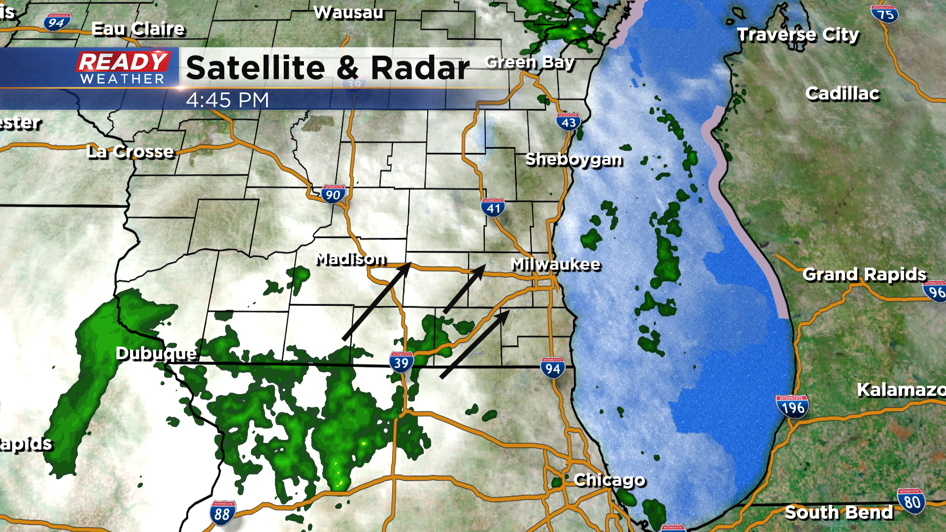
A few isolated sprinkles/very light showers have pushed across SE WI this afternoon with a few more showers looming to our southwest. These have been weakening as they push closer to southeast Wisconsin, but a few may hold together through sunset.
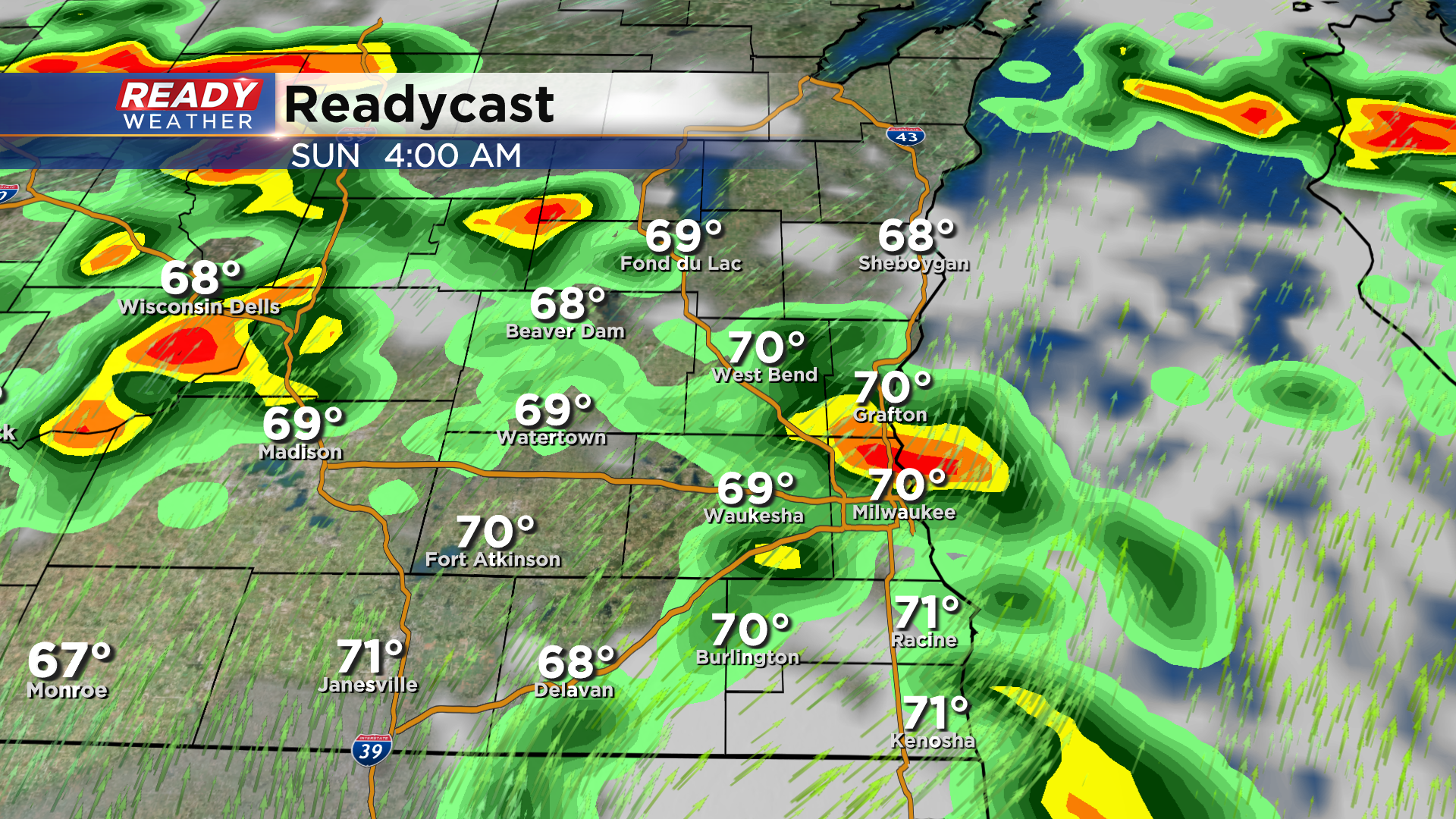
A bit better chance for scattered showers and isolated storms arrives overnight, tapering off early Sunday morning. This will be our best chance at rain this weekend.
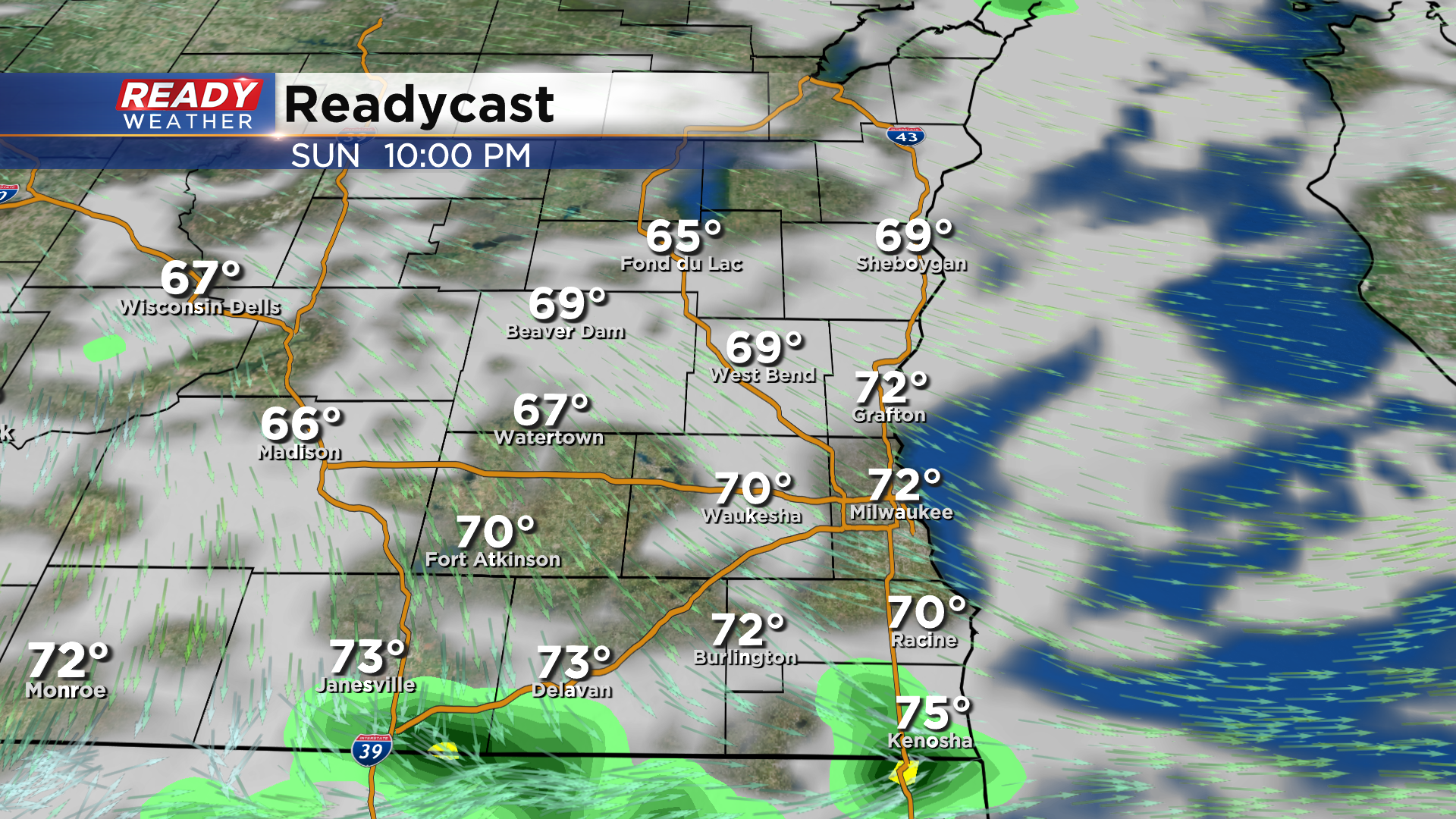
Most of the daylight hours have trended dry on Sunday, but we'll have to watch for a few isolated showers or storms late afternoon-evening as the cold front arrives. The best chance of additional wet weather will be near the Illinois border.
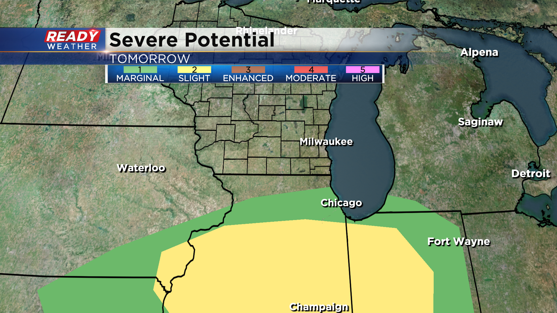
Latest data has trended south with the more robust area of storms Sunday evening, so southeast Wisconsin has been removed from the Marginal Risk for severe weather on Sunday.
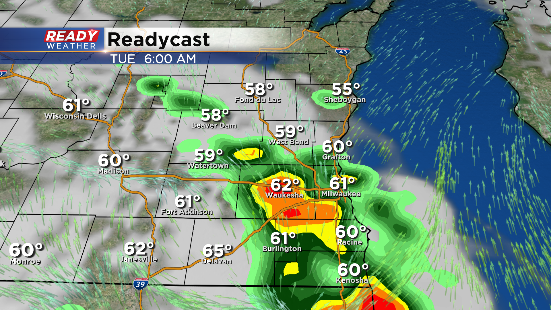
Temps and humidity will drop on Monday behind the cold front, but it'll return on Tuesday after a warm front lifts through the area early in the morning. This will likely trigger some stronger storms to start the day as well.
Enjoy the warmth while it's here because a strong cold front moves through on Wednesday, dropping temps back into the low to mid 60s for highs for the first day of fall.
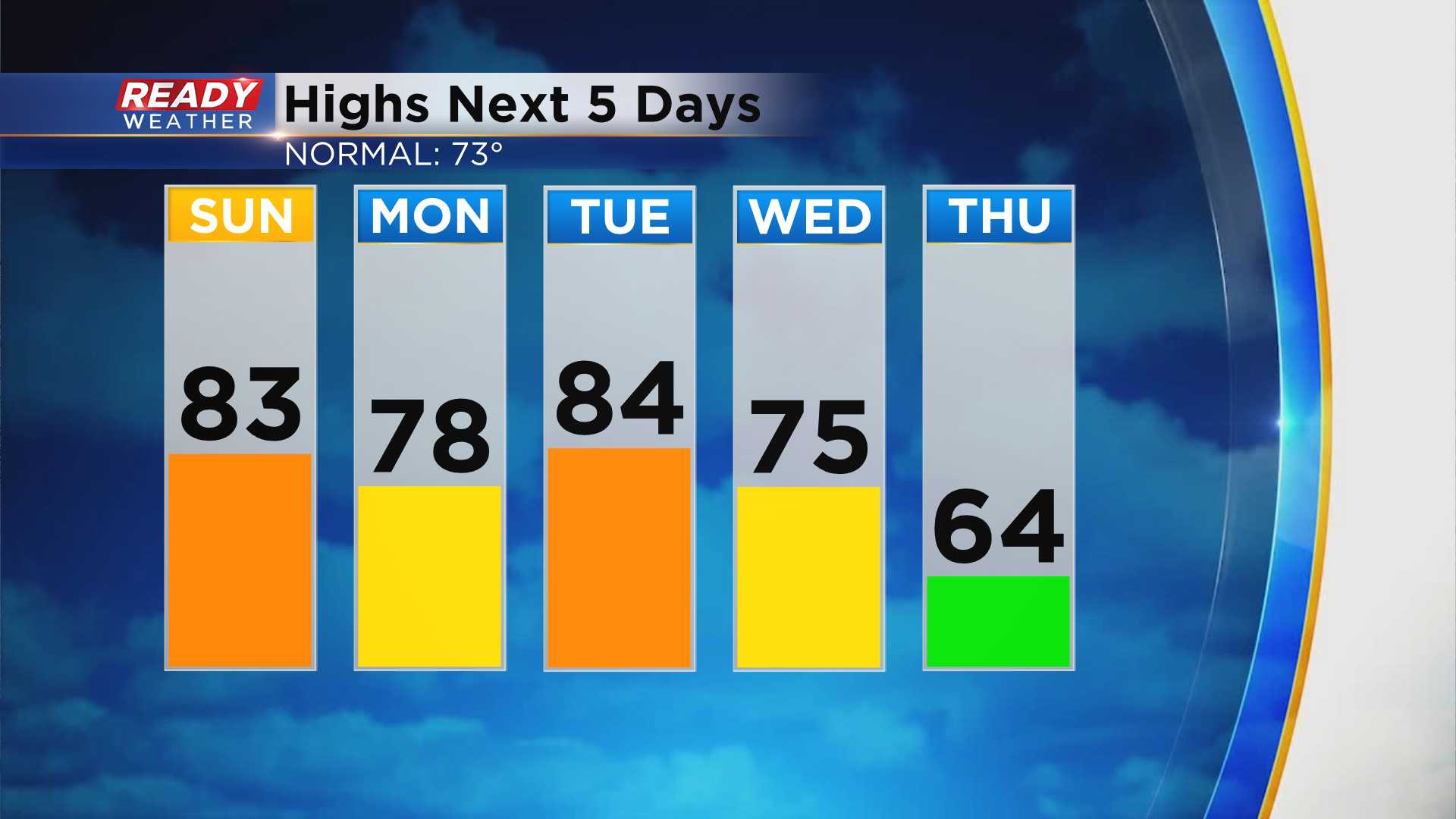
Download the CBS 58 Ready Weather App to see if the 60s continue after Thursday.