First day of spring could bring a shower
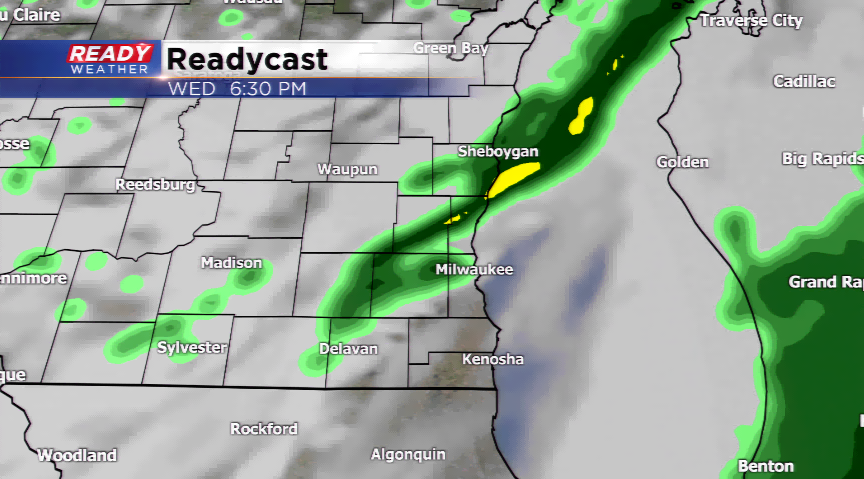
Weak disturbance passing to our south could climb far enough north to spark a shower in the southern tier of our viewing area this morning. Another trough north will sling a cold front in our direction later on today which could ignite another isolated shower area-wide this afternoon and evening. Both chances remain light in nature and in isolated form.

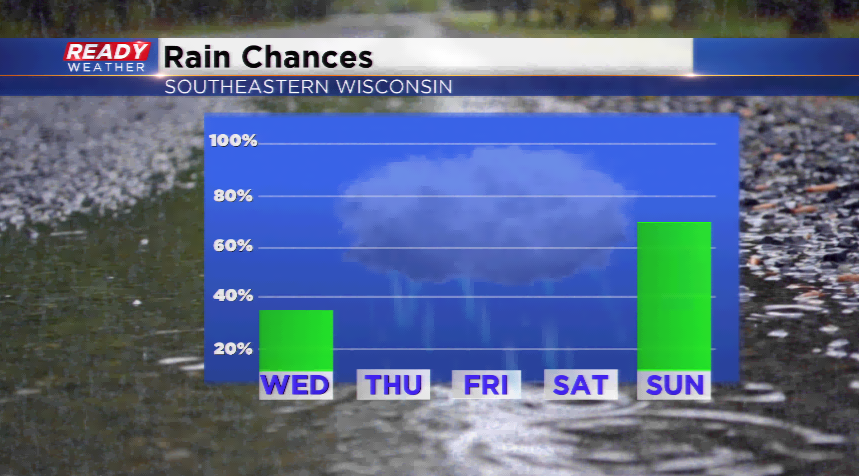
For the first day of spring, which by the way will be official at 4:58 pm cdt today, could always be worse. We’ll make a run at 50 degrees for a high with some sun followed by a lot more cloud cover compared to yesterday. The forecast does improve for sun the rest of the week, but it will be a touch cooler later this week with highs in the 40s. Our next big threat of rain runs late this weekend with a stronger storm system. Saturday is the better of the two days to get outdoor things done for the weekend.