First frost and freeze of the season likely to end the week


We finally got our first taste of fall weather last weekend and after some warmer days to start this week with highs in the 70s, another round of chill is moving in. Before the chill arrives we have to get through a few more light scattered showers through early Thursday afternoon. Less than a tenth of additional rain is expected. Lows over the next few mornings from Friday through Sunday will be cold enough for a frost and freeze for some of us. By Monday morning temps will warm up a little.

No frost or freeze advisory/warning have been issued for our local area. The National Weather Service is waiting to see how clouds will react this afternoon. The less clouds we expect tonight, the colder our temperatures will be. A frost advisory and freeze advisory have already been issued for parts of Minnesota, Iowa and SW Wisconsin.

Depending on the clouds, a frost looks likely for most areas away from the Lake Friday morning with an isolated freeze possible.

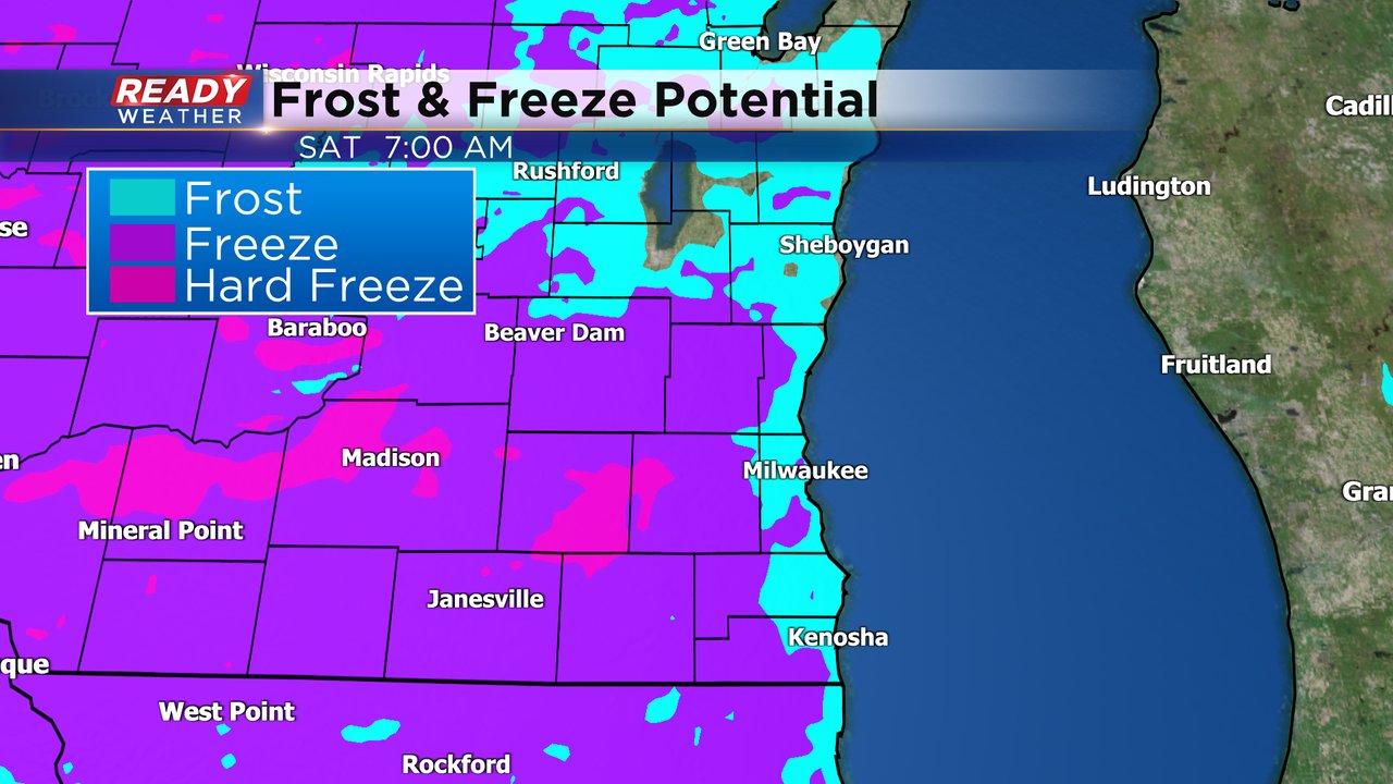
Saturday morning looks colder with the clouds clearing out completely. A widespread frost, even for lakeside areas, is expected Saturday morning. A lot of inland and western counties could get down below 32*. Even an isolated killing freeze when the temp gets below 28* is possible far inland.
A little more patchy frost may be possible away from the Lake Sunday morning before temps start to warm up.
The high temperature on Thursday was reached at midnight of 63*. The rest of Thursday will be spent in the low to middle 50s and that's what we can expect for highs through the beginning of next week. Thursday's official high of 63* makes it 146 straight days with highs at/above 60* just one day short of the record 147 days in 2016.

Download the CBS 58 Ready Weather app to see how cold it will get where you live.