First snowstorm of the season could slam parts of Wisconsin
It’s not even Halloween so we shouldn’t be talking about snow, right? Wrong.
Several inches of snow could blanket parts of Minnesota, Upper Michigan, and Wisconsin late tonight into early this weekend. An Alberta Clipper will glide into the Midwest around a trough of low pressure ushering the first true accumulating snow chance.
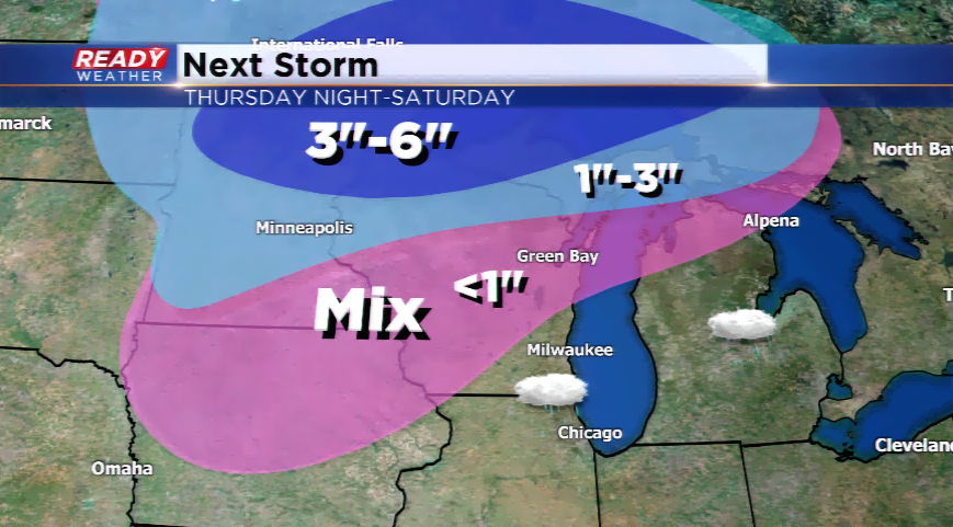
Snowfall amounts could stake up in sections of northern Wisconsin where 3”-6” of snow could fall, while most will see 1”-3”. There are Winter Storm Watches in play for northern Minnesota, and some type weather alert will be issued for northern Wisconsin for this system. Near blizzard conditions are even possible as the winds will crank up in the northern Plains and Minnesota. Minneapolis-St Paul could wake up to fresh powder on Friday.
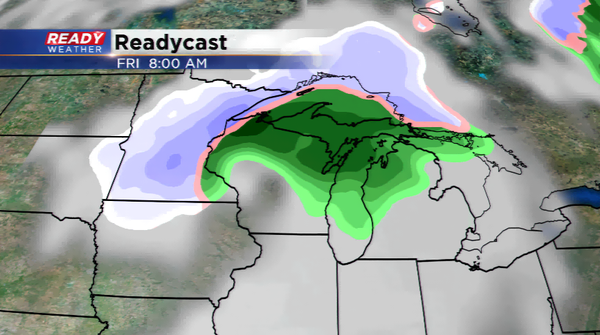
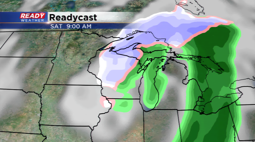
How will this storm impact southeastern Wisconsin? A dry slot will develop in our viewing area, which means we escape most of the madness. Our chance to see any wintry weather wouldn’t be until late Friday and Saturday. Light scattered rain showers or snow showers are possible once the low moves east early this weekend. Accumulation is not expected.
What is expected is the cold. Highs and lows will be the coldest of the season with daytime temps in the low to mid 40s, and overnight lows tumbling into the 20s an