Flooding and storms likely early this week
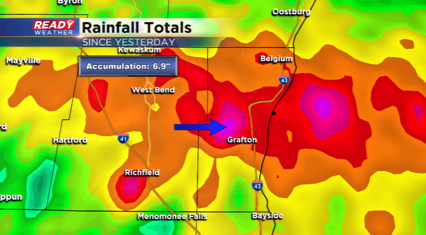
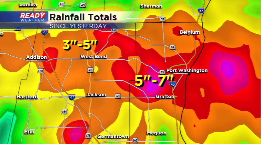
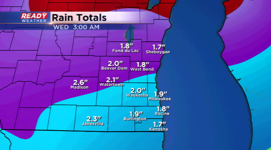
Rain and severe weather hammered the area yesterday, last night and this morning. Rainfall totals were between 3”-7” in parts of Ozaukee and Washington County. Some roads and highways were flooded out.
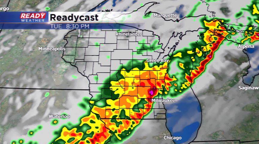
Rainfall and storms will ramp back up later today and tonight underneath the low level jet and favorable dynamics; however, it looks like the north will take the brunt of it. Computer models are sending most of the active north, but there could be some scattered showers and storms developing. Any storm that develops could reach strong to severe limits with hail, high winds, and heavy rainfall.
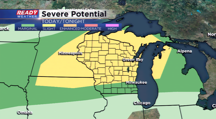
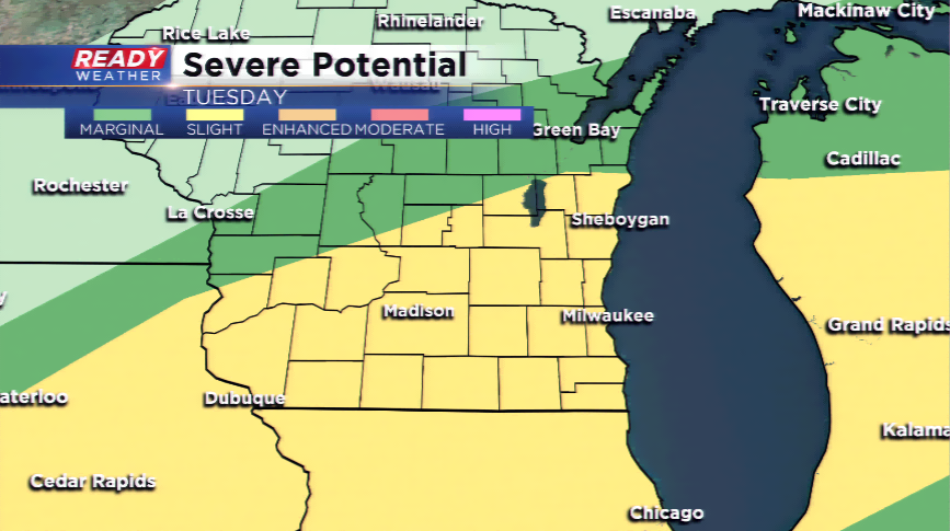
A warm, unstable atmosphere will be present on Tuesday across much of the state. There’s high confidence of widespread thunderstorm activity by Tuesday afternoon into the night. Severe storms and heavy rainfall will be possible with this line setting up ahead of a cold front. The front will usher in much cooler and drier air for Wednesday and Thursday with a taste of fall heading our way. Highs may struggle to make it out of the 60s on Wednesday.
Stay tuned for more updates!
