Flurries and sprinkles continue with a few more mild days before the chill returns
The start to 2025 has been fairly dry. January was the driest January on record, and while February has seen decent snowfall we haven't had much rain to beef up our precipitation total for the month. We tried to make up some of that deficit with some showers on Wednesday. Most of southeast Wisconsin saw just enough rain to clear the roads of salt with 0.10-0.30" falling for most.

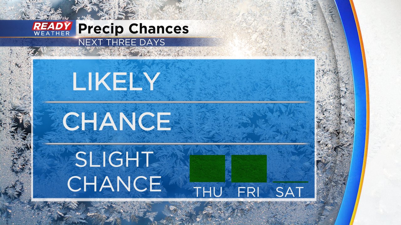
Following that rain on Wednesday we could see a few flurries and sprinkles throughout the day Thursday. Not much is expected in terms of accumulation, but don't be surprised if you see some snowflakes or a few raindrops on your windshield. Friday also has a chance for some light precipitation but since it's a warmer day it all falls as sprinkles or isolated showers. Both days the chance is about 20% so most stay dry then Saturday looks all dry.
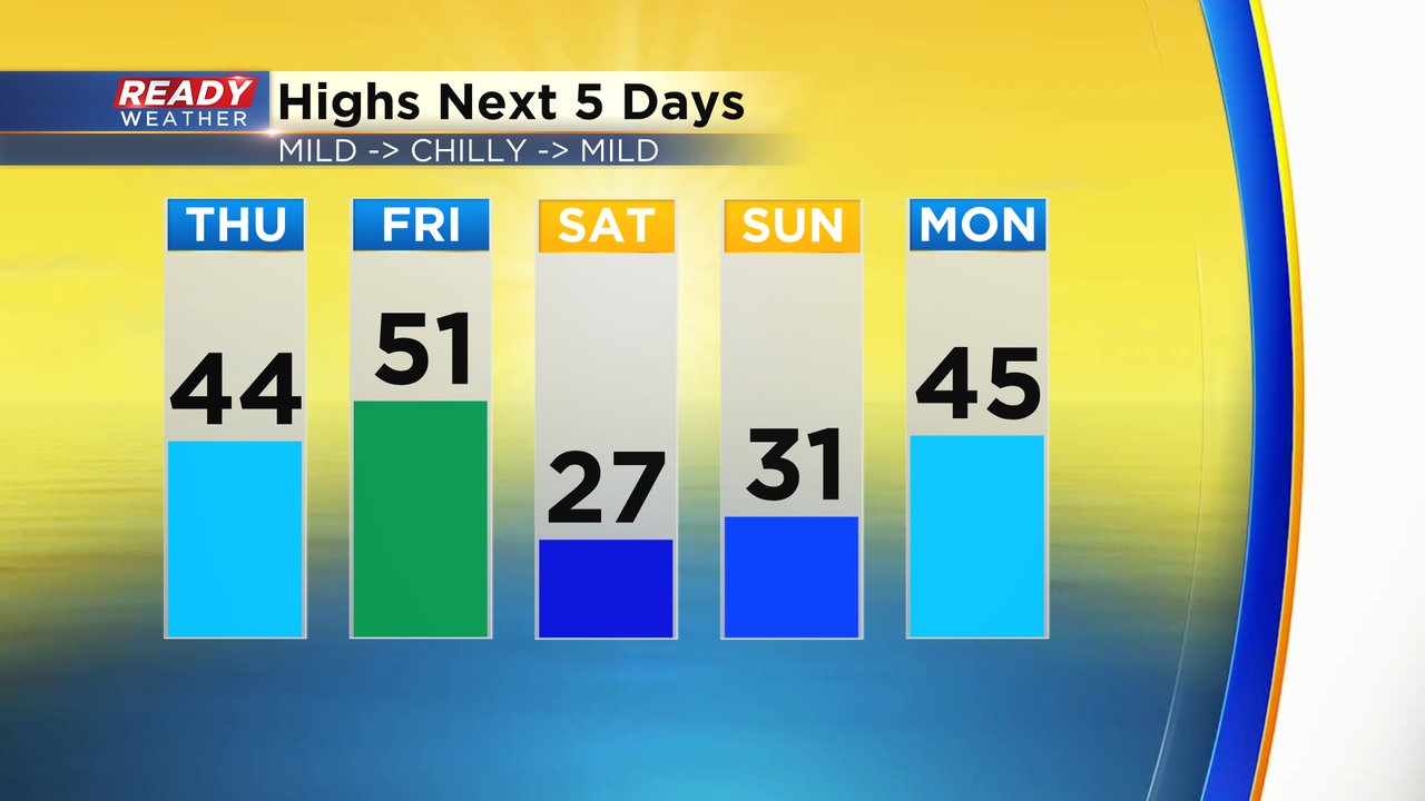
Thursday is still mild with highs in the low to middle 40s. Friday looks warm again with highs reaching 50! Then we get chilly for the weekend with highs staying in the 20s Saturday and around 30 on Sunday. The warmth returns next week with highs in the 40s.
Download the CBS 58 Ready Weather app to track any flurries and sprinkles that form and the temps through the first week of March.
