Heat advisory issued for feels-like temps around 100 Monday


Update as of 3:30 PM on Monday, July 28th...
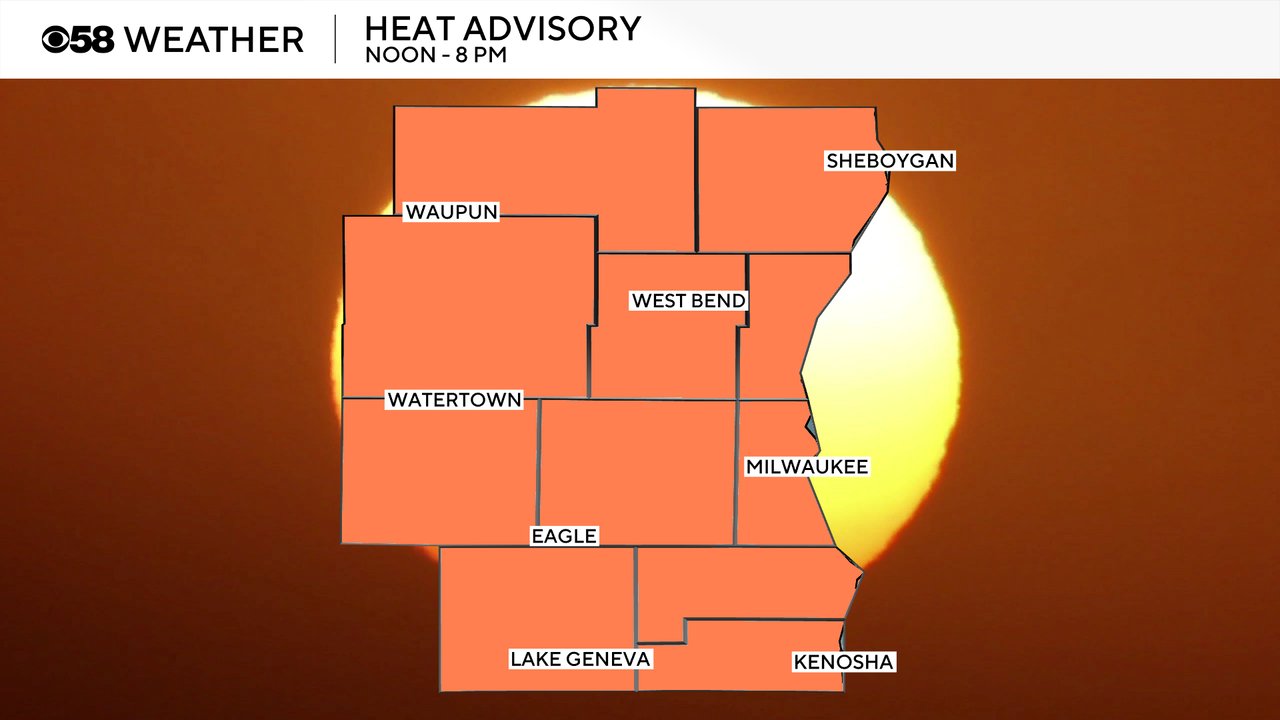
The Heat Advisory has been shaved across the northern half of the viewing area. But it still holds until 8 PM for the rest of the area where it'll feel close to 100 degrees in spots. Please drink lots of water and limit your time outside. Relief is on the way by the middle of the week. We face the chance for showers and storms Tuesday and Wednesday.


_____________________________________________________________________________________________________________
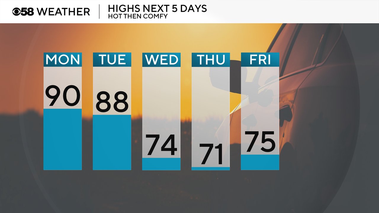
The next round of heat is here. Humidity levels stayed high all weekend long and temps warmed up on Sunday around 90 in some locations. that heat will stay with us to start the new work week on Monday and Tuesday with highs reaching the upper 80s to around 90. Then a cold front arrives and drops the highs in the 70s for the second half of the week through the weekend.
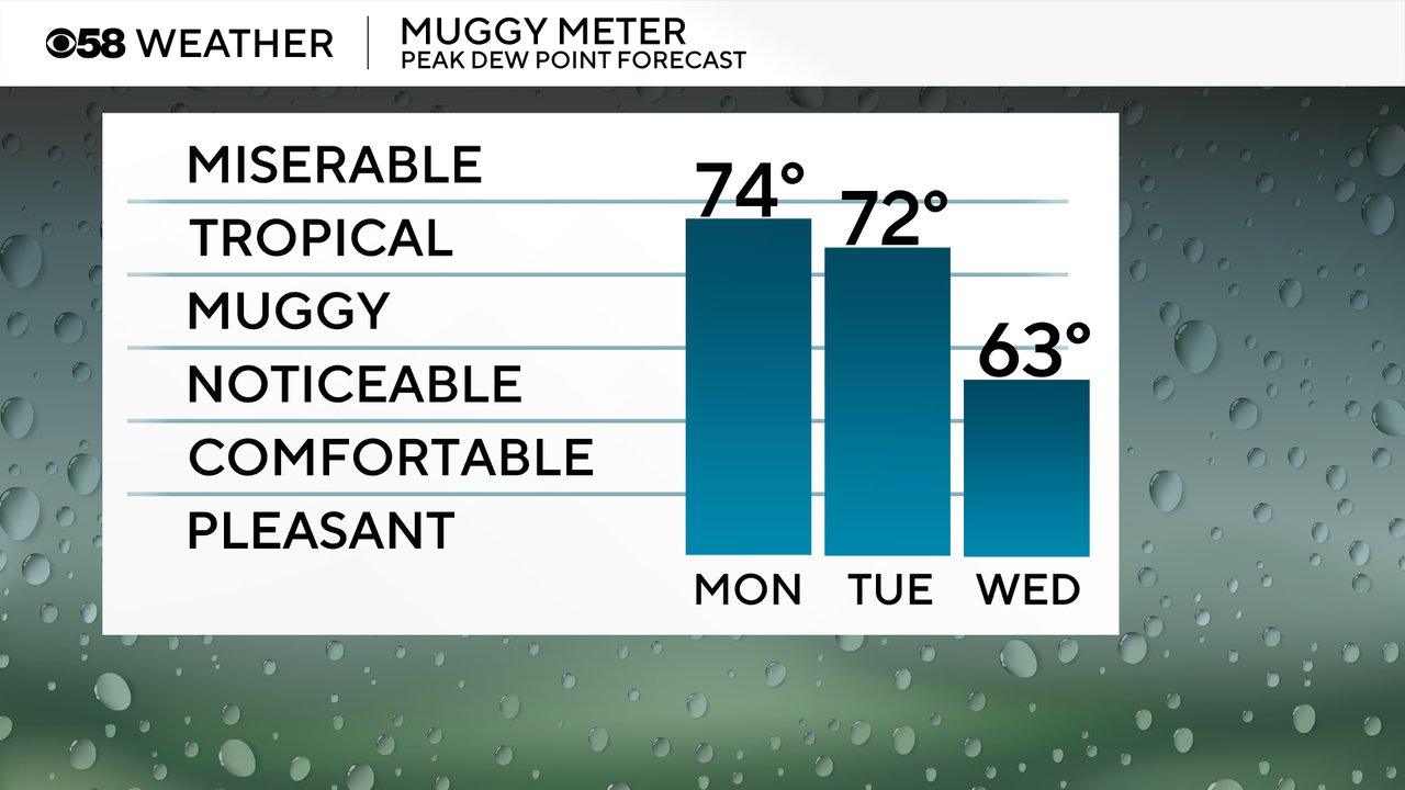
Humidity levels will stay very high Monday and Tuesday in the tropical category and at times feeling pretty miserable. The dew points start to drop for Wednesday in the low 60s but still some noticeable humidity Wednesday morning before comfy air returns for the rest of the week.
The combination of the heat and humidity will push feels like temps around 100 in many areas for Monday afternoon and evening.
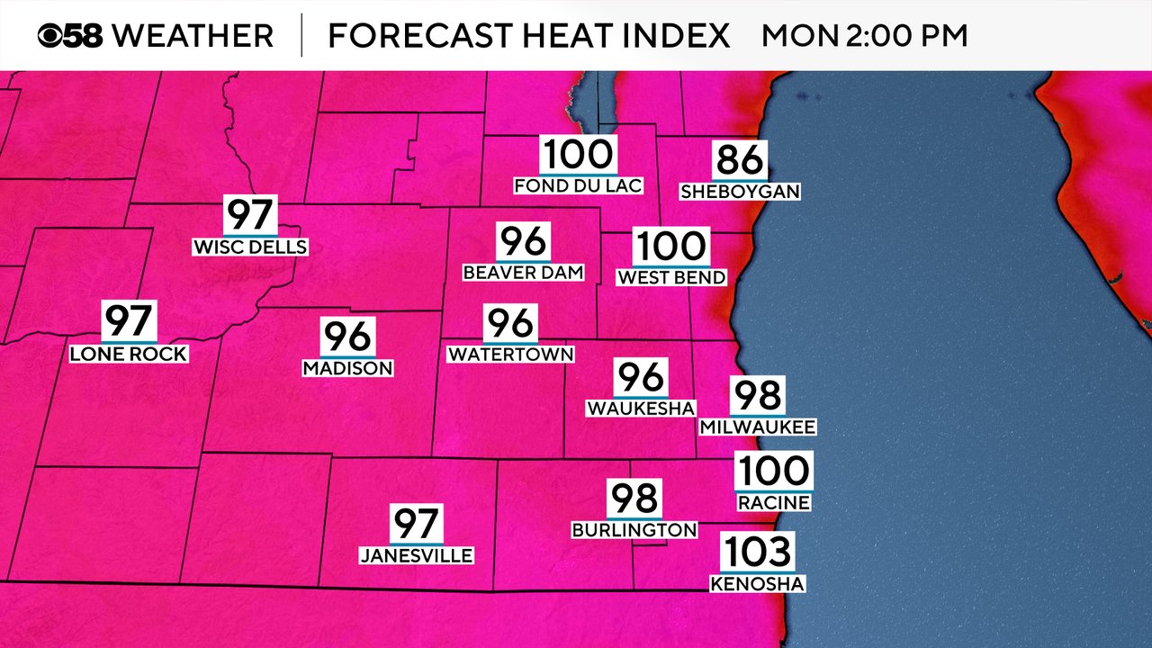
Because of the high heat and humidity and feels like temps reaching 100, a heat advisory has been issued for all of southeast Wisconsin. The advisory starts at noon and lasts through 8 PM. Tuesday will be close to advisory levels as well with feels like temps in the upper 90s.
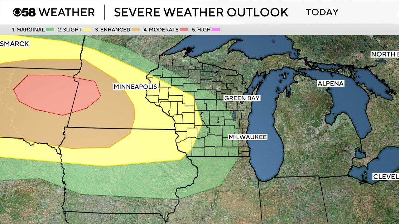
A few showers did role through southeast Wisconsin early Monday morning. The rest of the day is likely dry until Monday night into Tuesday morning with a round of storms rolling across the Upper Midwest. A derecho will be possible starting in the eastern Dakotas before moving through Minnesota and western Wisconsin. A Level 4 Moderate Risk is in place in the Dakotas with a Level 1 Marginal Risk in place in some of our local western counties. Most of the weather models have the storms weakening as they reach southeast Wisconsin but any storms that do survive could be strong to severe with strong wind.
Download the CBS 58 Weather app to track the storms tonight and the heat and humidity all day long.