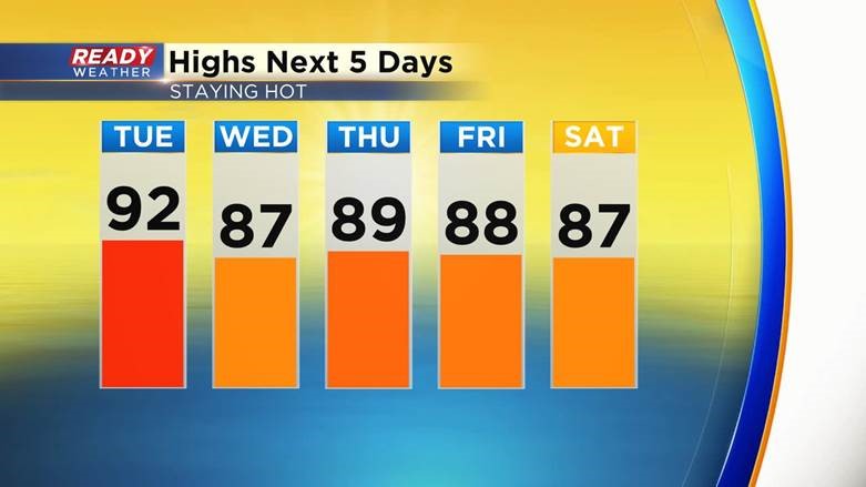
The heat returned to southeast Wisconsin Monday with highs hovering around 90 and dew points into the middle 60s. We stayed mild at night with a lot of locations only seeing lows in the 70s. The heat and humidity will continue to build reaching a peak on Tuesday with highs in the low 90s. Even though we may not be in the 90s the rest of the week it's still going to be pretty hot with temps well into the upper 80s.
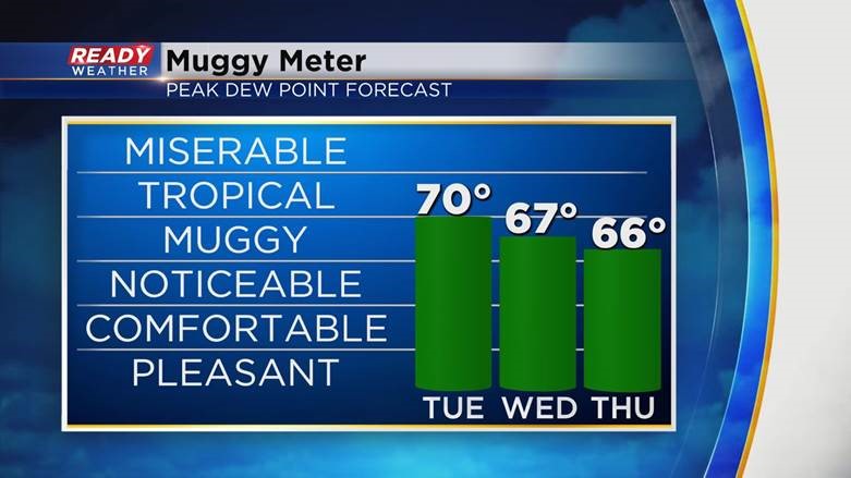
The dew point will reach a peak on Tuesday around 70* then drop slightly the rest of the week into the middle and upper 60s.
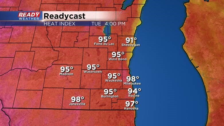
All of that heat and humidity will push heat indices into the upper 90s. Probably falling short of 100* for feels like temps. So, no heat advisory but still hot enough to drink plenty of water and take lots of breaks.
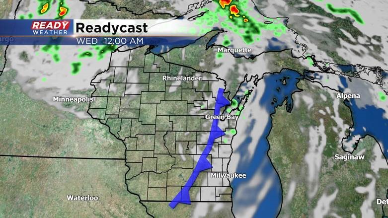
A weak cold front will move across Wisconsin Tuesday evening through early Wednesday morning. That cold front could spark a few isolated showers and storms. The chance doesn't look great and is better in north central Wisconsin but any storms that do form could be on the stronger side.
Download the CBS 58 Ready Weather app to track the continued heat and humidity and any storms that pop.
