Heat & humidity pave the way for stronger storms Wednesday night

-
2:17

Dems rally in Waukesha against Musk’s influence on Wisconsin...
-
2:02

Milwaukee man charged in killing of transgender woman
-
0:42

Milwaukee Bucks hold moment of silence to honor Junior Bridgeman...
-
1:17

Girls’ Day returns to Milwaukee City Hall
-
1:57

Bills addressing reckless driving, school resource officers pass...
-
1:22

Influenza cases on the rise across Wisconsin, including some...
-
1:32

A tradition that gives back: Tremper High School hosts 43rd annual...
-
2:39

Popular Milwaukee LGBTQ+ bar This Is It! announces permanent...
-
2:24

Former employee charged for hiding camera in Cristo Rey Jesuit...
-
2:50

History of Milwaukee-style pizza
-
3:12

Visit Milwaukee preview: March 13-15
-
1:39

Rachel Vasquez of Shorewood shows off her bold makeup line with...

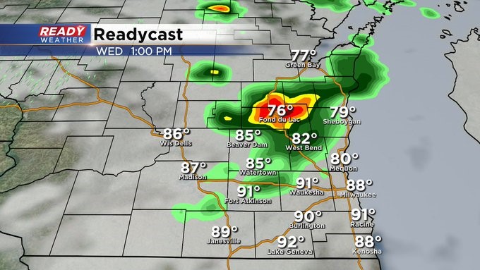
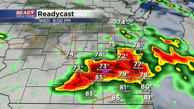
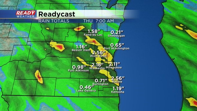
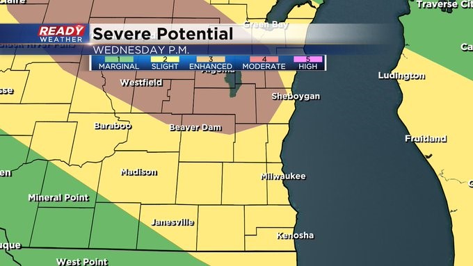
MILWAUKEE (CBS 58)--It's like a boiling pot with the heat and humidity. Look for a "boil over" into Wednesday night with strong to severe weather as low pressure moves into very unstable air.
There' s an "enhanced" risk of severe weather just to the north and west of the metro. Elsewhere it's a "slight" risk. Wind, hail. heavy rain, frequent lightning all possible. An initial band of storm activity could roll through early in the afternoon.
The dangerous weather should exit into Thursday morning.
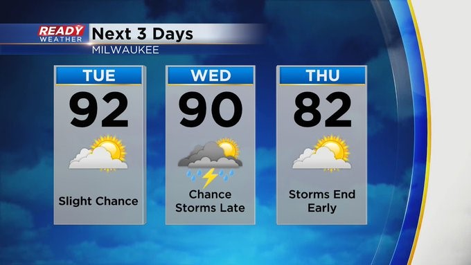
Look for the 90s to continue both Tuesday and Wednesday before backing off for the rest of the week.
The weekend looks fairly quiet except for some storm chances late in the day Saturday and Saturday evening with highs near 80 and lows in the 50s and 60s.