Heavy lake effect falling for some; more light snow possible Tuesday for everyone
Heavy lake effect snow is currently falling Monday morning. The snow is only impacting a very small area from southern Milwaukee County to eastern Racine and Kenosha Counties.
Here is a radar image that will update with time:

A Winter Weather Advisory remains in effect for those three counties, although the snow has just about ended in Milwaukee County and they will likely be dropped from the advisory soon. Currently the advisory goes until 8 AM Monday but could be extended if the lake effect continues.

Snow is piling up in eastern Racine and Kenosha County where the snow has been falling since midnight in some areas with rates of 2" of snow per hour in these locations. One of our viewers sent in this photo from Pleasant Prairie where 14" of snow has fallen and is continuing to come down.

Other snow reports range from 2" to 10" across Racine and Kenosha Counties.

As the snow begins to come to a bit of an end southern Milwaukee County will end up with just an inch or two. East of the I-41/94 freeway in Racine and Kenosha Counties could see 6-12" of snow, or even more in localized areas. West of the freeway the snow totals will drop off quickly. The nature of the beast of lake effect is that only a few miles will separate those that get 15" of snow from those that only see a half inch.
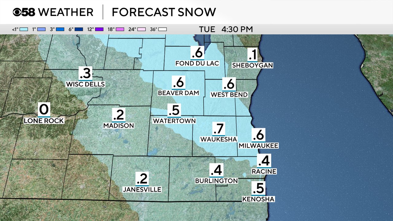
The lake effect snow should wrap up by mid-morning Monday at the latest. After that, the rest of Monday looks dry under a partly cloudy sky with some sunshine at times. Another round of snow, this time for everyone, is possible Tuesday from the morning through the early afternoon.

Some accumulating snow is possible Tuesday but closer to the amounts that we saw Saturday night into Sunday morning where many communities got a dusting to a half inch.
A lot of this snow melts by the end of the week as highs reach the 50s to around 60. Download the CBS 58 Weather app to track the snow and the 10-day forecast.
