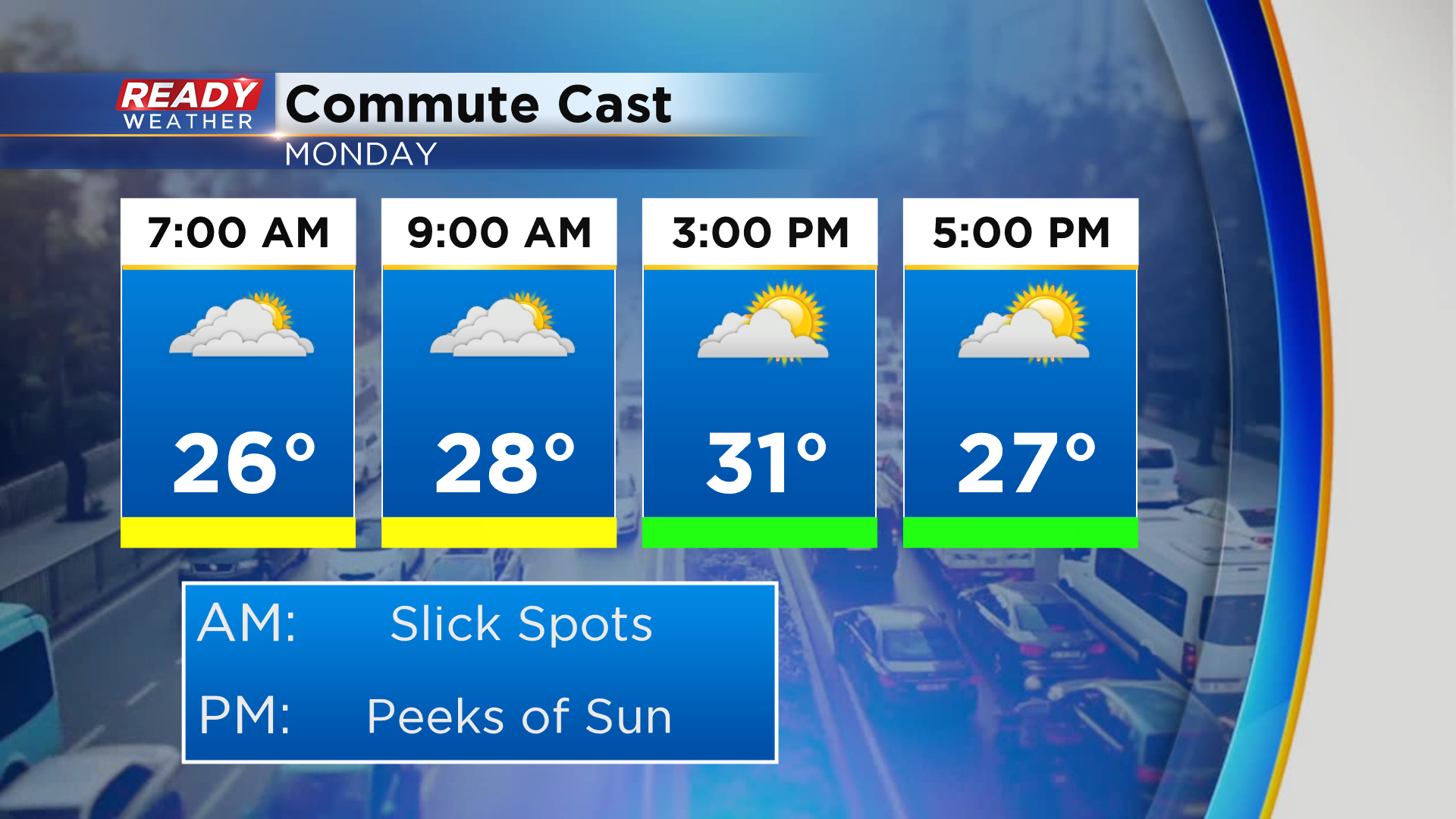
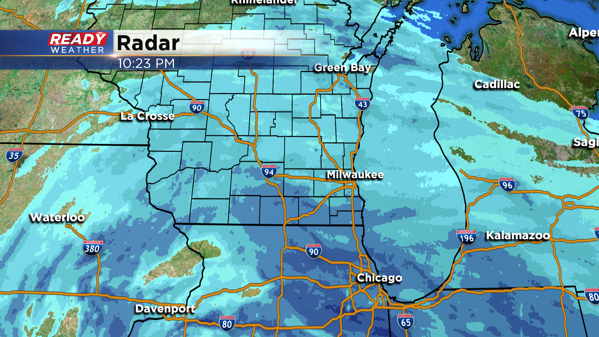
9:30 pm Update: Snow exiting SE Wisconsin, but slick spots linger into Monday morning


Updated: 9:30 pm Sunday, January 31st:
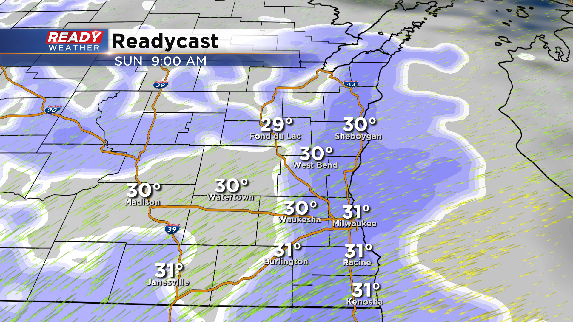
The last of the accumulating snow is exiting southeast Wisconsin. Besides a few stray lake effect flurries overnight, the accumulating snow is done.
Snow that was able to melt earlier today is now refreezing on area roads, which is causing slippery spots.
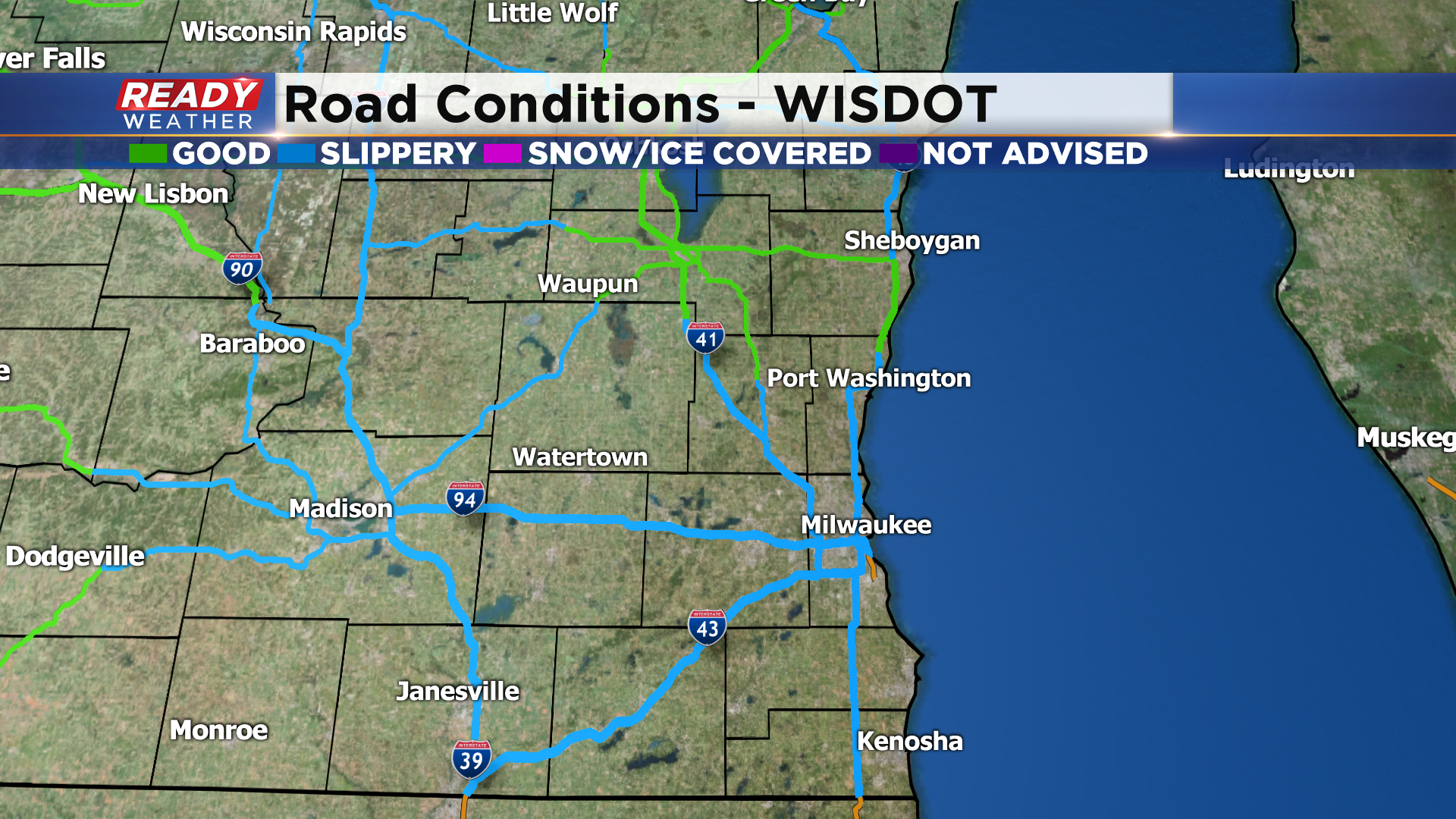
We'll likely have lingering slippery spots during the Monday morning commute, so drive with caution!
------------------------------------------------------------------------
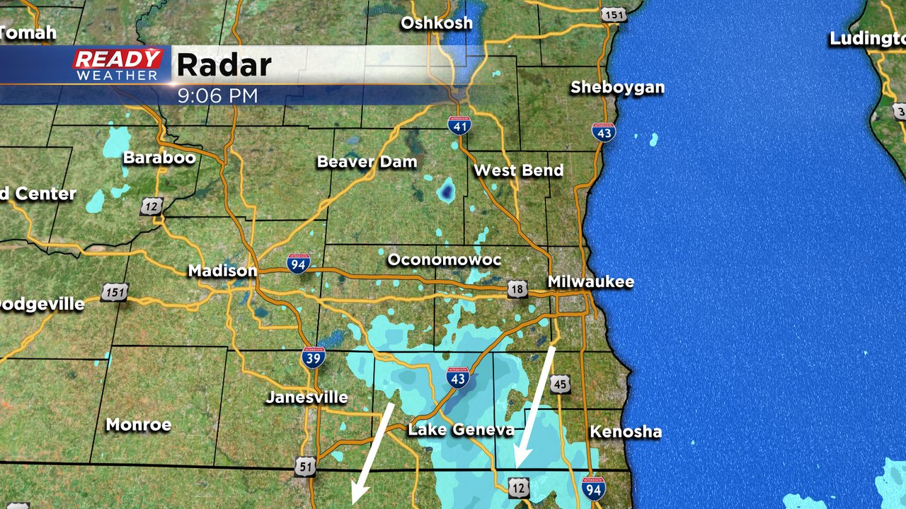
Updated: 6:10 pm Sunday, January 31st:
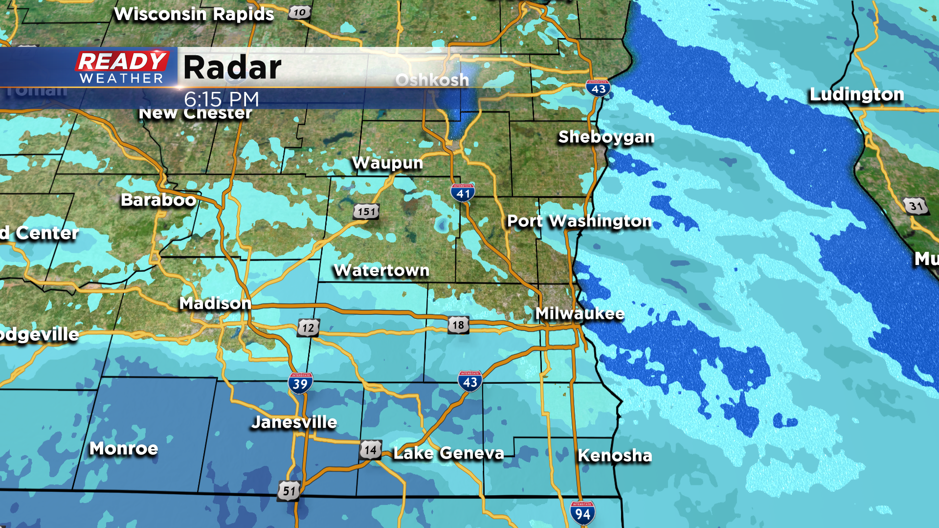
One small area of moderate lake effect snow is impacting the south side of Kenosha and Pleasant Prairie at the moment, otherwise the snow that's still falling elsewhere is very light.
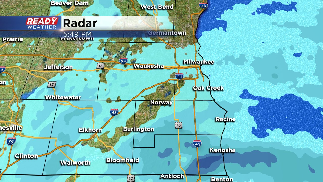
Snow will gradually taper off from north to south through the evening. Watch out for lingering slippery spots on the roads overnight and into the morning commute!
-------------------------------------------------------------------------------------------------------------------------------------------
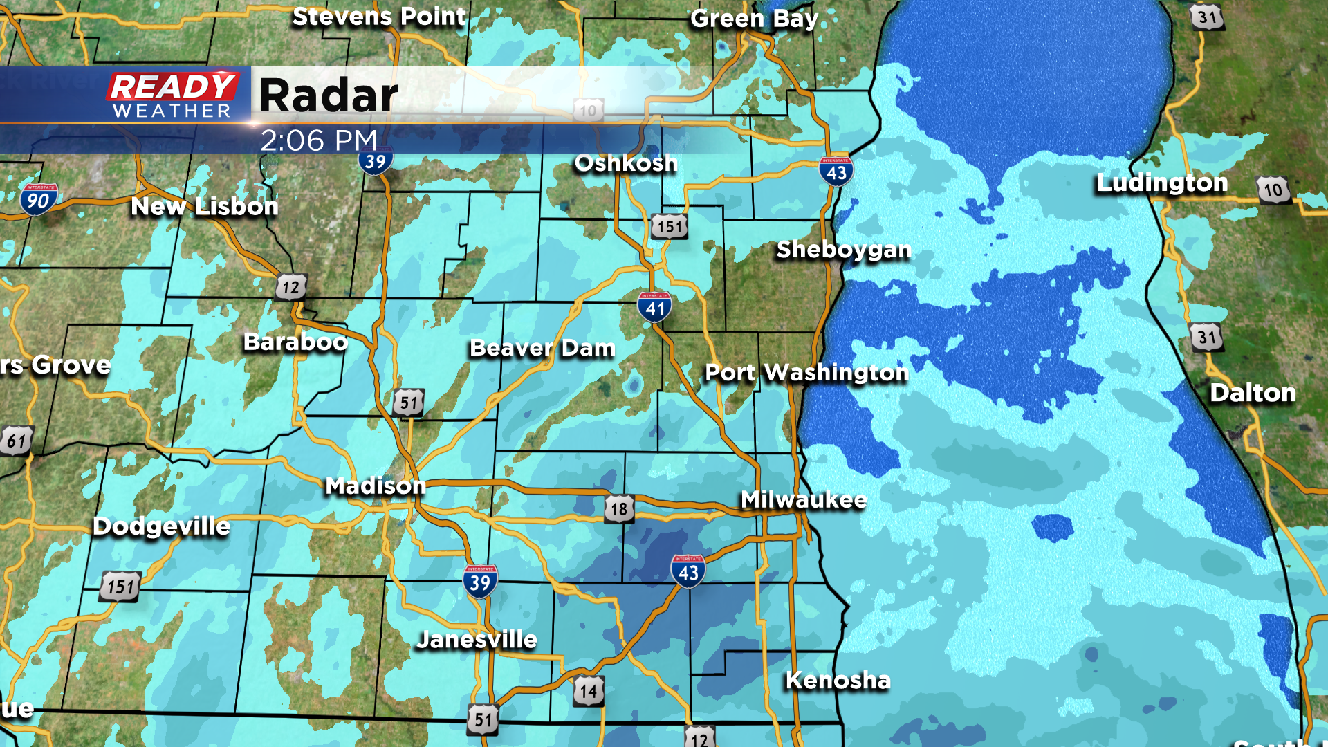
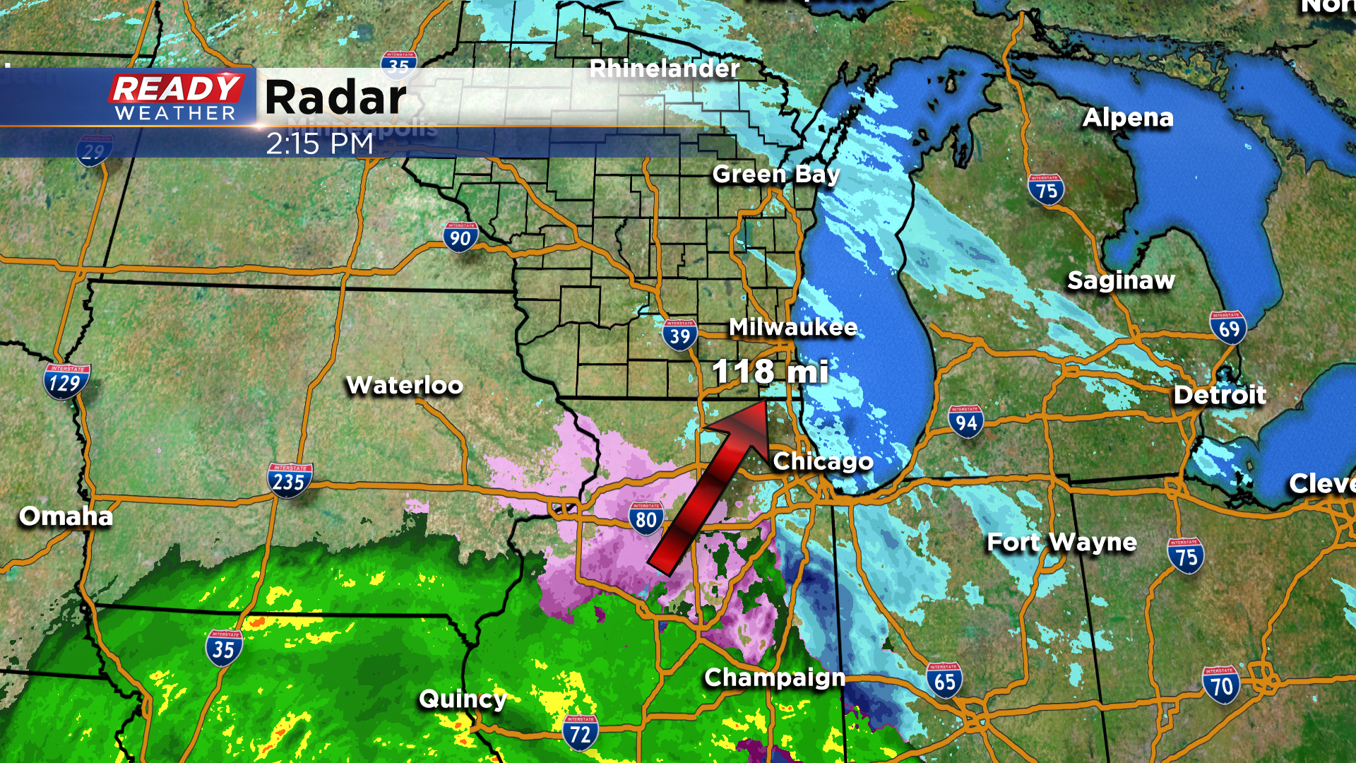
Updated: 2:15 pm Sunday, January 31st:
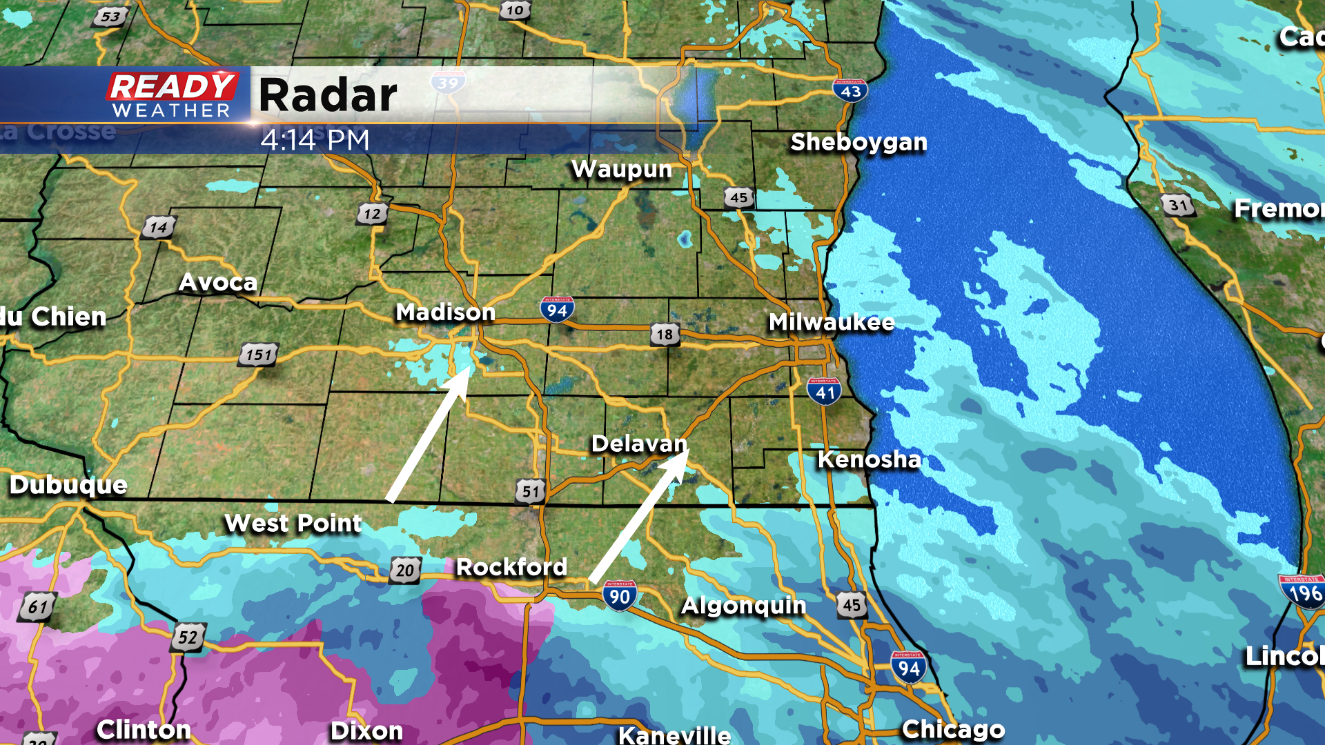
Areas of light to moderate snow continue to work through southeast Wisconsin this afternoon. Snow is still on track to come to an end by mid evening.
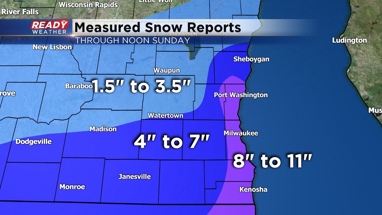
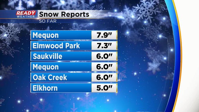
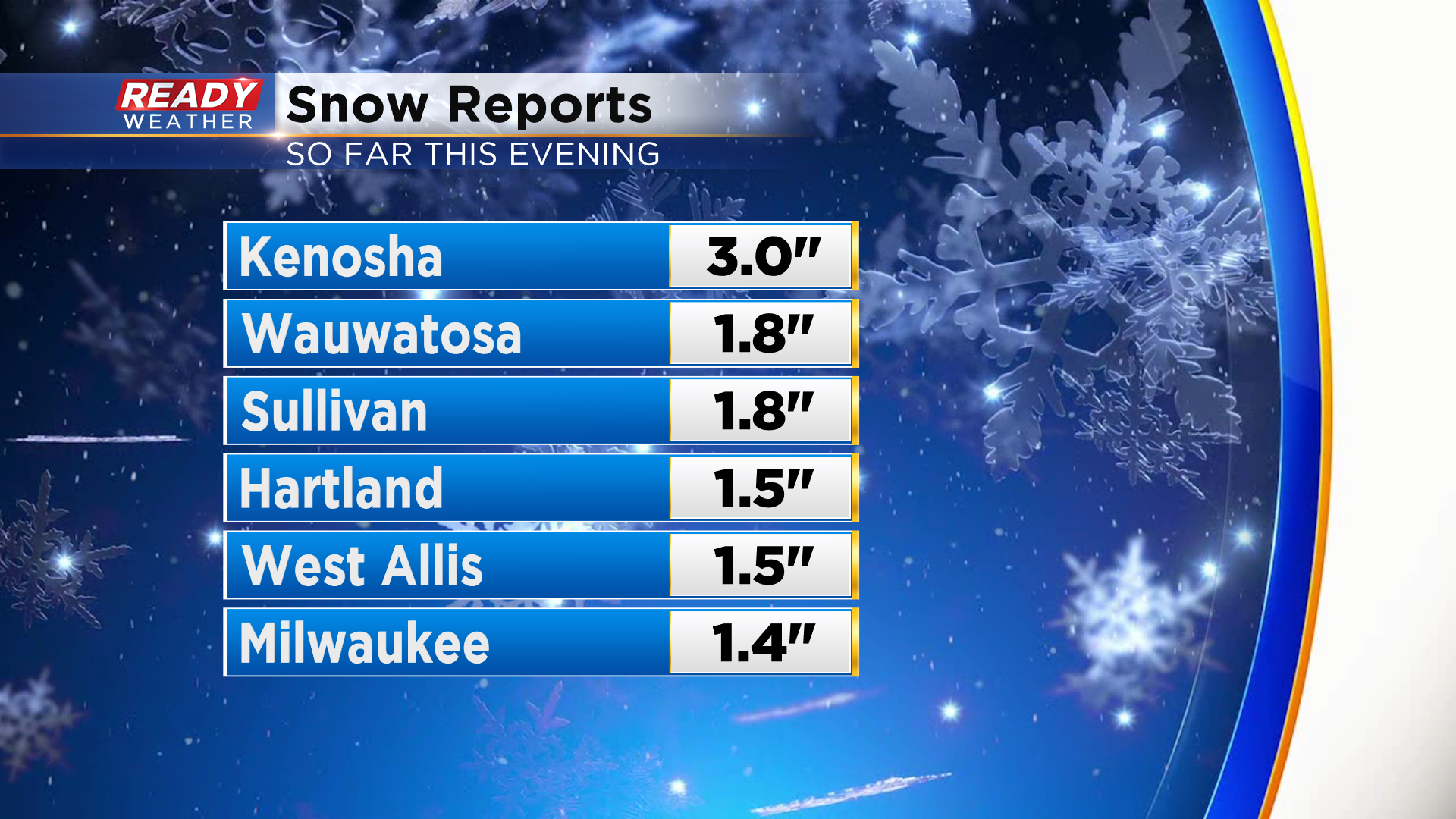
Here's a broad overview of how much snow has fallen across southeast Wisconsin through noon today.
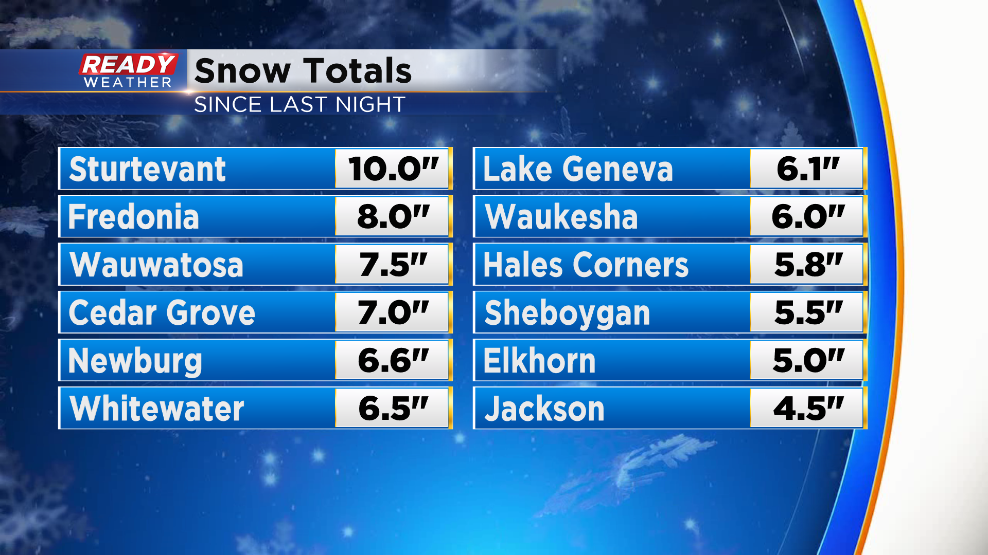
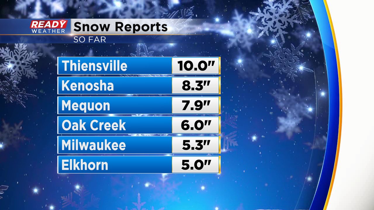
Here are the highest confirmed totals from around the area:
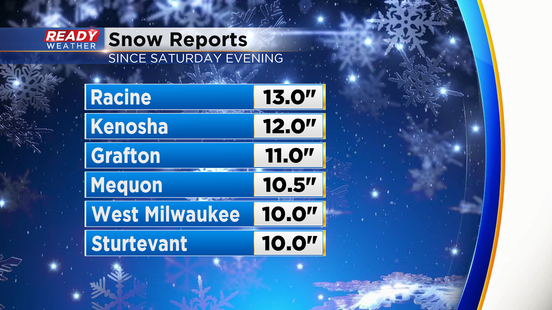
Full list of specific reports: https://www.weather.gov/source/crh/snowmap.html?sid=mkx
---------------------------------------------------------------------------------------------------------------
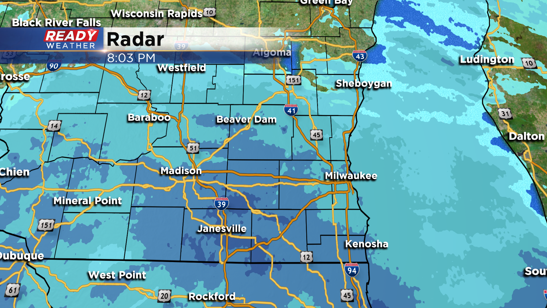
Updated: 11:00 am Sunday, January 31st:
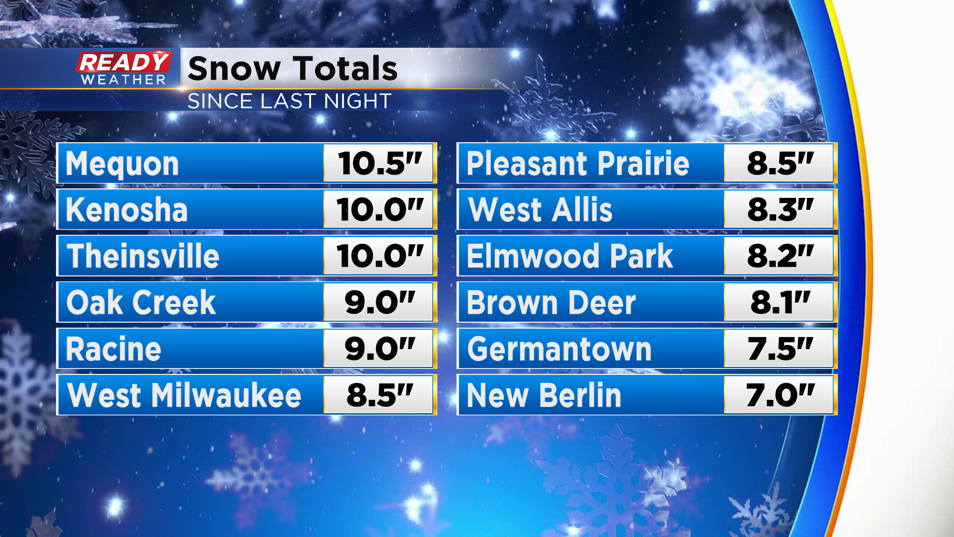
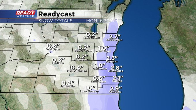
Snow totals keep coming in this morning with most spots lakeside currently between 7-10" and inland spots between 4-7".
The heavy lake effect snow band that's been impacting Racine and Kenosha counties over the last 2 hours is starting to weaken, but additional lake effect is possible through the afternoon.
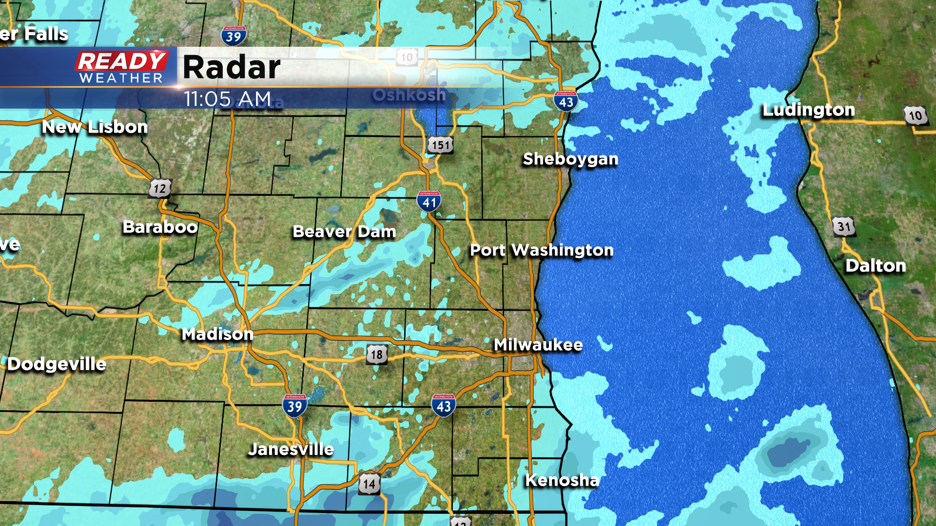
Additional amounts of 1-2" are possible through this evening near the lake, with less than an inch inland with any additional snow showers that develop. Snow should come to an end by 10 pm.
----------------------------------------------------------------------------------------------------------------------------------------------------
Updated: 9:00 am Sunday, January 31st...
I keep updating the snowfall total map. I almost can't keep up. A 7-10 inch snowfall range seems to be fairly common, especially along the lake and across the metro.
Again, a few more inches can't be ruled out today, mainly in this general area. Look for lesser amounts toward Lake Country. The snow should start to wind down into this evening but not before dumping close to a foot in spots, especially by the lake and near the Illinois border.
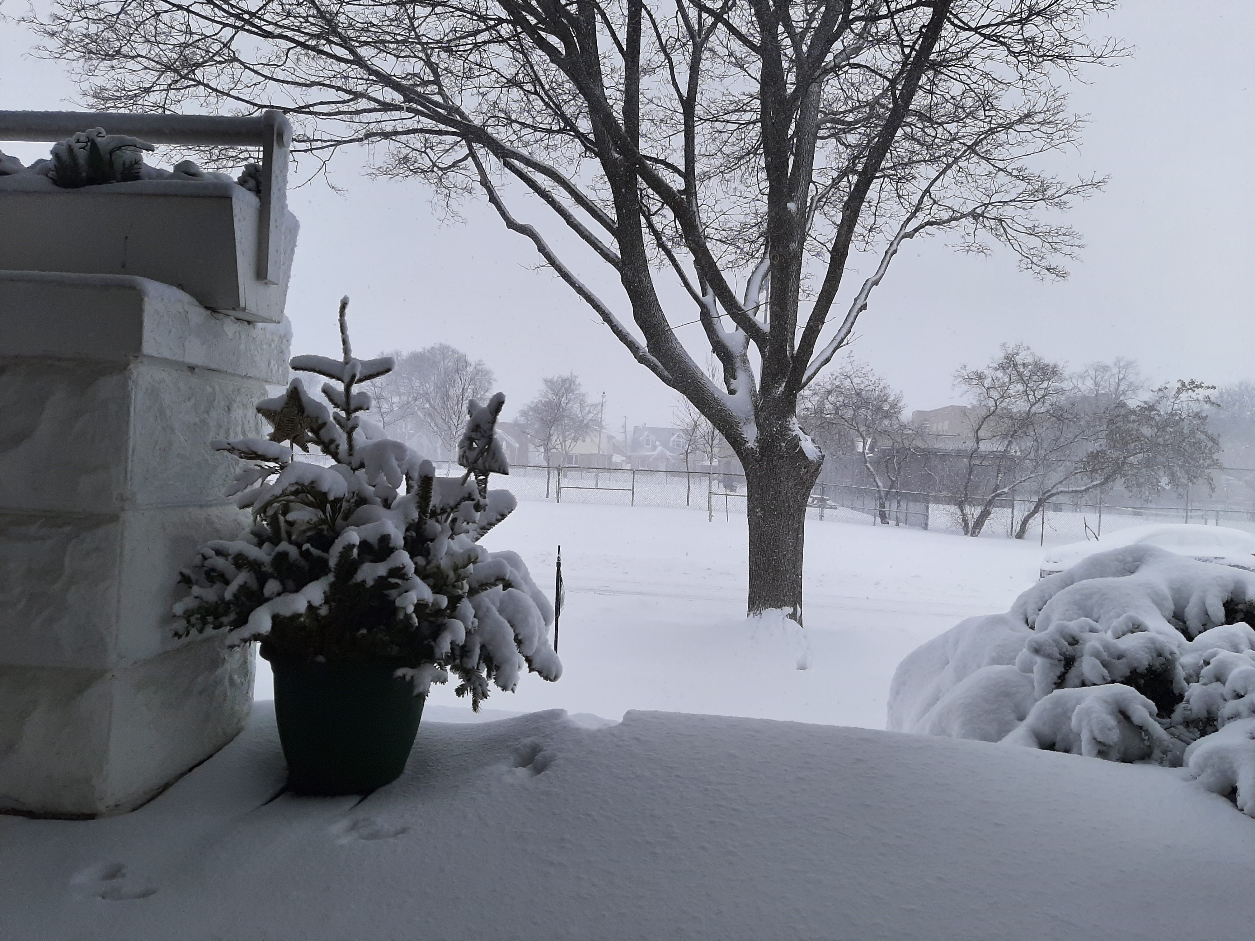
By the way, we've gotten some great weather photos. Katie VanBommel sent us this one from Milwaukee. It really captures the day nicely. Please send yours to either [email protected] or via the weather mobile app. We appreciate it.
____________________________________________________________________________________________________________
Updated: 7:30 am Sunday, January 31st...
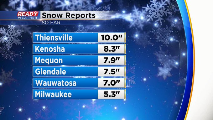
Incredible snow amounts coming into the CBS 58 Ready Weather Center. Thanks, spotters. 10 inches in Thiensville! A lot of places lakeside reporting well over a half a foot of snow.
And we're not done. We'll be seeing this throughout the day and into the evening, especially across the metro and lakeside areas. Expect to see a let up toward Lake Country into the afternoon. Could be a few extra inches at least.
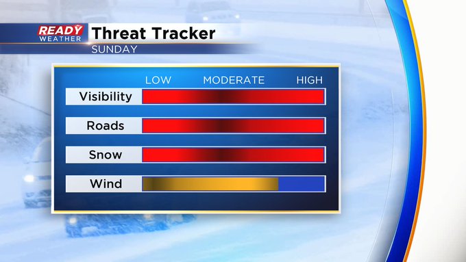
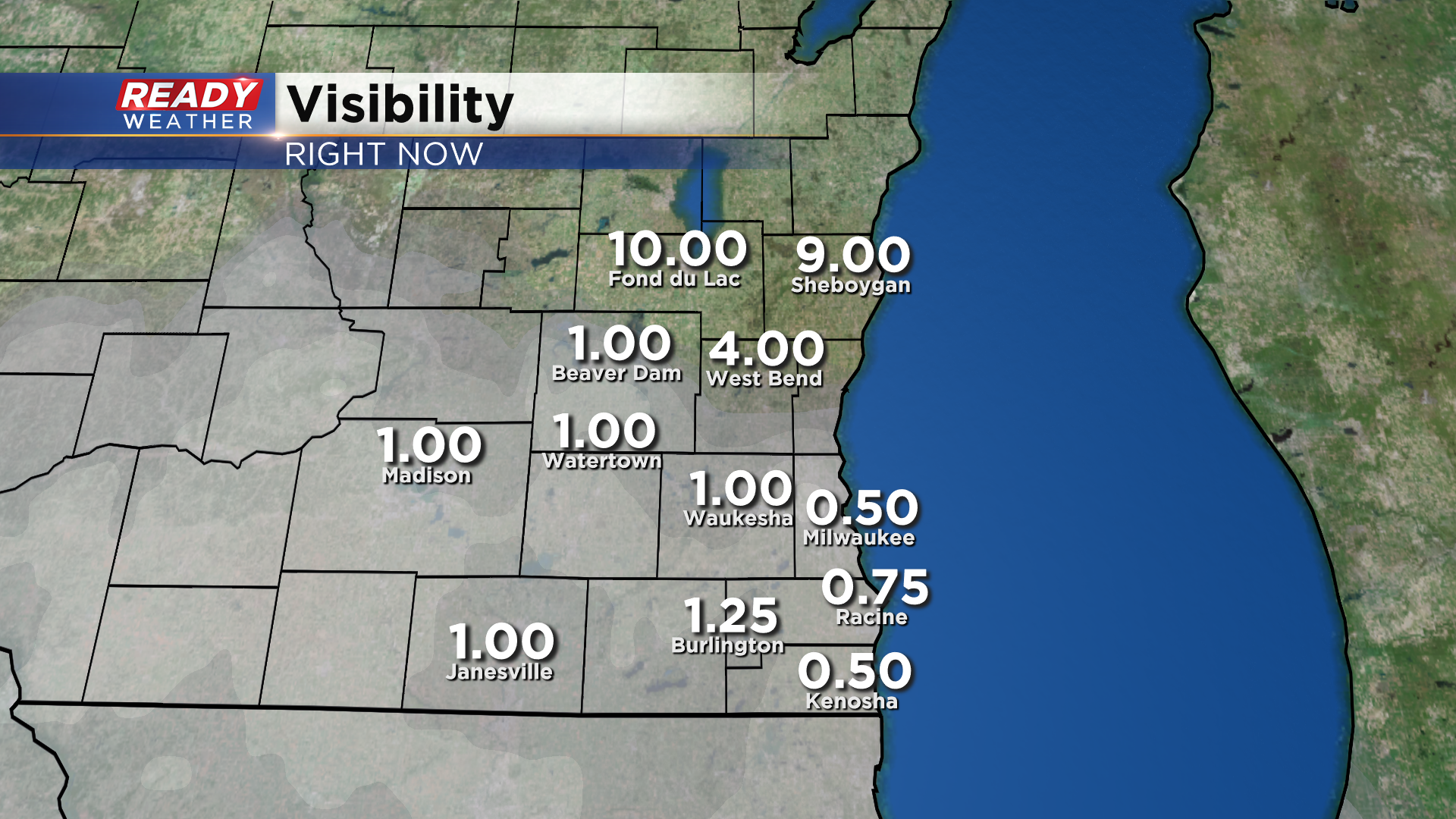
Again, 7-11"+ total amounts lakeside will be common with lesser totals farther away from the lake. Temps will be around freezing today, but the wind will make it feel much colder and reduce visibility greatly.
______________________________________________________________________________________________________________
Updated: 6:00 am Sunday, January 31st...
It snowed hard and heavy overnight in many locals. Some spots received well over a half a foot of snow, especially lakeside. Mequon has almost gotten 8 inches!
Expect snow to continue throughout the day, tapering off into this evening. But not before giving us between 7-11"+ throughout the area, especially by the lake and along the Illinois border. Travel will be treacherous.
______________________________________________________________________________________________________________
Updated: 10:30 pm Saturday January 30th:
More moderate to heavy snow is moving into southeast Wisconsin from Illinois and will continue to track through the area overnight.
As of 10 pm, Kenosha has already picked up 3" of snow, with 1.4" at the airport in Milwaukee as of 9pm.
Based on current snow totals and the heavier snow still expected to move through with lake enhancement, raised lakeside totals slightly to 8-11" with isolated higher totals possible if any persistent lake effect bands sit over one location for a period of time.

--------------------------------------------------------------------------------------------------------------------------------------
Updated: 8:15 pm Saturday January 30th:
Moderate snow is now falling across most of southeastern Wisconsin and will pick up in intensity as we head into tonight.
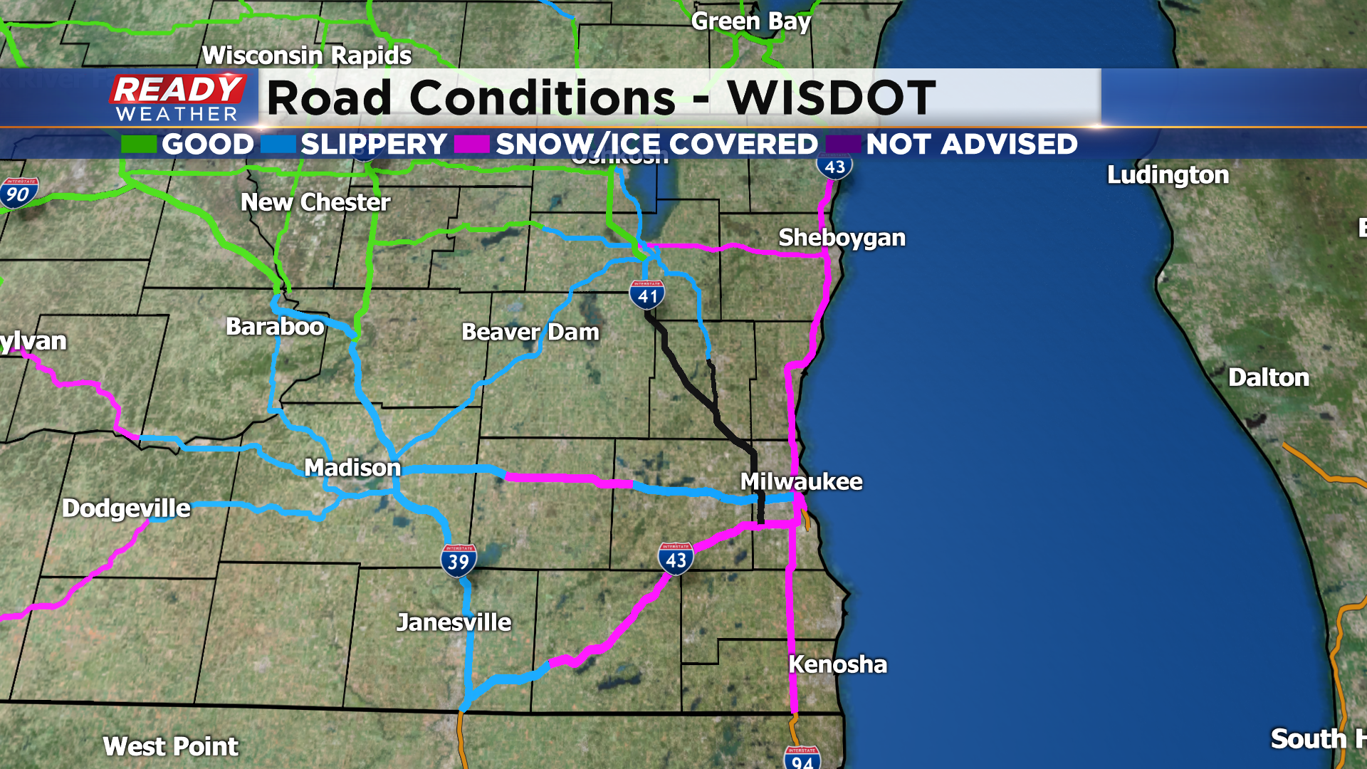
Snow is quickly accumulating on the roads, with most roads in southeast Wisconsin either snow covered or reporting slippery stretches. Roads will become snow covered across all of southeast Wisconsin overnight, so don't travel unless you absolutely have to.
Snow is now reducing visibility to under a mile near the lake, and this will likely worsen throughout the night across the entire area, especially once you factor in the 30-40 mph wind gusts that'll also cause blowing and drifting.
-----------------------------------------------------------------------------------------------------------------------------------------------------------
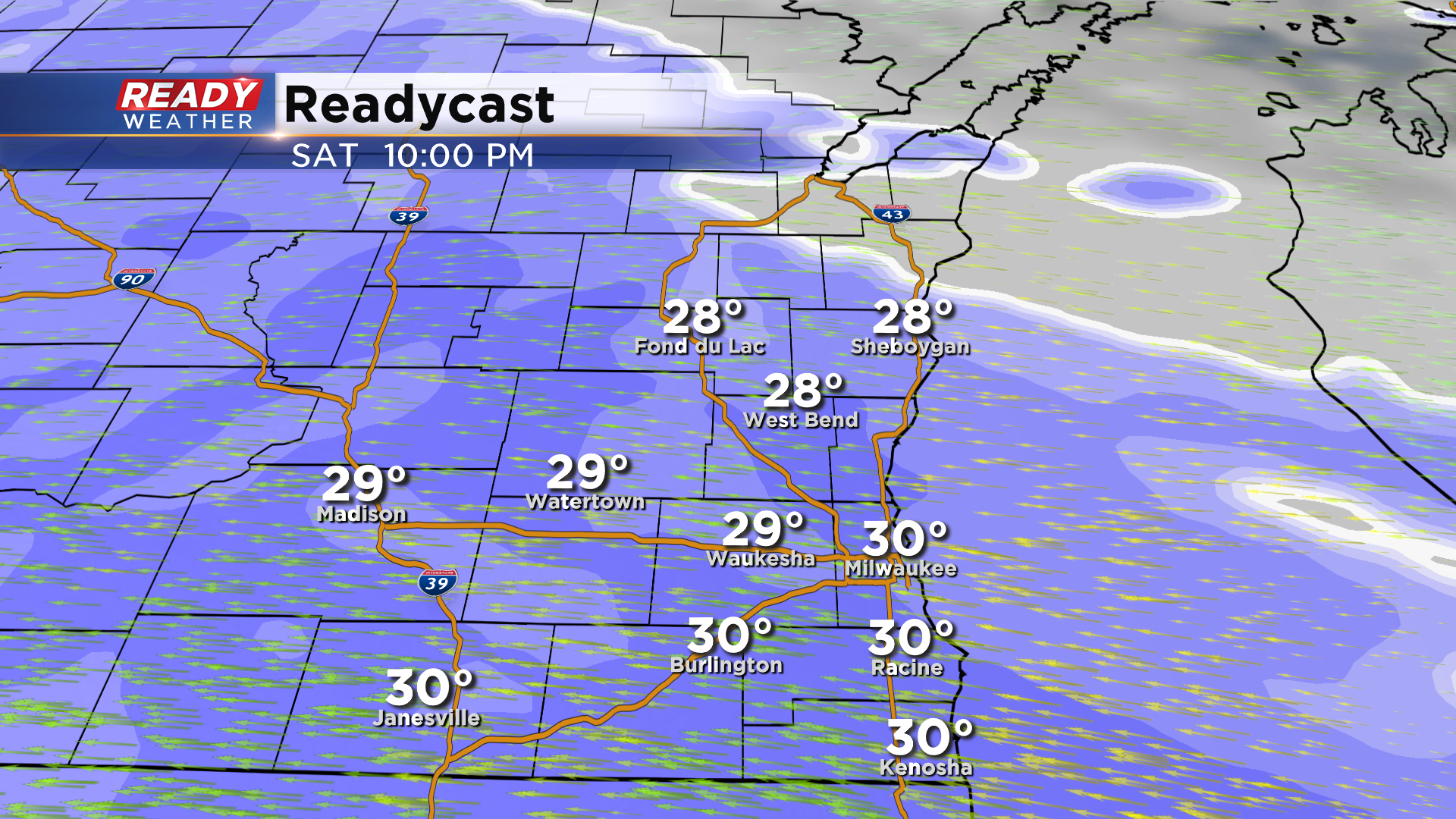
Updated: 6:15 pm Saturday January 30th:
Snow has made it across the WI/IL border and has reached the I-94 corridor as of 6:15pm. Snow will continue to push into the northern half of the area over the next hour.
Visibility has been reduced under a mile at times already, and snow is already covering roads in Kenosha, Racine, and Walworth counties. Expect deteriorating visibility and road conditions over the next few hours.
-----------------------------------------------------------------------------------------------------------------------------------------------------
Updated: 4:15 pm Saturday January 30th
While we've had some off and on graupel (snow pellets) over the last hour in parts of southeast Wisconsin, the main area of snow is still south of the WI/IL border. This will make it to the WI/IL border by 5pm and continue to spread northward into this evening.
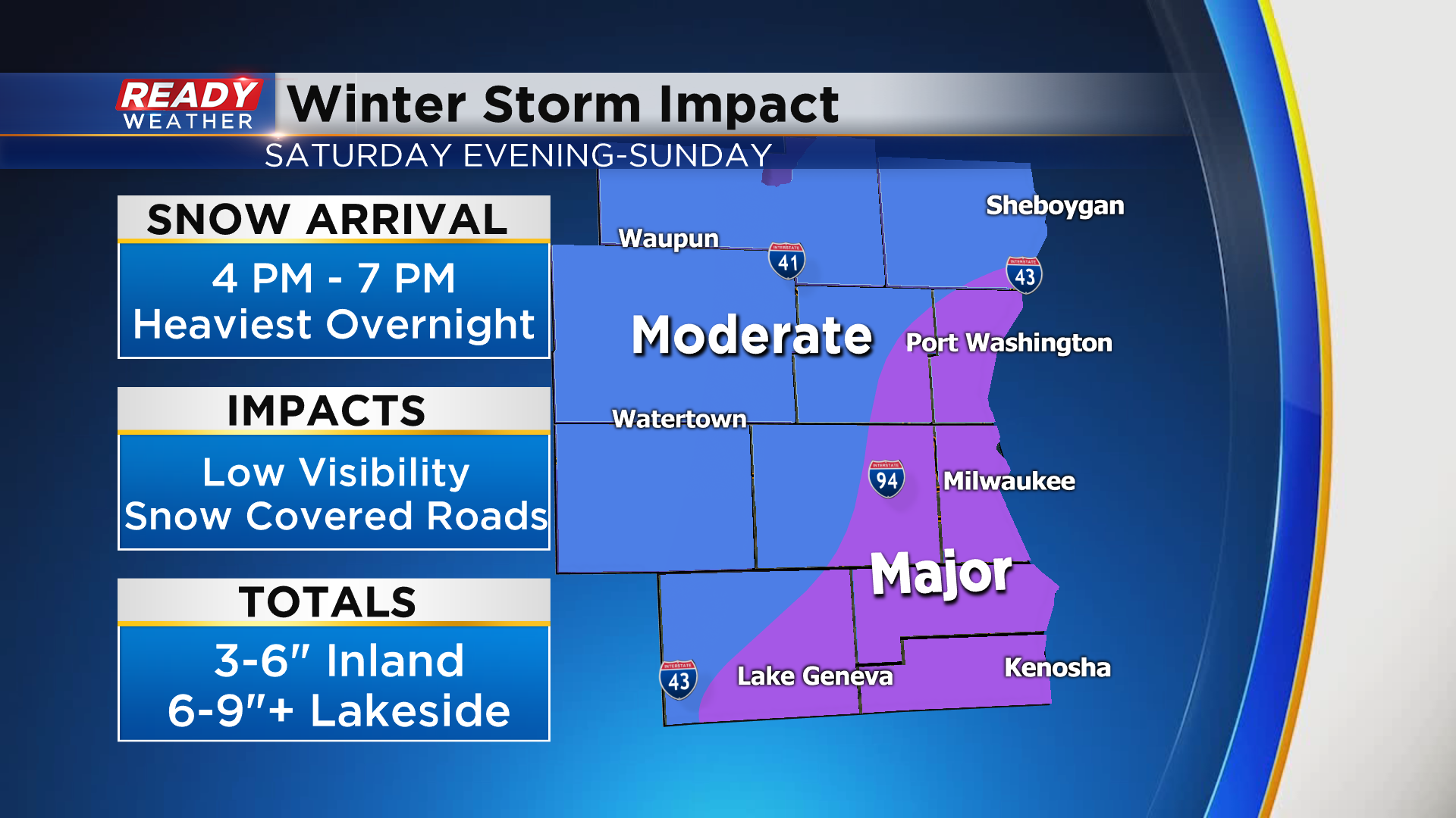
Heaviest snow will fall from 9pm this evening through 9am Sunday morning. While snow will taper off away from the lake by midday, lake effect snow will impact lakeside areas into the evening. With confidence growing in persistent lake effect, have slightly increased lakeside snow totals up to 10".
Overall impacts remain the same.
--------------------------------------------------------------------------------------------------------------------
Updated: 2:15 pm Saturday January 30th:
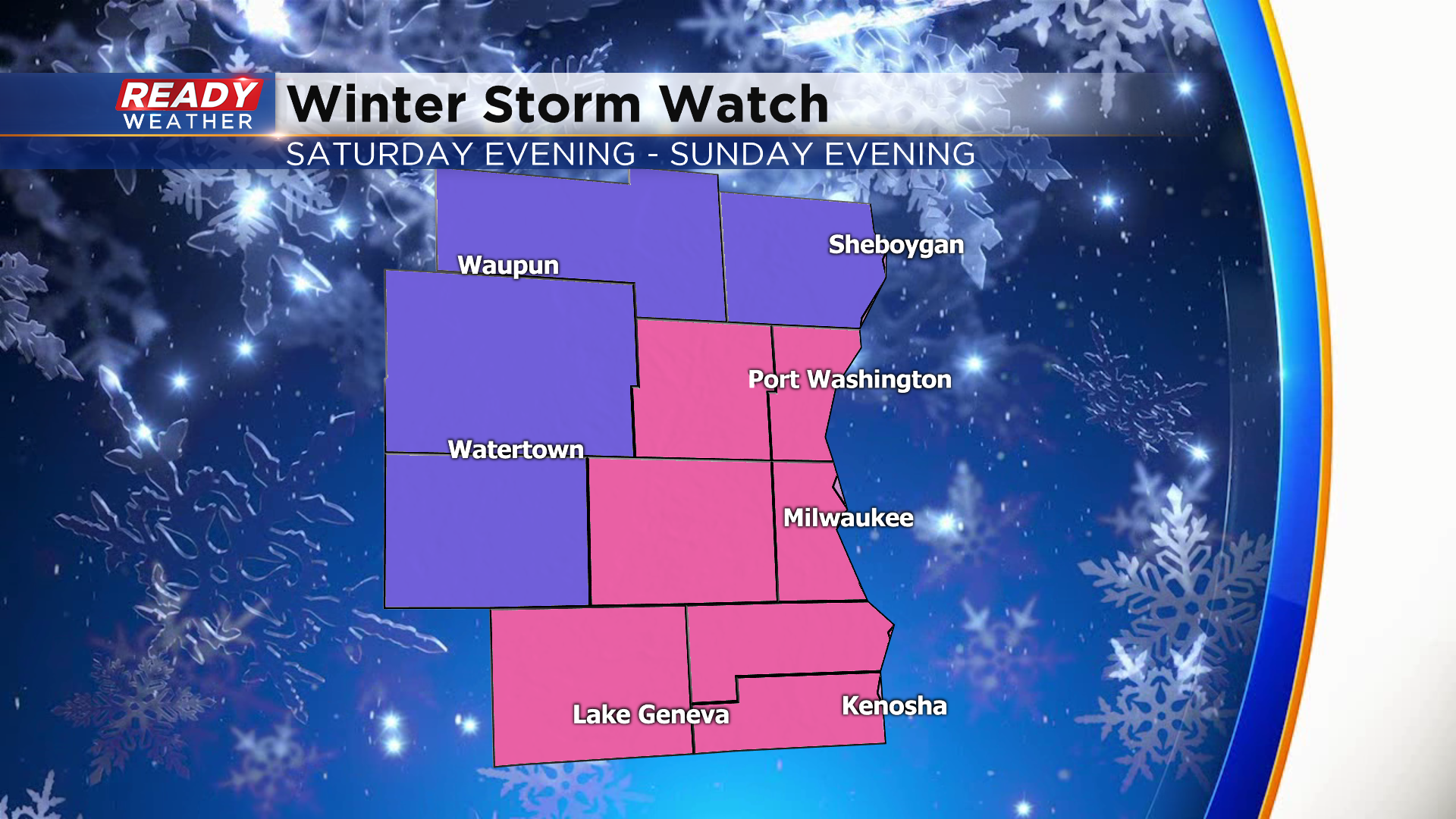
Sheboygan county has been added to the Winter Storm Warning as lake effect should boost snow totals there as well.
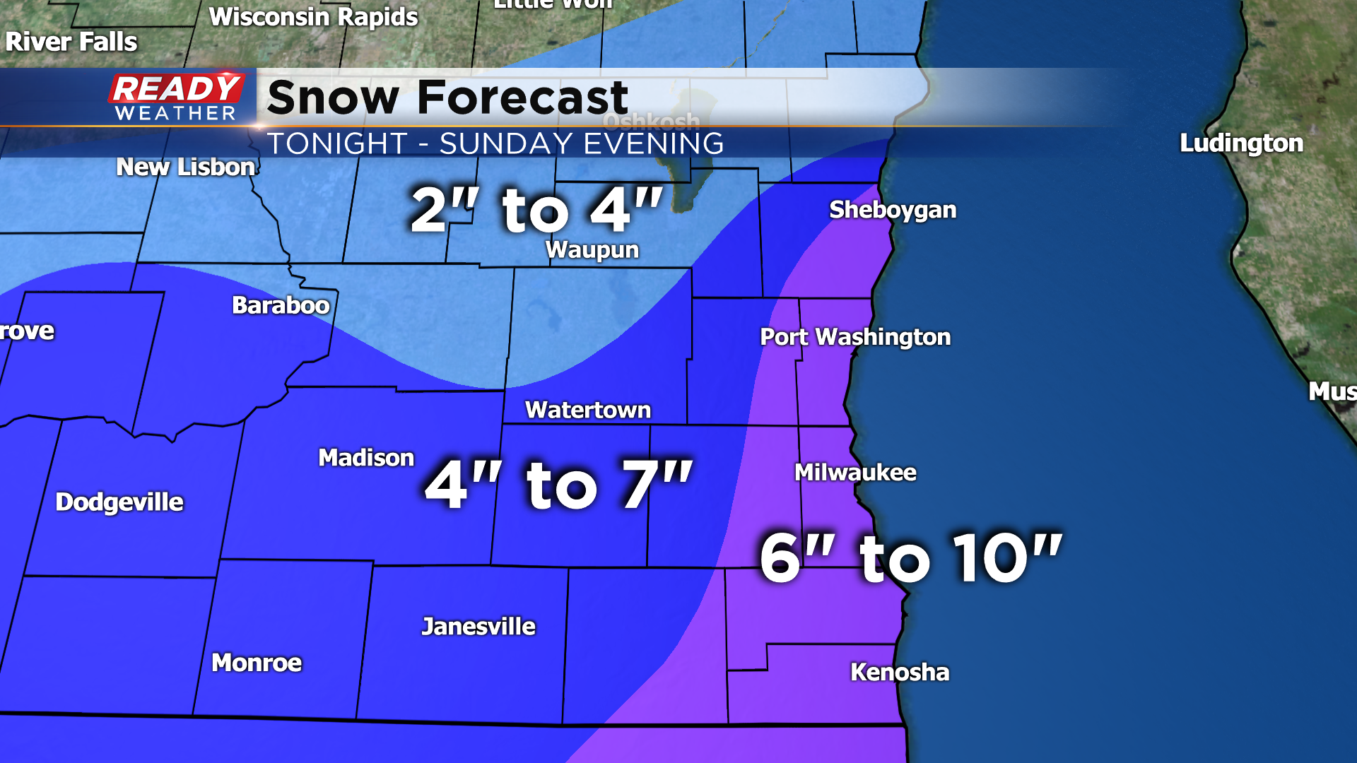
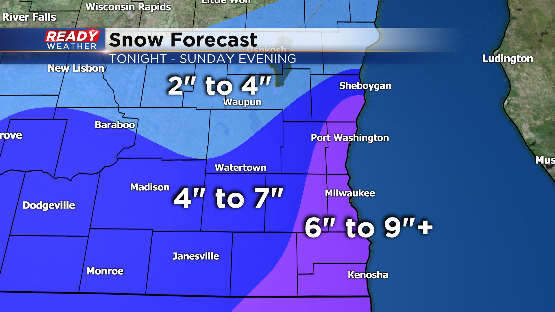
Confidence is growing that 6 to 9" will be likely in areas under the Winter Storm Warning, with isolated amounts around 10" possible closer the lake (best chance of this occurring is from Milwaukee to Kenosha). A general 3 to 7" is expected elsewhere with the lowest totals well west of the lake.
While some very light precip is starting to reach the ground in NE Illinois, the main area of precipitation is still over 100 miles to our south.
The leading edge of that precipitation (which will be snow by the time it crosses the state line) is still on track to move in between 4-7pm.
---------------------------------------------------------------------------------------
Updated: 12:00 pm Saturday January 30th:
The forecast remains on track. Snow is expected to move in from the south between 4-7 pm today, picking up in intensity overnight. Lingering lake effect on Sunday will boost snow totals into the 6-9"+ range near the lake.
-----------------------------------------------------------------------------------------------------
All is quiet across southeast Wisconsin this morning. Despite the radar showing snow over parts of the state, it's not reaching the ground. The main show is gathering strength to our southwest and will start bringing snow into the area from south to north beginning around sunset.
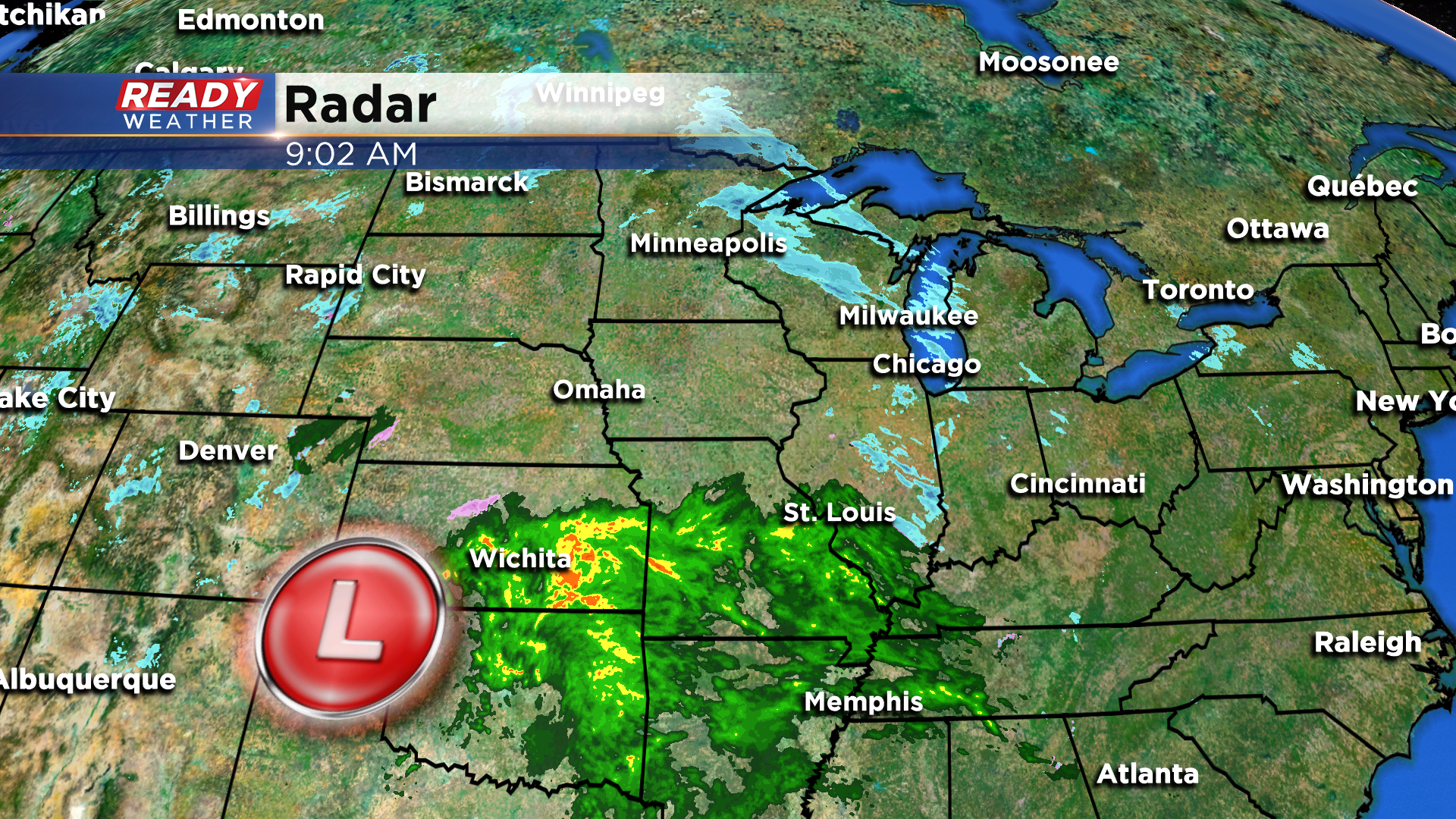
Snow will overspread the area throughout the evening and become heavy overnight into early Sunday.
Snow will start to taper off away from the lake Sunday morning, but strong northeast winds will cause moderate lake effect snow to continue lakeside.
This lake effect snow looks to continue for most of the day near the lake, coming to an end Sunday evening. With the long duration of the snow and lake effect component in play, heaviest snow totals of 6-9" are expected near the lake with isolated higher totals possible right along the lakeshore. 3-7" looks likely for most inland areas.

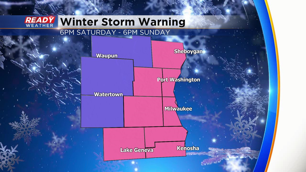
Counties that will be most impacted by the lake effect snow are under a Winter Storm Warning (pink) beginning at 6pm this evening and running through 6pm Sunday. Surrounding areas are under a Winter Weather Advisory for the same time frame.
Temperatures will be a couple of degrees warmer than the system we had earlier in the week, so this snow will be a bit wetter and heavier to move. Additionally, winds will likely be gusting between 25-35 mph, so blowing and drifting is likely. Snow will be the heaviest overnight, so expect very difficult travel. Difficult travel will likely continue for most of Sunday near the lake.
Download the CBS 58 Ready Weather App to track the incoming snow.