Hot and humid Monday ends with a chance for strong storms


Temperatures were on the warm side this weekend and humid at times with highs reaching the upper 80s. That heat is going to stick around for a few more days and with it comes the chance for storms. A few scattered storms are possible after sunset Monday night lasting through the overnight hours into Tuesday morning.
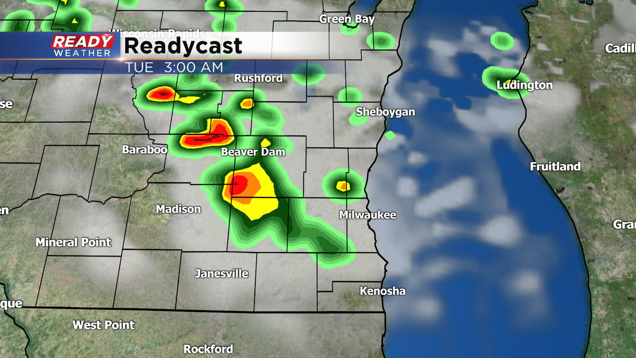
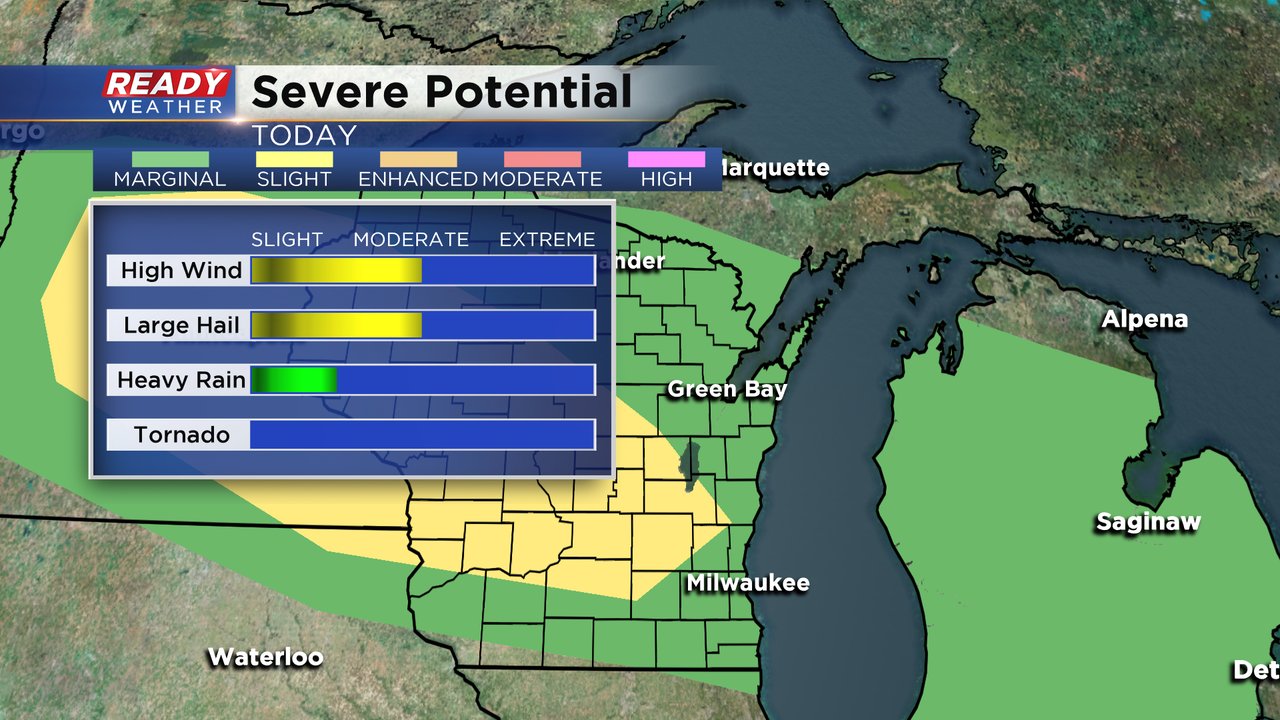
The threat for severe weather looks fairly isolated but is better in areas northwest of Milwaukee. Parts of Fond du Lac, Dodge, Washington and Jefferson Counties are under the slight risk for severe weather which is the second of the five severe levels we have. Wind and hail will be the main threats with any storms but some heavy rain is possible. The tornado threat is close to 0.
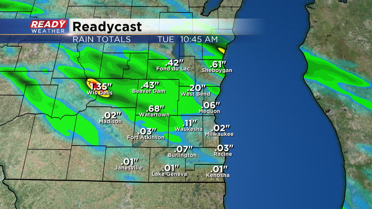
The storms will be fairly scattered so don't get your hopes up for a soaking rain that many of our gardens and lawns need. Those that see thunderstorms could get up to an inch but others may not see any rain or just a few showers adding up to less than a tenth.
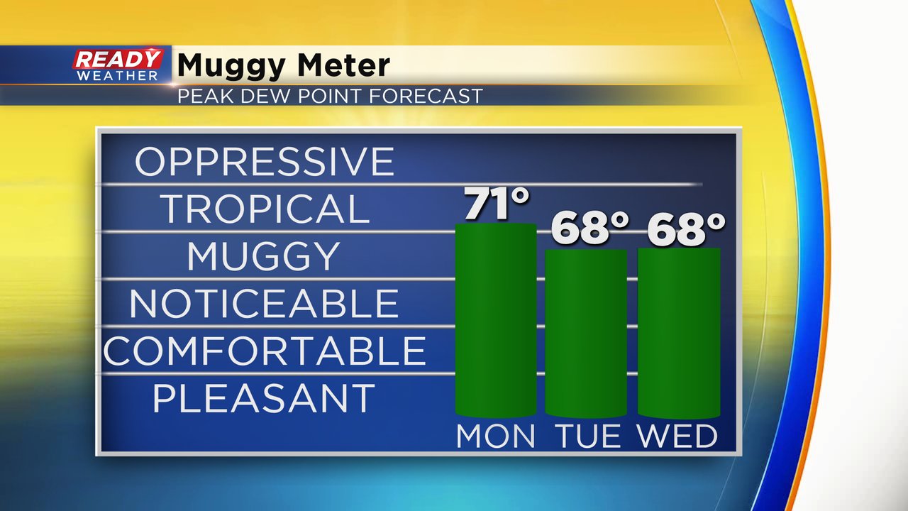
Part of the reason we have a chance for strong to severe storms is how hot and humid it will be. Dew points Monday will be tropical in the lower 70s and stay very muggy Tuesday and Wednesday in the upper 60s.
High temperatures on Monday will be even warmer than the weekend around 90*. The temps fall a bit into the low 80s Tuesday with a lake breeze but then surge back into the low 90s on Wednesday. With the combination of heat and humidity the feels like temps will push into the middle 90s Monday afternoon as shown below.

Download the CBS 58 Ready Weather app so you can get alerts if watches or warnings are issued. Make sure to have the volume up on your phone tonight since some storms could be severe while you are sleeping.