


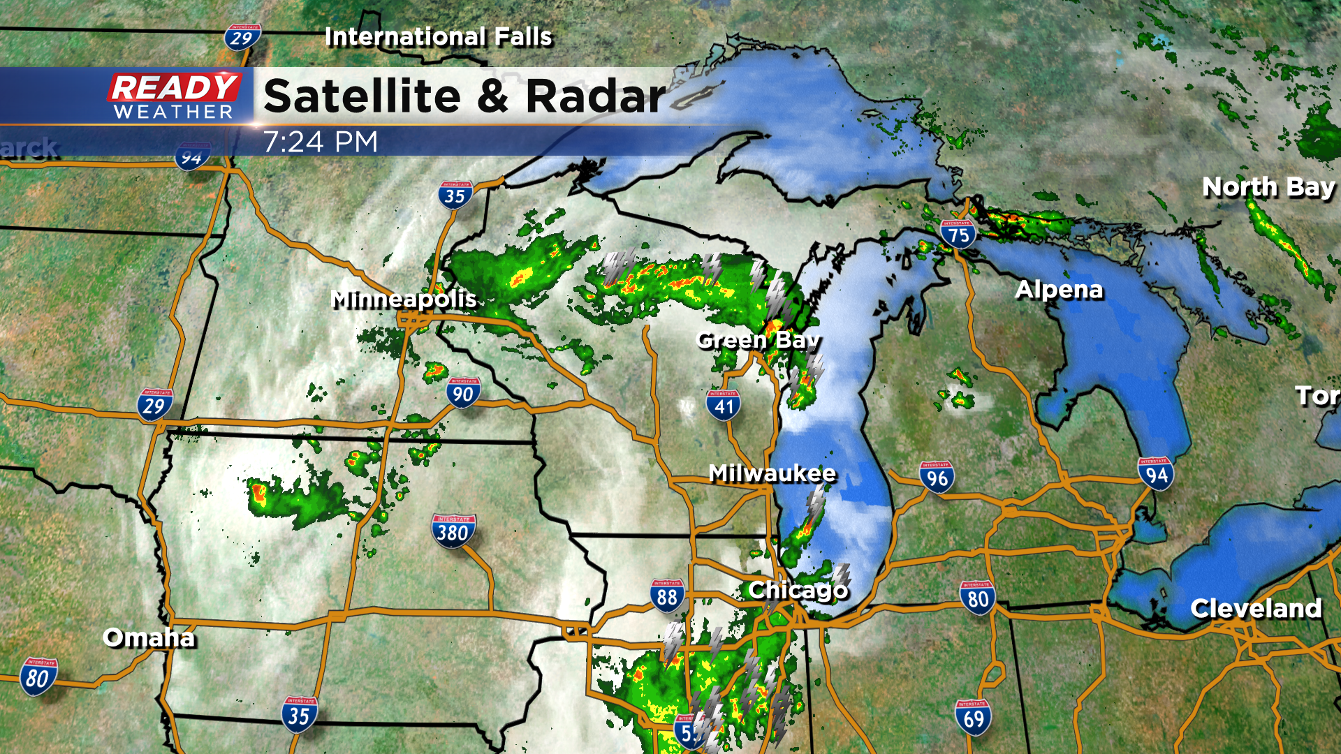
The weather is quieting down across southeast Wisconsin with the severe line of storms having pushed to the north.
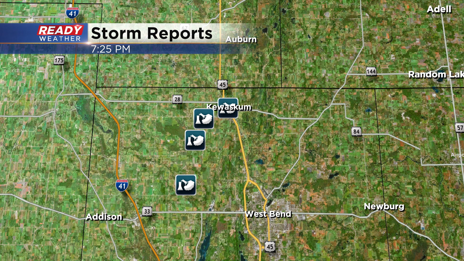
However, there was some tree and powerline damage in parts of West Bend, Allenton, and Kewaskum as a severe storm track through.
A few isolated showers or storms may sneak into far SE Wisconsin this evening out of Illinois otherwise a lot of us will be dry through the night. That dry weather won't continue into Monday as the upper low slowly tracks through the state, keeping scattered rain and storms in the area for a good portion of the day.
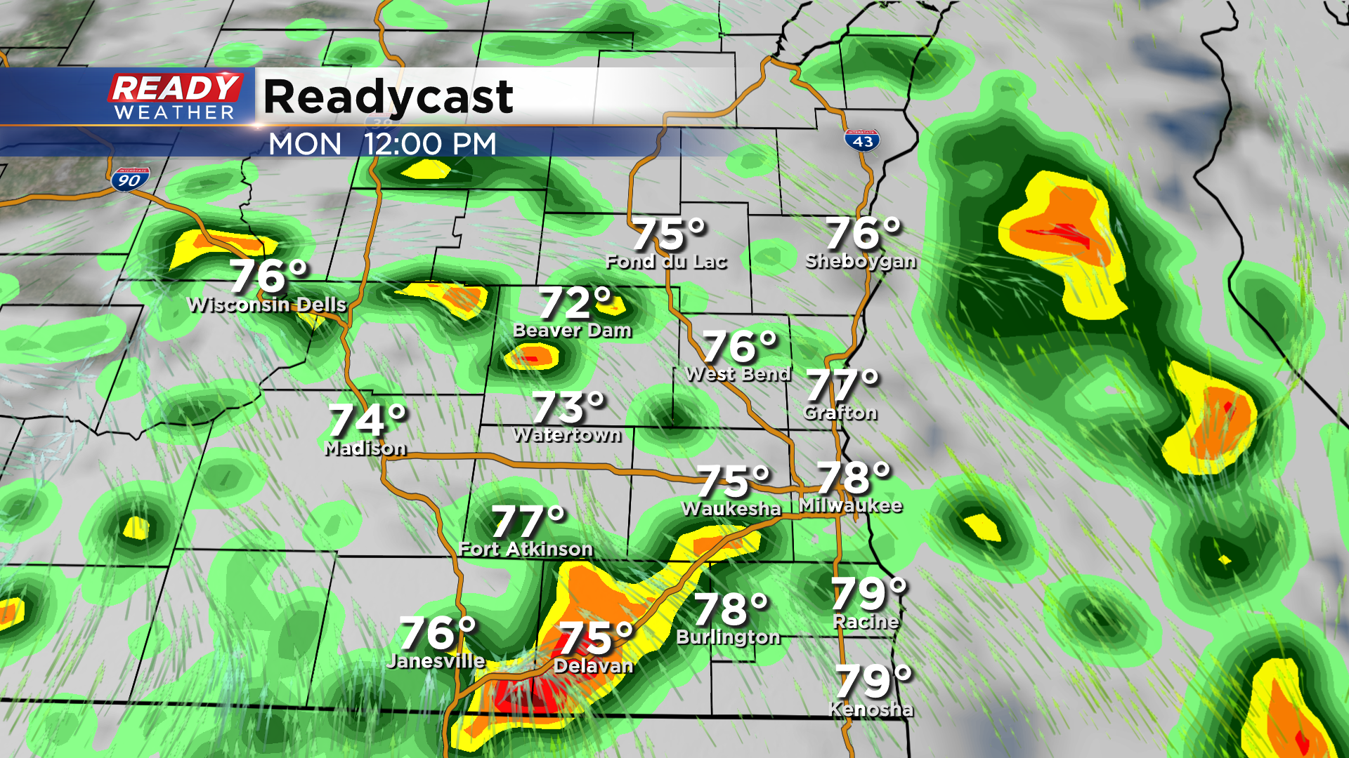
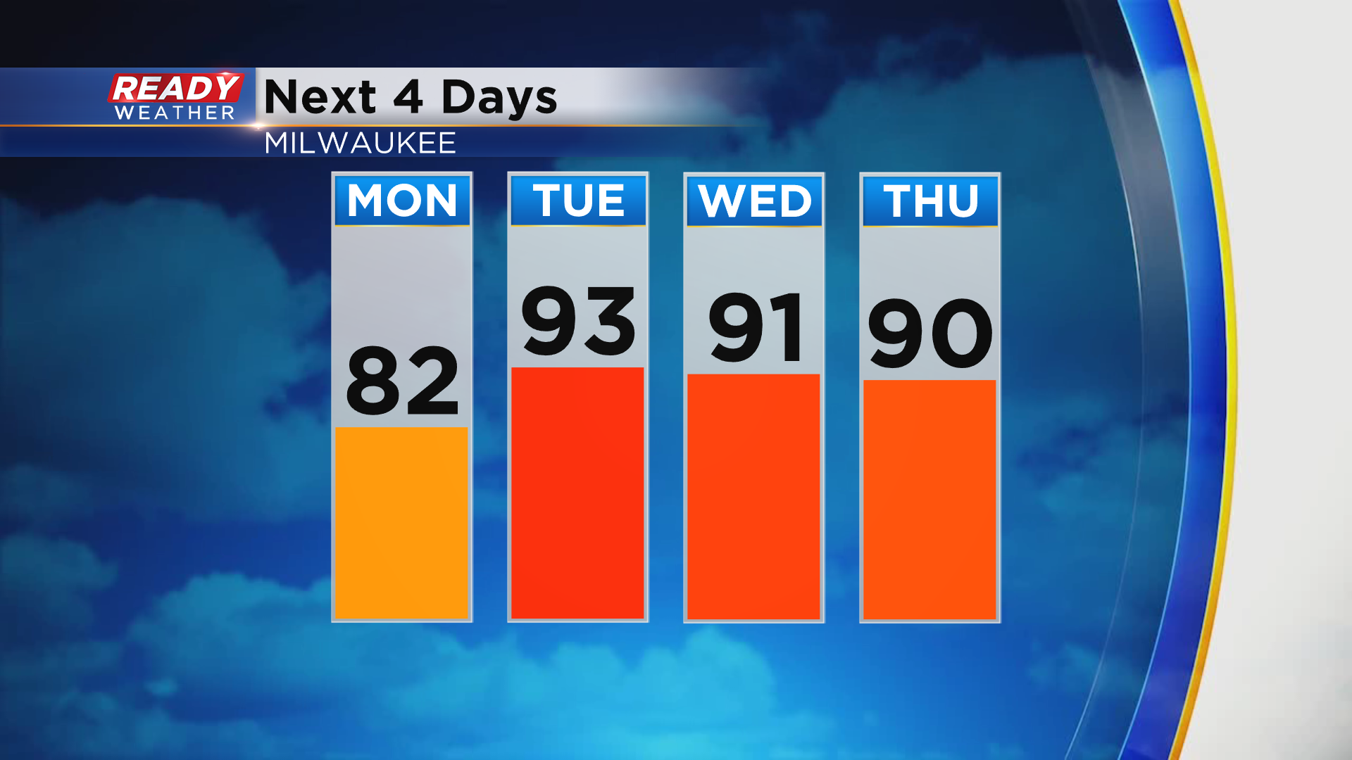
The clouds and showers will keep temperatures in check on Monday with highs in the upper 70s to low 80s, but once the sun comes back out Tuesday through Thursday temps will easily make a run into the low 90s.
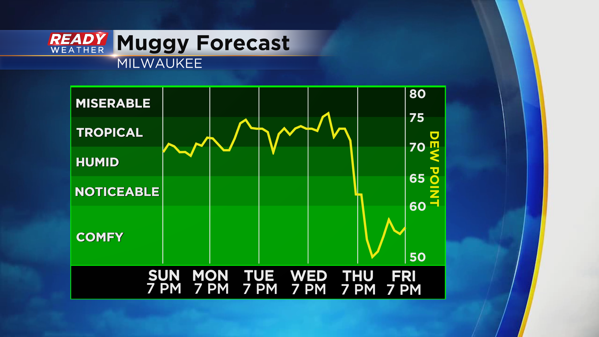
Humidity will remain at tropical levels through Thursday with dew points in the 70s.
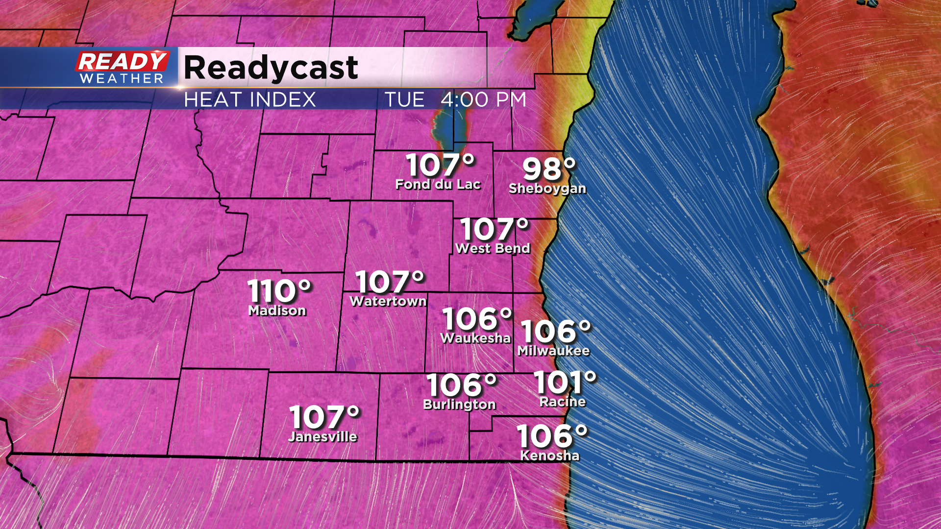
The combination of heat and humidity will make it feel more like 100-110 degrees on Tuesday afternoon.
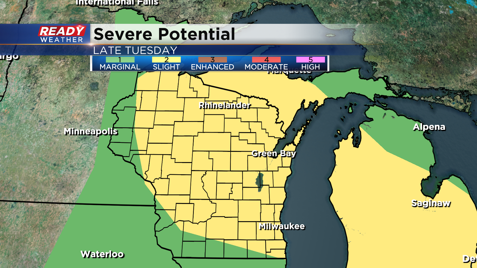
That heat and humidity will likely fuel at least one, if not two more rounds of severe weather this week. Next chance comes Tuesday evening-night. A level 2 of 5 Slight Risk is already in place for most of the state for Tuesday for the severe storm potential.
We'll have another chance later Thursday with the cold front as well. Once that front moves through we'll FINALLY get a break from the heat and humidity with temps dropping back into the upper 70s to low 80s to end the week. Download the CBS 58 Ready Weather App to get any warnings sent to your phone.