Afternoon Update: Drizzle and snow pellets making their way through SE WI


Updated: December 15, 2022 1:45 pm:
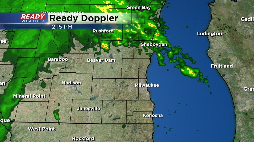
After a solid break in precipitation through the morning hours, it has returned as expected this afternoon. While the radar thinks it's snow, we're actually seeing a mix of drizzle, snow pellets (graupel), and flurries right now
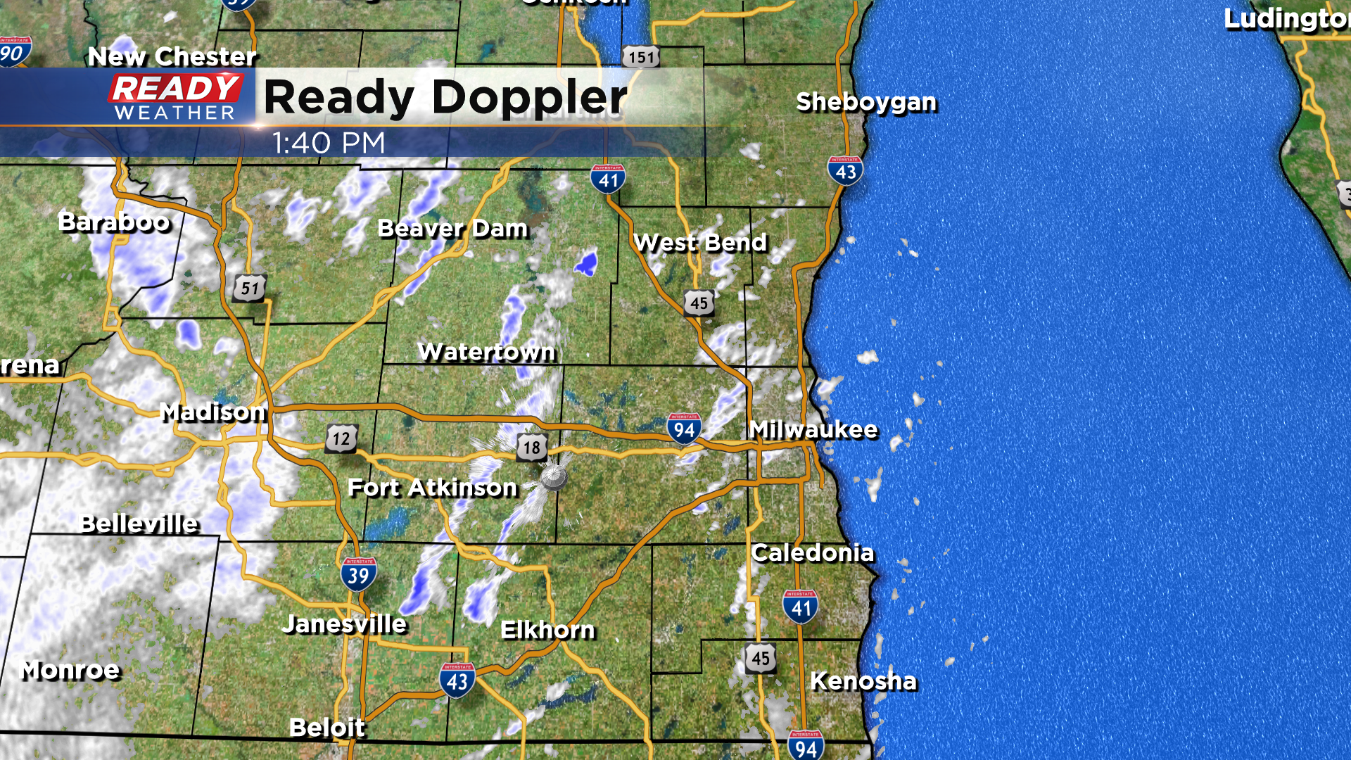
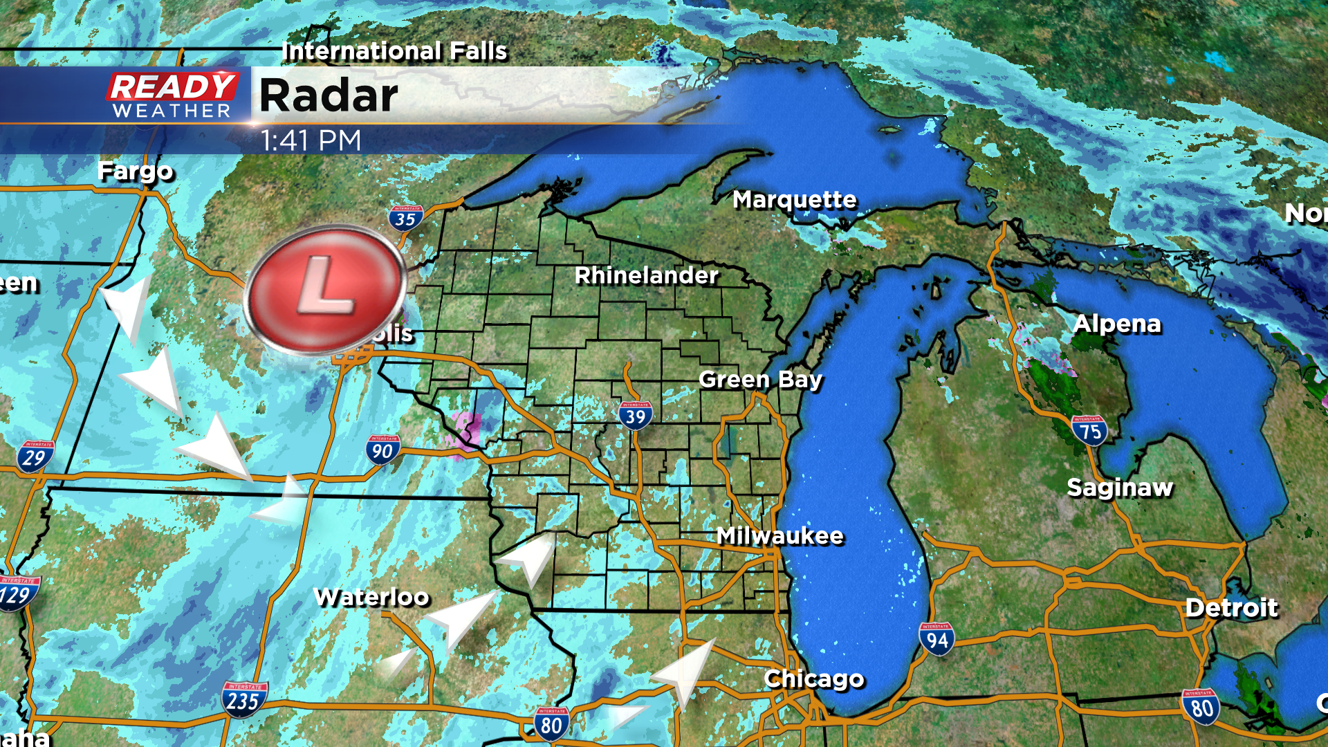
This will continue through the afternoon and evening with steadier, light snow moving in tonight through Friday as this pesky low pressure system slowly slides into northern Wisconsin.
An additional 1-2" is possible tonight through Saturday for most with a dusting to 1" lakeside.

Watch out for slick roads!
------------------------------------------------------
Updated: December 15, 2022 10:25 am:
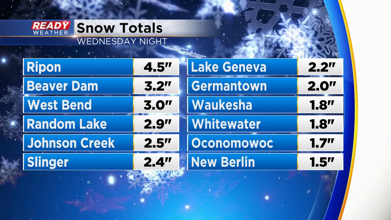
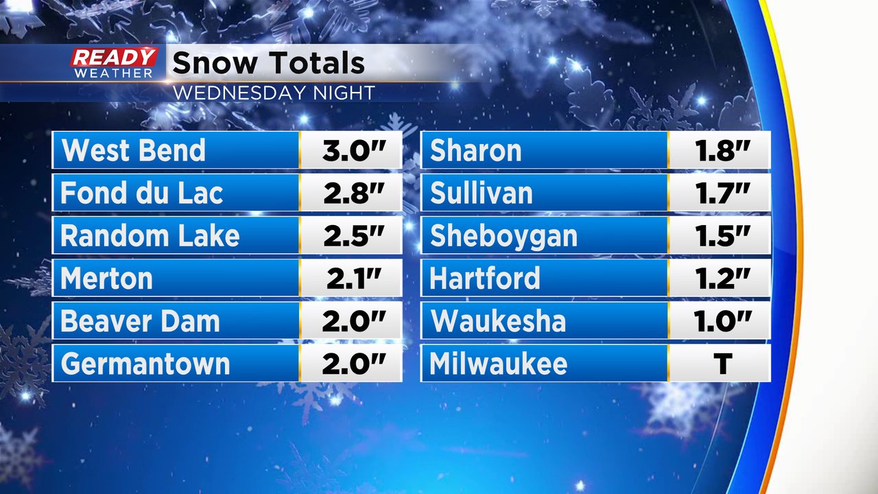
Snow reports continue to roll in this morning with most of the area picking up 1-3" of snow. Folks from Milwaukee to Kenosha didn't see any snow.
We're currently seeing a break in the action right now, but more spotty snow showers will move through later this afternoon into the evening.
Off and on light snow will continue through Friday and into Saturday before this system finally pulls away. An additional 1-2" of snow is possible during that stretch.
-----------------------------------------------------------------
Updated: 8:15 a.m. Dec. 15, 2022
Road conditions have vastly improved the last few hours with good driving conditions now reported across all of southeast Wisconsin. Some sunshine even made a brief appearance!

Snow totals are starting to come in from the snow Wednesday night with 1-3" of new wet snow for inland and northern counties. Milwaukee, Racine and Kenosha Counties just saw rain with no snow reported there.
After a mostly dry Thursday morning and afternoon we will see light snow showers return to the area Thursday evening and then off and on through most of Friday and Saturday. By the time snow wraps up Saturday snow totals over the three day period will range from a dusting to a few tenths lakeside and 1-2" inland.

Download the CBS 58 Ready Weather app to track the continued snow chances through Saturday.
------
Posted: 5:17 a.m. Dec. 15, 2022
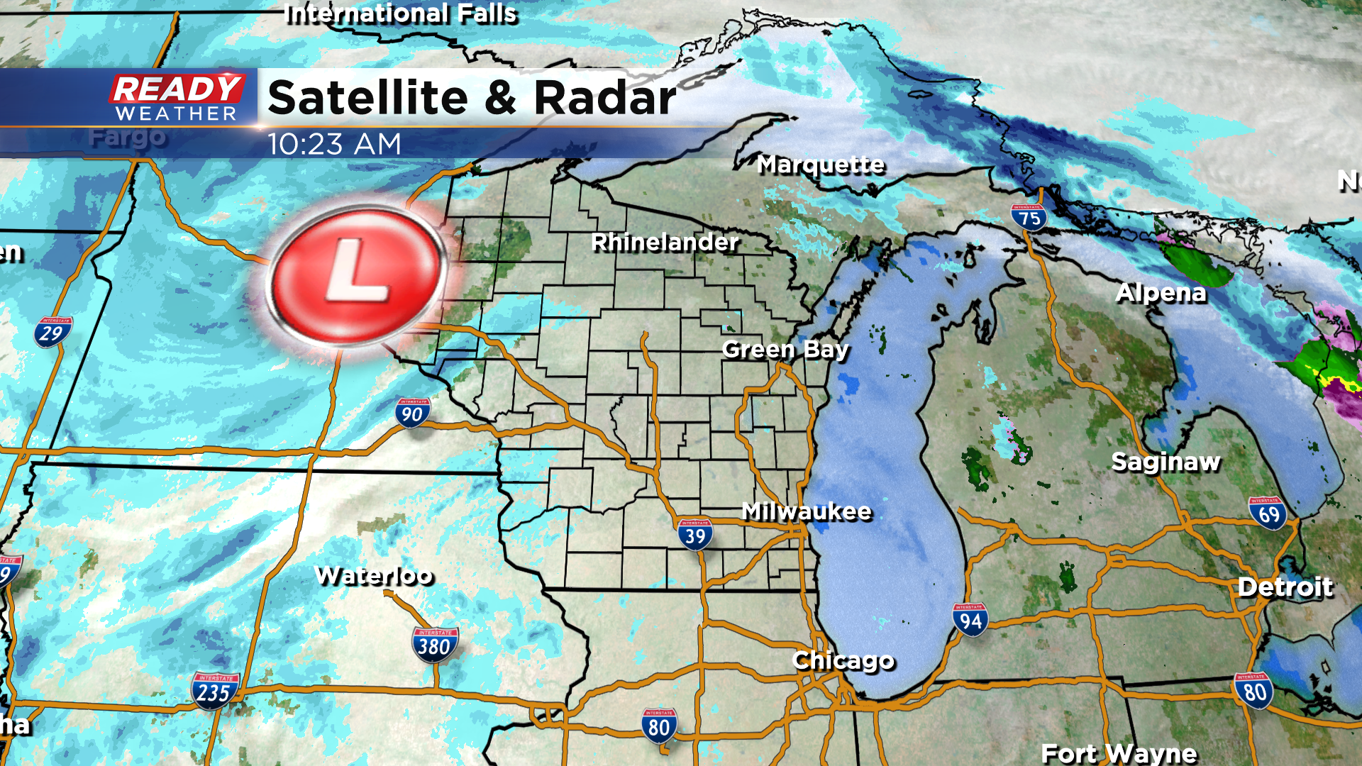
Wet snow and rain from Wednesday night has mostly wrapped up. We just have a few light snow showers lingering in inland communities but the heavy, wet rain and snow has ended and additional snow accumulation Thursday morning looks unlikely. Milwaukee, Racine and Kenosha stayed mostly rain with just a touch of slush but inland and northern counties that were under the winter weather advisory picked up anywhere from 1-5" of snow.
Here's a radar image that will update with time:
Road conditions from the DOT reflect the rain/snow well with only wet roads in the Milwaukee, Racine, Kenosha area, some slipper stretches away from the Lake and snow covered roads in NW counties who saw the most snow.

After a dry morning and afternoon we will see snow showers return to southeast Wisconsin Thursday evening. Those snow showers will continue most of Friday and Saturday. Each day could see anywhere from a dusting to a full inch of snow with additional totals by the end of Saturday ranging from a dusting to 2" across southeast Wisconsin.

Download the CBS 58 Ready Weather app to track the latest snow.