Light, fluffy, accumulating snow returns for everyone Thursday night


Afternoon Update:
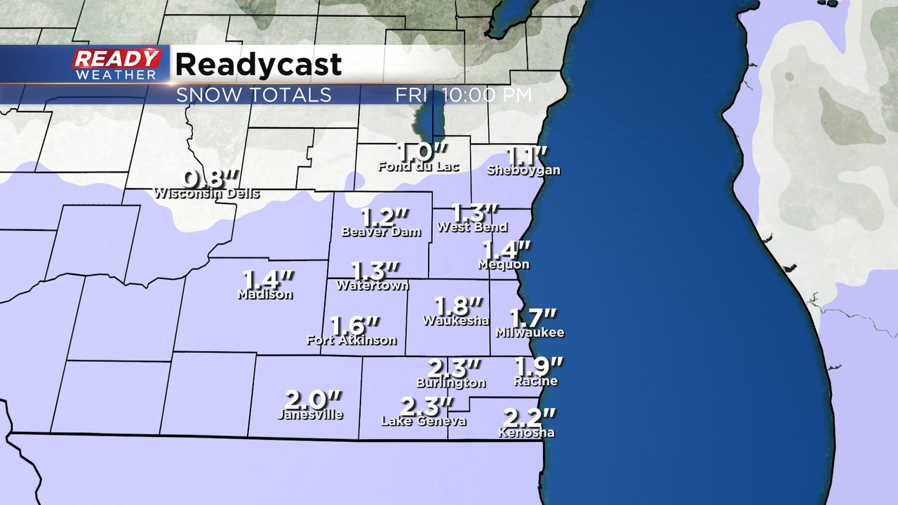
The clouds have rolled in. The forecast for light and fluffy snow for tonight remains intact. Here's the latest thoughts on snow totals. Also to note that

A little light snow rolled into southern Walworth County and Kenosha County last night and even Milwaukee reported a little light snow. Some accumulation may have happened near the IL border. The rest of the day Thursday is fairly dry with a mostly cloudy sky until the evening when our next chance for snow arrives. The Thursday evening commute should be ok but by 7 or 8 PM some snow showers will return to the area.

That snow will continue most of Thursday night through Friday morning. The Friday morning commute will likely be rough with accumulating snow on the roads. Especially those roads that still have compacted snow/ice on them will be very slippery with additional snowfall. 1-3" of new snow is expected for all of southeast Wisconsin with highest totals in southern counties.
The cold air is sticking around as well. Maybe not as cold as the beginning of the week but still very chilly with wind chills Thursday and Friday from the teens below zero in the morning to just above zero in the afternoon. Saturday morning looks to be a bit colder.

Download the CBS 58 Ready Weather app to track another round of snow.