Late Friday Update...Saturday snow still on track with lesser amounts expected


Updated as of 9:00 p.m. Friday...
Got a great picture of a halo Friday evening. Thanks, Patty Hoover, for sending. A halo is caused by the refraction, in this case, of moonlight through ice crystals. This means precipitation (snow) will be falling sooner. It's expected late Saturday morning and will continue through the day. An inch or so can be expected with heavier amounts well north and west of us. Watch for slick spots as temps fall off Saturday night.


______________________________________________________________________________________________________________
Updated as of 3:00 p.m. Friday...
We are still on track for snow on Saturday, but it looks less impressive compared to earlier computer runs. Perhaps a dusting to an inch across the metro with a few inches the farther north you go of I-94. Most of the snow will fall during the day. Temperatures will hover in the low 30s and then fall during the evening so don't expect a lot of melting either. We have a few other chances of snow this coming week, including Wednesday and next Saturday.


Snowfall expected...


Colder air coming next week...

______________________________________________________________________________________________________________
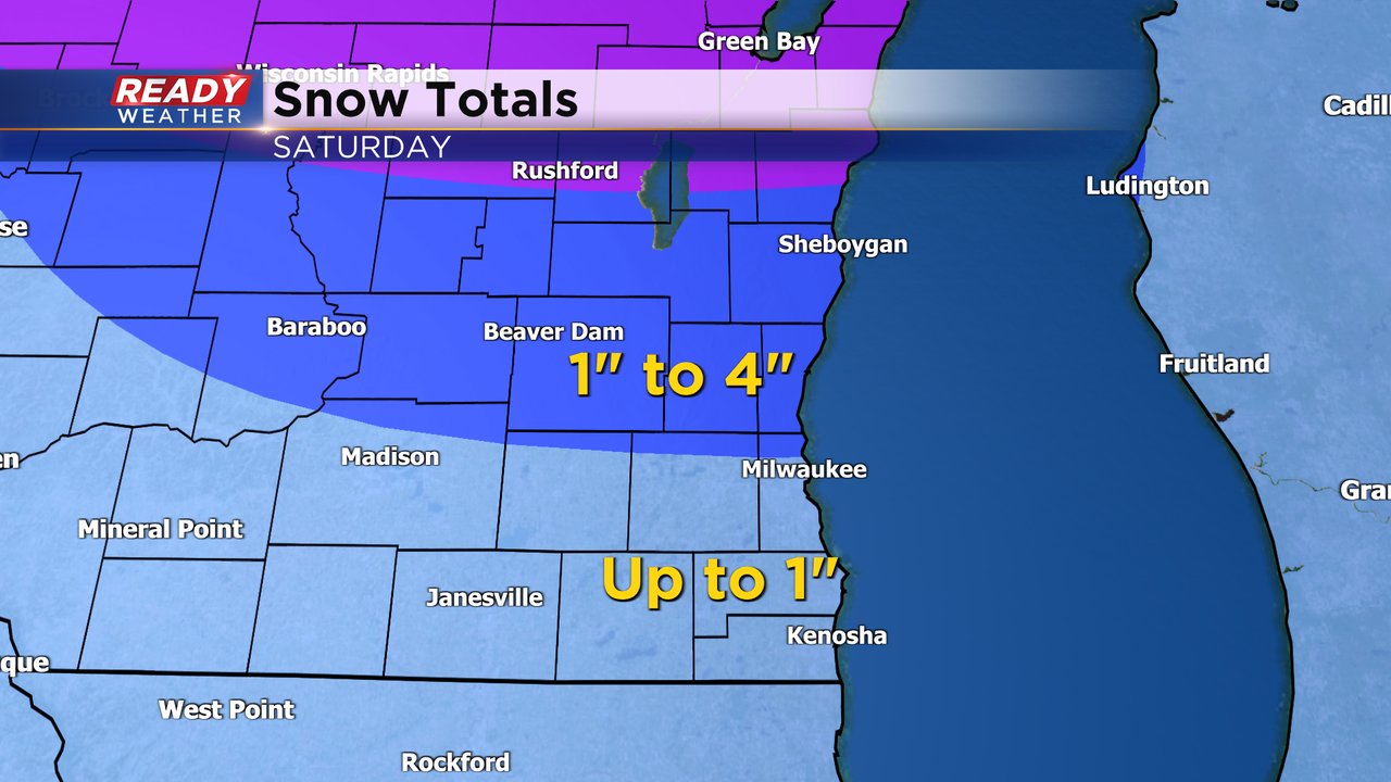
Our first widespread snow in weeks arrives across southeast Wisconsin on Saturday. Earlier in the week the snow totals looked more impressive but as the storm track has shifted north it only looks like most of southeast Wisconsin gets light snow. The snow will start Saturday morning and continue through the afternoon before wrapping up in the evening.

Northern counties will likely see the most snow and the highest snow totals with 1-4" expected. Highest totals are likely in Fond du Lac and Sheboygan Counties then we get a tight gradient as snow totals decrease closer to 1" north of Waukesha and Milwaukee over the course of just 20 miles or so. Southern counties will only see a few tenths of a inch up to 1" of new snow.
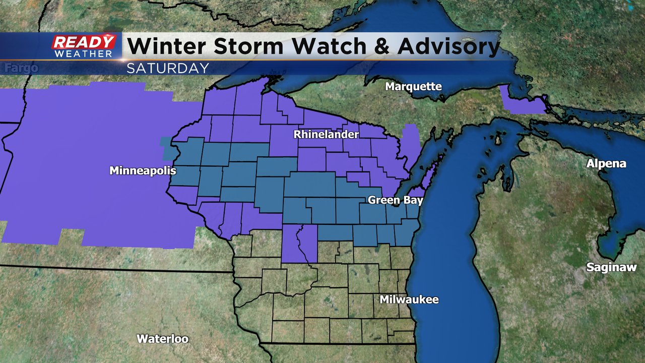
If you are looking for more snow you have to head into the northern half of the state. A Winter Weather Advisory, shown in purple, and Winter Storm Watch, shown in blue, have been issued for central and northern Wisconsin where 4-8" of snow is likely.
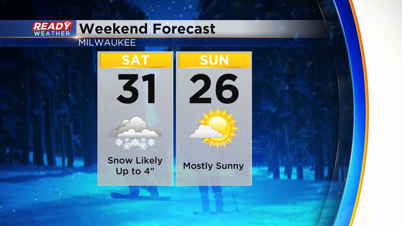
After the snow on Saturday, sunshine quickly returns for Sunday but temperatures drop a bit into the 20s.
Download the CBS 58 Ready Weather app to track the snowfall with the interactive radar.