Light snow on the way for Saturday with more chances next week


Updated: Friday, January 5th 5:15pm:
Dry weather continues through the evening with light snow moving in from the south during the early morning hours on Saturday. Steadiest snow occurs in the morning and becomes a bit more patchy in the afternoon and evening. Recent data suggest a touch more accumulation is possible. Up to 1.5" is possible in lakeside counties, but if you're within a mile of the lake expect less accumulation and a wetter snow since the lake is still so warm. A half inch to an inch is expected elsewhere.

-------------------------------------------------------------------------
We've made it through the first work week of January and the weather pattern is finally starting to turn more wintry. Temperatures are still expected to be above average in the middle to upper 30s but snow chances start to ramp up. The first chance arrives on Saturday. It's a fairly disorganized area of low pressure but still enough to bring in light scattered snow showers Saturday morning through the evening.
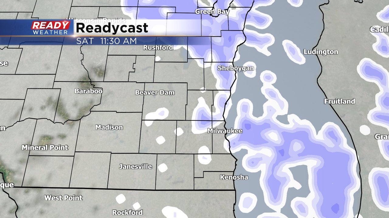
Snow totals for Saturday look fairly low but at least a dusting to an inch of snow will be possible. Some isolated hometowns could get a bit more than an inch. Most of the main roads will just stay wet but some side roads and sidewalks could get slick. Most of the accumulating snow stays on grass/cars/patio furniture.

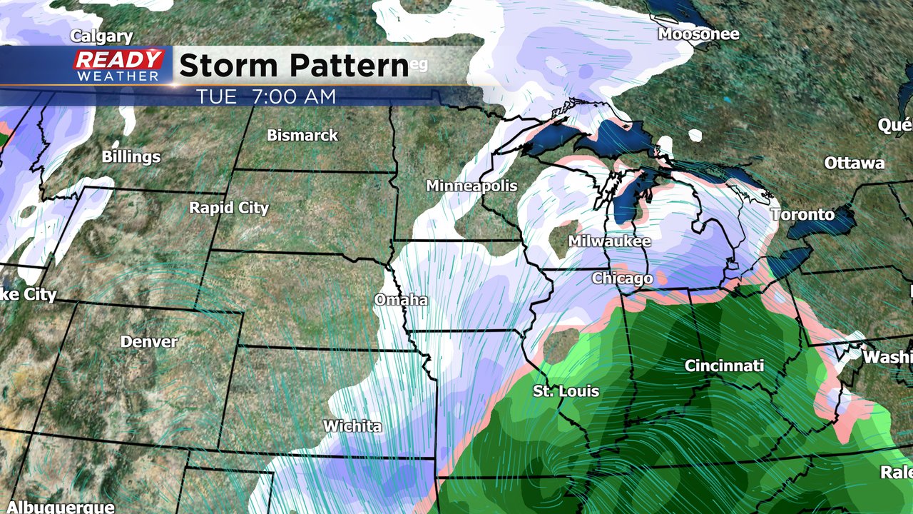
We are still tracking a potentially bigger storm system for next week. Tuesday would be the day to watch. Right now the storm track has shifted farther south over the last 24 hours meaning less snow for southeast Wisconsin but still the possibility for some accumulation. Definitely something to watch over the weekend. Wednesday and Thursday also have snow chances next with continued chances into the following weekend.
Download the CBS 58 Ready Weather app to track the Saturday snow with the interactive radar.