Noon Update: Quiet Wednesday, More Snow and Cold in the Days Ahead


Updated: Wednesday, November 16 12:00pm:
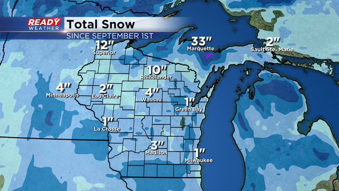
Drier air is helping to vanish the falling snow aloft. At this time only far western parts of the area have experienced flurry activity this morning. But look at the snow piling up this season across the region!
Updated: Wednesday, November 16 9:30am:
The lake effect snow showers have stayed over the lake this morning and will remain over the lake for the rest of the day.
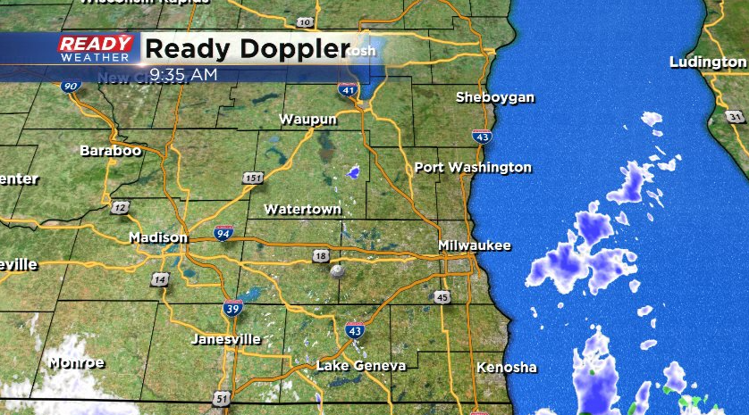
A few passing flurries are possible this afternoon, but the accumulating snow is done for the day. More snow showers are expected Thursday afternoon and evening. More details on that below.
-----------------------------------------------------------------------------------------
Updated: Wednesday November 16 5:50am:
The lake effect snow showers are primarily sitting over the lake early this morning, but more light snow has redeveloped in south central WI from Dodge county to the state line.
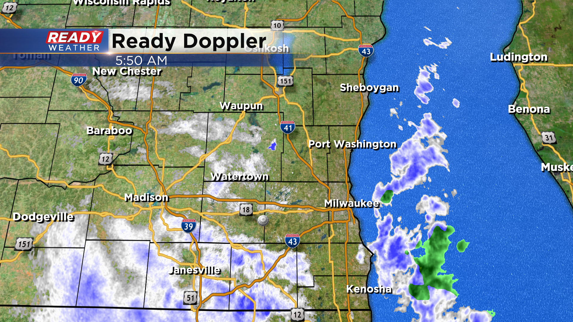
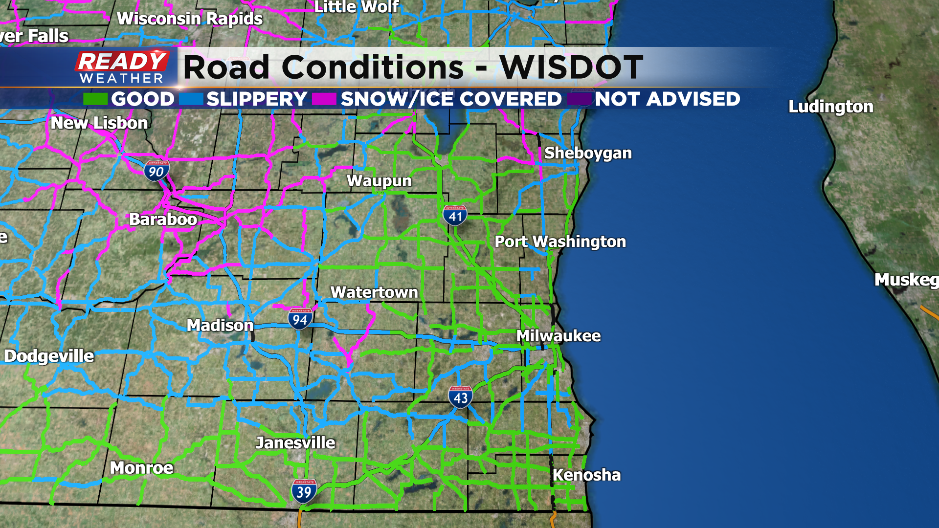
The main roads are in decent shape this morning, but secondary roads and less traveled inland roads are slippery. Inland spots are below freezing so drive with caution this morning!
------------------------------------------------------------------
The widespread snow has come to an end, but we're still watching a few lake effect snow showers that have been pivoting through eastern Wisconsin overnight.
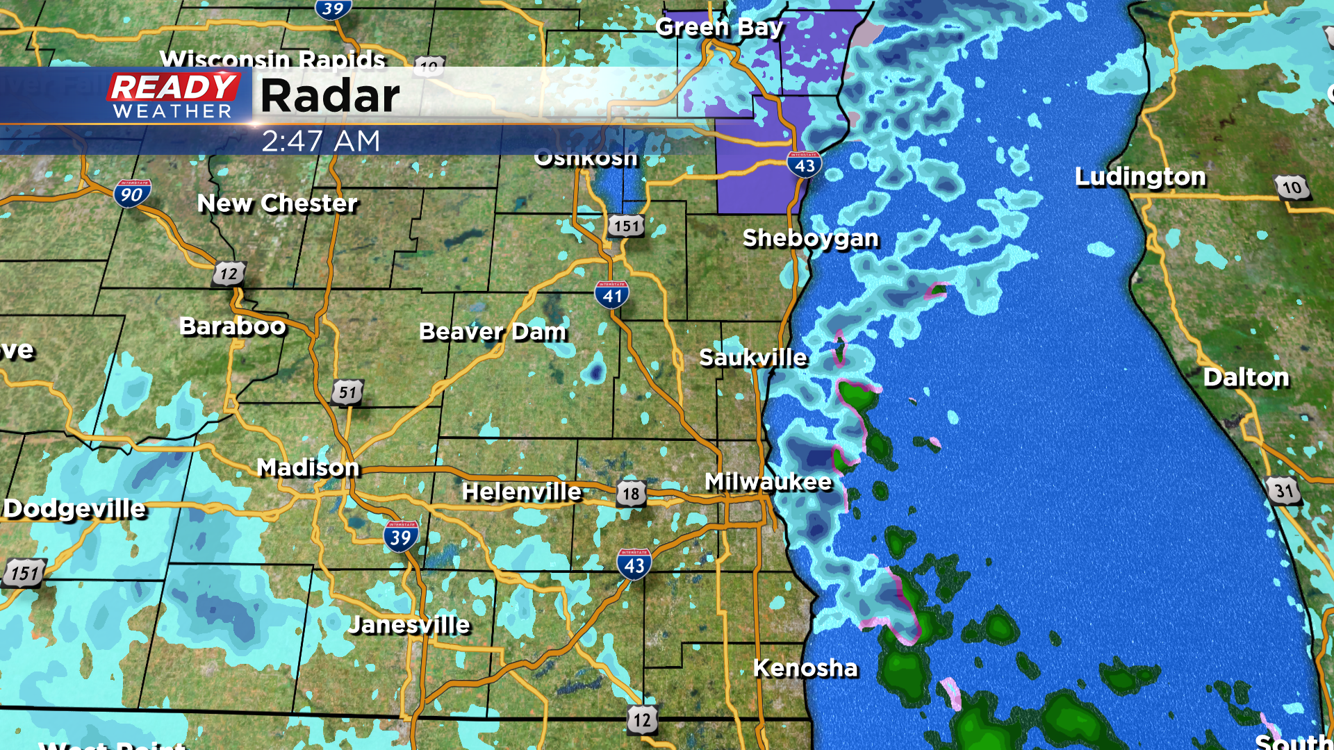
A few more snow showers will come onshore this morning before the wind turns more to the northwest and keeps them over the lake during the afternoon and evening. That being said, a few isolated flurries can't be ruled out. An additional dusting to few tenths of an inch is possible this morning.
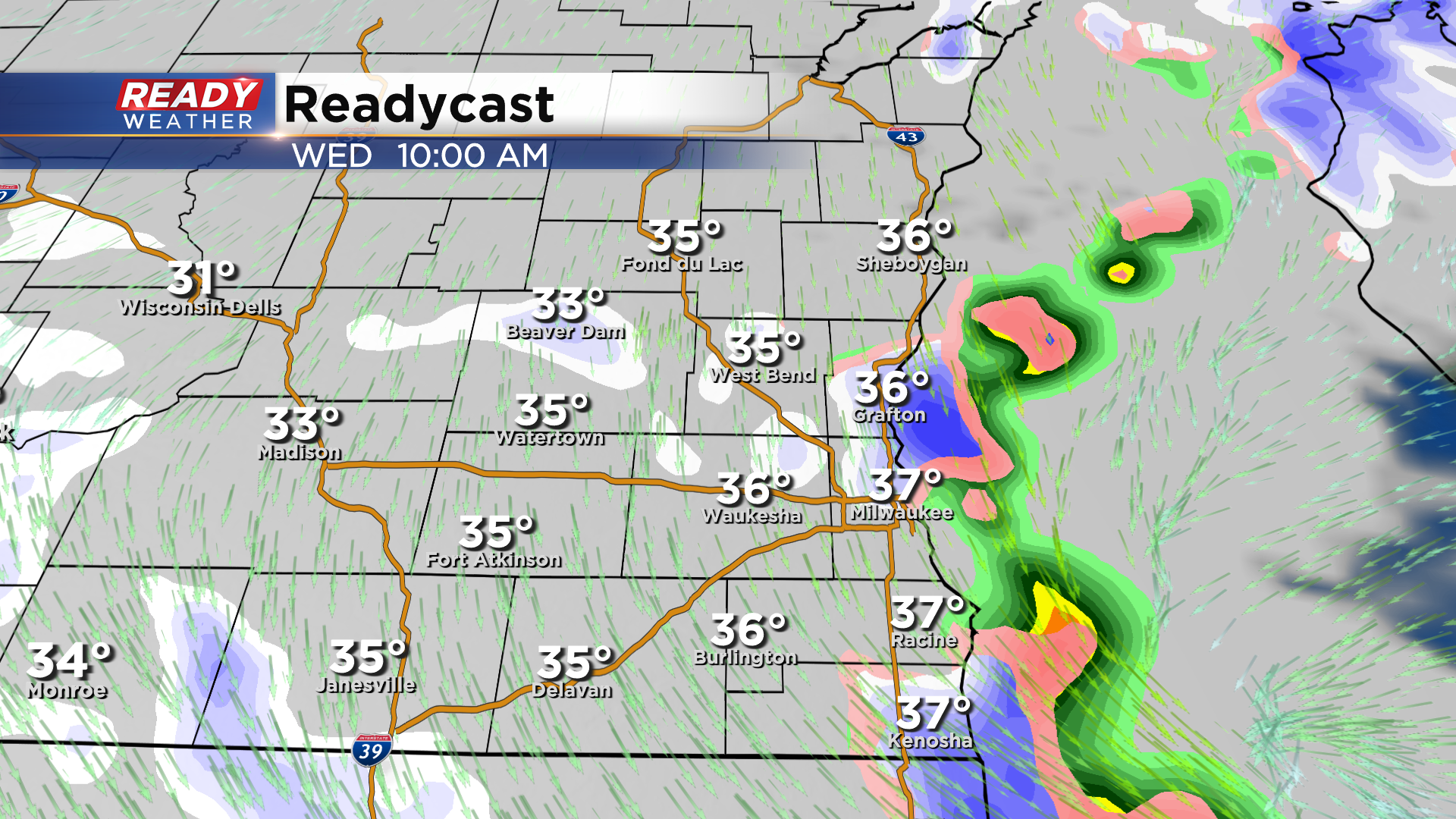
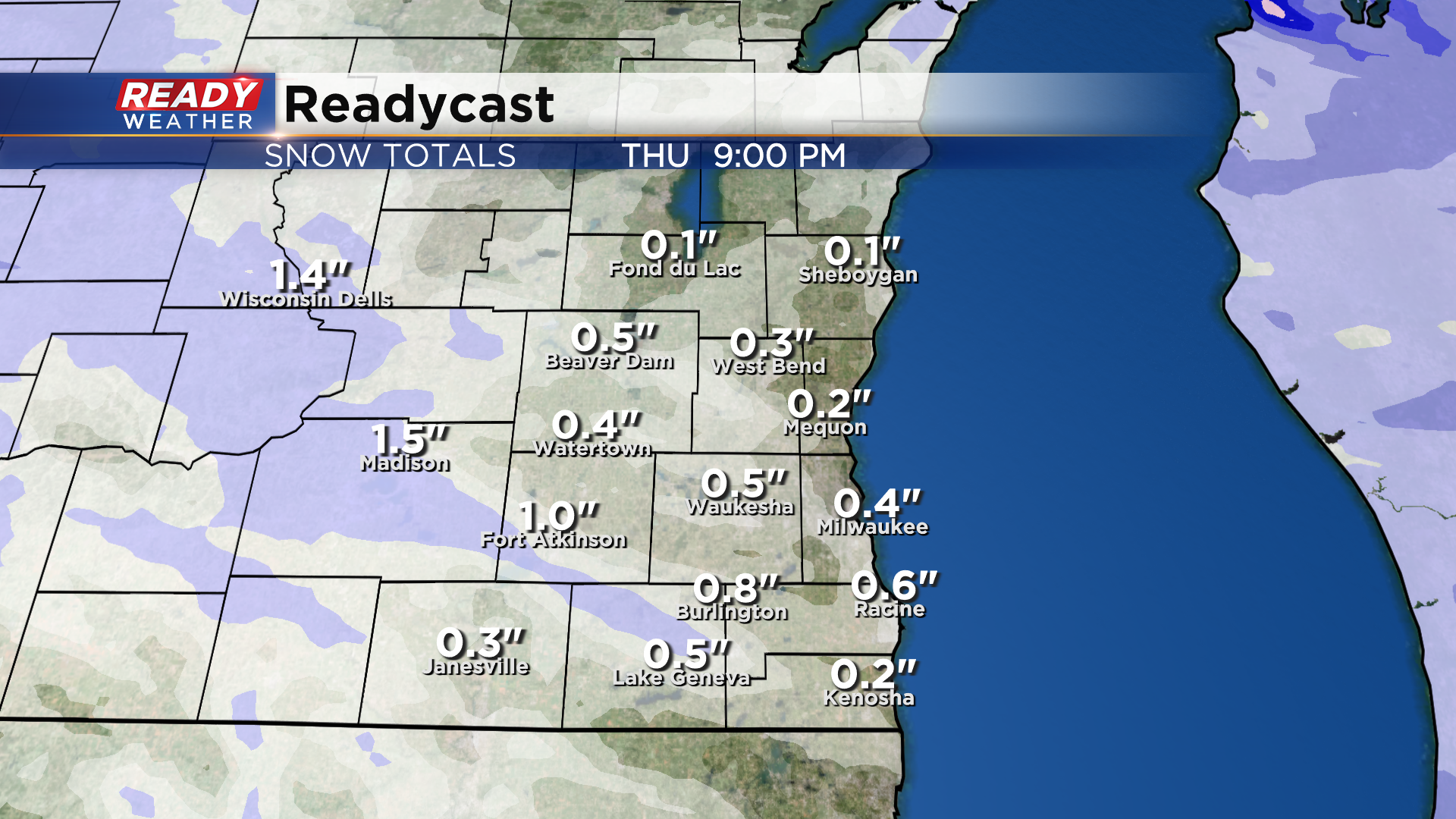
After a break in the action tonight into the start of Thursday, another batch of snow showers is possible Thursday afternoon as a cold front passes through.
Another dusting to half inch of snow will be possible, but lower visibility in the more moderate snow showers will be the main concern.
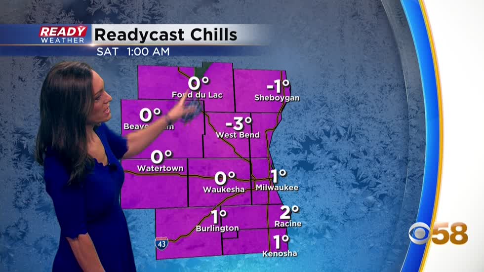
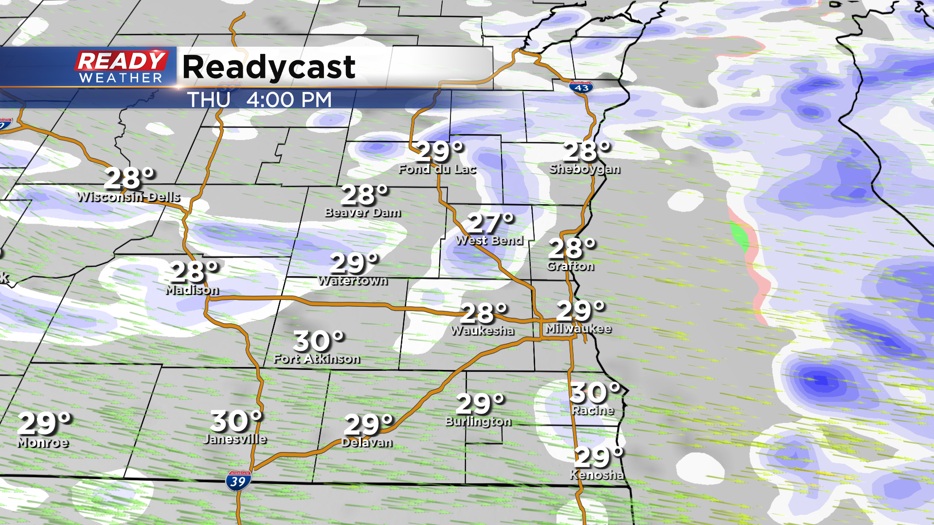
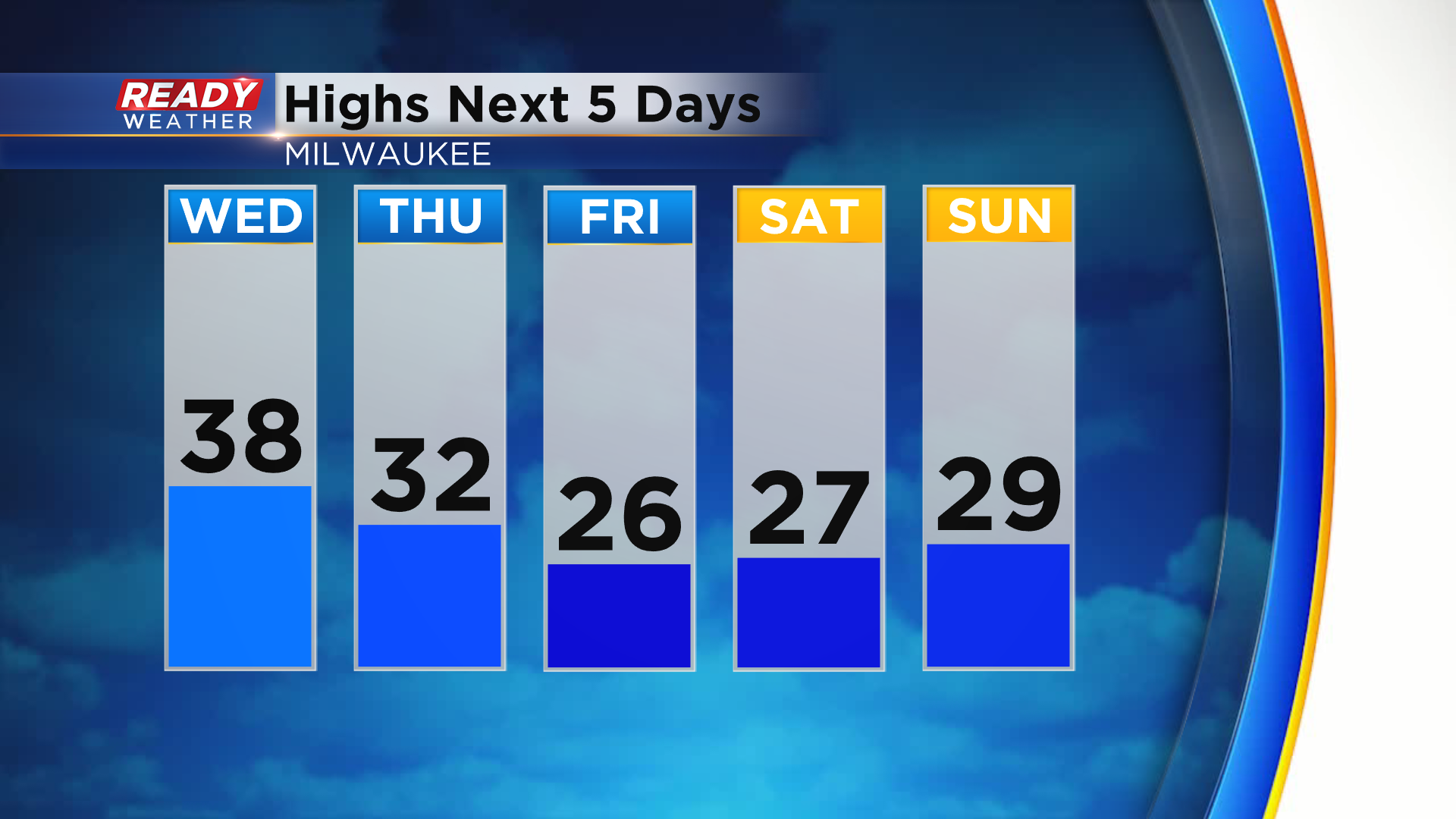
Conditions turn breezy and cold behind the cold front to end the week and will continue into the weekend. Highs only top out in the mid to upper 20s Friday through Sunday, and a gusty wind will make it feel more like the single digits to low teens.
One more batch of spotty snow showers on Saturday, but then temps will start to moderate early next week. Download the CBS 58 Ready Weather App to see the full 7 day forecast.