Mainly dry Sunday followed by storms for the 4th of July


It's been a rather pleasant start to the holiday weekend across southeast Wisconsin with filtered sunshine, low humidity, and seasonal temps in the low 80s. After being dry for most of the day, a batch of showers track through areas along and north of I-94 now through sunset. This area of rain and thunder is running into very dry air, so they will likely continue to weaken.
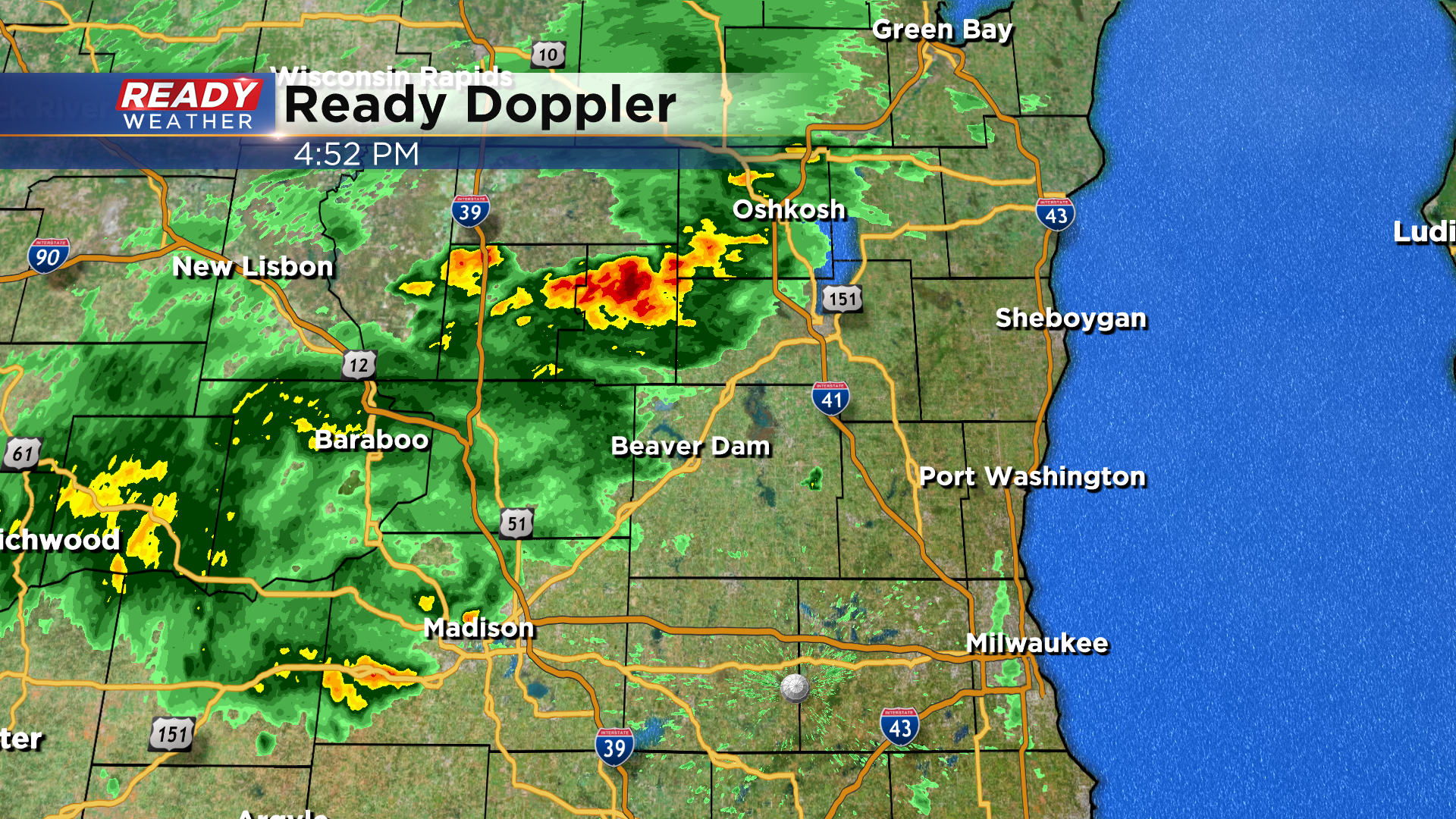
A few spotty, very light showers will be possible early Sunday morning north of Milwaukee, otherwise dry weather moves in for the afternoon and evening, which is great news for the Milwaukee lakefront fireworks!
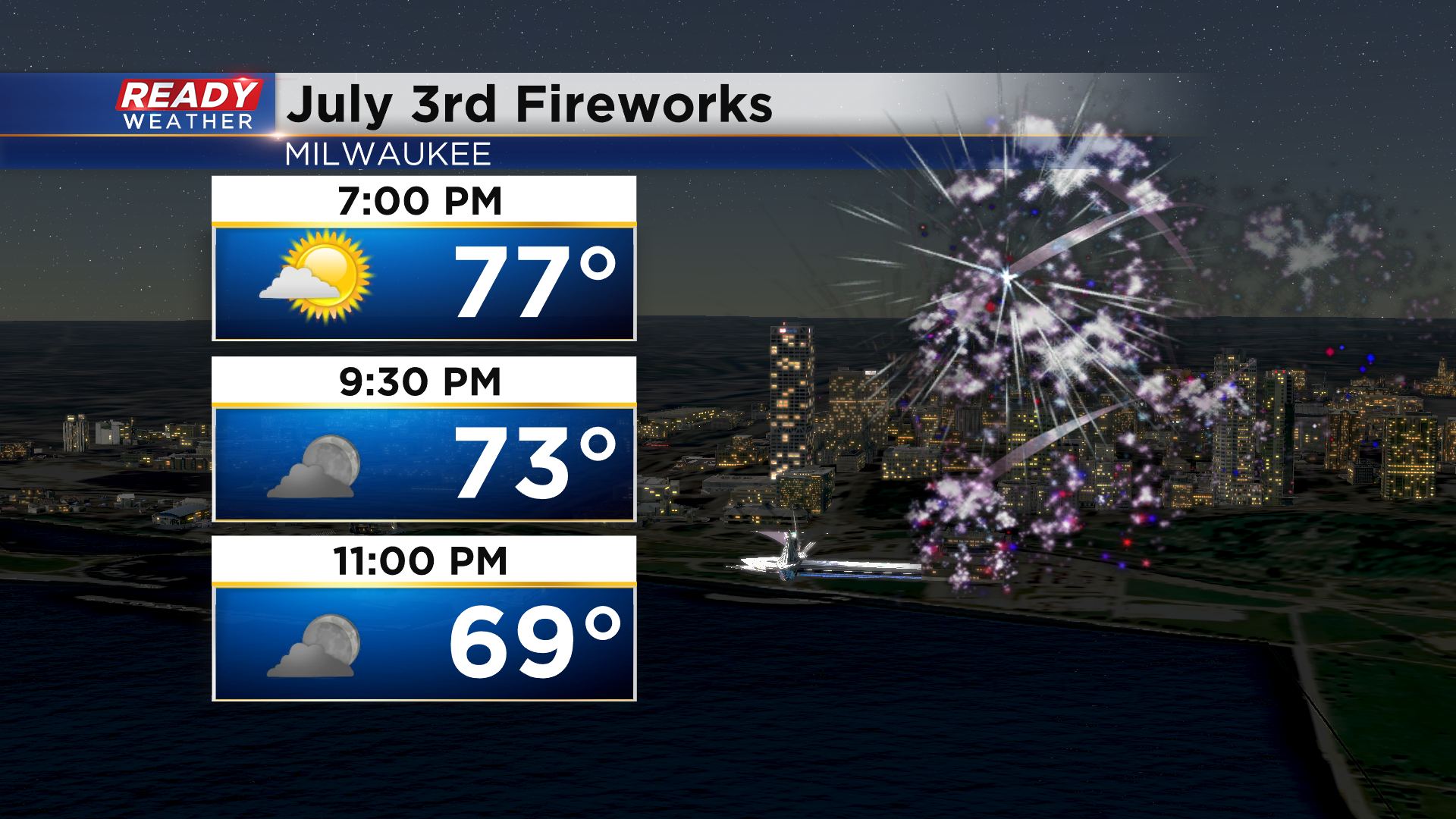
If you really want to see fireworks, I highly recommend seeing the Milwaukee Sunday evening show because storms look likely on the 4th of July. The exact timing is a bit hard to pin down at this point, but it currently looks like one round during the afternoon with another round possible at night.
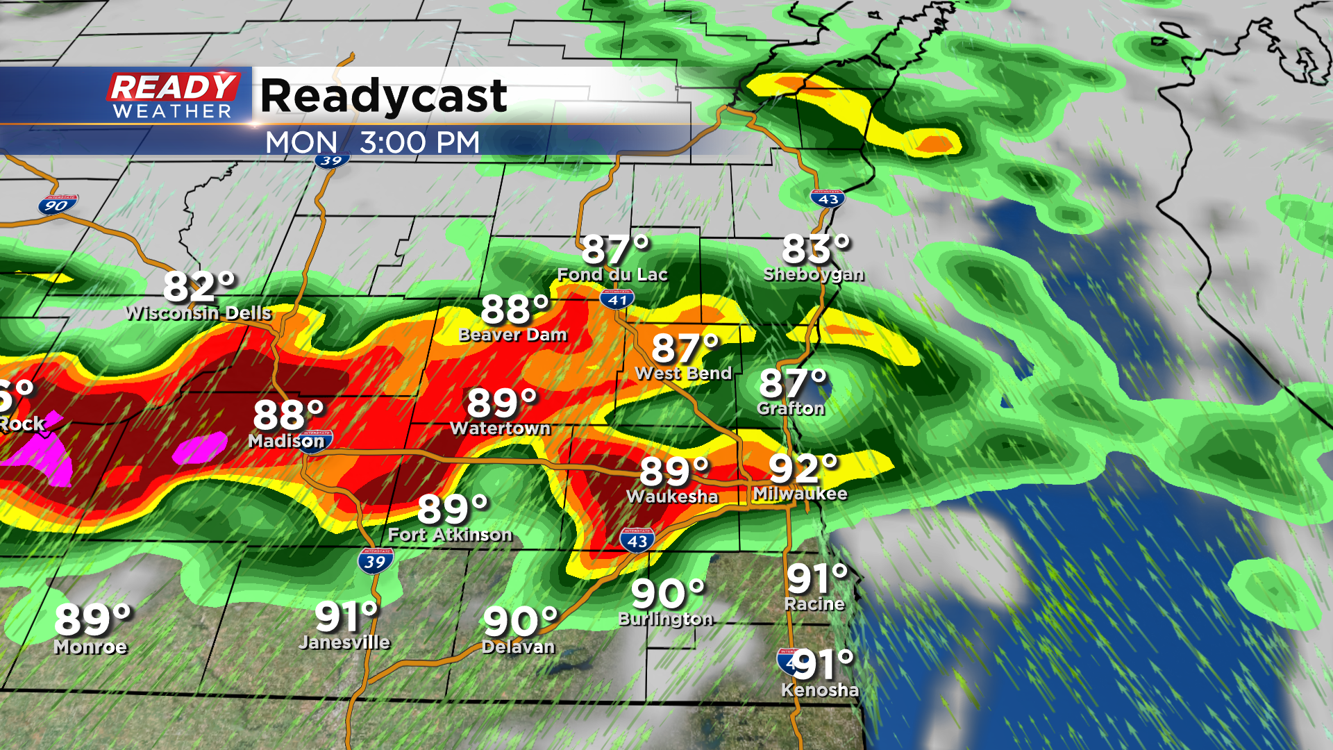
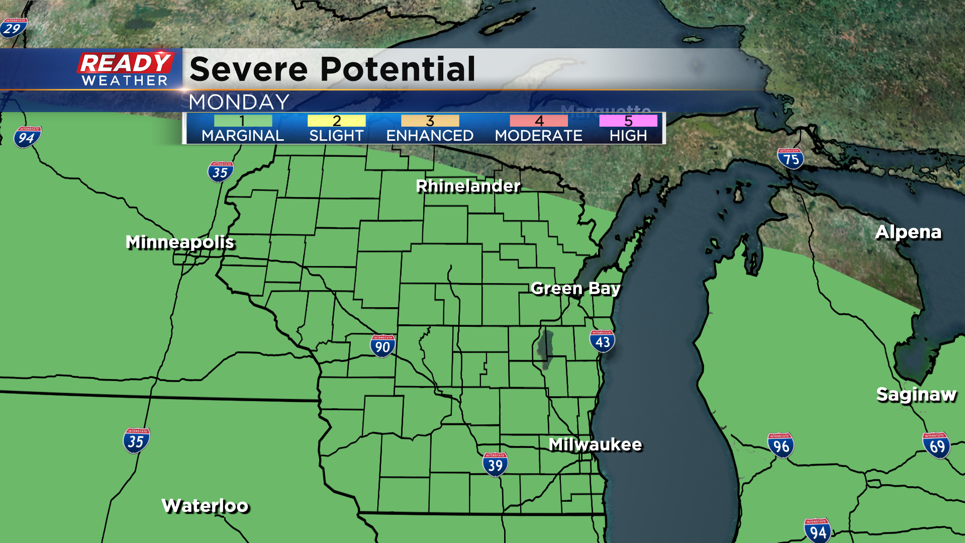
The second round will depend on if there's enough time for the atmosphere to recover after round one, and where round one pushes the front. All in all, it looks like this could impact fireworks shows Monday evening. The storms that move through on the 4th of July could be strong to severe as well with gusty winds and hail as the primary threats. All of the area is under a level 1, Marginal Risk, for severe storms on Monday.
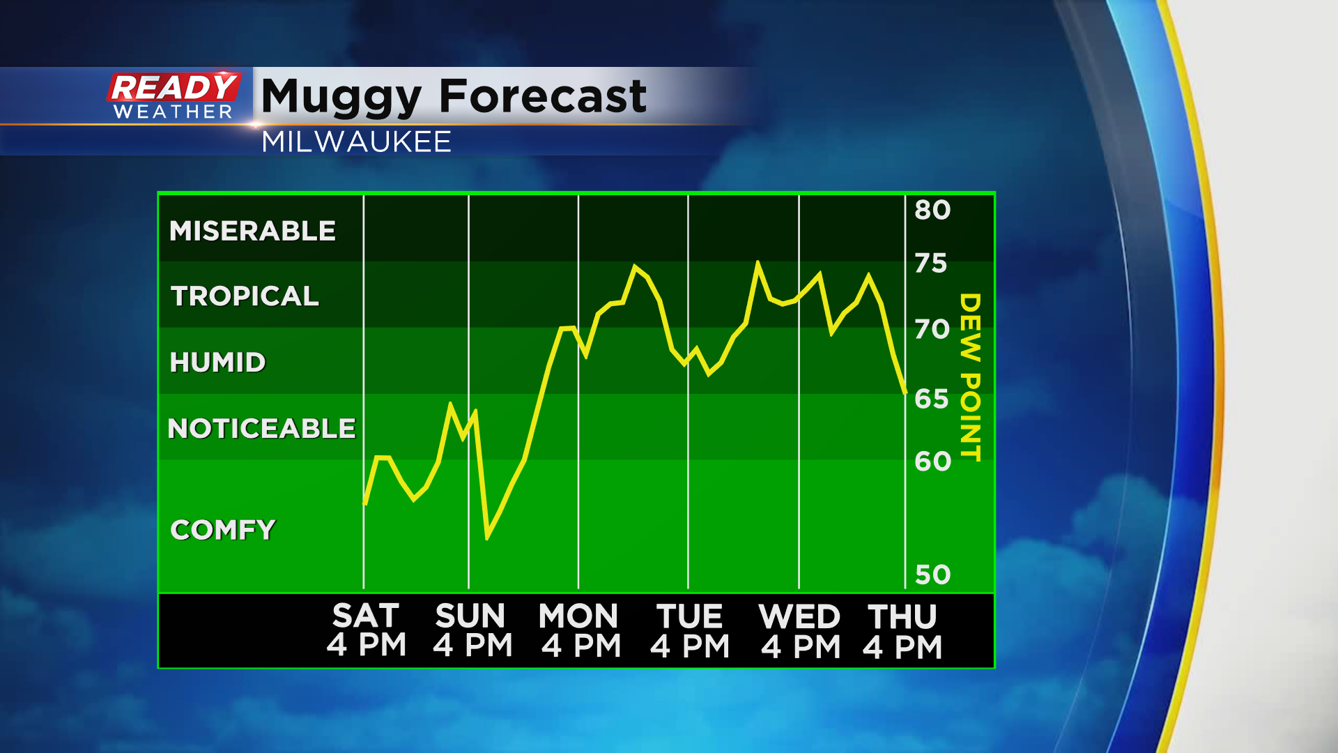
A "ring of fire" pattern will set up throughout the work week, sending daily waves and storm chances across the Badger state. Plenty of humidity will be around this week as well, so any storms could be on the strong side. This pattern will break down by the end of the week.
Download the CBS 58 Ready weather app to track the radar through the 4th of July weekend and to receive any watches and warnings right on your phone.