2pm Update: Snow squalls producing 50 mph gusts moving into the area with the cold front


Updated 2 pm Sunday, November 21st:
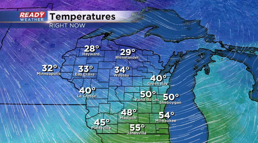
The cold front is knocking on our doorstep with temperatures currently in the low 50s across most of southeast Wisconsin, but in the 20s and 30s behind the front.
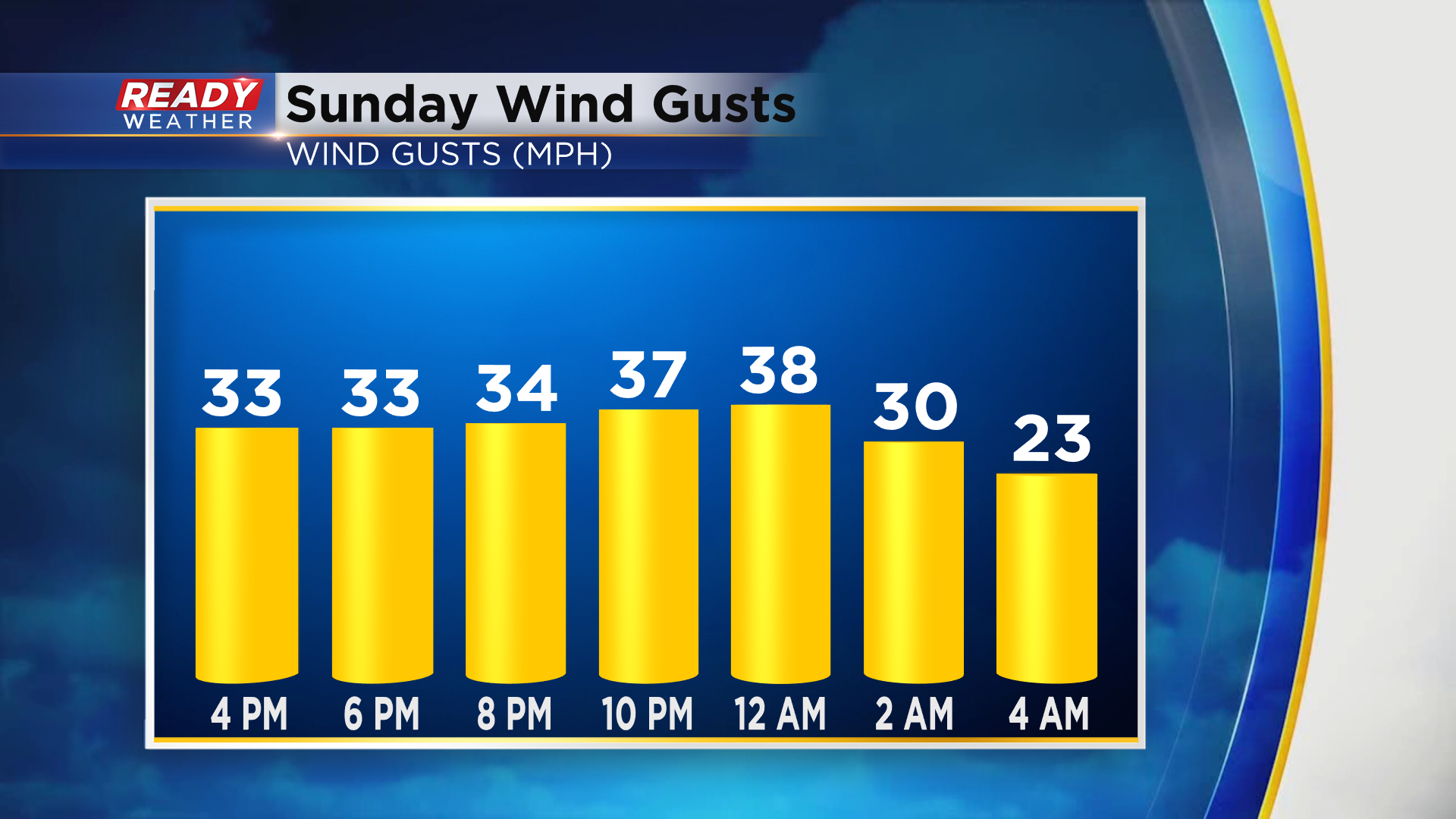
Strong wind gusts of 35-45 mph are occurring behind the front. Expect these winds across southeast Wisconsin throughout the evening.
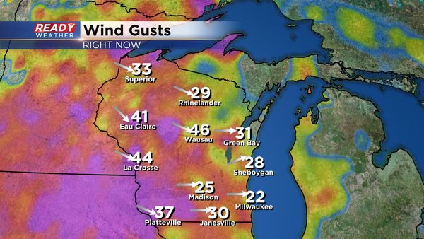
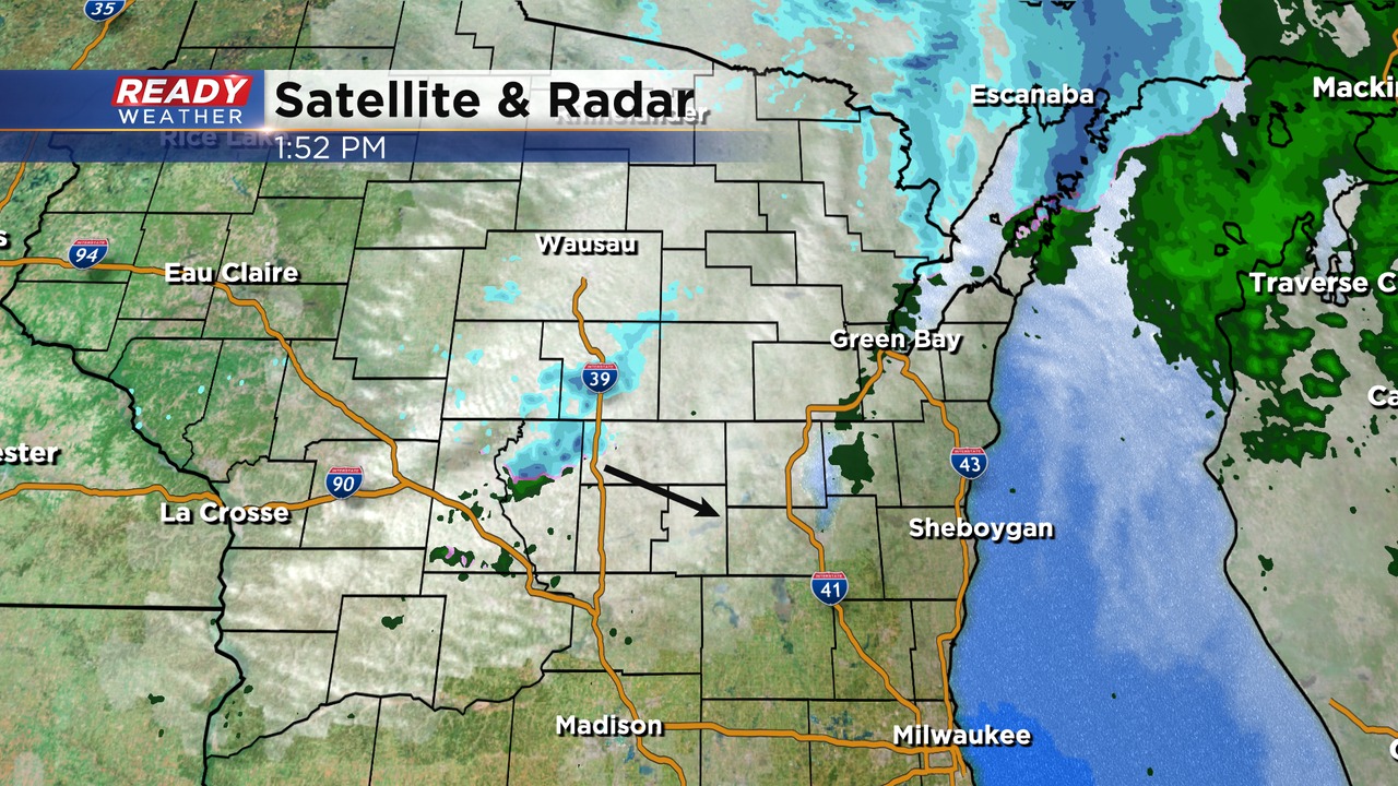
Additionally, there are a few snow squalls moving through central Wisconsin that have produced a 51 mph wind gust in Marshfield and a 52 mph gust in Wisconsin Rapids. Visibility is also being reduced down to a quarter mile in these squalls that are tracking towards Fond du Lac and Sheboygan counties.
Temps plummet into the 20s and 30s this evening behind the cold front.
-------------------------------------------------------------
Update as of 7 am Sunday, November 21st
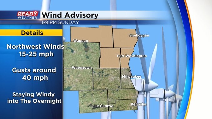
A Wind Advisory is in place from 1 to 9 pm Sunday for counties mainly north of I-94. Northwesterly winds will gust to near 40 mph during the afternoon and into the evening. Look for temperatures to plummet as well from around 50 in the early afternoon to near freezing by dusk. The "real feel" temps will range from 5 to 10 degrees!
------------------------------------------------------------------------
It's been a beautiful late November day with temps in the mid to upper 40s under a mix of sun and clouds. Temps will climb into the upper 40s to low 50s by early afternoon Sunday, but a strong cold front will push through during the afternoon, dropping temps into the upper 20s to low 30s by early evening.
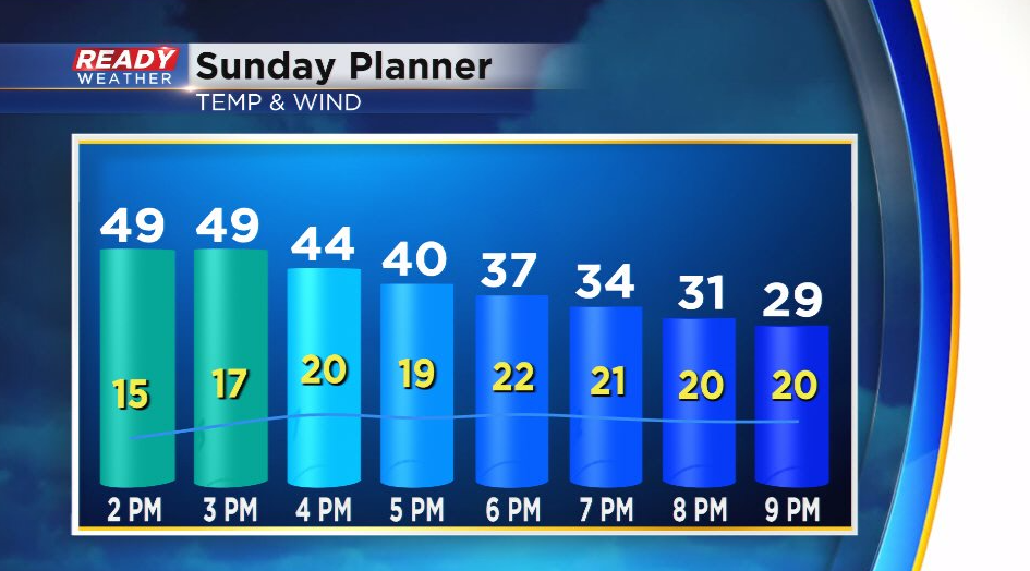
Wind gusts behind the cold front will become strong, with frequent gusts between 30-40 mph in the evening, tapering to 20-30 mph by Monday morning.
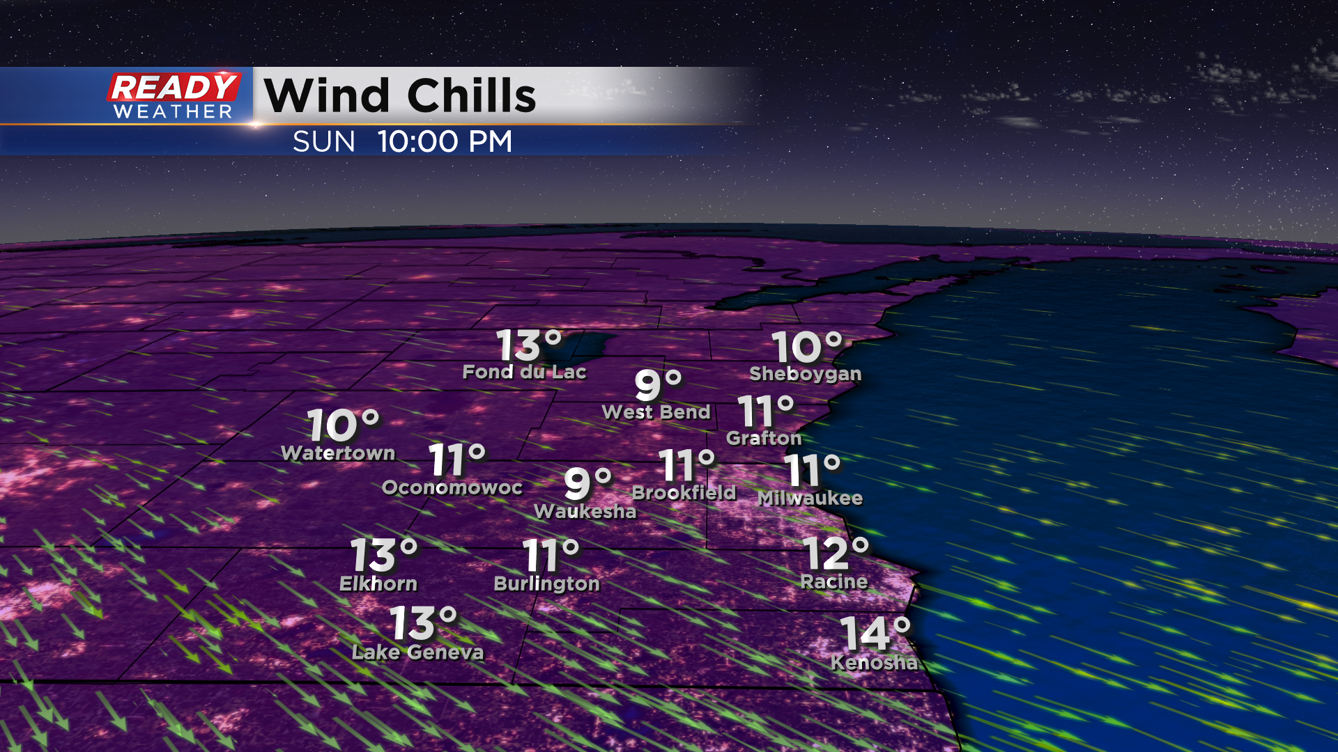
The combination of strong winds and temps falling through the 20s will make it feel like the low teens Sunday evening.
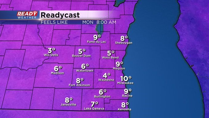
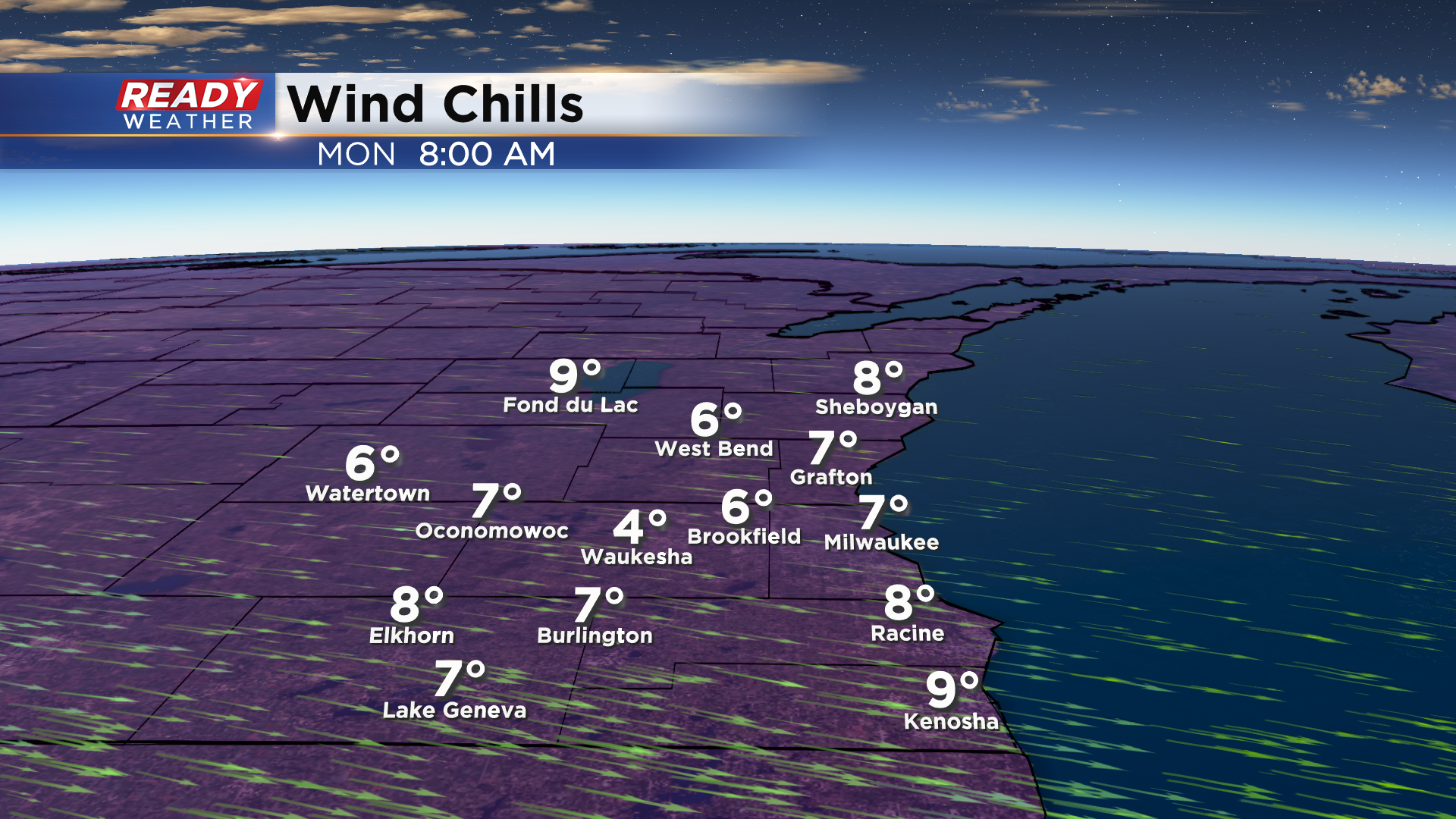
Actually air temperatures will be in the upper teens to around 20 degrees by sunrise Monday morning. With the gusty winds still in place, it'll feel like the single digits as you head out the door to work or school.
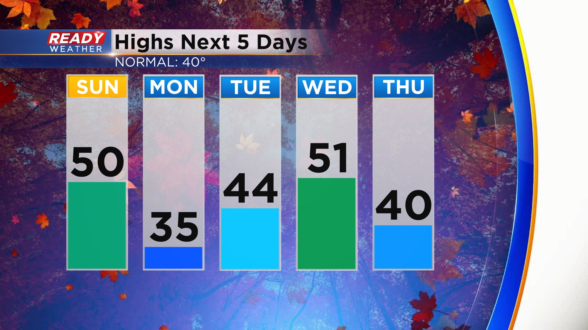
Thankfully this cold air isn't here to stay yet. Temps will only rise into the low to mid 30s on Monday, but a southerly wind will boost temps back into the 50s by Wednesday. However, a cold front will drop temps back to around 40 degrees on Thanksgiving.
That cold front brings our best chance of rain over the next week. Download the CBS 58 Ready Weather App to see the full 7 day forecast.