More storms with heavy rain possible next few days
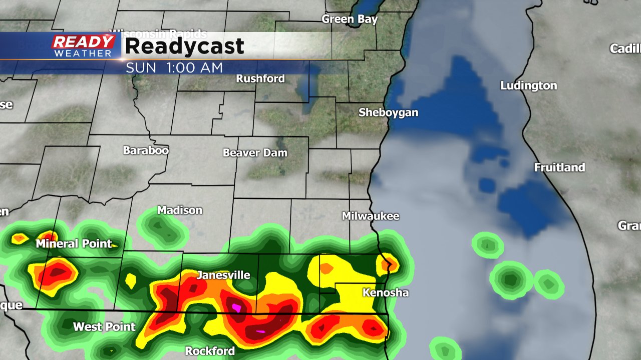
Most saw another round of, at times, heavy rain move through Saturday morning. A couple more rounds will be possible Saturday night, Sunday and Monday.
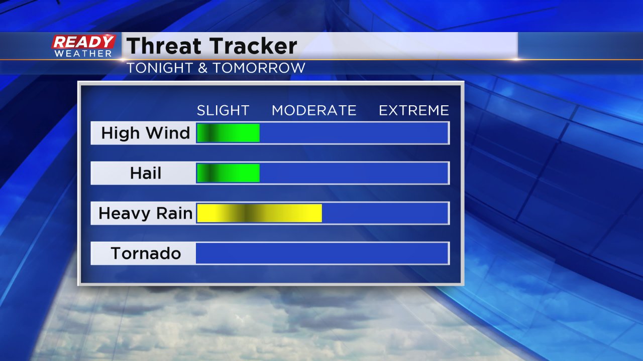
Each day will bring a low, or marginal, risk for strong to severe storms with heavy rain as the main threat but also with possibility of strong wind and hail in the strongest storms.
Timing and location with these scattered storm events is hard to pinpoint, but most days won't be a washout. The best chance for a dry break on Sunday will be from late morning into the early afternoon. For Labor Day the best shot at anything outdoors will be in the morning before more scattered storms roll through in the afternoon.
Heavy rain may be possible for some, but for the most part, flooding won't be an issue. Our southern counties of Walworth, Racine and Kenosha will probably see the most rain and this is an area that hasn't been hit as hard as some to the north. By the end of Sunday spots could see anywhere from a half inch to 2" of rainfall. Another inch may be possible Monday and a few inches Wednesday into Thursday as a cold front finally ends our chance for rain.
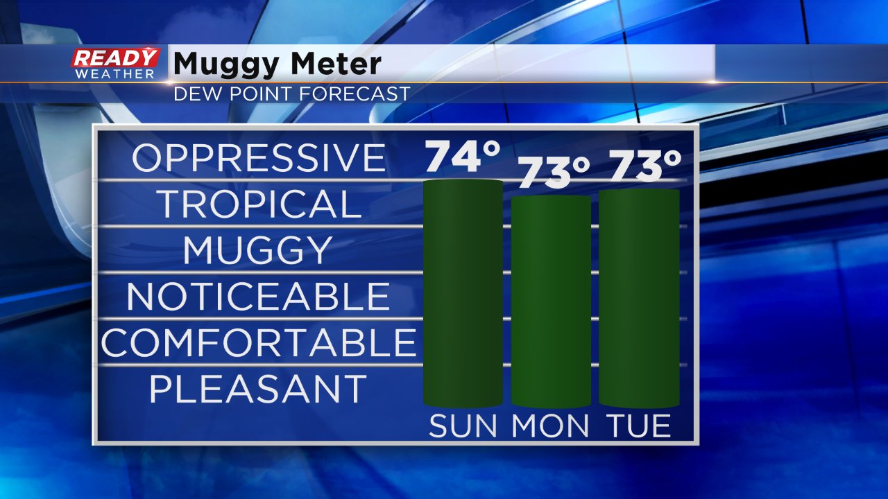
High dew points and humidity is one reason we've stayed in this soggy pattern. Dew points in the low 70s are more typical of the Gulf Coast this time of year. That gives storms a lot of moisture to pull into causing heavy rain. The humidity goes down as temps tumble starting Thursday.
Download the CBS 58 Ready Weather App to track the radar.


