Next chance for wintry precipitation arrives Wednesday night


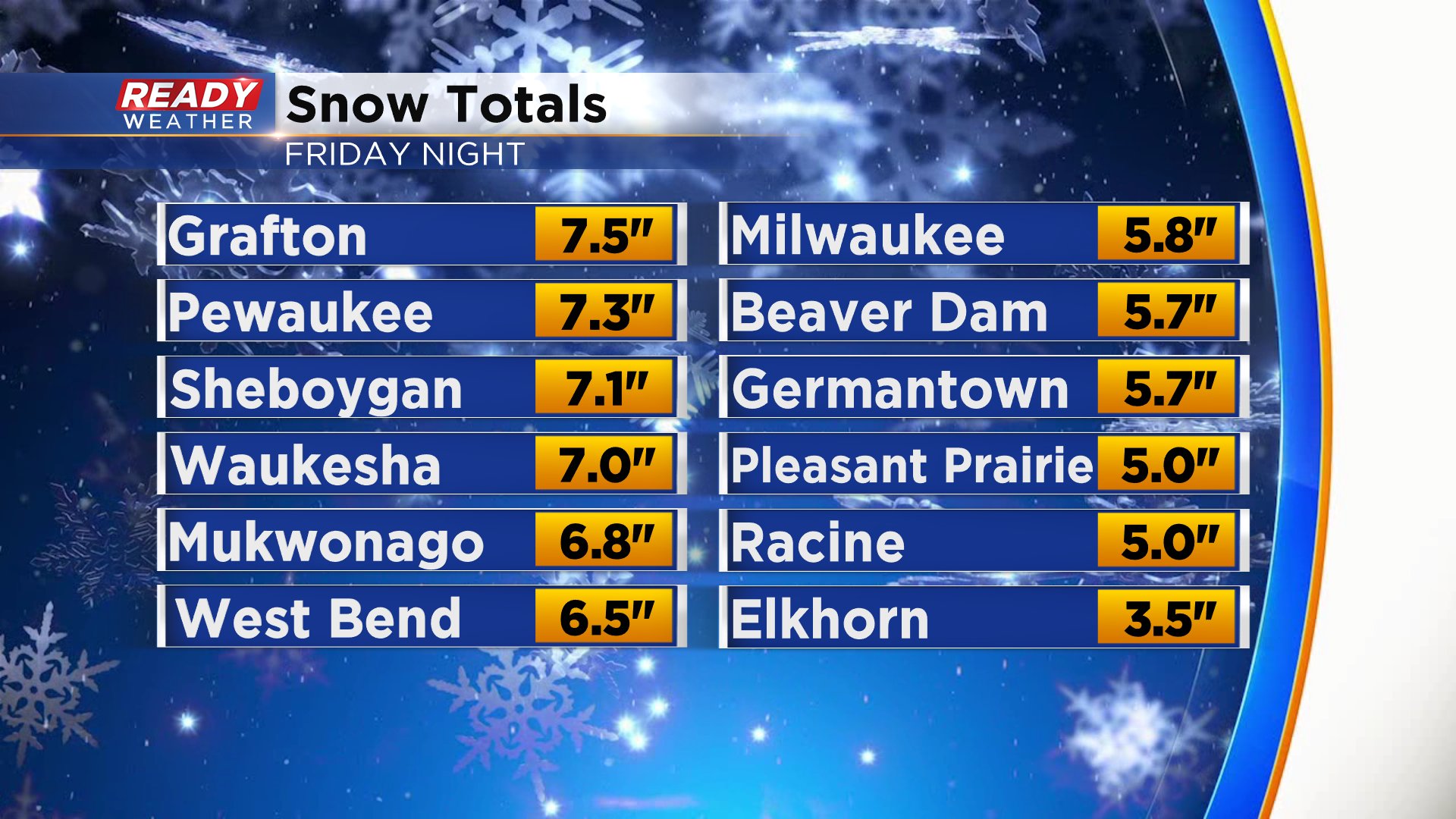
Southeast Wisconsin woke up to a good helping of snow Saturday morning. As expected, the bulk of the accumulating snow happened Friday night with lingering light snow showers and wintry mix the rest of the day. Most of the area picked up 5-7" of snow with a few spots getting a little more and some a touch less.
With the recent snowfall Milwaukee's snow depth Monday morning sits at 5" which is the most on the ground since our Halloween storm. The entire state now has a good coating of snow, but expect some of it to melt this week with sunshine and mild temps.

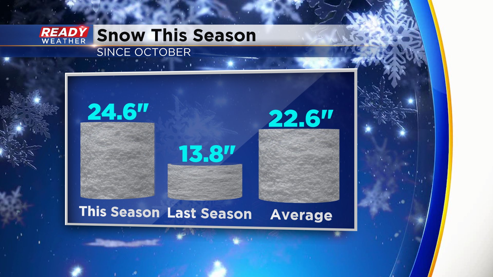
With the 5.8" of snow Milwaukee picked up Friday night our seasonal snowfall sits at 24.6" which is exactly 2" above-average. It's still well above our snowfall through this time last year.
After the snow came the cold. Lakeside locations like Milwaukee, Racine and Kenosha saw their coldest temps of the season Sunday morning. Most inland and northern spots were colder this past Friday morning. Combined with the wind, wind chills Sunday morning were in the teens to -20°. We had our first wind chill advisory issued for part of southeast Wisconsin.

After a couple of quiet weather days Monday and Tuesday with high pressure moving in our next storm system arrives Wednesday evening. It's a slow mover and right now all types of precipitation including rain, snow, freezing rain and sleet are in play. A wintry mix is possible for most of the day Thursday and Friday before the storm moves east Friday night.

Download the CBS 58 Ready Weather app to track the changes as the storm approaches.