Next weather maker to bring mainly rain to southeast Wisconsin
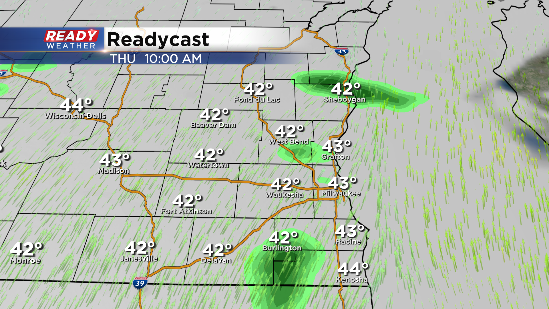
It's been nice to dry out and soak up the sun the last couple of days, but clouds are already increasing this afternoon ahead of the next low pressure system. Thankfully, this system will bring us more rain than snow. We'll remain dry through this evening, but isolated light showers or drizzle will be possible overnight into Thursday morning.
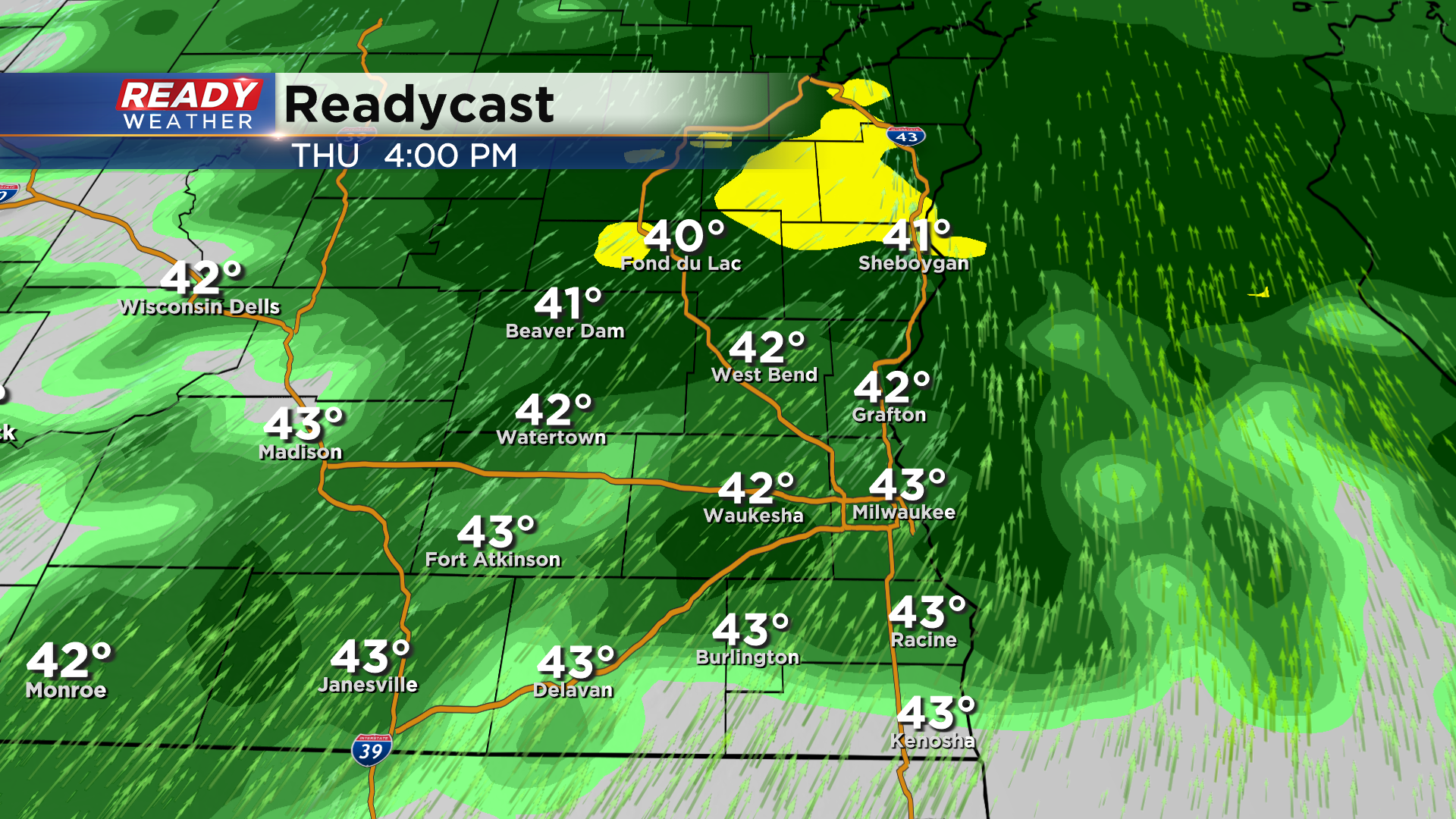
The more widespread rain overspreads the area Thursday afternoon and continues into the evening.
Overnight into Friday morning, some colder air will wrap into the backside of this system as it's departing to the east. This will cause a brief changeover to snow or a mix.
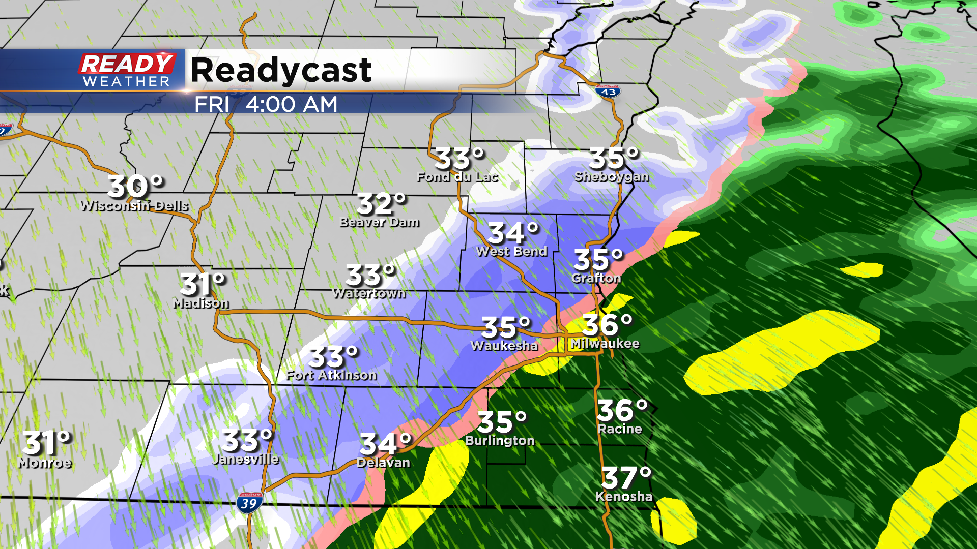
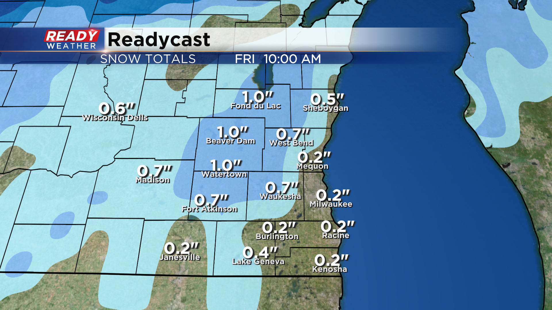
We're not expecting much in the way of accumulation, but far NW spots may pick up a quick inch as colder air will arrive there sooner than in the Milwaukee metro.
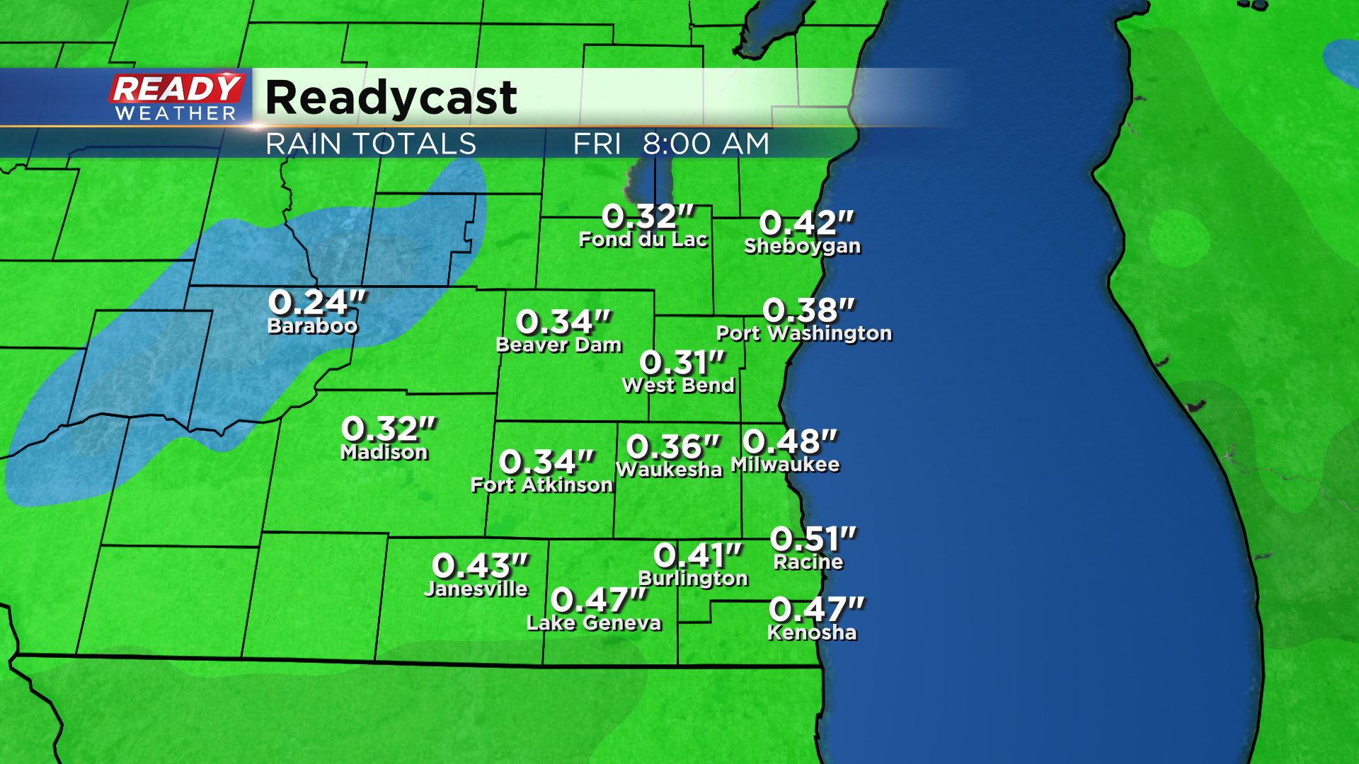
Overall, .25-.50" of rain is expected from this system.
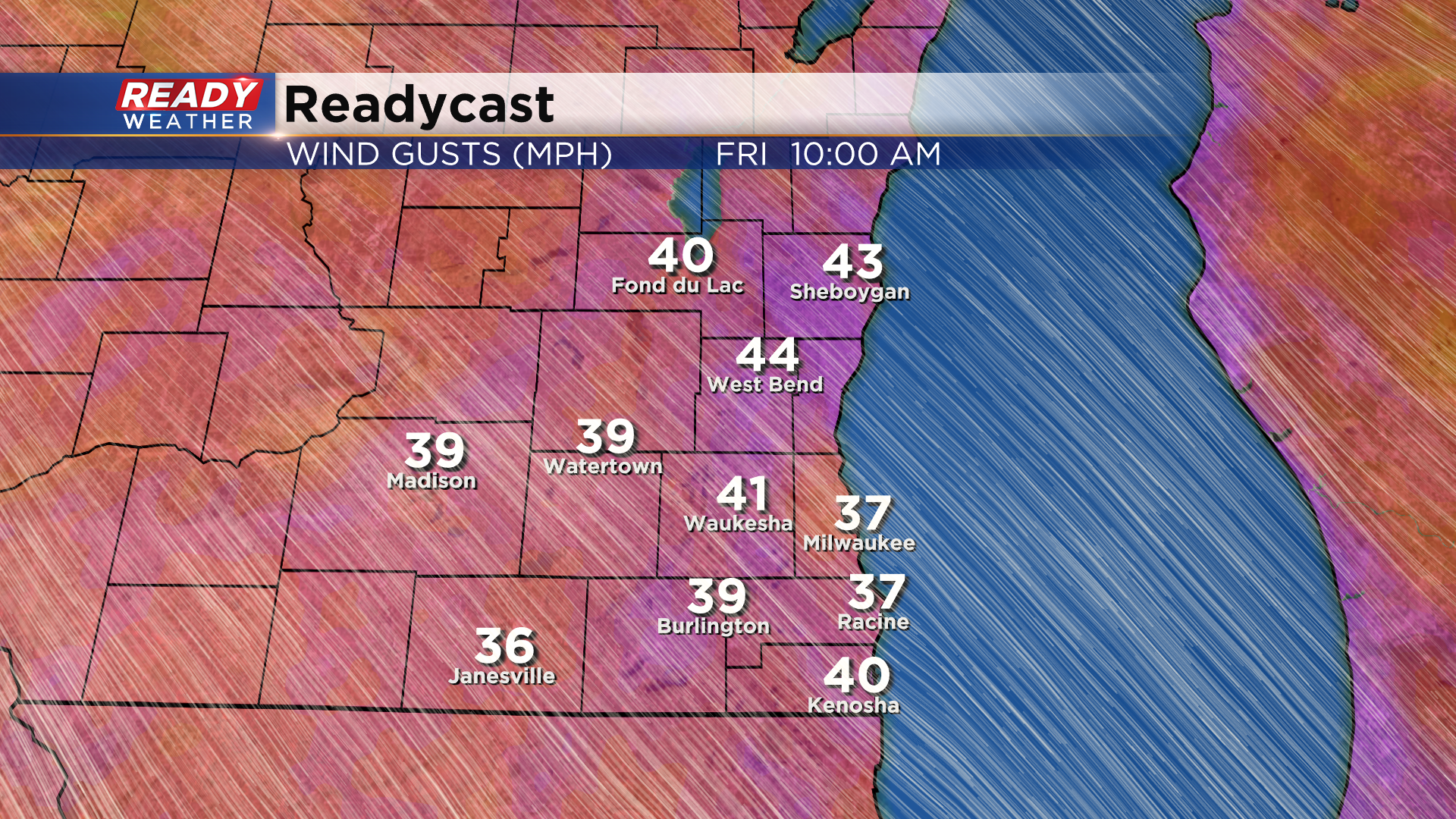
We can't rule out a few wrap around, nuisance snow showers later Friday into early Saturday, but the bigger story for Friday will be the strong wind. Wind gusts between 30-40 mph are expected throughout the day and will continue into Saturday.
While it's nothing we can't handle, it will make it feel like the single digits and teens Friday evening through Sunday morning. Download the CBS 58 Ready Weather App for future updates.
