One more mild day before soggy and cooler weather return


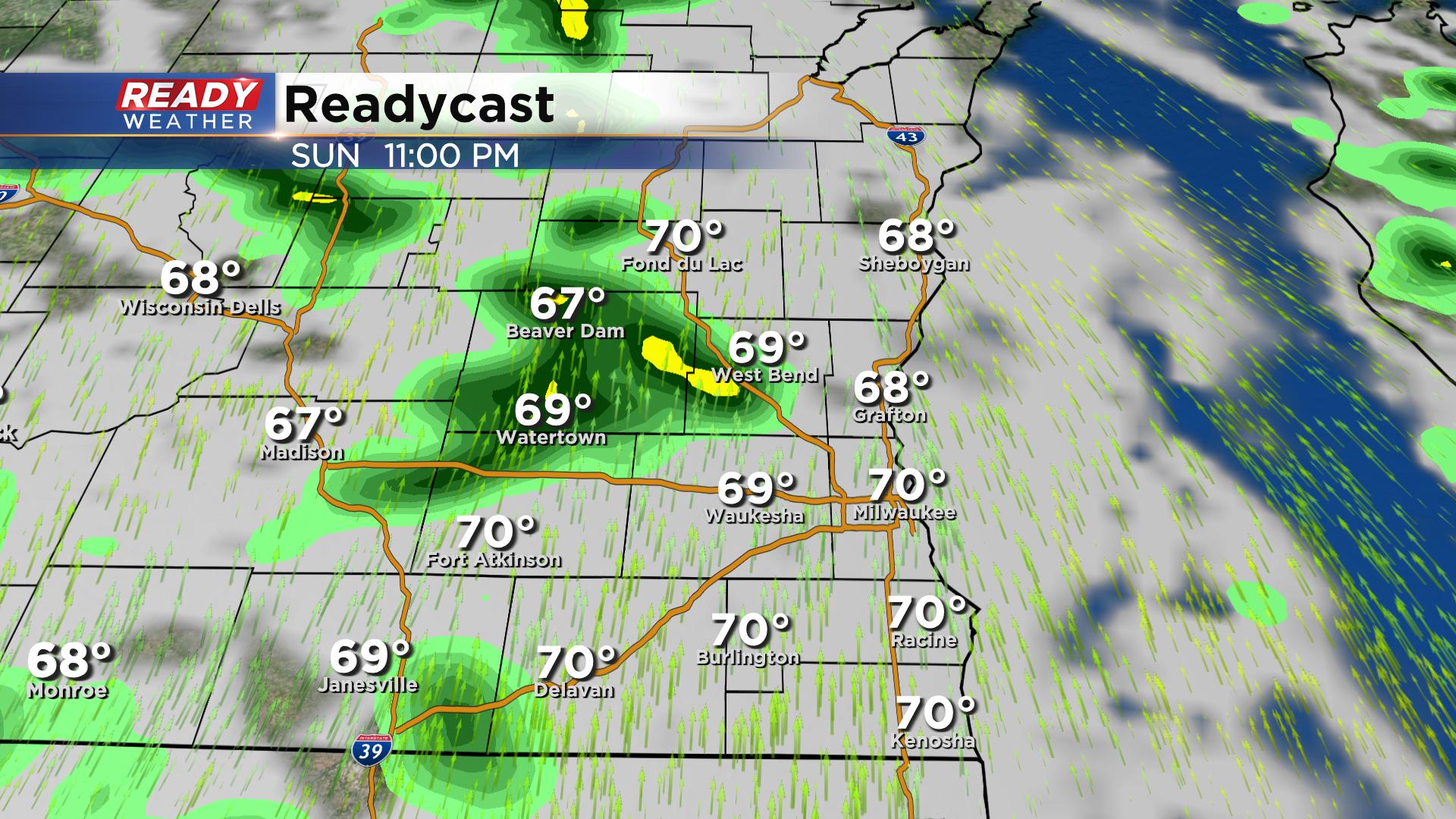
It's been a banner weekend across southeast Wisconsin with mostly sunny skies and highs in the 70s. However, all good things must come to an end. Clouds have started to increase late this afternoon ahead of a weak disturbance that'll trigger scattered showers and isolated rumbles of thunder late this evening into tonight.
Nearly all of these showers will exit before sunrise, but a couple stray showers can't be ruled out through mid morning Monday. Otherwise the rest of Monday should be dry and breezy with more clouds than sun.
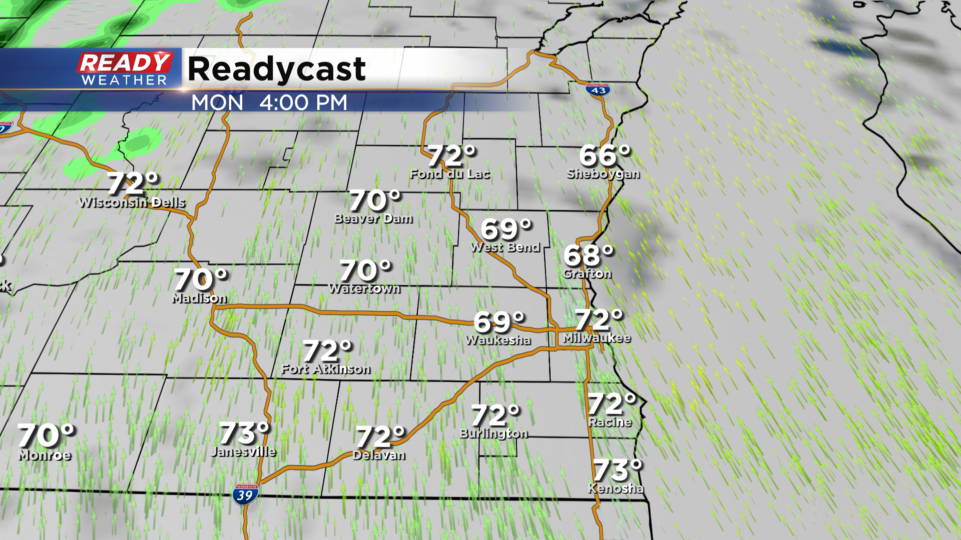
A breezy SSW wind gusting 20-30 mph and peeks of sunshine will help temps rise into the low 70s for one more day before temps drop back into the 50s for a majority of the week.
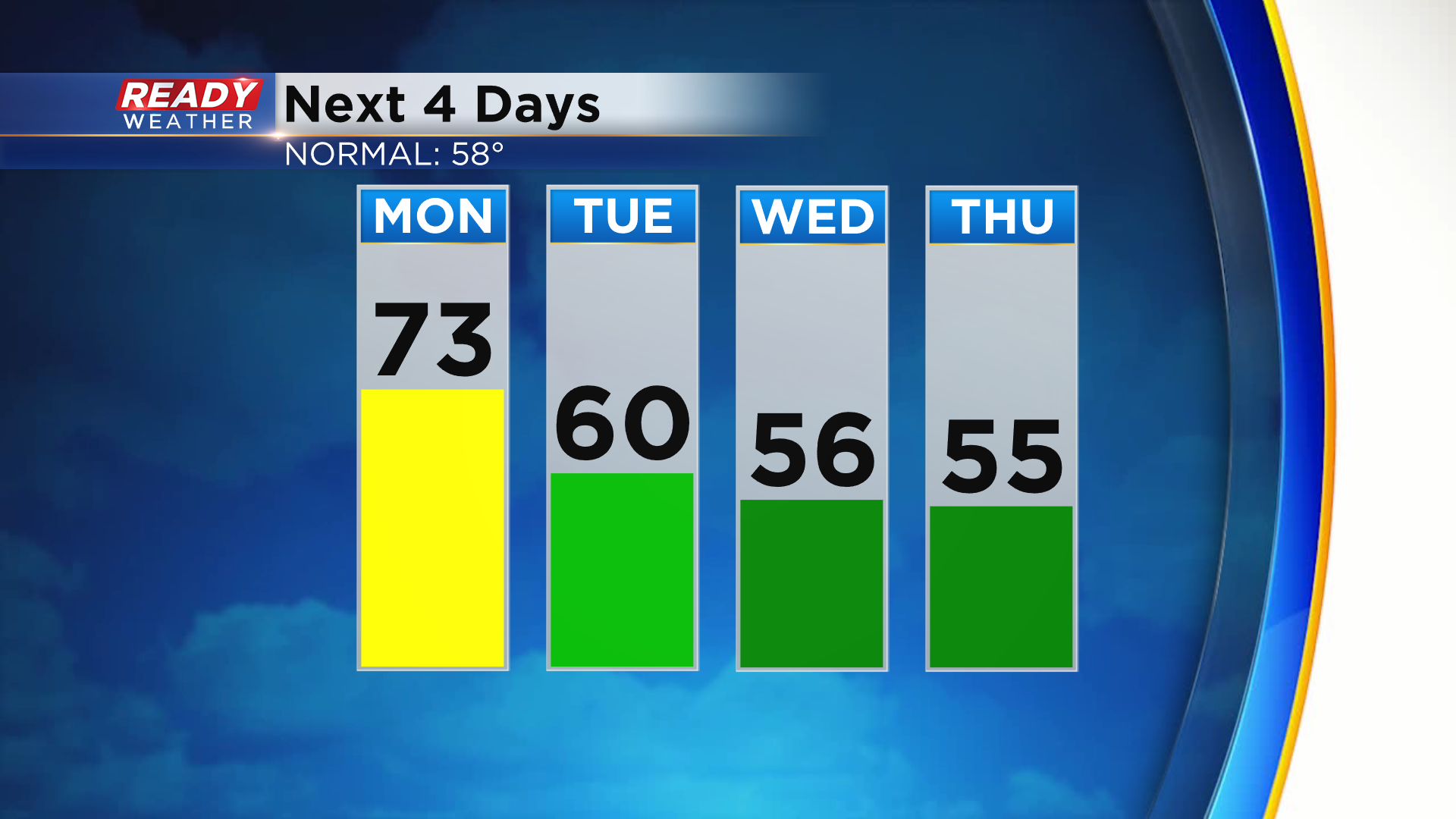
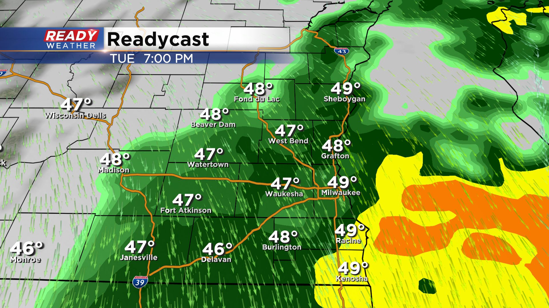
While high temps top out near 60 on Tuesday, it'll be a very soggy day. A batch of light rain moves back in Monday night and will continue into Tuesday morning ahead of the cold front.
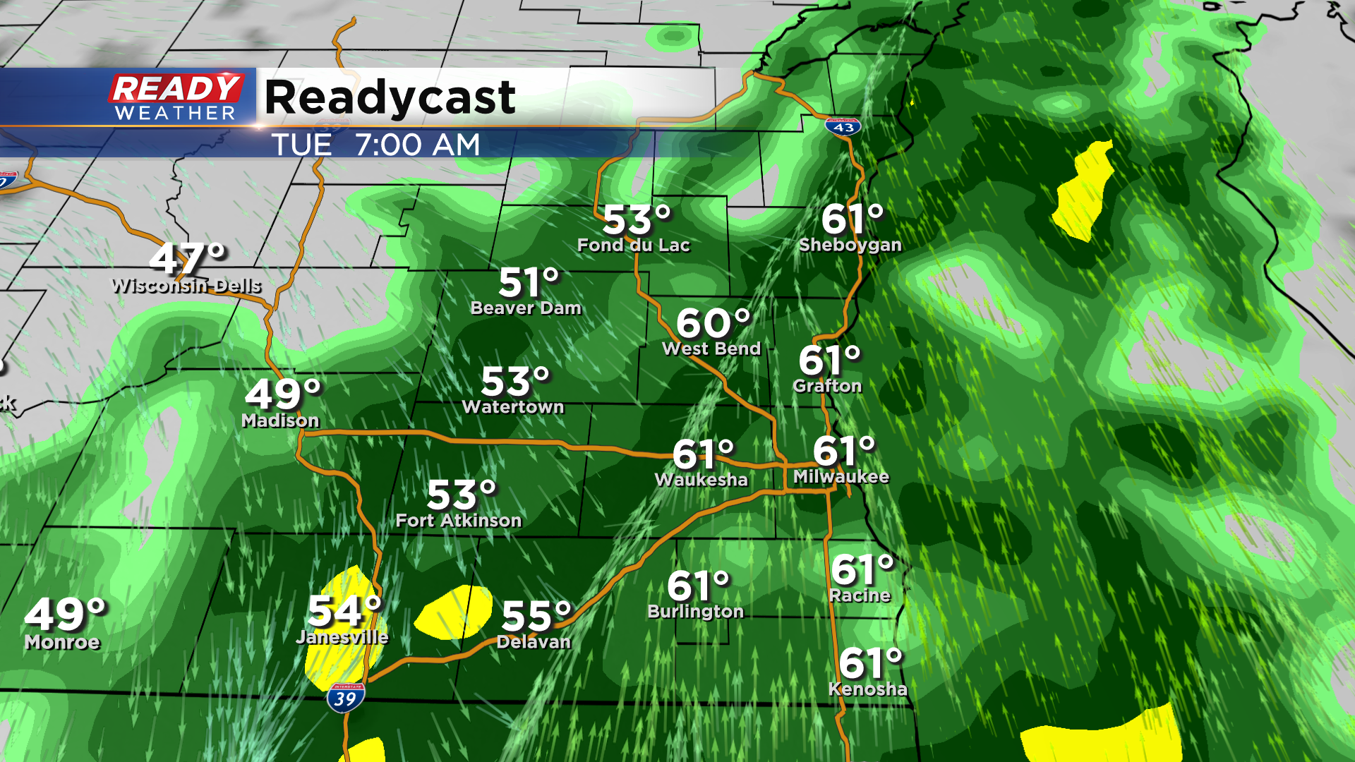
There may be a lull in the rain mid to late morning, mainly away from the lake, but another widespread area of rain will move in during the afternoon and continue through Tuesday night. These showers will largely exit to the east by sunrise on Wednesday.
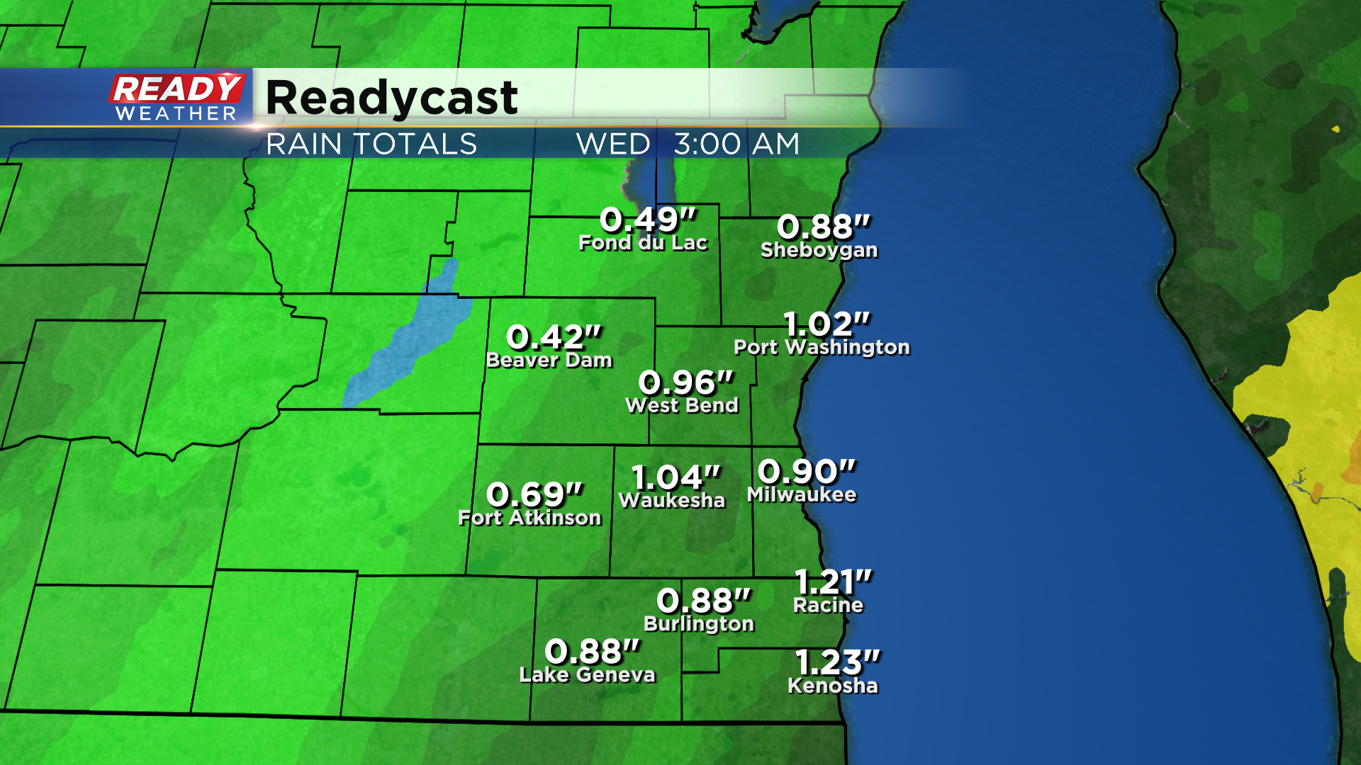
Once the rain is all said and done, most of SE WI will likely pick up between .50 - 1" of rain with the highest totals near the lake and lowest totals far northwest.
Download the CBS 58 Ready Weather App to see if there will be any more rain this week.