One more push of snow, then extreme cold into the middle of the week
Posted: Jan 23, 2022 6:03 AM CDT

-
1:13

Kewaskum holds parade for Olympic gold medalist Jordan Stolz
-
2:21

With no playoffs ahead for Bucks, fans reflect on 2025-2026 season
-
2:38

As Feds investigate NFL TV contracts, Packers say changes would...
-
3:08

Milwaukee vintage store owners devastated by second fire at...
-
5:00

Gov. Evers has restored Wisconsin’s commutations process; here’s...
-
2:40

Dodge County sheriff files lawsuit against woman who claims she...
-
0:49

Racine man sentenced to 7 years for drunk driving crash that...
-
1:57

New ordinance could shut down food trucks on Water Street by...
-
1:22

’Girl dinner’ comes to the Bar at Saint Kate
-
1:12

Milwaukee leaders discuss nationwide trend of ’teen takeovers’
-
0:29

Local workshops aim to make biking more accessible for people...
-
2:27

Karin Tyler’s confirmation to Department of Community Wellness...

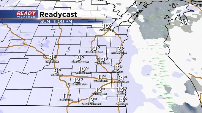
MILWAUKEE (CBS 58) -- Two down, one to go. Look for another clipper to come our way late Sunday night through Monday morning. We could see a few additional inches on top of what we've seen this weekend. Sunday morning's amounts were generally between 1 and 4 inches. Monday's commute in the morning promises to be a tough go, so please add 10 to 15 extra minutes.
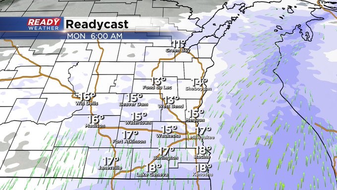
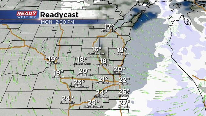
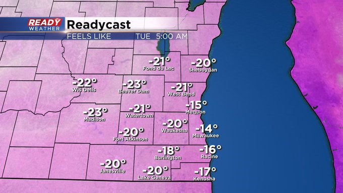
Behind the snow, we get cold. Lots of it. Look for temps to be below zero for most of us into Wednesday morning. With the wind, we'll have wind chill numbers -20 to -15 if not colder. Tuesday morning, by the way, won't be much better. Highs during this time will be 10 to 15. That's it.
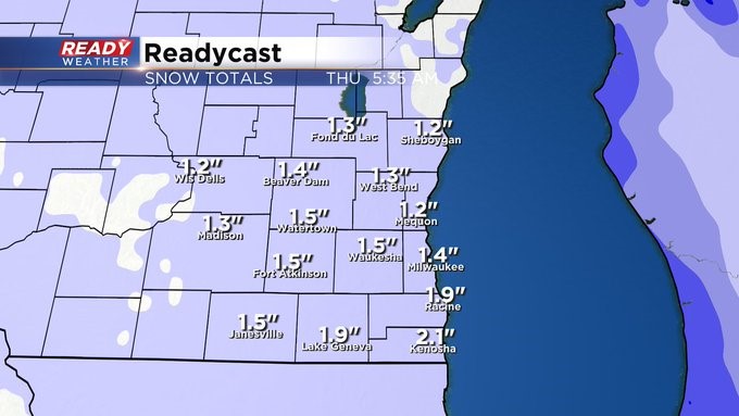
There's another snow system on Thursday. Doesn't look that impressive as it stands now.
Sign up for the CBS 58 Newsletter