


For the 3rd day in a row, Fond du Lac and Kenosha shattered their record highs as temps climbed into the mid 70s this afternoon.
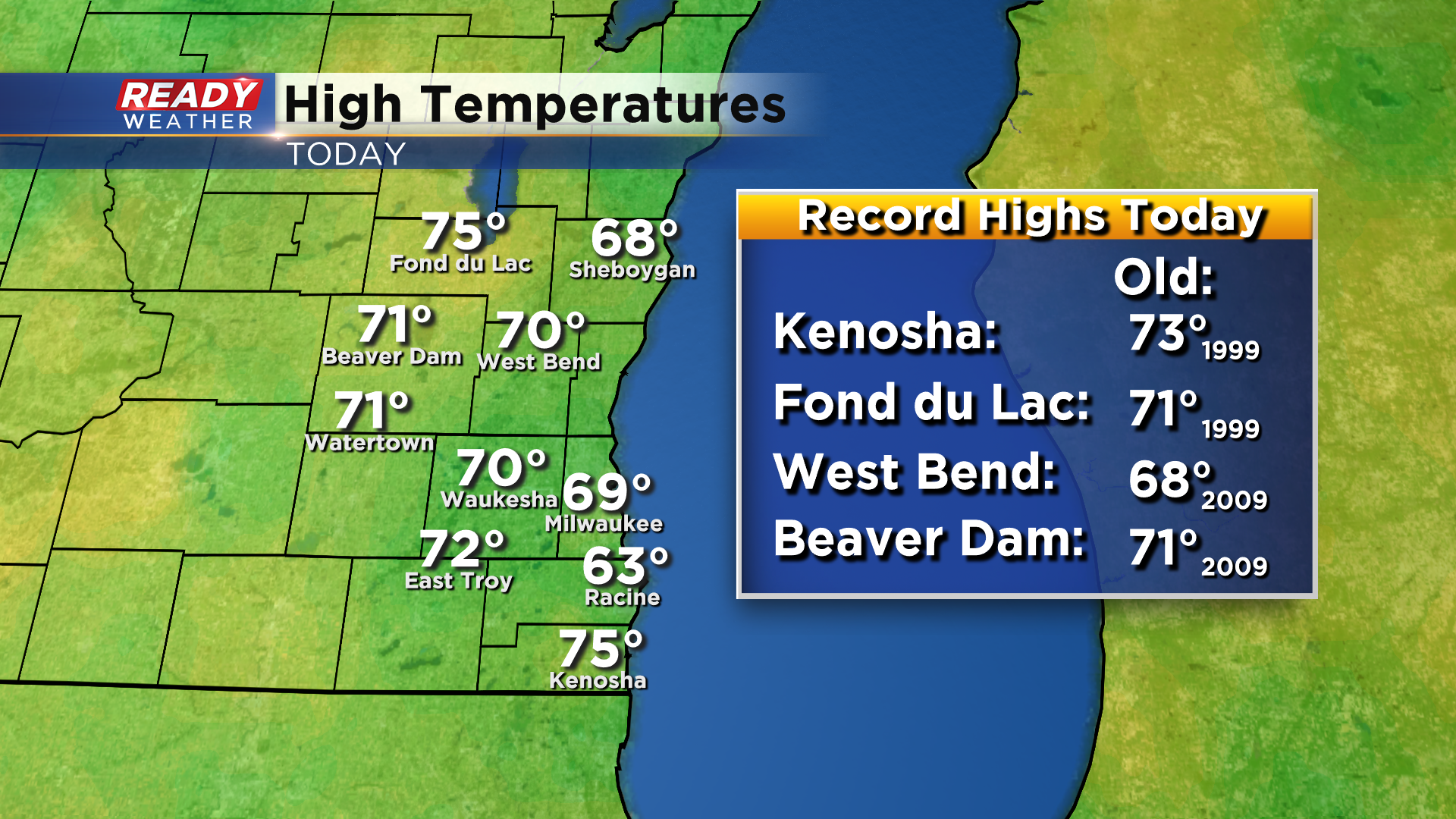
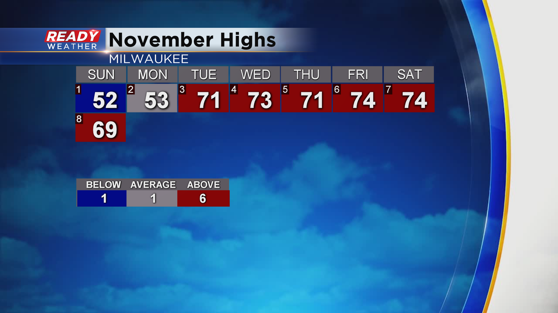
Unfortunately, Milwaukee’s streak of 70 degree days has come to an end. Temps rose to 69° at Noon, but a lake breeze kicked in and dropped temps into the mid 60s for the rest of the afternoon. The five straight days in the 70s is a record for November.
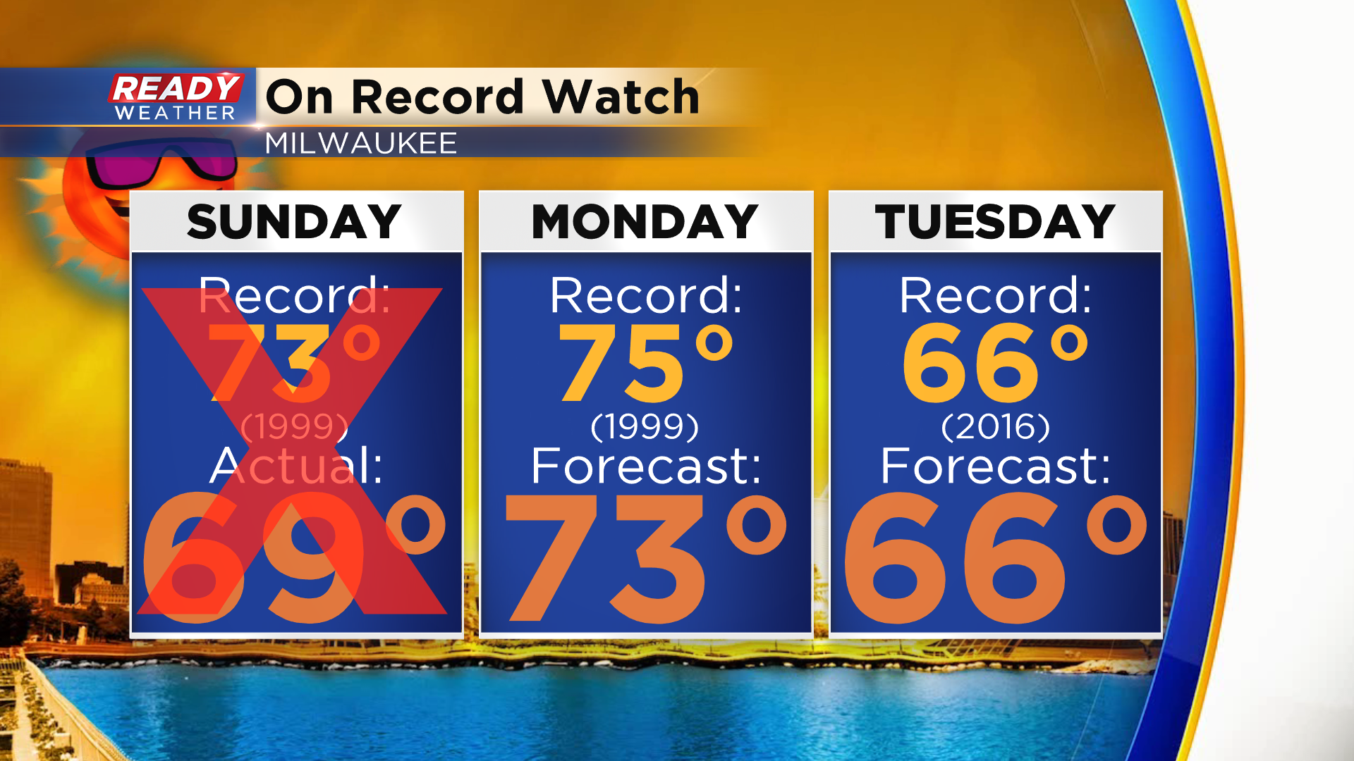
Temperatures will return to the lower 70s across all of southeast Wisconsin on Monday as breezy winds turn back to the southwest. The record high in Milwaukee is 75° on Monday, so we’ll likely come up just short. However, we’ll be on record watch on Tuesday as the record high is only 66° from 2016.
A low pressure system and cold front is expected to track through the state on Tuesday, bringing rain and a few rumbles of thunder back into the area. Areas northwest of Milwaukee could see rain as early as mid to late morning, with rain overspreading the rest of the area during the afternoon and evening.
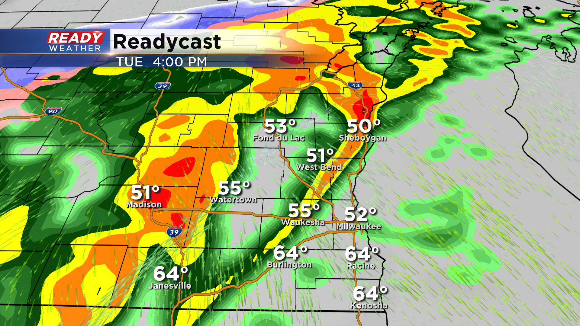
Rain will come to an end Tuesday night and cooler, drier air rushes in behind the cold front. Between .25-.50” of rain is expected for most of southeast Wisconsin, but up to 1” is possible northwest of Milwaukee.
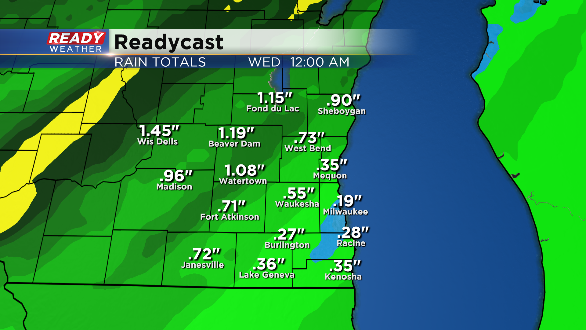
Temperatures will cool back to into the 40s to around 50 behind the cold front. Download the CBS 58 Ready Weather App to track the rain.