Only isolated showers the next few days with heat returning for the weekend


Some light steady rain fell in Racine and Kenosha Counties and southern Milwaukee County from the remnants of Beryl. Those showers have now left southeast Wisconsin but a few showers have popped in western counties. Those showers and storms will continue off and on through the rest of Wednesday. A shower or storm can't be ruled out on Thursday and Friday looks pretty dry.

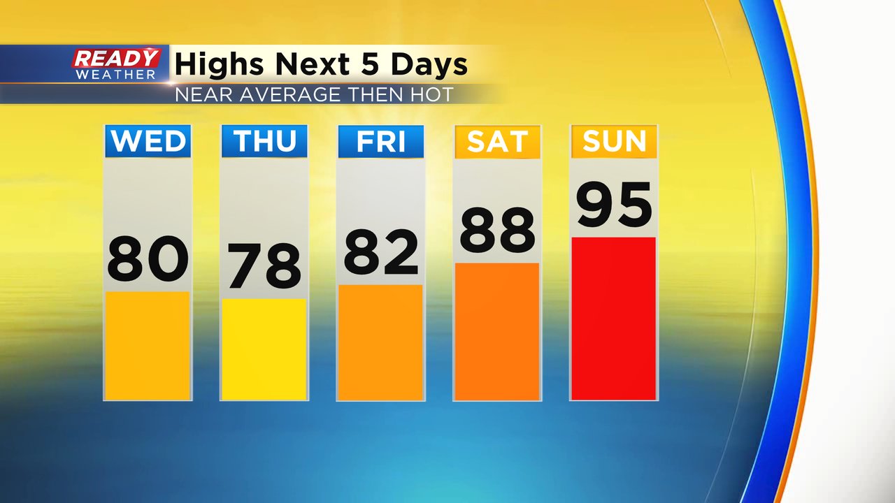
Temperatures will stay fairly close to average the next few days in the upper 70s and low 80s through Friday then the heat really builds in for the weekend in the upper 80s Saturday and mid 90s on Sunday. Monday and Tuesday of next week still look pretty warm then cooling a bit for the end of the week.
Dew points won't be awful Wednesday and Thursday in the mid 60s but definitely still noticeable and muggy at times. As temps start to warm on Friday the humidity level will increase with very muggy conditions. It's going to feel pretty tropical for the weekend!

Download the CBS 58 Ready Weather app to track any showers and storms that pop up and any changes to the heat forecast.